 |
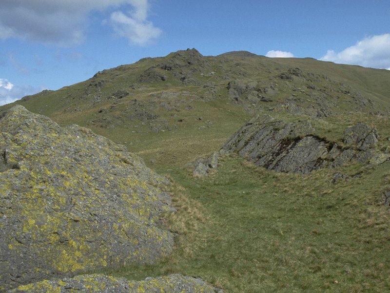
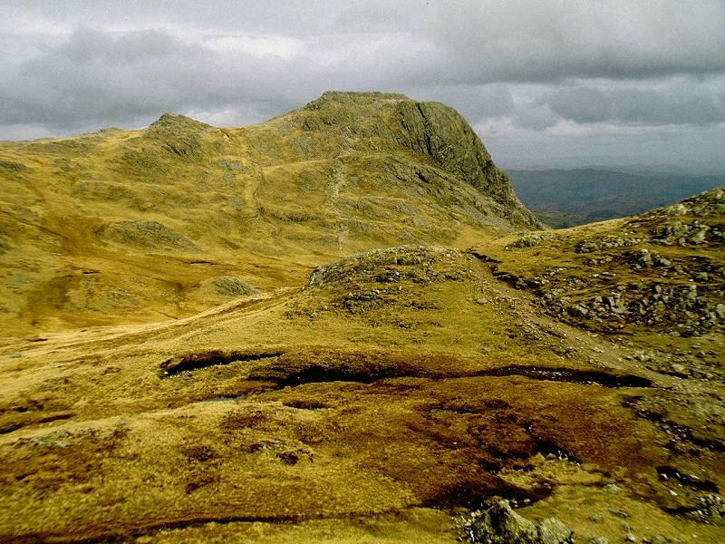
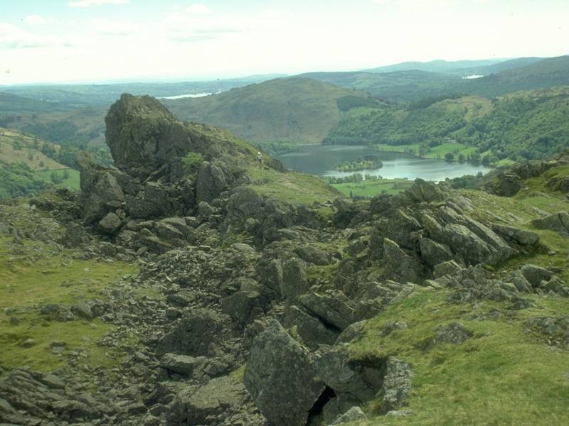
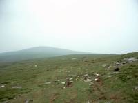
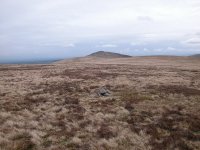
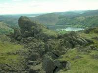
Great
Calva
Location: Lake
District, Northern Fells
Grid Ref: NY
290311
Height: 2264 ft (690
m)
Status: Wainwright,
Hewitt, Nuttall
Notes: Great Calva is
a prominent conical hill, liberally covered in heather and standing at
the head of the Glenderaterra valley between Skiddaw and Blencathra.
Part of the Caldbeck or "Back O' Skiddaw" massif, it is quite remote
and is perhaps best approached from the north via the neighbouring fell
of Knott. The thin paths through the heather on its southern slopes are
more easily found from above than below. The summit is very rocky and
quite untypical of the rest of the fell. A striking feature of the view
is that Great Calva looks straight down the Glenderaterra valley and in
turn straight along the Thirlmere valley towards Dunmail Raise.
Otherwise, vast empty moors and the great bulks of Skiddaw and
Blenathra dominate the panorama. |
|
|
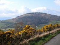
Great
Cockup
Location: Lake
District, Northern Fells
Grid Ref: NY
273333
Height: 1726 ft (526
m)
Status: Wainwright,
Dewey
Notes: Oh come on, I
hear you say, you're making this up. There surely can't be a hill with
such a ridiculous name.
There is, and this is it. Great Cockup is a lonely little summit, part
of the "back o'Skiddaw" group, and laying some two miles east of
Bassenthwaite village from where it's most easily climbed. The panorama
is rather dominated by the bulk of Skiddaw to the south and Knott and
its companions to the east, but the view of Binsey and Over Water is
good. The fell's most interesting feature is the tiny ravine of
Trusmadoor, dividing Great Cockup from Meal Fell.
|
|
|
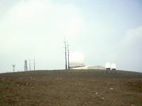
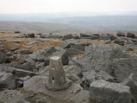
Great Dun
Fell
Location: North
Pennines,
Cumbria
Grid Ref: NY
710321
Height: 2782 ft (848
m)
Status: Hewitt,
Nuttall
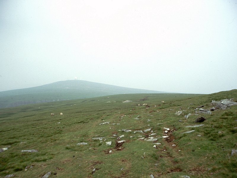
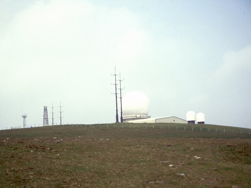
Notes: High on the
Pennines,
Great Dun Fell is home to the Civil Aviation Authority's air traffic
control
radar. The summit radomes are visible for a good forty miles around and
many see them as a visual intrusion, but of course installations like
this
have to be built somewhere. Great Dun Fell lays on the route of the
Pennine
Way, which is the usual approach, though it could also be climbed by
the
private road to the radar station (the highest surfaced road in
Britain).
The views are mainly of wild moorland and other Pennine tops. On good
days
the Lakeland fells can be seen to the south west.
|
|
|
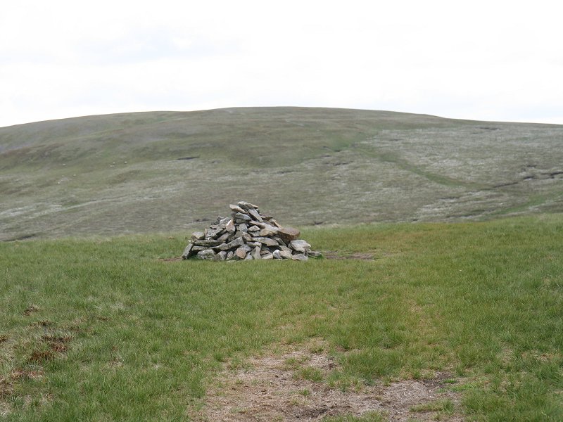
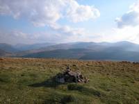
Great Knoutberry Hill
Location: North
Pennines, Yorkshire/Cumbria
Grid Ref: SD
788871
Height: 2205 ft (672
m)
Status: Marilyn,
Hewitt,
Nuttall
Notes: This lonely
summit lays on the main watershed of England and on the Yorkshire /
Cumbria border. A minor road from Dent to Garsdale crosses its
northwest shoulder and is the key to its ascent. Leave the road at
SD779850, having driven there or walked up from mearby Dent station,
follow the track for roughly half a mile, and then turn left through a
gate and along a faint path until you reach the top. The "stone men" in
view throughout the ascent prove to mark the lip of the steeper slope,
the actual summit laying half a mile beyond. The panorama is of endless
Pennine heights, broken only by the green valley of Dentdale to the
west.
|
|
 |
Great
Lingy Hill
Location: Lake
District, Northern Fells
Grid Ref: NY
310340
Height: 2021 ft (616
m)
Status: Nuttall(?)
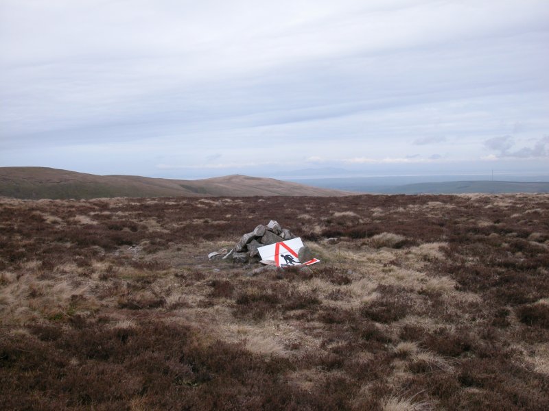
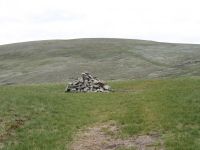
Notes: A minor top of
Caldbeck's High Pike, pathless and covered in
heather. Seen from High Pike itself it's just a gentle swell in the
moorland a mile or so to the southwest. The only feature of interest is
the "men at work" sign that forms part of the cairn, and no doubt that
will be temporary. The hill's status as a Nuttall appears to be in
doubt, as it's featured in the original book but no longer appears on
the Nuttall's website. It has perhaps been deleted. |
|
|
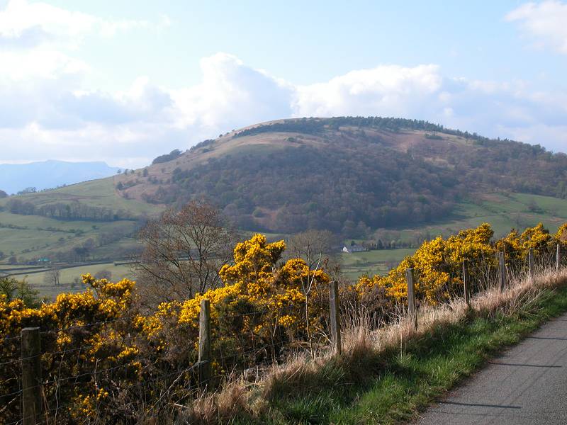
Great Mell
Fell
Location: Lake
District,
Eastern Fells
Grid Ref: NY
396254
Height: 1762 ft (537
m)
Status: Wainwright,
Marilyn, Dewey
Notes: Great Mell
Fell is
untypical of the Lakeland fells, being an isolated grassy dome rising
from
the pastoral country east of Matterdale. In Wainwright's day the fell
was
part of an army firing range and access was difficult, but the fell is
now owned by the National Trust and there are no restrictions. The fell
is largely pathless, however. Its flanks are quite steep and the least
difficult way up is probably by the eastern slopes, which are partially
wooded.
From the grassy bald of the summit there are splendid views of the
Fairfield
and Helvellyn groups as well as nearby Blencathra.
|
|
|
Great
Rhos
Location: Radnor Forest, Powys
Grid Ref: SO
182638
Height: 2165 ft (660
m)
Status: Marilyn,
Hewitt, Nuttall
Notes: Great Rhos is
the highest point of the Radnor Forest. A summit for list tickers only,
it is the centre of a sprawl of boggy moorland on which paths are few
and ill-defined. The easiest approach by far is from the forest tracks
to the north, but most walkers seeking out this summit will be doing
the round from New Radnor and you will be lucky to make it to or from
the village without having to wander over unpleasant trackless moorland
south of the trig point. The Harley Dingle valley is a firing range and
is out of bounds. The flat summit doesn't even allow for decent views,
though the Brecon Beacons should be prominent to the souh west.
|
|

|
Great
Rigg
Location: Lake
District,
Eastern Fells
Grid Ref: NY
355104
Height: 2513 ft (766
m)
Status: Wainwright,
Hewitt,
Nuttall
Notes: Fairfield's
immediate
neighbour on its southwest ridge, Great Rigg stands high above
Grasmere.
The fell is normally visited as part of the Fairfield horseshoe, and is
but a kilometre of simple grassy walking from its parent fell. The
ridge
continues southwards to Heron Pike and Great Rigg also has a southwest
ridge that includes the outlier of Stone Arthur. There is a splendid
mountainscape
through the whole western arc, from the Old Man of Coniston through to
Skiddaw.
|
|
|
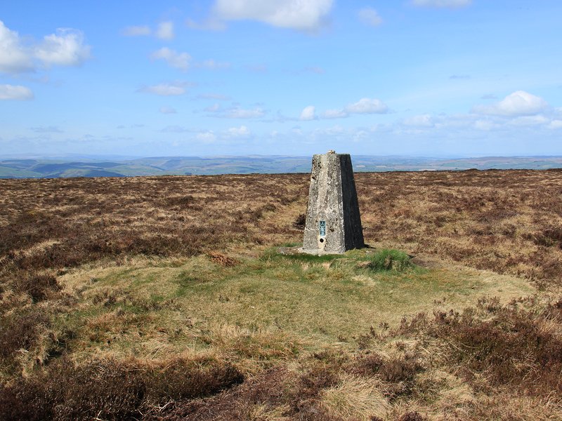
Great Sca
Fell
Location: Lake
District, Northern Fells
Grid Ref: NY
291339
Height: 2136 ft (651
m)
Status: Wainwright
Notes: Not to be
confused with Scafell Pike or Scafell some twenty miles to the south,
Great Sca Fell is a minor top in the "back o' Skiddaw" group and an
immediate neighbour of its parent fell, Knott. It's probably best
climbed as part of a round, either from Knott itself or from any of the
Uldale fells to the north and west. Apart from a glimpse of Carrock
Fell to the east and a nice grouping of the Whinlatter group to the
southwest, the view is curtailed by the bulks of Knott and Skiddaw. The
Solway Firth and part of the CUmbrian coastal plain are seen to the
northwest.
|
|

|
Great
Shunner Fell
Location: Yorkshire
Dales, Wensleydale
Grid Ref: SD
848973
Height: 2349 ft (716
m)
Status: Marilyn,
Hewitt,
Nuttall
Notes: Great
Shunner Fell
is the highest point of a great sprawl of moorland between upper
Wensleydale
and upper Swaledale, and lays on the route of the Pennine Way. It is
around
six miles and 1600 ft of ascent from Hawes, a straightforward walk of
about
3 hours. There is little foreground interest but distant panoramas are
superb and include the Lake District, the Three Peaks and much of the
north
Pennines.
|
|
|
Great
Whernside
Location: Yorkshire
Dales, Wharfedale
Grid Ref: SE
002739
Height: 2310 ft (704
m)
Status: Marilyn,
Hewitt,
Nuttall
Notes: Not to be confused with Whernside, which is actually higher,
Great Whernside is situated to the east of upper Wharfedale near the
village of Kettlewell. The summit can be reached from the village in an
hour and twenty minutes. The panorama is one of rolling hills in pretty
nearly all directions, with the view to the west being the finest and
encompassing Pen-y-Ghent and its neighbours.
|
|
|
Gun
Location: Staffordshire
Roaches
Grid Ref: SJ
970615
Height: 1263 ft (385
m)
Status: Marilyn,
Clement
Notes: Gun is the high point of Gun Moor, an area of unimproved
heathland on the western fringes of the Peak District adjacent to the
Staffordshire Roaches. It is but a ten minute stroll from the nearest
road access at SJ968609. Non-drivers can get a bus to Rushton Spencer
and walk along the back lanes, a walk of around an hour. The Cloud is
prominent to the west while the Peak Disrtict hills rise to the east
and north. A radio amateur was working the 15-metre band from the
summit on the day I visited and had just contacted an operator in
Pennsylvania in the USA.
|
|

|
Hallin
Fell
Location: Lake
District, Far Eastern Fells
Grid Ref: NY
433198
Height: 1273 ft (388
m)
Status: Marilyn,
Wainwright
Notes: Tucked within
the lower elbow of Ullswater, Hallin Fell is virtually isolated from
the rest of the Far Eastern Fells and is a delightful little hill. It's
a mere twenty minute ascent from Martindale church, not far from
Howtown. There is a huge square cairn on the summit. The views of
Ullswater are excellent, and the mountain panorama includes the eastern
satellites of the Dodds and the Helvellyn group, Gowbarrow and the Mel
Fells, Blencathra, Cross Fell and the northern Pennines, and some of
the many tops of the High Street and Stony Cove Pike groups crowding
into the southern arc.
|
|
|
Harbour
Hill
Location: Pentland
Hills
Grid Ref: NT
206654
Height: 1381ft (421 m)
Status: none
Notes: A modest
yet pleasing
little hill in the Pentlands, overlooking the city of Edinburgh. The
hill
lays immediately east of Maiden's Clough, the pass between Penicuik and
Balerno, and is probably visited most often by walkers exploring the
ridge
west of Allermuir Hill. The summit is unmarked, laying about 100 metres
south of the boundary fence between Edinburgh and Midlothian.
|
|

|
Hanter Hill
Location: Radnorshire
Grid Ref: SO
252571
Height: 1358 ft (414
m)
Status: Clement
Notes: Hanter Hill is
a minor top of Hergest Ridge in Herefordshire but, thanks to the
meanderings of the England-Wales border in these parts, Hanter Hill
itself is in Wales. The summit is a short and pleasant excursion from
Hergest Ridge itself and the diversion takes just fifteen minutes. The
hill country of Herefordshire and Powys is laid out around the northern
arc, but of course the view to the south is blocked by Hergest Ridge
itself.
|
|
 |
Hare
Stones
Location: Lake
District, Northern Fells
Grid Ref: NY
315343
Height: 2057 ft (627
m)
Status: Nuttall
Notes: The tiniest of
cairns marks the summit of Hare Stones, a minor top of Caldbeck's High
Pike and little more than a slight bump in the surrounding moorland.
Two paths running round the shoulders of High Pike and a third path
down from its summit converge into one near the head of the Graingill
Beck valley, and Hare Stones itself lays barely a hundred metres to the
northwest of this point though can be rarely visited. But for its
status as a Nuttall it's a fair bet that it would be ignored, for its
drab moorland surround ensures that it lacks any interest, save that of
being in the middle of nowhere. |
|

|
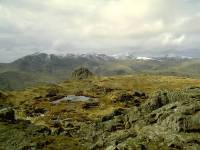
Harrison
Stickle
Location: Lake
District,
Central Fells
Grid Ref: NY
281073
Height: 2415 ft (736
m)
Status: Wainwright,
Hewitt,
Nuttall
Notes: The highest
of the
Langdale Pikes, Harrison Stickle (together with its near neighbour Pike
O'Stickle) dominates Langdale and is prominent in views from
Windermere,
Lonsdale and along the A65 down from Ingleton. It has something of a
tower-shaped
profile, making it look formidale in views from the valleys, yet can
easily
be ascended from the plateau to the rear, or from the valley via
Dungeon
Ghyll or Stickle Ghyll (both routes are straightforward but a bit
strenuous).
A longer but easier ascent can be made from Grasmere via Easedale.
There
is an excellent view, particularly over the southeastern arc across
Windermere
to the Pennines.
|
|
|
Hay Bluff
Location: Black
Mountains
Grid Ref: SO
244366
Height: 2221 ft (677
m)
Status: none (deleted
Nuttall)
Notes: Hay Bluff is
the dramatic little butt-end at the northern extremity of the Black
Mountain ridge on the England/Wales border. It overlooks Hay-on-Wye and
the nearby Hay to Capel-y-Ffin road provides easy access. A series of
grassy paths, some of them pretty steep, lead from the various car
parks along Gospel Pass to the top of the hill. It's a favourite spot
for hang gliding. The view is superb, the northern arc encompassing the
pastoral stretches of Herefordshire and Powys while the southern arc
consists of the rest of the Black Mountains and also part of the Brecon
Beacons to the southwest. Plynlymon is seen to the northwest.
|
|
|
Helm
Crag
Location: Lake
District,
Central Fells
Grid Ref: NY
327093
Height: 1299 ft (316
m)
Status: Wainwright
Notes: Known to
generations
of tourists as the Lion and the Lamb, Helm Crag is an outlier of High
Raise
situated two miles northwest of Grasmere. The unusually rocky summit
sits
atop an otherwise unremarkable grassy fell. The fell can be climbed
direct
from Grasmere - it requires some effort but takes less than ninety
minutes.
The actual top of the fell, the "Howitzer", is tricky to reach. The
view
is restricted by the Helvellyn and Fairfield groups to the east and the
bulk of High Raise to the west, but the Grasmere Valley is the obvious
highlight.
|
|
|
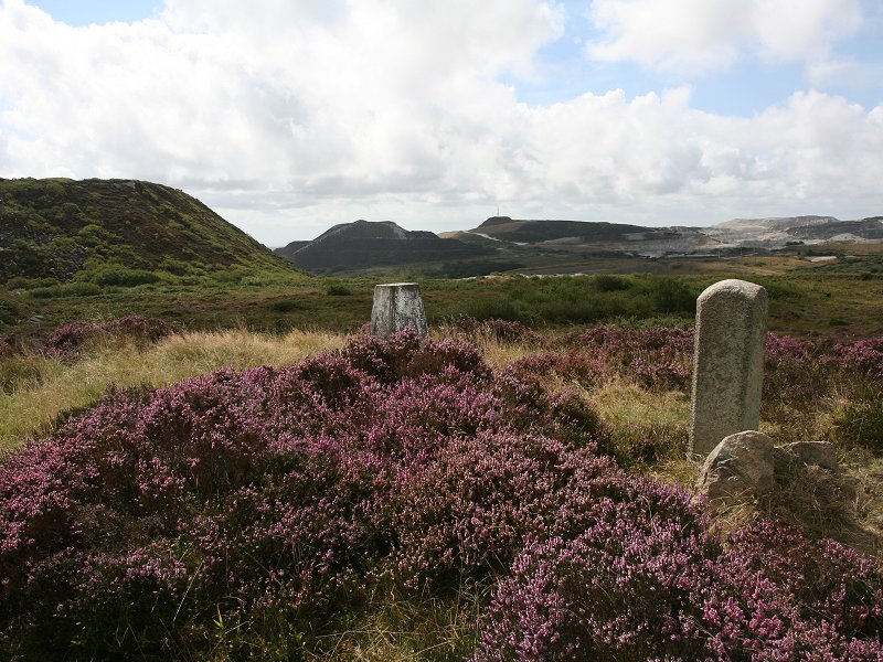
Hensbarrow
Beacon
Location: Cornwall
Grid Ref: SW
996575
Height: 1024 ft (312
m)
Status: Marilyn,
Clement
Notes:
Surely the saddest summit in Britain. Technically it is the highest
natural point for many miles around, but in practice Hensbarrow Beacon
is
surrounded and overtopped on three sides by the massive spoil heaps of
Cornwall's china clay quarries. Some of these heaps are a good three to
four hundred feet higher, many are still growing, and there can be
little doubt that they will be permanent fixtures. Someday this summit
will have to be relocated. If you do wish to visit and claim a
technical "bag" then the trig pillar is just ten minutes' walk east of
the minor road between Carthew and Coldvreath, about three miles north
of St Austell. You don't want to know about the qualities of the view.
|