|
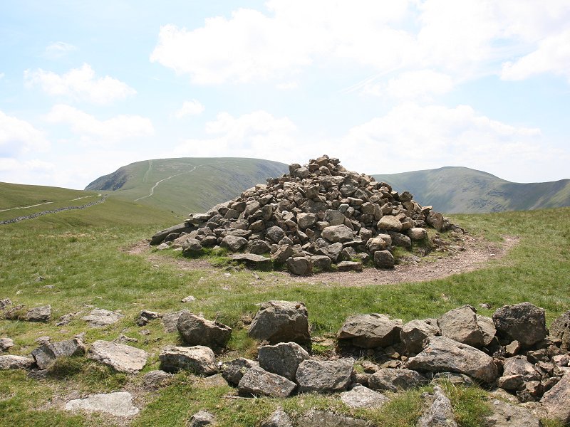
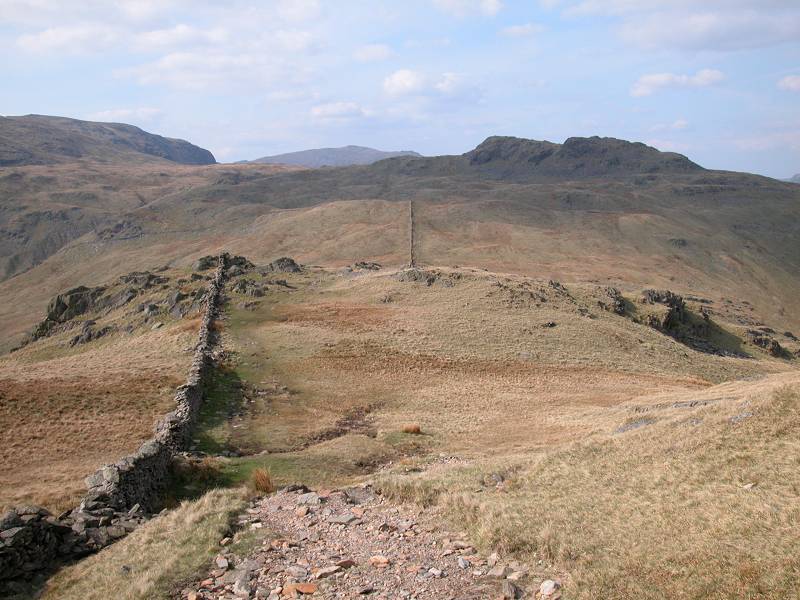
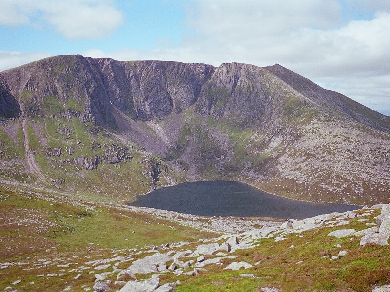
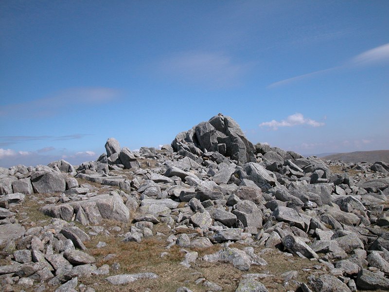
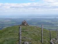
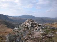
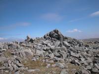
The
Knott
Location: Lake
District, Far Eastern Fells
Grid Ref: NY
437127
Height: 2425 ft (729
m)
Status: Wainwright
Notes: The Knott
looks like a significant fell when you approach it from the west, but
in reality is is a mere pimple on the ridge between High Street and
Rest Dodd, and it can be climbed from the intervening col in just two
minutes. The col carries the path from Ullswater to High Street (part
of Wainwright's Coast to Coast Walk) and this is the obvious ascent
route. The High Street ridge dominates the view to the east, Ullswater
is seen to the north, the Helvellyn group to the east and Stony Cove
Pike to the south. A grand mountain panorama.
|
|
|
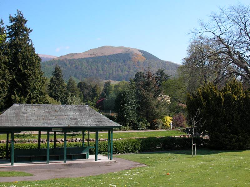
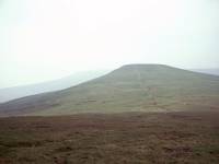
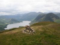
Latrigg
Location: Lake
District,
Northern Fells
Grid Ref: NY
278246
Height: 1207 ft (368
m)
Status: Wainwright
Notes: Latrigg is
Keswick's
local fell and stands immadiately above the town to the north. It is
rather
dwarfed by Skiddaw, of which it is really just an outlier, but
nevertheless
it's a bit of a magnet to the town's visitors. Its slopes are quite
extensively
wooded, and like many of the lower fells it is relatively steep and
needs
a fair bit of effort to climb. The easiest way up is to set out along
the
Skiddaw path from Spooney Green Lane and head almost as far as the
Latrigg
- Skiddaw col, from where the top of Latrigg is a relatively easy
stroll.
There is no trig point, marker or cairn on the highest point (seen
left).
The principal viewpoint is a few hundred metres west of the highest
point
and has excellent views of Keswick, Derwentwater, Skiddaw, and the
Grasmoor
and Dale Head groups.
|
|

|
Laughter
Tor
Location: Dartmoor
Grid Ref: SX
653757
Height: 1381 ft (421
m)
Status: Clement
Notes: One of
Dartmoor's many tors, Laughter Tor is easy enough to climb though it's
an hour or so from Postbridge, its most convenient access point. It is
usually climbed along with its near neighbour, Bellever Tor. The view
is not extensive but if you like endless vistas of empty moorland then
Laughter Tor is for you.
|
|
|
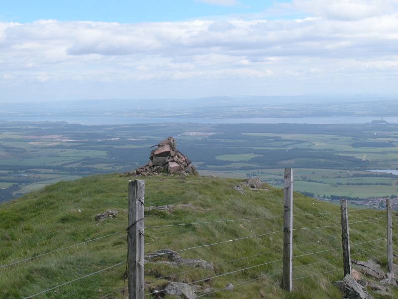
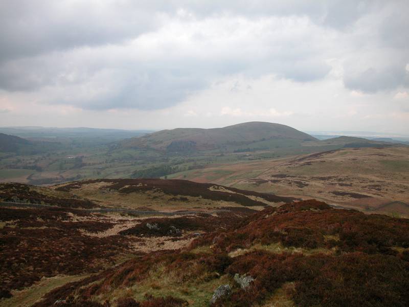
The Law
Location: The
Ochils
Grid Ref: NS
910996
Height: 2093 ft (638
m)
Status: Donald top
Notes: The Law is
an outlier
of Ben Cleuch, the highest top of the Ochils, and lays directly along
the
path to the parent fell from Tillicoultry. The cairn is actually just
across
the fence from the path but it would take a real purist to claim that
the
hill was not "bagged" unless one had slid across the fence to touch the
cairn proper. Views over the plain of the Forth are superb.
|
|
|
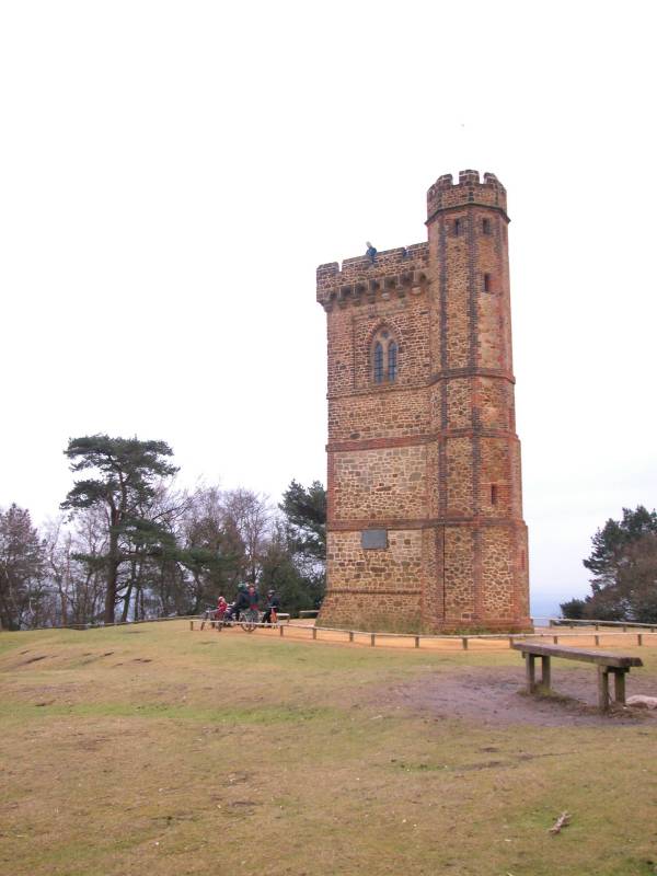
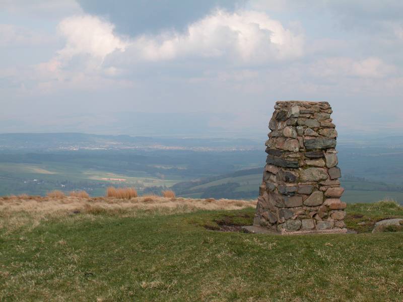
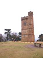
Leith
Hill
Location: North
Downs, Surrey
Grid Ref: TQ
139431
Height: 968 ft (295 m)
Status: Marilyn,
County
Top (Surrey)
Notes: Leith Hill
is the highest
point in south east England, the summit of an area of heath and forest
laying proud of the North Downs a few miles southwest of Dorking. The
tower
is an eighteenth century folly built in an effort to raise the height
of
the hill to 1000ft. Due to the tree cover there is no view from the
summit
although a good sweep of the North Downs can be seen from a point a few
hundred metres to the northeast. The nearest road access is the hamlet
of Coldharbour, a mile away, while the nearest rail access is Holmwood
on the London Victoria to Horsham line. The hill can be climbed from
Holmwood
in about 50 minutes by using a combination of lanes and local footpaths.
|
|
|
Ling
Fell
Location: Lake
District,
North Western Fells
Grid Ref: NY
179285
Height: 1224 ft (373
m)
Status: Wainwright
Notes: Like its
neighbour
Sale Fell, Ling Fell is a grassy hill on the northwestern edge of the
Lake
District. Its position gives it a good view over the Vale of Lorton and
Cockermouth, and beyond to Scotland across the Solway Firth. It can be
ascended with relative ease from the Kelswick farm road above Embleton.
|
|
|
Lingmoor
Fell
Location: Lake
District, Southern Fells
Grid Ref: NY
302046
Height: 1539 ft (469
m)
Status: Wainwright,
Marilyn
Notes: An
isolated fell laying between Langdale and Little Langdale, Lingmoor is
of modest height yet great complexity. Its slopes are steep and its
summit ridge is both rocky and boggy and, despite it being one of those
fells habitually left for a mediocre day, it is not a place to be in
poor weather. Best approached from the unclassified road between
Dungeon Ghyll and Little Langdale, Lingmoor is a prime viewpoint for
the Langdale Pikes (another reason to visit in good weather). There's
an awesome closeup view of Bowfell and its neighbours to the west,
while eastwards the Fairfield and Helvellyn ranges dominate.
|
|
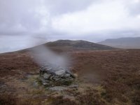 |
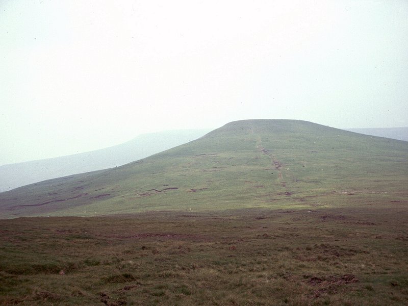
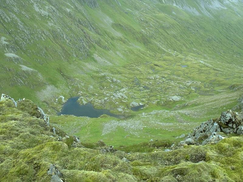
Little
Calva
Location: Lake
District,
Northern Fells
Grid Ref: NY
282314
Height: 2106 ft (642
m)
Status: Nuttall
Notes: A minor top
west of Great Calva. Were it not for its status as a Nuttall it's
doubtful if anyone would ever seek out this fell top, situated as it is
in the midst of a boggy and dreary sea of heather. It wasn't until I
got home that I noticed the rain on the camera lens, but unfortunately
this image will have to do as I seriously doubt I'll ever come here
again. The best approach is probably from Great Calva, from which there
is a path of sorts, a splendid expedition for those who enjoy wading
through soup. The view is about as exciting as the fell itself. Best
visited in sunshine when at least the situation of being well off the
beaten track can be enjoyed. |
|
|
Little Dun
Fell
Location: North
Pennines,
Cumbria
Grid Ref: NY
704330
Height: 2762 ft (842
m)
Status: Hewitt,
Nuttall
Notes: Little Dun
Fell is
one of the Cross Fell group of summits in the north Pennines, and is on
the route of the Pennine Way. The PW is the normal route of ascent to
the
summit, though it could also be climbed by way of the private road to
the
summit of its neighbour, Great Dun Fell. There is not a great deal to
commend
the summit as a viewpoint; much of the panorama consists of the wild
high
ground of the Pennines, though the Lakeland Fells crowd the skyline to
the southwest.
|
|
|
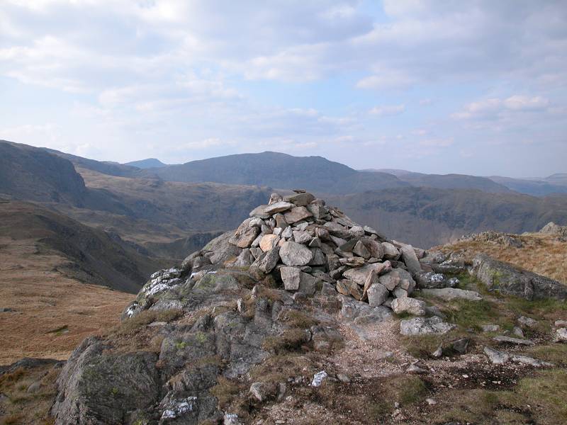
Little
Hart
Crag
Location: Lake
District,
Eastern Fells
Grid Ref: NY
387100
Height: 2090 ft (637
m)
Status: Wainwright,
Hewitt,
Nuttall
Notes: Little Hart
Crag is
effectively an eastern outlier of Dove Crag. It's a fearsome looking
summit,
a crown of crags standing above the head of Scandale, but is far less
daunting
than it looks. It can be climbed from the Scandale col in fifteen
minutes.
It is excellently placed for close-up views of Red Screes (to the east)
and Dove Crag and Fairfield (to the west) but the bulk of these hills
does
rather tend to shut out the wider panorama. |
|
 |
Little
Lingy Hill (a.k.a. Iron Crag)
Location: Lake
District, Northern Fells
Grid Ref: NY
303338
Height: 1998 ft (609
m)
Status: none
Notes: Laying to the
west of Great Lingy Hill and a minor "Top" of Caldbeck's High Pike,
Little Lingy Hill is a more prominent and better defined hill than its
big brother but is just two feet short of qualifying as a Nuttall.
Strictly the summit itself is nameless - Iron Crag is a rock formation
on its north slopes and the map places the legend "Little Lingy Hill"
almost at the col between here and Knott. The summit lacks interest
apart from the view out across the Solway firth, and there are no paths
anywhere near it. The hill itself looks quite handsome from down in the
valley, however, towering above the gash of Dale Beck south of Fell
Side. |
|
 |
Little Mell
Fell
Location: Lake
District,
Eastern Fells
Grid Ref: NY
423240
Height: 1657 ft (505
m)
Status: Wainwright,
Marilyn
Notes: Little Mell
Fell is
the lesser companion of Great Mell Fell, and like its big brother it's
an isolated grassy dome laying north of Ullswater and east of
Matterdale.
Its portrait to the left is from neighbouring Gowbarrow Fell. There is
a permissive path to the summit from The Hause, below its southern
flank
where it meets Little Meldrum (an outlier of Gowbarrow Fell). Ullswater
is not well seen from the summit, and the better views are to the west
and south west where the Fairfield and Helvellyn groups, the Dodds and
Great Mell Fell look very inviting. On a clear day the high tops of the
north Pennines should be in view to the northeast.
|
|
|
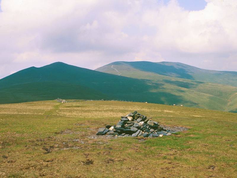
Loadpot
Hill
Location: Lake
District, Far Eastern Fells
Grid Ref: NY
456181
Height: 2201 ft (671
m)
Status: Wainwright,
Hewitt, Nutall
Notes: Loadpot Hill
is the northernmost hill of the High Street ridge. The ridge falls
northwards towards Pooley Bridge and this is the most obvious ascent
route if you're climbing Loadpot for its own sake, though it is usually
climbed as part of the ridgewalk. Masochists might try the very steep
ascent from Howtown. The view is not terribly exciting save for the
southwestern arc, which contains the head of Ullswater and the
Helvellyn group. The Vale of Eden fills the northern and eastern
panoramas, with the high Pennines visible to the northeast.
|
|

|
Lochnagar
(Cac
Carn
Beag)
Location: Scottish
Highlands,
Mounth
Grid Ref: NO
243861
Height: 3789 ft (1155
m)
Status: Munro, Murdo,
Marilyn
Notes: A superb
mountain, the highest summit of the Mounth, Lochnagar is not only a
pleasure to walk but also posesses dramatic features. Its summit
plateau is one of the largest tracts of high ground in the UK and, on
its northern lip, it falls away in a series of cliffs towards Loch
Nagar (from which the mountain is named). The highest summit, Cac Carn
Beag, sits above the western end of these cliffs. The most popular
ascent is from the Spittal of Glenmuick, southwest of Ballater, and
takes roughly three hours. The panorama is magnificent and features a
mountainscape ranging through the Fife hills in the south, the Mounth
and Perthsire hills to the west and the Cairngorms to the north. The
hills and plains of Aberdeenshire are seen to the east and there are
occasional glimpses of coastline. The summit features a topograph as
well as the usual Ordnance Survey trig pillar. |
|
|
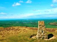
Long Mynd
Location: Shropshire
Hills
Grid Ref: SO
4155944
Height: 1693 ft (516
m)
Status: Marilyn
Notes: The Long
Mynd is an impressive and extensive heathland plateau, part of the
Shropshire Hills, laying immediately to the west of Church Stretton
near Shrewsbury. A moorland road passes within a quarter of a mile of
Pole Bank, the highest point, but to drive to the summit would be to
miss the delights of the area as a whole. There are a number of
possible approaches from either side but for the best experience walk
up from Church Stretton by the path south of Town Hollow and return by
Cardingmill Valley, which boasts some of the best ravine scenery in
England. The top is just 90 minutes' walk from the town and the whole
plateau is superb, easy walking country. Wales is only a few miles to
the west and the view extends to the mid-Wales hills and the Becon
Beacons, while in the other direction the panorama includes Wenlock
Edge and the Wrekin.
|
|
 |
Long
Side
Location: Lake
District,
Northern Fells
Grid Ref: NY
248284
Height: 2408 ft (734
m)
Status: Wainwright,
Hewitt,
Nuttall
Notes: The central
top of the subsidiary ridge that lays to the southwest of Skiddaw's
summit, Long Side is dwarfed by its lofty parent yet is a delightful
excursion. It can rarely be climbed in its own right, but is a useful
diversion from Skiddaw itself along with its neighbours Carl Side and
Ullock Pike. There's an easy path from Skiddaw to Long Side via the
Carl Side Col. The Long Side ridge is airy without being in any way
daunting, and has fine views over both Derwentwater and Bassenthwite. |
|
|
Lonscale
Fell
Location: Lake
District,
Northern Fells
Grid Ref: NY
285271
Height: 2346 ft (715
m)
Status: Wainwright,
Hewitt,
Nuttall
Notes: Lonscale
Fell is an
eastern outlier of Skiddaw. Its pleasant, grassy and almost flat top is
easily reached from the main Skiddaw path by turning off right at the
top
of Jenkin Hill. It boasts one of the best views of Derwentwater. The
fell
itself has few interesting features apart from its shapely east top,
which
overlooks the Glenderaterra valley. A cycle track winds around the
lower
slopes of the fell en route for the Skiddaw House youth hostel.
|
|
|
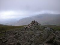
Looking
Steads
Location: Lake
District,
Southern Fells
Grid Ref: NY
245101
Height: 2543 ft (775
m)
Status: Nuttall
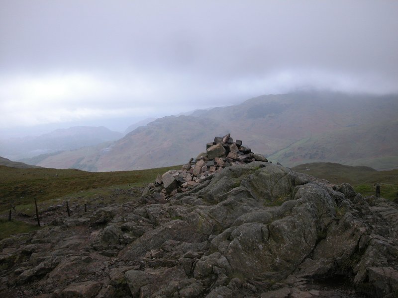
Notes: A top of
Glaramara,
laying some 800 metres to the south of its parent fell and, thanks to
the
rocky nature of the local terrain, qualiofying as a Nuttall in its own
right. The summit cairn is roughly sixty metres to the east of the main
ridge path. The ascent from the south, the usual route from Allen Crags
to Glaramara, is a slightly tricky clamber and requires care. The views
are rougly the same as from Glaramara.
|
|
|
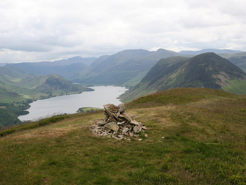
Low
Fell
Location: Lake
District, Western Fells
Grid Ref: NY
137226
Height: 1388 ft (423
m)
Status: Marilyn,
Wainwright, Clement
Notes: A lonely fell,
Low Fell the highest top of the group of hills that seperates
Loweswater from the Vale of Lorton. It's best approached from
Thackthwaite, from where a rough track takes a route into the valley of
Meregill Beck and curves south to reach Low Fell's north ridge. The
view into the main bulk of the Lakeland fells, fronted by Crummock
Water and Mellbreak, is the highlight of the panorama.
|
|

|
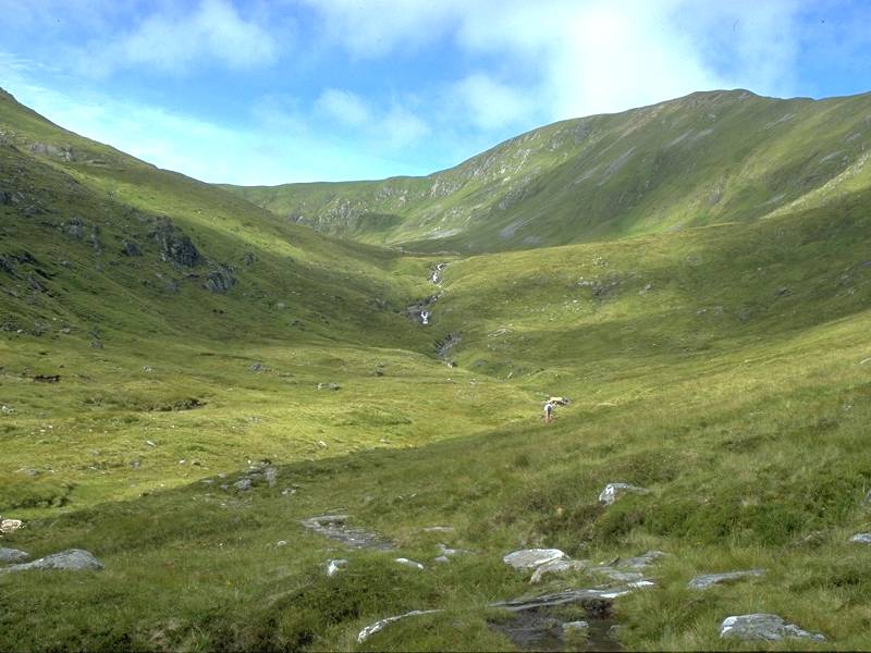
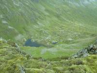
Mam Sodhail
Location: Scottish
Highlands,
Affric
Grid Ref: NH
120253
Height: 3875 ft (1181
m)
Status: Munro, Murdo
Notes: Britain's
fourteenth
highest mountain, and the second highest north of the Great Glen, Mam
Sodhail
(or Mam Soul, its Anglicized form) is surprisingly easy to ascend. The
nearest road access is just a handful of miles away at the end of the
Glen
Affric road from where you take the footpath along the north side of
Loch
Affric, turning right into Coire Leachavie and following a stalkers'
path
up to the col. The summit of Mam Sodhail is a short stroll from here up
the last couple of hundred feet. The summit picture to the left is the
view down into Gleann nam Fiadh from the top, which features a massive
pepperpot cairn. The view is excitingly crowded and includes much of
the
North West Highlands.
|