|
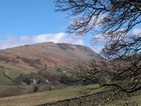
Mynydd Dinas
Location: Port
Talbot
Grid Ref: SS
760915
Height: 846 ft (258
m)
Status: Marilyn
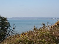
Notes: Mynydd Dinas
is a heathland dome overlooking the Welsh coastal town of Port Talbot.
It can be climbed from the town in about 50 minutes. The best part of
the panorama is the northwestward arc, where the coast sweeps around to
Swansea, and Neath is also visible. Somerset and Exmoor are visible
across the Bristol channel.
|
|
|
Mynydd Machen
Location: Ebbw Vale
Grid Ref: ST
223900
Height: 1188 ft (362
m)
Status: Marilyn,
Clement
Notes: Mynydd Machen
stands to the southwest of Risca, a few miles north of Newport. The
hill carries a prominent TV relay mast on its summit and can be seen
from most of the coastal plain between Cardiff and Newport. Both towns
figure prominently in the summit view, which also extends across the
Bristol channel to Somerset. The easiest access from the road network
is at Gelli-ffiniog farm at ST216907, from where a track goes right to
the top.
|
|
|
Mynydd Twyn-glas
Location: Lwyd Vale
Grid Ref: ST
259978
Height: 1549 ft (472
m)
Status: Marilyn,
Clement
Notes: Mynydd
Twyn-glas (Mynydd Maen on some maps) is an extensive area of high
ground situated between Cwmbran to the east and Newbridge to the west.
It can be ascended from either, though the approach from Cwmbran is
quicker. Drivers can park at ST277979 and take the track to the
top; non drivers can get a bus as far as Upper Cwmbram at ST274969. The
ascent is gentle. The summit is a typical heathland plateau, though any
sense of wilderness is dashed by the line of pylons and two clusters of
radio masts. Newport, the Bristol Channel and Somerset are seen to the
south, the Abergavenny hills to the northeast and the higher tops of
the Brecon Beacons to the northwest.
|
|
|
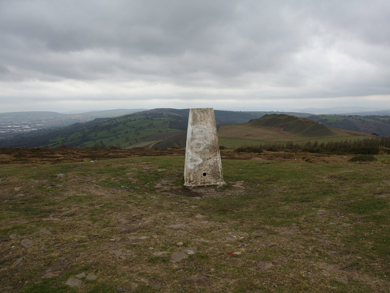
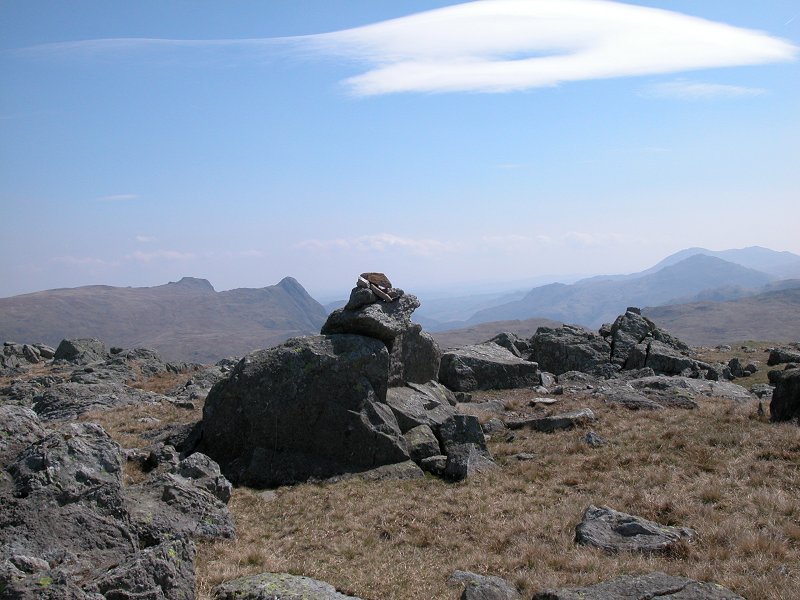
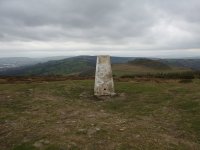
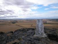
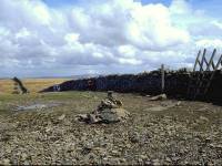
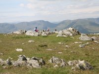
Mynydd y Glyn
Location: Rhondda
Valley
Grid Ref: ST
031896
Height: 1237 ft (377
m)
Status: Marilyn,
Clement
Notes: Mynydd y Glyn
lays to the south of Porth in the Rhondda valley, from where it's best
climbed. The map suggests that access is difficult but in fact Mynydd y
Glyn is one of the easiest marilyns in the Valleys. The unkarked top
can be reached from Porth by taking a path from the highest suburbs
southeastwards below the old quarry workings as far as an artificial
watercourse, then alongside it for a couple of hundred meters before
turning right for the gate that gives access to open country.
Unsurprisingly the panorama encompasses the Brecon Beacons to the north
and the Bristol Channel, with Exmoor and the Quantocks beyond, to the
south. The trig pillar to the southeast is not the summit!
|
|
|
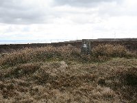
Mynydd y Lan
Location: Ebbw Vale
Grid Ref: ST
208923
Height: 1250 ft (381
m)
Status: Marilyn,
Clement
Notes: Mynydd y Lan
lays to the west of Crosskeys in lower Ebbw Vale, not many miles
northwest of Newport, a near neighbour of Mynydd Machen (q.v.).
It features steep slopes on most sides though the summit itself is
pretty flat and featureless, marked only by a boundary stone. The best
access is at ST218917 though the map is not terribly accurate in its
depiction of the path network; the route I found was initially along
the Two Rivers walk then along an unmarked track up left through the
forest
to the foot of Cox's Quarry, from where a sketchy path ran up the left
side of the quarry rim to reach a track hugging the side of the forest
for the rest of the way up. Cardiff and Newport both feature in the
view to the south, while the rest of the panorama encompasses many of
the heights between the Glamorgan valleys.
|
|
|
Nine
Barrow
Down
Location: Purbeck
Downs, Dorset
Grid Ref: SZ
007811
Height: 653 ft (199
m)
Status: Marilyn
Notes: One of a
handful of Marilyns whose status was discovered after Dawson published
his original list, Nine Barrow Down is the top of a downland ridge
laying to the southwest of Poole Harbour. It stands above the coastal
resort of Swanage, from where it's a comfortable walk of just under an
hour. To make it a worthwhile expedition consider walking the whole
three-mile ridge from Swanage to Corfe Castle, or vice-versa. The
highest point is unmarked, the trig pillar having been removed, and
lays about 100 metres north of the footpath at a field corner near a
pair of masts. Poole and Bournemouth are seen to the north, the Ise of
Wight to the east and the Purbeck Downs and Corfe Castle to the west.
|
|
 |
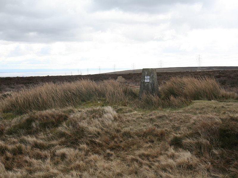
Nine
Standards
Rigg
Location: Yorkshire
Dales,
Swaledale
Grid Ref: NY
8250611
Height: 2172 ft (662
m)
Status: Marilyn,
Hewitt,
Nuttall
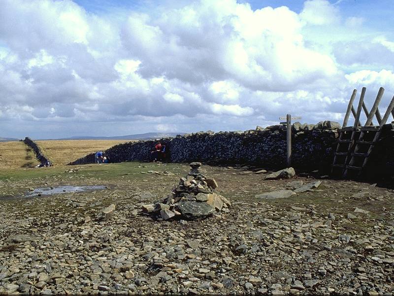
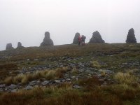
Notes: A sprawling
hill in the northern Pennines, Nine Standards Rigg lays on the route of
the Coast to Coast Walk. On the edge of the Yorkshire Dales National
Park and on the main watershed of England, it overlooks the town of
Kirkby Stephen three miles to the west, and it's from here that the
easiest ascent can be made. The origin of the nine "stone men" or
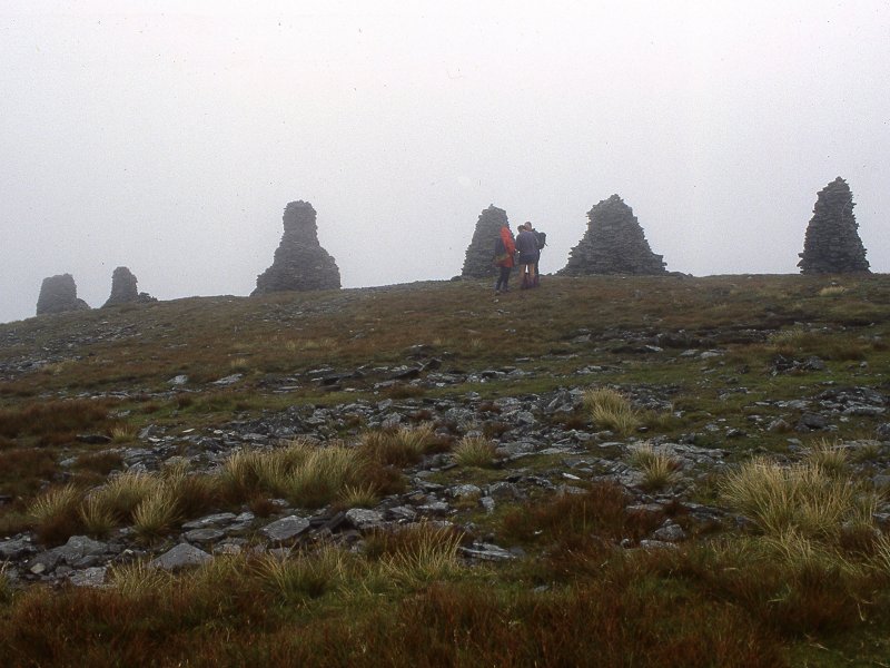
columnar cairns on the summit, is a mystery. |
|
|
North
Berwick Law
Location: East
Lothian
Grid Ref: NT
556842
Height: 613 ft (187 m)
Status: Marilyn
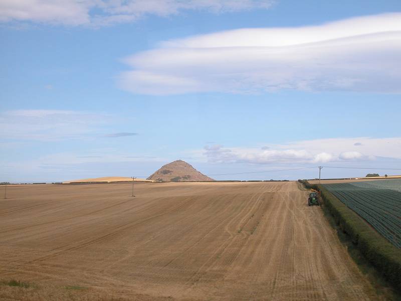
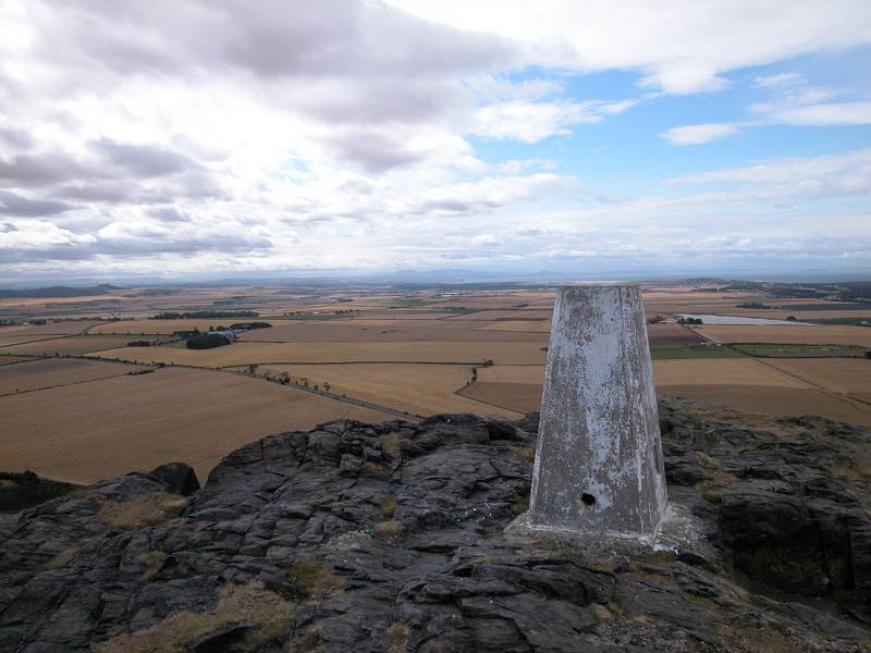
Notes: Rising
stark and alone
from the coastal plains of East Lothian not far from Dunbar, North
Berwick
Law is an ancient vocanic plug. Its summit features a mix of grass and
rock plus a good deal of "furniture", including a couple of old
buildings
and an arch. It is easily climbed from North Berwick in around 45
minutes
via a path winding around its western side. The view from the top is
most
rewarding, encompassing the Firth of Forth, the Lammermuirs to the
south,
and the crouching lion shape of Arthur's Seat some thirty miles to the
west.
|
|
|
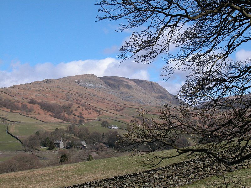
Orrest Head
Location: Lake
District,
Far Eastern Fells
Grid Ref: SD
414994
Height: 781 ft (238
m)
Status: Wainwright
outlying fell
Notes: Orrest Head is
the spot at which, on a summer day in 1930, Alfred Wainwright first set
eyes on the mountainscape of the Lake District and fell in love with
it. That view can't have changed much since then, save that Windermere
town has grown. Orrest Head, a modest fell by any standards, can be
reached by first following the Kendal road out of town then taking a
farm driveway and a woodland path up to the rocky little bald of the
summit. All is pastoral through the southwestern arc, dominated by
Windermere itself and the forests on its far shore, but it's the
northwestern arc that commands attention for here the fells crowd into
view. The Coniston fells, the Langdale Pikes, the Fairfield Horseshoe,
Red Screes and the western arm of the Kentmere horseshoe all
feature strongly.
|
|
|
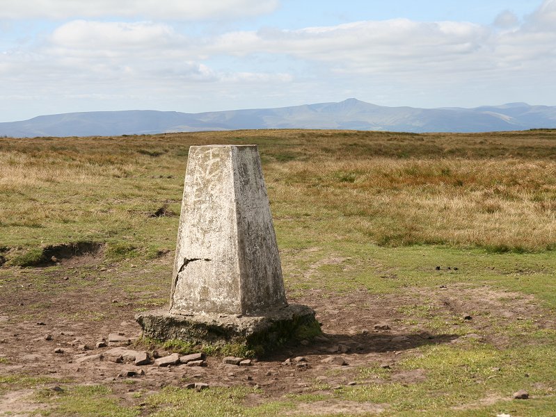
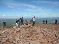
Pen y Fan
Location: Brecon
Beacons
Grid Ref: SO
012215
Height: 2907 ft (886
m)
Status: Marilyn,
Hewitt, Nuttall
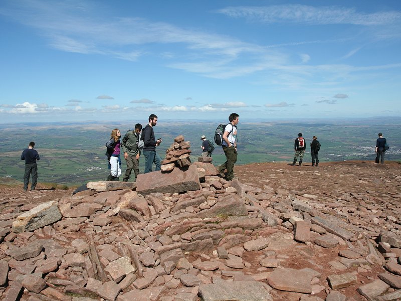
Notes: The highest
summit in the Brecon Beacons, indeed the highest summit in south Wales.
Pen-y-Fan's characteristic flat top stands out for many miles around.
It is best climbed from Storey Arms on the Brecon - Merthry road
(there's a regular bus service for non-drivers), from where a
straightforward and reasonably graded path will get you to the top in
75 minutes. The view is glorious and includes the hills of mid-Wales
(Cadair Idris, Plynlymon, the Arans and Berwyns), the Marches (the
Wrekin, the Shropshire Hills, the Clee Hills), the Black Mountains and
the Forest of Dean, the Cotswolds, the Mendips and the Quantocks, the
Bristol Channel and Exmoor, Lundy and Gower. On the clearest of days
there are glimpses of Snowdonia, 90 miles away.
|
|
|
Pen-y-Ghent
Location: Yorkshire
Dales,
Ribblesdale
Grid Ref: SD
838733
Height: 2278 ft (694
m)
Status: Marilyn,
Hewitt,
Nuttall
Notes: One of the
"Three Peaks"
of the Yorkshire Dales, Pen-y-Ghent is a great whaleback hill with a
distinctive
double cliff on its southern spur. The upper and lower cliffs are
formed
of gritstone and limestone respectively. The rocky summit of the hill
is
crossed by a drystone wall. Pen-y-Ghent is on the route of the Pennine
Way and also lies on the main watershed of Britain. Views are
extensive,
though are perhaps at their best to the west and northwest,
encompassing
Ribblesdale, Ingleborough and Whernside. The hill is a straightforward
climb from Horton in Ribblesdale, a distance of 3 miles with some 1500
ft of ascent. Don't miss Hull Pot and Hunt Pot, spectacular limestone
potholes
both just off route.
|
|
|
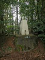
Periton
Hill
Location: Exmoor
Grid Ref: SS
946442
Height: 973 ft (297 m)
Status: Marilyn
Notes: This summit
is the
highest point of a long ridge of heathland laying south of Minehead, on
the Somerset coast. The trig point itself is fairly well hidden by
trees
and stands atop an old stone wall. Periton Hill is an easy walk from
Minehead;
the most straightforward approach is to walk through the town's
residential
streets to Hopcott, follow the woodland track up to the ridge, then
walk
to the west for just under a mile. Thanks to the surround of woodland
there
is little view, but from various spots in the vicinity you can see the
bulk of Exmoor including Dunkery Beacon, Gallax Hill south of Dunster,
eastwards to the Quantocks and north across Minehead and the Bristol
Channel
to Wales.
|
|

|
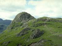
Pike
O'Stickle
Location: Lake
District,
Central Fells
Grid Ref: NY
274073
Height: 2326 ft (709
m)
Status: Wainwright,
Hewitt,
Nuttall
Notes: One of the
Langdale
Pikes, Pike O'Stickle's shapely topknott commands a fine view over
Langdale
itself, Windermere and the south east lakes, and across to Lonsdale.
It's
really just a top of High Raise but its profile and position make it a
prized conquest for hillwalkers. The ascent of its summit tor is
actually
quite tricky and the fainthearted may well think twice. It can be
included
in a round of the Pikes, or can be climbed individually by way of Stake
Pass, Easedale, Stickle Ghyll or Dungeon Ghyll.
|
|
|
Pinhaw
Beacon
Location: Aire
Gap, West
Yorkshire
Grid Ref: SD
944473
Height: 1273 ft (388
m)
Status: Clement
Notes: Pinhaw
Beacon is on
the route of the Pennine Way and is the highest part of a sprawl of
unimproved
heather moorland between Colne and Skipton. Skipton itself is in view
from
the summit, which can be ascended very easily from the minor road
crossing
Elslack Moor, only ten minutes' walk away.
|
|

|
Raise
Location: Lake
District,
Eastern Fells
Grid Ref: NY
342174
Height: 2889 ft (883
m)
Status: Wainwright,
Hewitt,
Nuttall
Notes: The
thirteenth highest
summit in England, a height reached by virtue of Raise being one of
Helvellyn's
northern neighbours. Raise lays between the Glenridding mine track and
Stick's Pass, each of which offer straightforward ascents (and from
Raise
it's little more than a stroll to Helvellyn itself). The rocky summit,
a novelty on this otherwise grassy ridge, provides an interesting
foreground
to a grand summit vista.
|
|
|
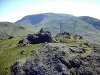
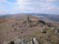
Rampsgill Head
Location: Lake
District,
Eastern Fells
Grid Ref: NY
442128
Height: 2598 ft (792
m)
Status: Wainwright,
Hewitt,
Nuttall
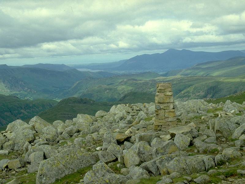
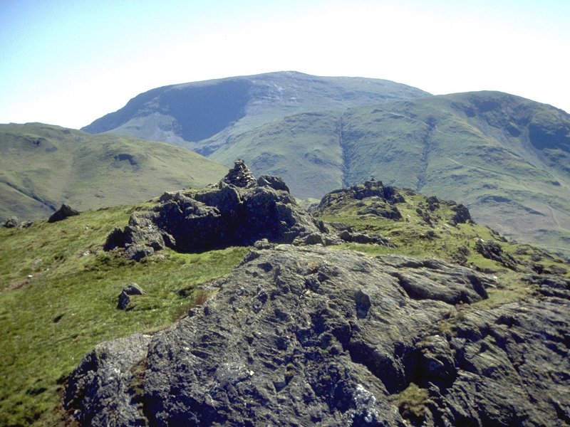
Notes: Situated atop
the dogleg in the High Street ridge just north of High Street itself,
Rampsgill Head stands at the head of both Ramps Gill (to the northwest)
and Riggindale Beck (to the southeast) and boasts a pretty good
panorama. The outcrop of rocks pictured appears to be the highest
point, though a similar outcrop a couple of hundred metres to the
southwest is actually a superior viewpoint and does appear to be the
true head of Ramps Gill. Standing as it does at the crossroads of the
High Street ridge and Wainwright's Coast to Coast route, it boasts a
choice of four ascent routes; that from Ullswater is probably the most
popular.
|
|
|
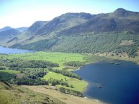
Rannerdale Knotts
Location: Lake
District,
North Western Fells
Grid Ref: NY
167183
Height: 1165 ft (355
m)
Status: Wainwright,
Clement
Notes: Just a 45
minute climb from Buttermere, this rocky little summit is a very
rewarding climb for the minimum effort involved. An offshoot of
Whiteless Pike in the Grasmoor group, Rannerdale Knotts has a
commanding view over both Buttermere and Crummock Water, and in the
other direction offers a superb view of the wild slopes of
Grasmoor and Whiteless Pike. |
|
|
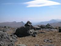
Red
Beck
Top
Location: Lake
District,
Southern Fells
Grid Ref: NY
242097
Height: 2365 ft (721
m)
Status: Hewitt,
Nuttall
Notes: A nameless
top on the
high ridge between Allen Crags and Glaramara. Since it qualifies as
both
a Nuttall and a Hewitt, it has been named after the nearest watercourse
for inclusion in the Nuttall list (though the Hewitt list gives it as
Glaramara
South Top), Typically rocky, like all the tops in this area. The summit
has fine views of the Langdale Pikes and Coniston fells (as pictured)
as
well as Great End and the Gables.
|
|
|
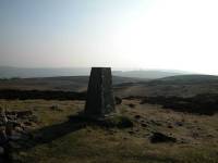
Red
Screes
Location: Lake
District,
Eastern Fells
Grid Ref: NY
396087
Height: 2546 ft (776
m)
Status: Wainwright,
Marilyn,
Hewitt, Nuttall
Notes: Red Screes
lays to
the east of the Fairfield horseshoe overlooking Kirkstone Pass. The
ridge
rises just north of the town of Ambleside and Red Screes can be
ascended
from the town in around two and a half hours. The mountain dominates
the
northern end of Windermere and the views from its summits are
excellent,
taking in just about all the major Lakeland fells apart from Skiddaw
and
Blencathra. It is unusual in having a substantial tarn adjacent to its
summit.
|
|
|
Rhos Dirion
Location: Black
Mountains
Grid Ref: SO
211334
Height: 2339 ft (713
m)
Status: Nuttall
Notes: The Black
Mountains are a range of north-south heathland ridges just west of the
England/Wales border, and their northern terminations form a series of
splendid little summits. Rhos Dirion is one of these, laying to the
west of its immediate neighbour Twmpa. Although higher than Twnpa it
has lesser topological status as there is only 90 metres of reascent
from its parent fell back along the ridge. It is equally well climbed
from Gospel Pass in the east (via Twmpa) or from Talgarth in the west,
though there is rather less ascent from Gospel Pass. The view to
the north is excellent, taking in much of rural Powys and
Herefordshire, while the bulk of the Black Mountains lays to the south
and the Brecon Beacons are well presented to the southwest.
|