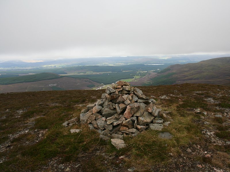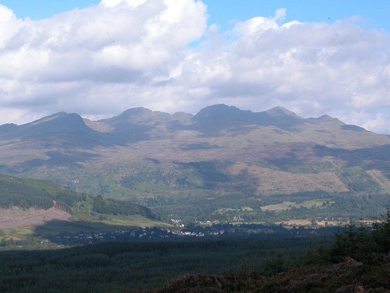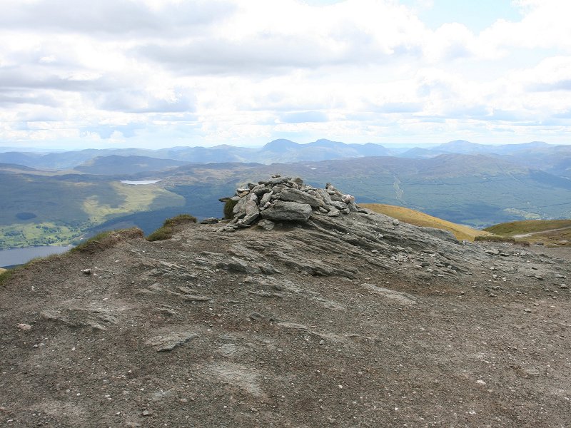
|
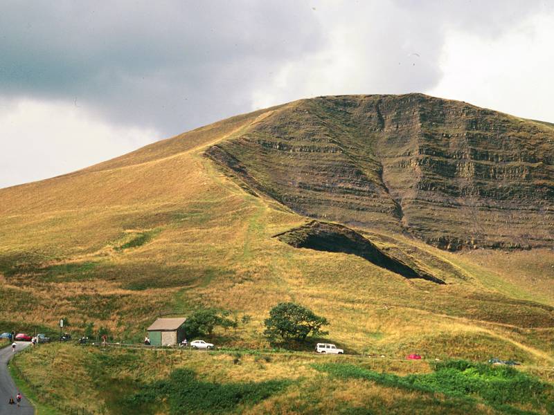
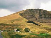
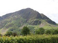
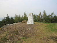
Mam Tor
Location: Peak
District, Derbyshire
Grid Ref: SK
127836
Height: 1695
ft (517 m)
Status: Dewey
Notes: Mam
Tor is a magnet to visitors to the Derbyshire
village of Castleton, from where it can be climbed
in around 50 minutes. The highest point of the ridge
between Castleton and Edale, it's a favourite spot
for hang-gliding. The south face features bedding
planes of gritstone and shale, and is remarkably
steep. The best approaches are via the col of
Hollins Cross to the east, or via Mam Nick to the
west. Mam Tor is also known as the Shivering
Mountain, on account of the occasional landslips on
its southern face.
|
|
|
Maol Chinn-dearg
Location: Scottish
Highlands, Kintail
Grid Ref: NH
032087
Height: 3218
ft (981 m)
Status: Munro,
Murdo
Notes: The
fourth of the seven Munros of the South Kintail
ridge. 2km and about an hour's walk from Aonach air
Chrith. The east ridge is complex with a couple of
shapely minor tops, which can be bypassed. The
summit stands at the apex of a bend in the ridge,
and it gives splendid views along both aspects of
Glen Shiel and the mountains either side. To the
south, Loch Quoich and the surrounding hills are
well seen, and there's also an inviting view into
the remote Knoydart area. If you're not continuing
along the main ridge, a good path all the way down
the north ridge will get you back down to Glen Shiel
only 2km from the Cluanie Inn.
|
|
|
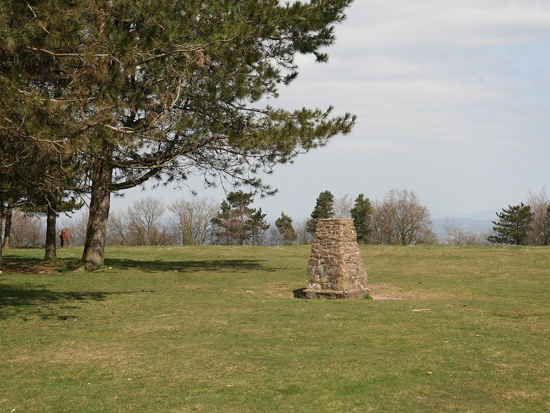
May Hill
Location: Forest
of
Dean
Grid Ref: SO
695212
Height: 971
ft (296 m)
Status: Marilyn
Notes: May
Hill is the highest point of the Forest of Dean, an
area of wooded hills situated in the west of
Gloucestershire and eastern Monmouthshire. The hill's
flat summit is home to a copse of trees planted to
mark Queen Victoria's golden jubilee, and the trig
pillar marking the highest point stands just outside
the trees to the southeast. The hill stands above May
Hill Village from where it is best ascended; the
nearest public transport node is the bus stop at
Dursley Cross on the nearby A40. To the east and
southeast the Cotswolds are displayed broadside-on
across the Severn vale, and the Severn's meanders are
seen to the south, beyond which Somerset is visible.
To the west the view extends into south Wales and
includes the Brecon Beacons and Black Mountains. The
Malvern hills can be seen almost end-on to the north.
|
|

|
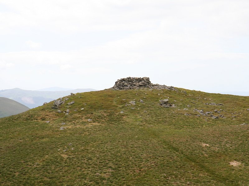
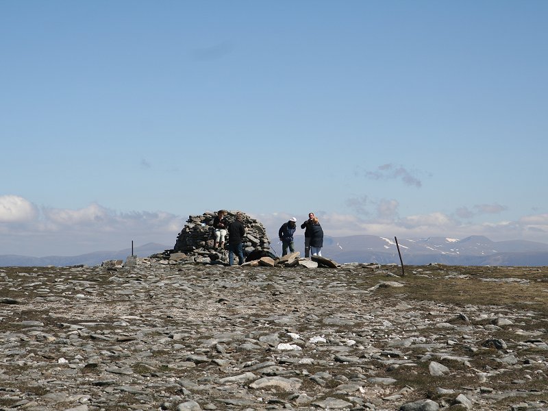
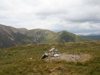
Meal Fell
Location: Lake
District,
Northern
Fells
Grid Ref: NY
282337
Height: 1804
ft (550 m)
Status: Wainwright,
Dewey
Notes: Meal
Fell is a hill in the "back of Skiddaw" group, laying
to the northwest of its parent fell, Knott. It is
notmally climbed in conjunction with its neighbour,
Great Cockup, from Orthwaite or Bassenthwaite. Much of
the panorama is shut in by the bulks of Skiddaw and
Knott, though there is a good view across the Cumbrian
coastal plain to the Solway Firth and across to
Scotland. The summit carries a huge wind shelter, an
unusual adornment to an insignificant fell such as
this.
|
|
|
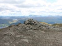
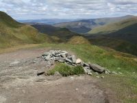
Meall a'Buachaille
Location: Scottish
Highlands, Cairngorms
Grid Ref: NH
990115
Height: 2657
ft (810 m)
Status: Corbett,
Marilyn
Notes: The
highest top of the ridge to the north of Loch Morlich,
Meall a'Buchaiile is a popular climb. The standard
route takes the forest track from Glenmore through the
Pass of Ryvoan to Ryvoan Bothy, from where a
well-maintained path goes up the eastern ridge of the
hill. It is a fine vantage point for Cairn Gorm and
its ridges and corries, and also overlooks the
Rothiemuchus forest to the south and the Abernethy
forest to the north. There are glimpses of high tops
beyond the Great Glen, and of those either side of the
upper Spey valley around Newtonmore and Dalwhinnie.
|
|
|
Meall Chuaich
Location: Scottish
Highlands,
Drumochter
Grid Ref: NN
716878
Height: 3120
ft (951 m)
Status: Munro,
Murdo, Marilyn
Notes: Meall Chuaich stands at the northeast
corner of the group of hills surrounding the
Drumochter pass and overlooks the upper Spey valley.
Access is easy, there being a good waterworks track
from Chuaich, near Dalwhinne, to the adjacent loch and
then a moderately graded hill path to the summit. The
only slight obstacle is a boulder field surrounding
the summit dome. Views are extensive and include the
Cairngorms, the Mounth, the Glen Tilt hills and the
rest of the Drumochter hills, as well as the Ben Alder
group to the west and the Monadhliath to the
northwest. Newtonmore, Kungussie and Aviemore can all
be seen. The vast emptiness of the Gaick forest
stretches for many miles to the southeast.
|
|
|
Meall Greigh
Location: Scottish
Highlands,
Perthshire
Grid Ref: NN
674438
Height: 3284
ft (1001 m)
Status: Munro,
Murdo, Marilyn
Notes: Meall
Greigh is the easternmost of the five Munros of the
Ben Lawers group. Superheroes will want to tackle all
five in one expedition but ordinary mortals will be
more content to tackle Meall Greigh alone, or possibly
together with neighbour Meall Garbh. Although there is
a ridge path between the two there are no paths
linking it to the outside world; starting at Machuim
and walking up the Lawers burn path you can either
tackle the hill direct via Sron Mhor (good terrain but
nastily steep) or walk along to the dam and make your
way from there up to the Garbh/Greigh col (rough
grass, a touch boggy). Views of Loch Tay are superb,
and those of the Ben Lawers massif across Lochan nan
Cat come a very close second.
|
|

|
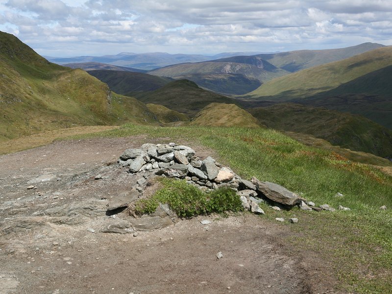
Meall nan Sleac
Location: Scottish
Highlands, Cairngorms
Grid Ref: NN
868944
Height: 2625
ft (800 m)
Status: Corbett
Top
Notes: Meall
nan Sleac is a northeastern outlier of Mullach Clach
a'Bhlair, and is just a five minue diversion off the
ascent path to the latter from Glen Feshie. The best
feature of the view is that the summit stands on the
southern lip of the ravine-like Coire Garbhlach. The
huge bulk of the western Cairngorm plateau shuts out
any view to the east, but westwards several stretches
of Glen Feshie are in view as well as the wild country
beyond, over towards Glen Tromie, the Gaick Forest and
Drumochter.
|
|
|
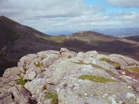
Meall nan Tarmachan
Location: Scottish
Highlands,
Perthshire
Grid Ref: NN
585390
Height: 3425
ft (1044 m)
Status: Munro,
Murdo, Marilyn
Notes: Meall
nan Tarmachan stands immediately to the west of the
Ben Lawers group and is the Jekyll to Ben Lawers's
Hyde; in complete contrast to the rounded slopes of
Ben Lawers, Meall nan Tarmachan presents a fascinating
line of tors and crags to Killin at the end of Loch
Tay. There is some scrambling for those who traverse
the whole ridge but the main summit can be reached
without any problems by a path from the Bridge of
Balgie road just north of the Ben Lawers visitor
centre. The reascent from the south top is rather
steep but the path is good. The Glen Lyon Munros
feature in the northern panorama, Ben Lawers dominates
the view to the east, Ben Vorlich and Stuc a Chroin
are prominent to the south, Ben More and Stobinian to
the southwest and the greater part of the Tarmachan
Ridge fills the scene to the west.
|
|
|
Meall nan Tarmachan (South Top)
Location: Scottish
Highlands,
Perthshire
Grid Ref: NN
589385
Height: 3028
ft (923 m)
Status: Munro
Top, Murdo
Notes:See the
notes directly above for Meall nan Tarmachan itself.
The south top is the first summit that you encounter
if you take the path uo from the Bridge of Balgie road
a few hundred metres north of the Ben Lawers visitor
centre. It commands a grandstand view of the steep
path from the next col up to Meall nan Tarmachan
itself.
|
|
 |
Meall Tairneachan
Location: Scottish
Highlands,
Perthshire
Grid Ref: NN
807544
Height: 2582
ft (787 m)
Status: Corbett,
Marilyn
Notes: Not to
be confused with the Munro Meall nan Tarmachan (q.v.),
Meall Tairneachan is a Corbett laying a few miles east
of Schiehallion. There is a track servicing a bayrites
mine running nearly all the way to the summit; it
leaves the public road at NN780562. Simply walk up the
track to the bend at NN808545 and then strike off half
right for the top. Schiehallion is prominent to the
west of course, the Glen Lyon Munros are seen to the
south, Farragon Hill to the east and the Drumochter
Hills to the north.
|
|
|
Meikle Pap
Location: Scottish
Highlands, Mounth
Grid Ref: NO
259860
Height: 3215
ft (980 m)
Status: Munro
top, Murdo
Notes: Meikle
Pap is a top of Lochnagar, and the first one reaached
if you approach by the usual route from Spittal of
Glenmuick. It's a mere 200 ft of ascent from the col
below the main summit plateau, and the diversion from
the main path takes a mere ten minutes. It's worth the
visit, for the Pap is a superb viewpoint for
Lochnagar's northern cliffs and corries.
|
|
|
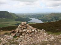
Mellbreak
Location: Lake
District,
Western Fells
Grid Ref: NY
148186
Height: 1680
ft (512 m)
Status: Marilyn,
Wainwright,
Dewey
Notes:
Mellbreak is something of a Jekyll & Hyde fell. It
dominates the scenery around Crummock Water, towering
over its southwestern shore, and has very steep flanks
and even steeper spurs. Yet, once you get to stand on
the summit, you realise that Mellbreak is still
dwarfed by the neighbouring Grasmoor and Pillar
groups. The easiest way up is by a path on the
southwestern side, which in turn is reached by a farm
track from Loweswater. Crummock Water is not seen from
the summit, the view from which is dominated by the
Grasmoor group to the west, the Scafells to the
southwest and Pillar to the south.
|
|
|
Mellbreak (north top)
Location: Lake
District,
Western Fells
Grid Ref: NY
143194
Height: 1670
ft (509 m)
Status: Dewey
Notes:
Mellbreak's north top is but ten feet lower than the
main summit a few hundred yards away, and there is
little doubt that it's the superior vantage point of
the two. Apart from it having a much more prominent
cairn the view is generally better. The mountain
skyline is much the same as from the main summit but
in other directions the view out to the Lorton vale
and the Cumbroan coastal plain is excellent. Crummock
water is not in view but Loweswater is seen end-on. |
|
|
Middle Dodd
Location: Lake
District,
Eastern Fells
Grid Ref: NY
397095
Height: 2146
ft (654 m)
Status: Wainwright
Notes:
Middle Dodd is really no more than a slight rise on
the north ridge of Red Screes as it descends to
Brothers Water, but nevertheless it's a pleasant
place to be. The views down towards Brothers Water,
eastwards to Stony Cove Pike and westwards to Little
Hart Crag and Fairfield are all excellent. It's
easily visited from Red Screes, with minimal
reascent, and the walk takes less than fifteen
minutes. Curiously, Wainwright gives the height of
the fell at 2106 ft. Perhaps he regarded a minor
bump further along the ridge as the summit.
|
|
|
Minch Moor
Location: Southern
Uplands,
Traquair
Grid Ref: NT
358330
Height: 1860
ft (567 m)
Status: Marilyn
Notes: A
lonely summit, a few hundred metres off the route of
the Southern Upland Way between Galashiels and
Traquair. Minch Moor is a broad moorland top
surrounded by forest plantations and there is no
immediate view, just distant panoramas. The view to
the south and west is especially fine. The hill can be
climbed from Traquair in an hour and a half.
|
|
|
Moncreiffe Hill
Location: Perth
Grid Ref: NO
135199
Height: 732
ft (223 m)
Status: Marilyn
Notes:
Moncreiffe Hill is a wooded height 3km southeast of
Perth, and can be reached via a series of woodland
trails leaving the minor road at Tarsappie Cottages.
The hill has three tops and boasts several Iron Age
hill forts. The view isn't great but the exploration
of the woodland trails makes a pleasant two hours'
expedition. |
|

|
Morrone
Location: Scottish
Highlands, Mounth
Grid Ref: NO
132886
Height: 2818
ft (859 m)
Status: Marilyn,
Corbett
Notes: Morrone
is one of the most accessible and easily ascended of
Britain's higher summits. Laying just two miles
southwest of Braemar in Aberdeenshire, its summit can
be climbed from the town in just 75 minutes. The
slopes are largely heather clad but towards the top
the terrain becomes more rocky. A mountain rescue
radio hut at the summit is served by a rough track
that leads south then east off the summit and reaches
the minor road opposite Auchallater - it can be
utilised as an alternative route of ascent or descent
to make a visit to Morrone a circular walk. Views
southward are restricted by the Carn Aosda / Carn a'
Gheoid massif, but there are good views of the Mounth
ranges to the east and west and an excellent view of
the Cairngorms to the north.
|
|
|
Mullach Clach a'Bhlair
Location: Scottish
Highlands,
Cairngorms
Grid Ref: NN
882927
Height: 3343
ft (1019 m)
Status: Munro,
Murdo
Notes: A
remote top, not so much a peak as a gentle swelling in
the huge moorland void between the Feshie and the
Eidart in the southwestern corner of the Cairngorms.
Access is relatively easy, however, by virtue of a
landrover track that comes up from Glen Feshie and
crosses the moor just three hundred meters north of
the summit. The top can be reached in just under three
hours from the nearest road access at Achlean. There
is no foreground interest, and on the day I climbed
the Mullach it was blanketed in dense cloud so I had
no view, but it would be expected to include the Sgor
Gaoith ridge end-on to the north, and the twin bulks
of Monadh Mor and Beinn Bhrotain to the east with
perhaps Cairn Toul and Ben Macdui overtopping them. To
the south and southeast are the wastes of the Feshie /
Geldie watershed, beyond which An Sgarsoch, Beinn
Dearg and the hills of Glen Tilt would stand out.
|
|
|
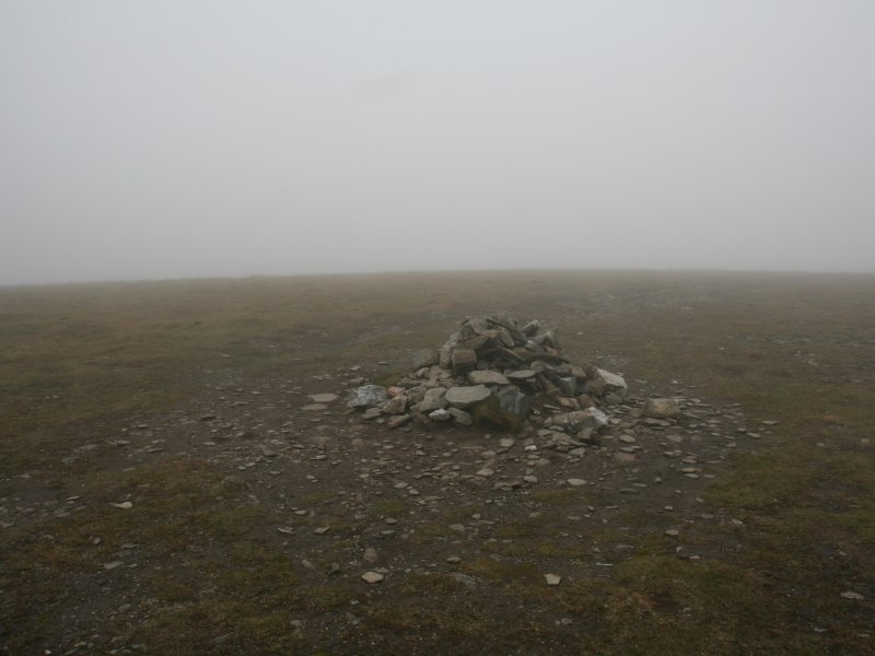
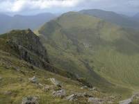
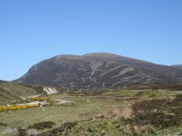
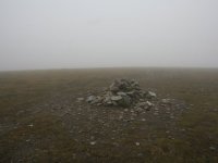
Mungrisedale Common
Location: Lake
District,
Northern
Fells
Grid Ref: NY
311293
Height: 2077
ft (633 m)
Status: Wainwright
Notes: Why
did Wainwright count Mungrisedale Common as a fell
in its own right? There are two common theories: he
either included it as a joke to see how many of his
readers would seek out the summit, or he was seeking
to fill the pages of his Northern Fells book, which
has a relative paucity of fells compared to the
others. Whatever the reason, he was pretty
dismissive of Mungrisedale Common, likening its
shape to that of "a pudding which has been sat on".
In his day there was nothing to mark the nominal
summit but a small cairn now exists and no less than
seven paths converge on it. The common is a vast
splodge of moorland forming the northwestern
hinterland of Blencathra, and barely rises above the
intervening col; nevertheless it has its charms,
provided that you visit on a sunny day. Best
approached from the foot of Foule Crag, from where
there's a path most of the way. The top image shows
the fell as seen from Blencathra; it's the grassy
sprawl in the middle distance.
|
|
|
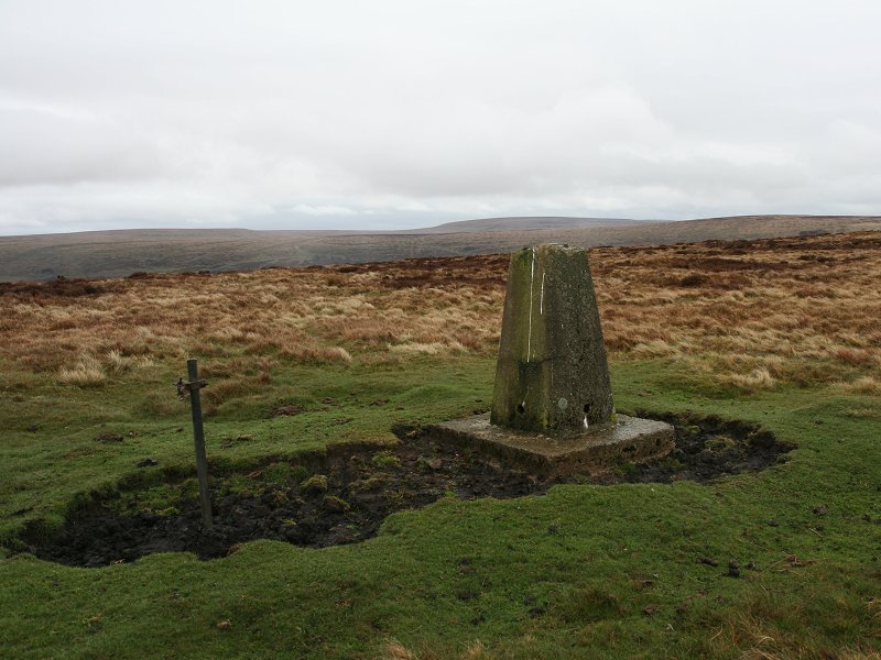
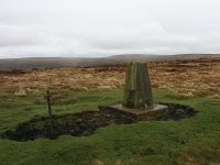
Mynydd Carn-y-Cefn
Location: Ebbw
Vale
Grid Ref: SO
187184
Height: 1804
ft (550 m)
Status: Marilyn,
Dewey
Notes: The
highest point of the moorland ridge seperating Ebbw
Vale from Ebbw Fach to the east, Mynydd Carn-y-Cefn is
most easily approached from Nantyglo from where a
track skirts West Monmouth golf club and runs along
the east side of the ridge. The summit itself features
a trig pillar sitting on an expanse of dull moorland.
There is no foreground interest but the view takes in
the Valleys (southwards), the Brecon Beacons
(northwestwards) and the Black Mountains
(northeastwards).
|