|
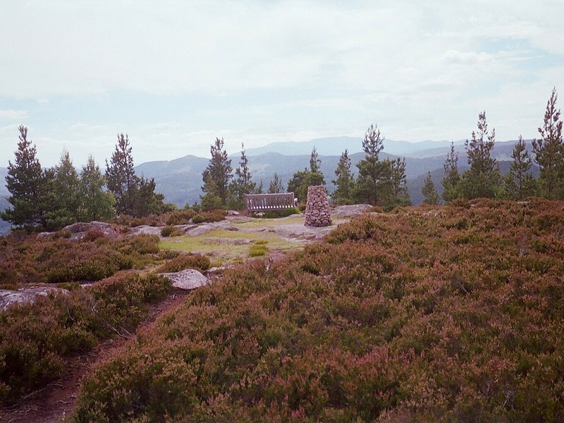
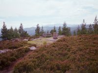
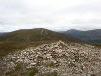
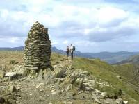
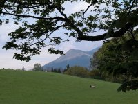
Craigendarroch
Location: Scottish
Highlands,
Cairngorms
Grid Ref: NO
365965
Height: 1319 ft (402
m)
Status: Marilyn
Notes:
A little gem of a hill, a wooded crag standing immediately above the
town of Ballater in Deesside. There is a network of paths through the
woods, one of which leads to the summit, where you'll find a bench and
a topograph and a glorious view. The ascent takes about 45 minutes, 15
minutes of which is spent negotiating suburban roads. The climb through
the woods is a delight and the view that rewards you includes stretches
of the Dee to the east and west, Lochnagar and its cliffs to the
southwest, Beinn a Bhuiridh and Geallaig to the west, Morven to the
north, Mount Keen poking above the hills to the southeast and Driesh
appearing through the dip of Glen Muick. Craigendarroch is an ideal
evening stroll.
|
|
|
Craiggowrie
Location: Scottish
Highlands,
Cairngorms
Grid Ref: NH
962134
Height: 2253 ft (687
m)
Status: Graham Top
Notes: Craiggowrie is
the westernmost of the four tops of the Meall a'Buachaille ridge that
lies to the north of Loch Morlich, and as such is the nearest of the
four to Aviemore, which it overlooks. The route to the summit from
Glenmore runs through forest for a couple of miles before emerging onto
a featureless, heathery hillside and running straight up a ridge to the
hill's short western shoulder. Normally one would come down this way,
having reached Craiggowrie at the end of the ridgewalk. The Spey
valley, the Rothiemurchus and Abernethy forests and the corries and
tops of Cairn Gorm are the principal features of the view.
|
|
|
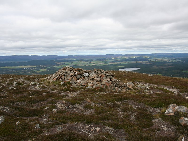
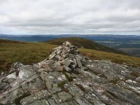
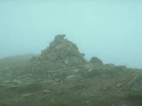
Creag
a'Chaillich
Location: Scottish
Highlands,
Cairngorms
Grid Ref: NH
968127
Height: 2332 ft (711
m)
Status: Graham Top
Notes: One of the
tops of the Meall a'Buachaille ridge north of Loch Morlich, and the
third one along if the ridge is walked from east to west. There are
paths from both neighbouring summits but none from down in the valley.
The view is pretty much the same as that from neighbouring Creagan Gorm
(see below).
|
|
|
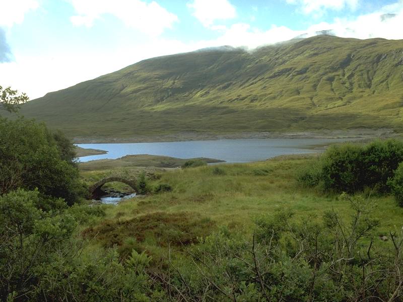
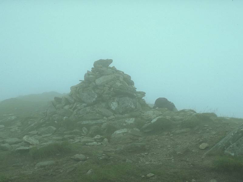
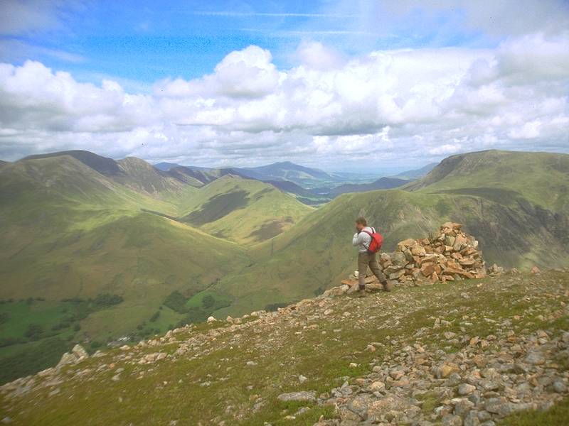
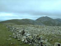
Creag
a Mhaim
Location: Scottish
Highlands,
Kintail
Grid Ref: NH
087077
Height: 3107 ft (947
m)
Status: Munro, Murdo
Notes:The
easternmost of the
seven Munros of the celebrated South Glenshiel ridge, Creag a Mhaim has
splendid views to the east, enlivened by both Loch Cluanie and Loch
Loyne
(assuming you don't suffer hill fog, like I did on the day the summit
picture
was taken). The top picture shows the mountain seen from Carn Ghluasaid
across Loch Cluanie. Creag a Mhaim is often recommended as an ideal
first
Munro, given its relative ease of ascent by a fine stalker's path up
its
southeast ridge, reached in turn by an estate track from the Cluanie
Inn.
From Creag a Mhaim a good ridge, with very few difficulties, stretches
some miles to the west and incudes six more Munros.
|
|
|
Creag
an Dubh-loch
Location: Scottish
Highlands,
Mounth
Grid Ref: NO
233822
Height: 3225 ft (983
m)
Status: Munro top,
Murdo
Notes: Part of the
Lochnagar massif, Creag an Dubh-loch lays to the southwest of the
Dubh-Loch and is the top of a mighty buttress of cliffs on that side.
The cliffs are not seen from the plateau, however, from which the
summit is a mere ten minute stroll off the path between Broad Cairn and
Cairn Bannoch. There is no path but the route is obvious and lays over
easy terrain. The Dubh-Loch is not seen from the summit but the whole
of the Lochnagar plateau is seen to advantage and Loch Muick looks
quite spectacular to the east.
|
|
|
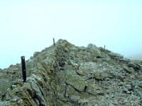
Creag
Leacach
Location: Scottish
Highlands,
Mounth
Grid Ref: NO
154745
Height: 3238 ft (987
m)
Status: Munro, Murdo
Notes: Creag
Leacach is Glas
Maol's immediate neighbour to the south and can easily be climbed from
it; there's only about 200 ft of reascent. The summit itself is
surprisingly
rocky and, unusually for a Scottish mountain, carries a drystone wall
along
its crest. There are good views to the south down to Spittal of
Glenshee
and beyond, but the great bulk of Glas Maol cuts out much of the
panorama
to the north and northeast.
|
|
|
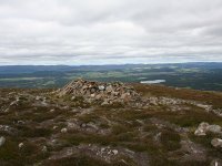
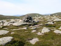
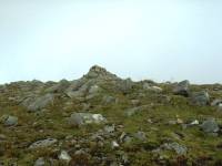
Creagan
Gorm
Location: Scottish
Highlands,
Cairngorms
Grid Ref: NH
978120
Height: 2401ft (732
m)
Status: Graham Top
Notes: Creagan Gorm
is one of the tops of the Meall a'Buachaille ridge north of Glenmore,
the second of the four if you traverse the ridge in the usual direction
from east to west. The ridge path is well maintained as far as the col
between Buachaiile and Gorm, after which it gets a good deal rougher.
There is also a path up to this col direct from Glenmore. The view is
similar to that of its neighbour, consisting of the ridges and corries
of nearby Cairn Gorm, the Rothiemurchus and Abernethy forests, and
various distant high summits.
|
|

|
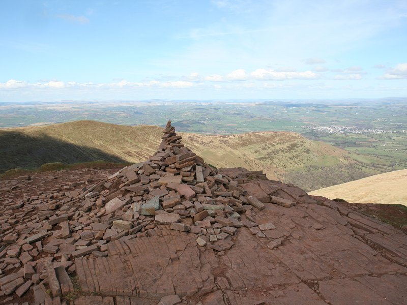
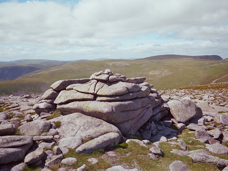
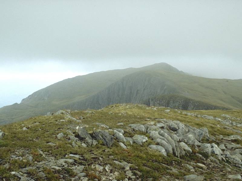
Cribyn
Location: Brecon
Beacons
Grid Ref: SO
023213
Height: 2608 ft (795
m)
Status: Hewitt,
Nuttall
Notes: A summit in
the Brecon Beacons, situated just under a mile east of Pen y Fan,
Cribyn is probably best climbed as part of a Beacons ridgewalk. The
nearest public road is at SO 038237, from where a prominent track runs
up to the pass between Cribyn and Fan y Big (the next summit along the
ridge). The highlight of the panorama is of course Pen y Fan itself,
but the view also takes in the Black Mountains, the Bristol Channel,
the vale of Brecon and Mynydd Epynt.
|
|
|
Cross
Fell
Location: North
Pennines,
Cumbria
Grid Ref: NY
687343
Height: 2930 ft (890
m)
Status: Hewitt,
Nuttall, Marilyn
Notes: Just
seventy feet short
of Munro height, Cross Fell is the highest summit of the Pennines (and
therefore the highest point on the main watershed of England). Formely
known as Fiends Fell, the hill is a massive moorland lump with a broad,
rocky summit plateau. A well built wind shelter adorns the summit, and
the view encompasses much of the north Pennines as well as the Lakeland
fells. On clear days both the east and west coasts are visible.
The
fell is best ascended by the "corpse road" up from Garrigill in the
upper
South Tyne valley, a distance of seven miles. This track forms part of
the Pennine Way, as does Cross Fell itself.
|
|
|
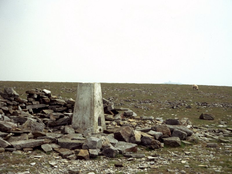
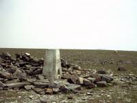
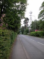
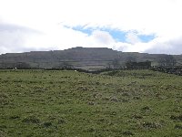
Crowborough
Beacon
Location: East
Sussex
Grid Ref: TQ
510305
Height: 794 ft (242 m)
Status: Marilyn
Notes: Crowborough
Beacon
(simply given as "Crowborough" by most sources) has the distinction of
being Britain's only urban Marilyn. Unfortunately that's really its
only
interesting feature. The highest point of an area known as Ashdown
Forest,
it lays somewhere along Beacon Road, pictured here. There is a trig
point
on a covered reservoir, just by the communications mast, but as an
artificial
earthwork that doesn't realy count. Look for the house named "Beacon
Crest"
just here on the left, which is arguably the highest natural point. A
pleasant
enough saunter of about 40 minutes from Crowborough railway station.
|
|
 |
Cuidhe
Crom
Location: Scottish
Highlands,
Mounth
Grid Ref: NO
259849
Height: 3553 ft (1083
m)
Status: Munro top,
Murdo
Notes: A top of
Lochnagar, laying roughly 2km southeast of the main summit. Once you've
hauled yourself up to Lochnagar's summit plateau via the shoulder known
as the Ladder (part of the popular route from Spittal of Glenmuick),
you're very close to Cuidhe Crom itself. The walk to the summit tor
from here is simple - about ten minutes' diversion over short turf with
virtually level gradients. An easy one for list-tickers to collect. The
name apparently trasnaltes as "crooked wreath" and probably refers to a
crescent shaped snow cornice (there is a better-known Cuidhe Crom on
the headwall of Coire Cas on Cairn Gorm). |
|
|
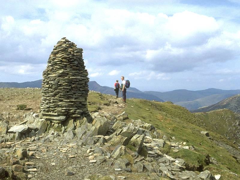
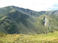
Dale Head
Location: Lake
District,
North Western Fells
Grid Ref: NY
223153
Height: 2470 ft (753
m)
Status: Wainwright,
Marilyn,
Hewitt, Nuttall
Notes: Said to be
the Lakeland
fell with the highest reward to effort ratio, Dale Head can be climbed
from Honister Hause in around forty five minutes. It forms the apex of
two ranges, the ridge to the west rising to Hindscarth and then again
to
Robinson, while that to the north encompasses High Spy, Maiden Moor and
Catbells. Dale Head forms a continuous wall above the Honsiter and
upper
Borrowdale road. It looks across to the Gable and Scafell massifs to
the
south, and is also on intimate terms with the High Stile and Grasmoor
ranges.
Dale Head Tarn, down at the col between the fell and its neighbour High
Spy, is a favourite picnic spot and wild camp site. The top picture
portrays Dale Head as seen from High Spy. |
|
|
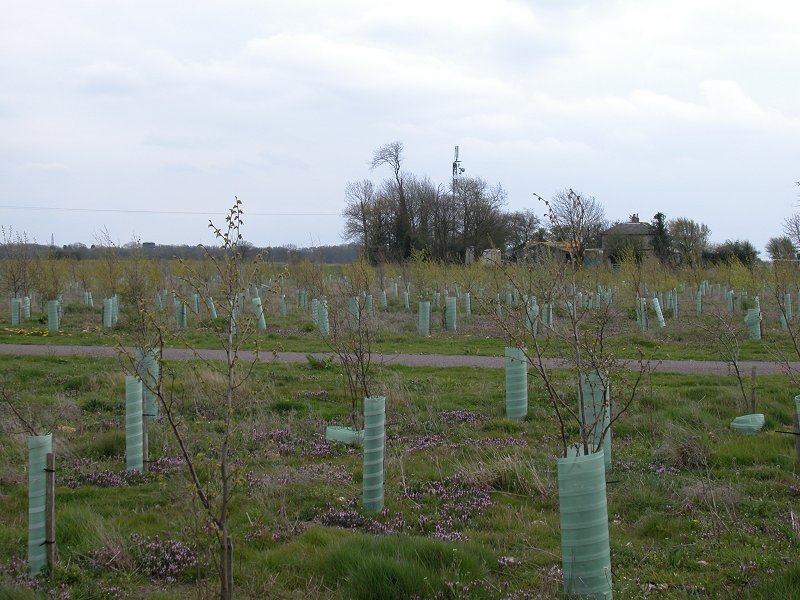
Detling
Hill
Location: North
Downs, Kent
Grid Ref: TQ
804586
Height: 656 ft (200 m)
Status: Marilyn
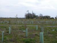
Notes: One of the
four Marylins
of the North Downs, and typically disappointing. The scenic interest
lies
in the nearby slopes facing Maidstone, which is a couple of miles to
the southwest. The
top itself is indeterminate, laying somewhere within a couple of
hundred
square metres of flat land sandwiched between a six lane motorway and a
mobile phone mast. The nearby trig point at 198 metres is obviously not
the summit - rather, walk to the northwest to enter the topmost
pasture,
newly planted with trees, and go up to the west boundary fence near the
chalet. Good view of Maidstone, Leeds Castle and the Len valley from
the
trig point. The top is barely a mile and a half from Bearsted railway
station.
Drivers can cheat by parking on the adjacent lane up from Thurstone.
|
|
|
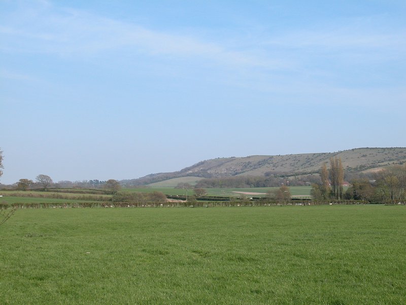
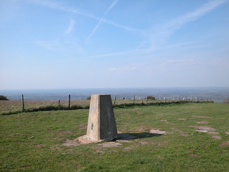
Ditchling
Beacon
Location: South
Downs, Sussex
Grid Ref: TQ
331130
Height: 814 ft (248 m)
Status: Marilyn,
County
Top
(East
Sussex)
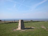
Notes: A splendid
little hill,
the highest point in East Sussex is a popular place with a view
encompassing
huge tracts of Sussex to the north and glimpses of Newhaven, Brighton
and
the English Channel to the south. The trig point is close to the scarp
slope and it's only necessary to walk thirty or forty metres to the
north
for the best views. The hill can be climbed from nearby villages such
as
Ditchling or Clayton, the latter just fifteen minutes' walk from
Hassocks
railway station. Drivers can cheat by parking up just a few minutes'
walk
from the top off a lane to the east.
|
|
|
Dodd
Location: Lake
District, Northern Fells
Grid Ref: NY
245273
Height: 1647 ft (502
m)
Status: Wainwright
Notes: The
westernmost top of the Skiddaw massif, Dodd stands alone, its slopes
heavily forested. There is apparently a new path up from the adjacent
Carl Side col, connecting Dodd with the rest of the massif, but
previously Dodd had to be climbed alone, ascended by a maze of forestry
roads whose layout was always more recent than the newest available
map. The top used to be hidden in trees but nowadays a little bald
patch provides a useful view of Derwentwater, and arguably the finest
panorama of Bassenthwaite (as pictured). |
|

|
Dodd
Location: Lake
District,
Western Fells
Grid Ref: NY
164158
Height: 2103 ft (641
m)
Status: Nuttall
Notes: Dodd is an
outlier
of the Buttermere Red Pike, and overlooks both the lake and village of
Buttermere. It is easily visited from the standard ascent route of Red
Pike, by turning right after the steep pull up from Bleaberry Tarn.
It's
worth it for the view.
|
|
|
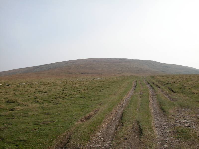
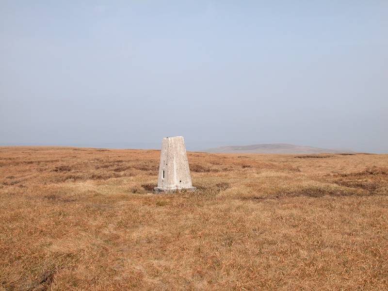
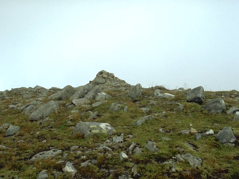
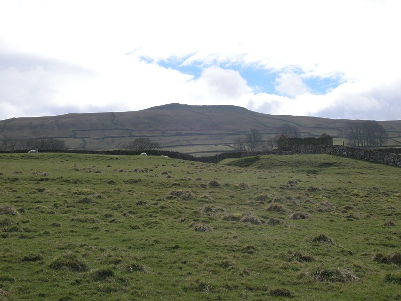
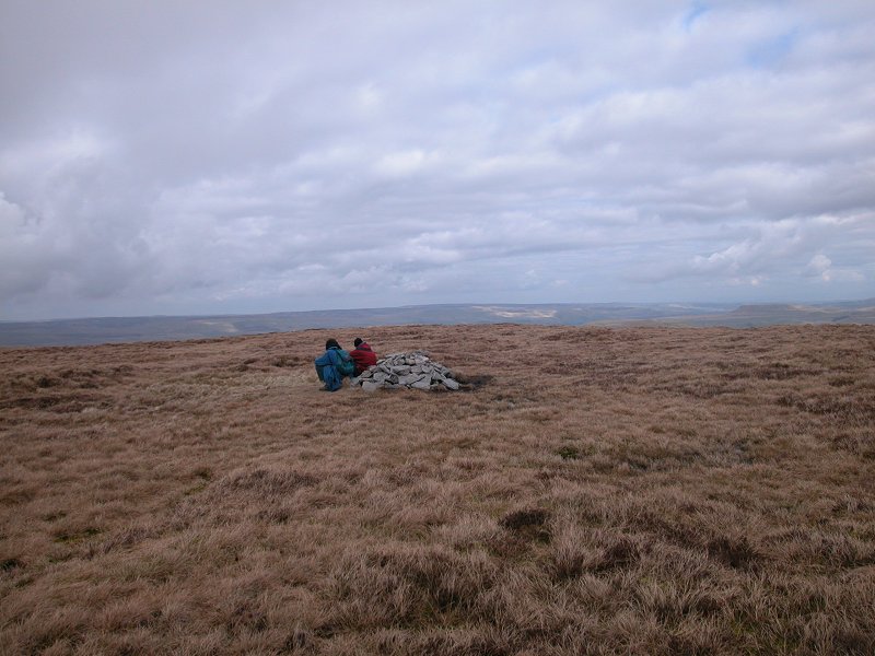
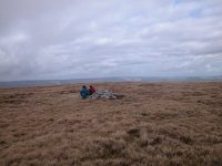
Dodd Fell
Location: Yorkshire
Dales,
Wensleydale
Grid Ref: SD
840845
Height: 2192 ft (668
m)
Status: Marilyn,
Hewitt,
Nuttall
Notes: Dodd Fell
is a wasteland
of rough grasses and peat hags laying some 600m east of the line of the
Pennine Way just after it crosses the watershed between Ribblesdale and
Wensleydale. It has little merit either as a viewpoint or as a place to
be and its climb, though perfectly straightforward, is unrewarding. The
nearest road access is Kidhow Gate, reached from upper Wensleydale,
from
where it's a mere 20 minute walk. A summit for list-tickers only.
|
|

|
Druim
Shionnach
Location: Scottish
Highlands,
Kintail
Grid Ref: NH
074084
Height: 3238 ft (987
m)
Status: Munro, Murdo
Notes: The second
of seven
Munros of the celebrated South Glenshiel ridge (counted from the
eastern
end), Druim Shionnach ("Foxes' Ridge") is only thirty minutes' walk
from
the first, Creag a Mhaim. The reascent is some 350ft. The last part of
the connecting ridge is a surprisingly narrow arete, though it's less
scary
than Striding Edge in the Lakes and is unlikely to prove difficult to
the
average hillwalker. The view is similar to that from its neighbour
except
that the third Munro along the ridge, Aonach air Chrith, looks quite
daunting.
The Kintail peaks to the north and the Quoich and Knoydart hills to the
south provide a splendid panorama.
|
|
|
Drumaldrace (a.k.a. Wether Fell)
Location: Yorkshire
Dales,
Wensleydale
Grid Ref: SD
873867
Height: 2014 ft (614
m)
Status: Hewitt,
Nuttall
Notes: Drumaldrace
stands above the town of Hawes in upper Wensleydale, from where it can
be ascended in just over an hour and a half. The summit dome is broad
and relatively flat, restricting the view to that of other tops and
ridges round about, while the best views of Hawes and along Wensleydale
itself are seen from the approach slopes. The ascent track from
Burtersett is rough and muddy as far as the point where it joins the
old
Roman road that bypasses the top of the fell on its south side. The
summit
dome itself carries no actual rights of way though paths are beginning
to appear. A footpath also runs around the summit dome to the north,
the Hawes side, but approaches to or descents from the cairn in this
direction should be avoided as the intervening terrain is exceptionally
boggy. |
|
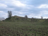 |
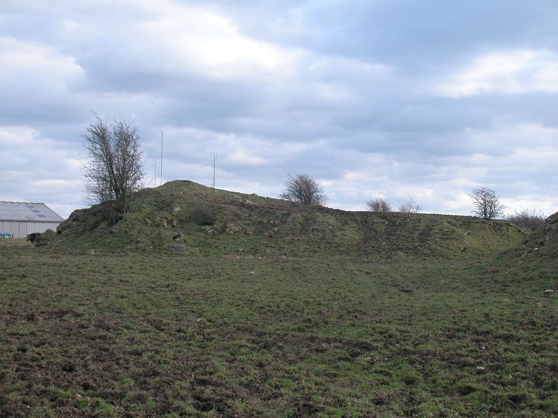
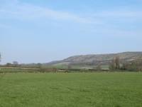
Dundry
Down
Location: Bristol
Grid Ref: ST
553667
Height: 764 ft (233
m)
Status: Marilyn
Notes: The highest
point of the Dundry Hills overlooking Bristol from the southwest,
Dundry Down is not exactly one of Britain's more worthwhile summits.
The trig point, seen here (in front of the bush just right of centre)
stands on top of what looks like an artificial earthwork, fifty metres
beyond a barbed wire fence crossing a muddy pasture and adjacent to a
cluster of farm sheds. Purists may argue but I consider this top
as "bagged" as it's ever going to be. Not worth visiting unless you're
a list-ticker. At least the view of Bristol from the adjacent village
of Dundry is worth seeing. |