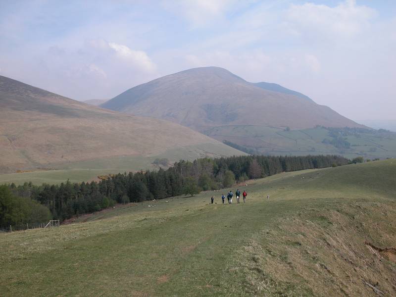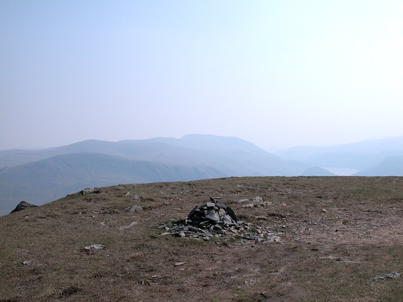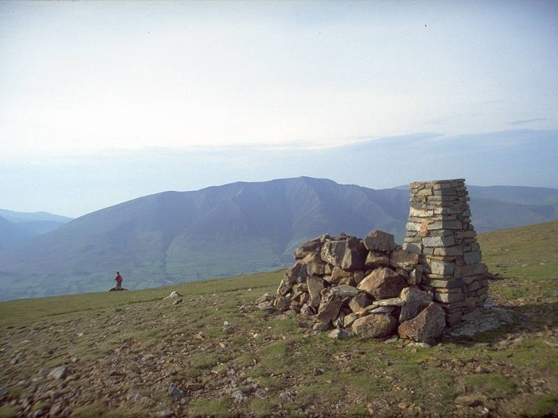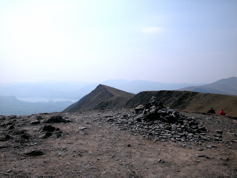
|
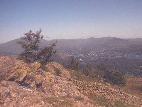
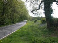
Birks
Location: Lake
District,
Eastern Fells
Grid Ref: NY
380143
Height: 2041 ft (622
m)
Status: Wainwright,
Nuttall
Notes: Birks is the
eastern outlier of St Sunday Crag, itself a satellite of Fairfield. It
is on intimate terms with the lower third of Ullswater and the view of
the lake from here is particularly fine; also of note is the panorama
of fells crowding in around Patterdale to the south and the valley of
Grizedale to the southwest. The ascent is straightforward and
enjoyable; leave the Grizedale lane at NY386158 and take the path
climbing through Glenamara Park to Thornhow End, which is steep but
very well constructed, and then follow the plainer path along to the
col between Birks and St Sunday Crag, where you turn hard left for a
simple stroll to the summit.
|
|

|
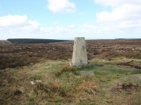
Black Down
Location: South
Downs, West
Sussex
Grid Ref: SU
919296
Height: 919 ft (280 m)
Status: Marilyn,
County
Top (West Sussex)
Notes: This trig
pillar presumably
once stood on open heath but nowadays it is surrounded by forest. It
marks
the topmost point of an area of heathland a couple of miles southeast
of
Haslemere, on the Surrey / West Sussex / Hampshire border. The summit
itself
lacks interest but Black Down as a whole is splendid walking country,
featuring
a generous networks of paths, cycle tracks and viewpoints. A good
portion
of the South Downs, from Ditchling Beacon to Butser Hill, is visible
from
the viewpoint about 600m south of the trig point.
|
|
|
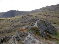
Black Fell
Location: Lake
District,
Southern Fells
Grid Ref: NY
340015
Height: 1059 ft (323
m)
Status: Wainwright,
Clement
Notes: Black Fell
stands roughly a mile north of Tarn Hows, near Coniston. Like many of
the lower Lakeland summits it makes up in ruggedness what it lacks in
height and is surprisingly rocky. The most direct ascent is a simple
stroll by a path from the lane between the fell and Tarn Hows. As Black
Fell is the first high ground west of Windermere the views around the
eastern and southern arcs are extensive, while a huge panorama of
Lakeland summits fills the views to the north and west.
|
|
|
Black Mixen
Location: Radnor
Forest, Powys
Grid Ref: SO
196643
Height: 2133 ft (650
m)
Status: Hewitt,
Nuttall
Notes: Part of the
Great Rhos group of hills in the Radnor Forest, Black Mixen is home to
a radio mast, a couple of associated buildings and some engineering
debris. The surrounding terrain is unpleasant, cloying moorland. Black
Mixen is best gained from the forest tracks immediately to the east; if
you approach from either Bache Hill or Great Rhos as part of a round
then you're in for a bit of pathless walking. A summit for collectors
only, and not a place to be in poor weather.
|
|
|
Black Mountain
Location: Black
Mountains
Grid Ref: SO
255350
Height: 2306 ft (703
m)
Status: Marilyn,
Hewitt, Nuttall, County Top (Herefordshire)
Notes: It's not black
and it isn't a mountain, but it is the highest point on the
England/Wales border. A long heathland ridge, it is traversed by the
Offa's Dyke long distance path. The summit is unmarked, in fact it's
pretty nearly impossible to tell when you're at the highest point as
the gradients along the ridgetop are imperceptible. A road immediately
to the west (Hay-on-Wye to Capel-y-Ffin) allows access to the ridge at
a number of points and non-drivers can take advantage of the summer
Sunday bus
from Hay. The view mainly encompasses similar ridges to the left and
right, with other summits of the Black Mountain range predominating.
For better views walk a mile north to Hay Bluff.
|
|

|
Black Mountain (South Top)
Location: Black
Mountains
Grid Ref: SO
266322
Height: 2090 ft (637
m)
Status: Nuttall
Notes: Black
Mountain's south top is very similar to its parent fell except that the
summit is actually obvious, and that there's a view across part of
rural Herefordshire towards the Malvern Hills. It can be climbed in
roughly an hour from Capel-y-Ffin and no doubt all who climb it will go
on to Black Mountain itself and then Hay Bluff.
|
|

|
Blackstone
Edge
Location: South
Pennines
Grid Ref: SD
972164
Height: 1549 ft (472
m)
Status: Clement
Notes: The main
watershed
of Britain rises to this craggy height between Rochdale and
Huddersfield
in the narrowest part of the Pennines. Blackstone Edge is on the route
of the Pennine Way and is a remarkable outcrop of gritstone overlooking
Rochdale to the west. It is roughly midway between the A672 at Windy
Hill
and the A58 at the White House above Littleborough, and can easily be
ascended
from either in less than thirty minutes.
|
|
|
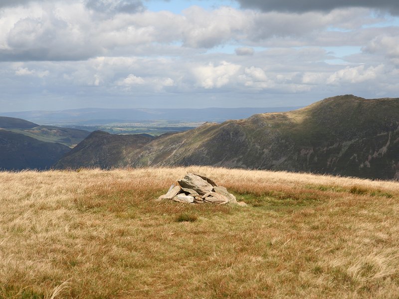
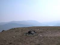
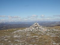
Blea
Rigg
Location: Lake
District,
Central Fells
Grid Ref: NY
301078
Height: 1775 ft (541
m)
Status: Wainwright
Notes: Blea Rigg is
the greater part of a huge shoulder of upland that runs down from the
Langdale Pikes to the southeast, terminating ultimately at Loughrigg.
The most obvious feature of Blea Rigg is the daunting line of crags on
its north slope, overlooking Easedale. The true summit is a matter of
guesswork for the ridge contains a number of outcrops and tors. The one
pictured here does not match Wainwright's drawing but does appear to be
the highest point. Blea Rigg is most easily climbed from Easedale Tarn
by a path to
the southwest. The panorama is confined by the huge bulk of High Raise
and its satellites but it does give an excellent view of Harrison
Stickle and Pavey Ark, while the Helvellyn and Fairfield ranges are
well seen to the east together with the Coniston group to the south.
|
|
|
Bleaberry
Fell
Location: Lake
District,
Central Fells
Grid Ref: NY
285195
Height: 1932 ft (590
m)
Status: Wainwright
Notes: Bleaberry
Fell is the
northernmost top of the ridge that stretches northwards from the
Langdale
Pikes between Derwentwater and Thirlmere. It is an excellent viewpoint
for Keswick itself and also shows Skiddaw, Grizedale Pike and the Eel
Grag
group off to great advantage. The fell can be climbed from Keswick via
Walla Crag in just over an hour. Walla Crag (to the north) and Falcon
Crag
(to the west) both have superb views over Derwentwater. The path
southwards
to High Seat and High Tove is rather boggy.
|
|
 |
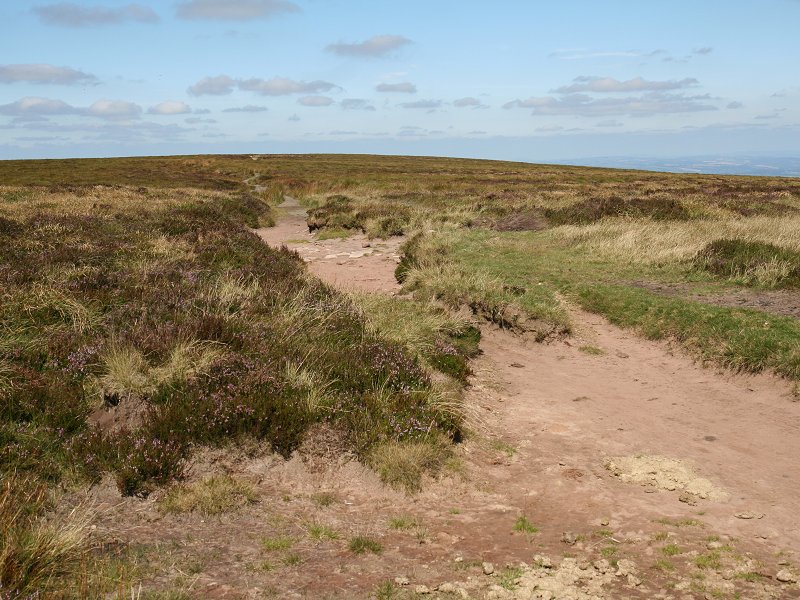
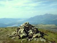
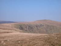
Bleaklow
Location: Peak
District, Derbyshire
Grid Ref: SK
092959
Height: 2077 ft (633
m)
Status: Hewitt,
Nuttall
Notes: Bleaklow lays
on the route of the Pennine Way and thus is
blessed with well trodden and well maintained routes to its summit.
Were this not the case it is doubtful whether Bleaklow would ever be
visited other than by hardy list tickers, for it is a remote moorland
top surrounded by exceptionally difficult terrain. Even with the
assistance of the Pennine Way one does arrive at Bleaklow's cairn with
a sense of accomplishment. Bleaklow lays at the centre of a broad and
largely flat upthrust of peat moorland and hence there are no views,
save of the equally inhospitable rises of Black Hill to the north and
Kinder Scout to the south. The summit is one hour's climb from Snake
Pass or one and a half hours from Longendale. |
|
 |
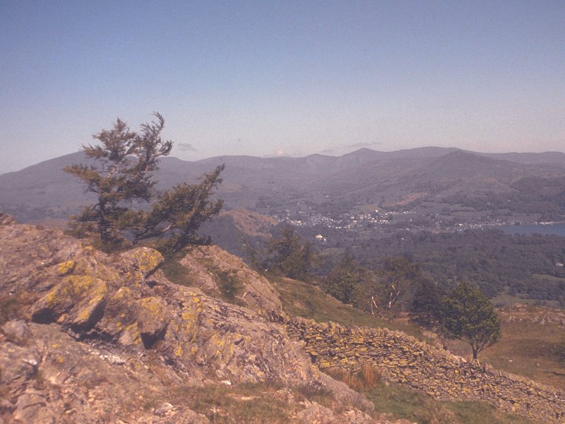
Blease Fell
Location: Lake
District,
Northern Fells
Grid Ref: NY
312270
Height: 2638 ft (804
m)
Status: none
Notes:
Blancathra's far west
top. The summit is not really significant, except as Blencathra's best
viewpoint for Keswick and Derwentwater. Rather it's the vast, convex
grassy
slope that descends to the Glenderaterra valley to the west that is
well known, for it's
this
face that Blencathra presents to Keswick, and this face that a
substantial
majority of fellwalkers choose for their descent from the ridge back to
Threlkeld. It's sheer tedium and is hell on the knees and calves, but
everyone
seems to agree that it would be far worse as an ascent. If you do climb
Blencathra this way, Blease Fell summit will be a little piece of
heaven.
|
|

|
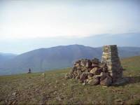
Blencathra
(a.k.a.
Saddleback)
Location: Lake
District,
Northern Fells
Grid Ref: NY
323277
Height: 2848 ft (868
m)
Status: Wainwright,
Marilyn,
Hewitt, Nuttall
Notes: Saddleback
may be the
popular name for this splendid fell, but Blencathra is its proper name
and it's known as such to all serious fellwalkers. It's the eastern
neighbour
of Skiddaw in Lakeland's northern fells, and towers over the village of
Threlkeld at its foot. From Clough Head (top picture) Blencathra is
revealed
as a ridge with several tops, each with a supporting buttress falling
to
the Keswick - Penrith gap below. The highest top is Hallsfell, at the
eastern
end of the ridge. Surprisingly, there is no trig pillar, just a simple
cairn. The easiest way up is by the well-trodden path from Scales up
the
eastern shoulder of Scales Fell. The superb views take in most of
Lakeland
and the northern Pennines.
|
|
|
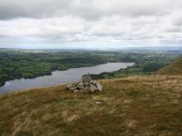
Bonscale Pike
Location: Lake
District, Far Eastern Fells
Grid Ref: NY
453200
Height: 1719 ft (524
m)
Status: Wainwright
Notes: Bonscale Pike
is not really a seperate fell at all though it has that appearance when
viewed from nearby Howtown. It's really just a minor top of Loadpot
Hill. It can be climbed by way of a very steep grassy path from Howtown
though it's probably more often approached from its neighbour, Arthur's
Pike. The view of Howtown and Ullswater is excellent, and so is the
view of the High Street ridges to the south. The Helvelln range is well
presented to the west, but to the east the view is shut in by the
rather dreary bulk of Loadpot Hill.
|
|
|
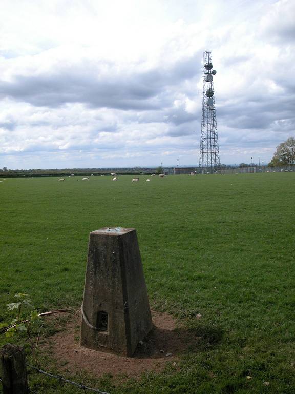
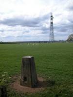
Botley
Hill
Location: North
Downs, Surrey
Grid Ref: TQ
396553
Height: 875 ft (267 m)
Status: Marilyn
Notes: Boring
name, boring
hill. Botley Hill is the highest part of that section of the North
Downs
straddling the meeting point of London, Kent and Surrey (and as such is
the nearest Marylin to London), but the summit itself is a
disappointment.
The top of the downs here is flat, and the highest point lays within a
pasture grazed by sheep. A road runs right past the trig point, which
is
just the other side of the hedge (and, to the chagrin of purist summit
baggers, is not actually at the highest point which is some thirty
metres
away within the pasture). There is no view. The surrounding countryside
is very pleasant, however, and you could justify a visit to Botley Hill
by walking a local section of the North Downs Way (which passes only a
few hundred metres away) and taking in this "summit" as an
afterthought. (Update; the ground near the radio mast is now known to
be higher than the trig point and hence is the true summit; I shall
need to revisit this hill someday).
|
|
|
Bowscale Fell
Location: Lake
District,
Northern Fells
Grid Ref: NY
333305
Height: 2303 ft (702
m)
Status: Wainwright,
Hewitt,
Nuttall
Notes: Bowscale
Fell is a
lonely summit standing northeast of Blencathra, its parent fell, in the
north of the Lake District. It's a grassy dome tucked in between loops
of the Calder and Glenderamackin rivers, and is probably best climbed
from
the path along Bannerdale from the village of Mungrisedale to the east.
The most obvious features of the view are the vast "Back o' Skiddaw"
wilderness
to the northwest and the arresting sight of Blencathra just west of
south.
There's also a good view eastwards towards the northern Pennines on
clear
days.
|
|
|
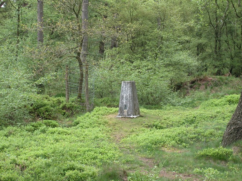
Bradnor
Hill
Location: Herefordshire
Grid Ref: SO
282584
Height: 1283 ft (391
m)
Status: Marilyn,
Clement
Notes:Bradnor Hill is
situated immediately to the north of Kington in Herefordshire. While
it's not the only summit to be situated on a golf course it is unique
in that it forms one of the course's tees. From the golf course's
clubhouse take the vehicle track to the north northwest and then work
your way round to the summit in an anticlockwise direction, taking care
not to put any golfers off their strokes. The hill is open access land.
There is a good view of the verdant hills of Herefordshire and Powys
though there is no foreground interest. The Brecon Beacons, Black
Mountains and the Malverns are the highlights of the panorama.
|
|
 |
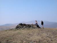
Braigh Coire Chruinn-bhalgain
Location: Scottish
Highlands,
Perthshire
Grid Ref: NN
925724
Height: 3510 ft (1070
m)
Status: Munro,
Murdo,
Marilyn
Notes: One of the
Beinn a' Ghlo group, Braigh Coire Chruinn-bhalgain is best ascended by
first climbing Carn Liath (q.v.) and then following the ridge. There's
a good path all the way though there is quite a substantial drop
between the two summits. The view is dominated by Beinn a' Ghlo's
principal top, Carn nan Gabhar, and its outlier, Airgiod Bheinn,
filling the eastern arc. The Cairngorms are well displayed to the
north, and the main feature eastwards is the Ben Lawers massif. A
really fine climb. |
|
 |
Bram
Rigg Top
Location: Howgill
Fells
Grid Ref: SD
668964
Height: 2205 ft (672
m)
Status: Nuttall
Notes: A minor top in
the Howgills, midway between Calders and The Calf and off to the left
of the main ridge path. There are paths to and from the little cairn,
although none are shown on the map. The neighbouring hills dominate the
scene to the north and south, with wild, empty valleys to the east and
west. About ten minutes' walk from Calders. |
|
 |
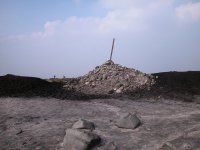
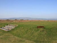
Bredon
Hill
Location: Vale of
Evesham
Grid Ref: SO
957402
Height: 981 ft (299
m)
Status: Marilyn
Notes: Bredon Hill
lays alone within the Vale of Evesham, a broad, wooded hill covering an
area of several square miles. It stands above the lovely village of
Elmley Castle, about four miles west of Evesham, from where there is a
track to the top. This ascent is exceptionally muddy but it does hide
the best of the views until you reach the summit. The panorama is
allegedly glorious, taking in the Cotswolds, the Malvern Hills, the
Forest of Dean, Black Mountain and the whole of the vale of the Severn
from Bristol to Birmingham - though on the day I climbed Bredon Hill in
March 2005 a dense fog denied me any view whatsoever. The summit is a
broad pasture ringed by a drystone wall and some Iron Age earthworks.
There is a topograph set within a lone rock, while a couple of hundred
metres to the south a squat brick tower (pictured) appears to occupy
the highest point of the hill. |
|
|
Broad Cairn
Location: Scottish
Highlands,
Mounth
Grid Ref: NO
240815
Height: 3274 ft (998
m)
Status: Munro, Murdo
Notes: Broad Cairn is
part of the Lochnagar massif and is one of two Munros laying to the
south of the Dubh Loch. Access is easy, there being a vehicle track
from Spittal of Glenmuick to within half a kilometre of the summit. A
path goes most of the rest of the way though the summit dome itself is
defended by a tedious boulder field. The view is excellent, ranging
over the whole of the eastern Mounth, the tops of the Cairngorms and
the lower hills of Angus and Aberdeenshire.
|