|
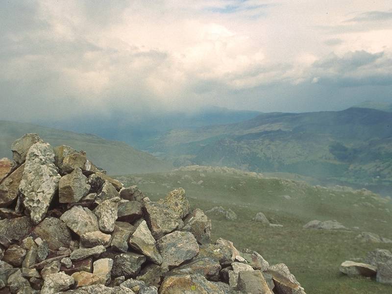
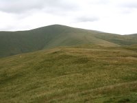
Allen Crags
Location: Lake
District,
Southern Fells
Grid Ref: NY
236085
Height: 2575 ft (785
m)
Status: Wainwright,
Hewitt, Nuttall
Notes: Although
it's one of
the principal summits of the Scafell massif, Allen Crags is curiously
unregarded,
often described as "that one you have to climb before you get to
Glaramara".
This lack of fame is undeserved, for Allen Crags is really in the heart
of things. It stands immediately north of the path crossroads of Esk
Hause,
and commands glorious views of Bowfell, Esk Pike, Great End, the Gables
and the Langdale Pikes, together with more distant views of Borrowdale
and its surrounding fells. Its most obvious route of ascent is from
Seathwaite
via Grains Gill, and is usually climbed together with Glaramara,
further
north along the same ridge.
|
|
|
Allermuir
Hill
Location: The
Pentlands
Grid Ref: NT
227661
Height: 1617 ft (493
m)
Status: Marilyn,
Yeaman
Notes: A hill
situated towards
the northeastern tip of the Pentlands, Allermuir Hill enjoys a superb
view
over the city of Edinburgh immediately to the north. It's about a mile
west of Caerketton Hill, easily accessible from the Hillend dry ski
slope.
Several paths radiate from the summit and Allermuir can be visited as
part
of an extended trek across the northern Pentlands.
|
|

|
Aonach air
Chrith
Location: Scottish
Highlands,
Kintail
Grid Ref: NH
051083
Height: 3350 ft (1021
m)
Status: Munro, Murdo,
Marilyn
Notes:Aonach air
Chrith is
the third and highest Munro of the South Glenshiel ridge (if you're
traversing
from the east to the west, as most guidebooks would have you do). It
can
be reached in less than an hour from Druim Shionnach, the previous
summit
on the ridge. The hill has splendid views down into Glen Shiel,
westwards
to the Five Sisters, southwards to the peaks around Loch Quoich and
northwards
to the many mountains bordering Kintail and Affric. The west ridge
onwards
to Maol Chinn Dearg falls in a steep gradient to the intervening col
and
the descent requires care, though it is not hazardous.
|
|

|
Aonach Beag
Location: Scottish
Highlands, Lochaber
Grid Ref: NN
197715
Height: 4049 ft (1234
m)
Status: Munro, Murdo,
Marilyn
Notes: Britain's
seventh highest mountain. The name means "little ridge". Aonach Beag
lays immediately south of Aonach Mor (great ridge) and despite the name
it is actually higher. The names are believed to refer to the relative
bulk of the two summits rather than their respective elevations. The
classic route to Aonach Beag is from Steall, in Glen Nevis to the
southwest, but a far easier route is from the Nevis Range gondola to
the north, via Aonach Mor. There is a very simple ridgewalk between the
two. Aonach Beag has a much rockier summit than Aonach Mor but there is
still more vegetation growing here than on any comparable height in the
UK. Views are extensive, encompassing much of the Western highlands,
with the Mamores, Grey Corries and Glencoe ranges well seen. Carn Mor
Dearg and Ben Nevis lay immediately to the west.
|
|

|
Aonach Mor
Location: Scottish
Highlands, Lochaber
Grid Ref: NN
193729
Height: 4006ft (1221
m)
Status: Munro, Murdo
Notes: The eighth
highest mountain in the UK and one of the select few to rise above 4000
ft, Aonach Mor (The Great Ridge) is more characteristic of a Pennine
fell than one of the great Scottish mountains. It is distinctly odd to
find grass growing and sheep grazing at 4000 ft, though possibly this
is because Ben Nevis, immediately to the west, acts as a wind shelter.
The top of Aonach Mor is an elongated flat plateau from which the
mountain's most exciting features - the dramatic cliffs on the east and
west flanks - are hidden. It can be climbed in about 90 minutes from
the top of Britain's only cabin lift (Nevis Range), which rises to 2000
ft on the northern slopes; from there a stroll to the western viewpoint
followed by a steady climb up the western lip of the mountain will get
you to the summit. A path is gradually beginning to appear.
|
|
|
Arant
Haw
Location: Howgill
Fells
Grid Ref: SD
662946
Height: 1985 ft (605
m)
Status: Dewey
Notes: Arant Haw is a
southern outlier of Calders, in the Howgill Fells near Sedbergh. It can
easily be mistaken for Calders itself on the approach from the
southwest as, curiously, it looks insignificant on the 1:25000 maps. A
rounded, grassy fell, it has little intrinsic interest. It can be
climbed in an hour from Sedbergh by the Settlebeck Gill track. The view
consists mainly of other gently rolling fells, notably Calders to the
northeast, while some of the Lakeland fells can be seen to the far
northwest and the main Pennine ranges to the east.
|
|

|
Arnside
Knott
Location: Morecambe
Bay,
Cumbria
Grid Ref: SD
456774
Height: 522 ft (159
m)
Status: Marilyn
Notes: Situated
just outside the southeastern edge of the Lake District and overlooking
the Kent estuary from the east, Arnside Knott has the distinction of
being England's lowest Marilyn. Its status was only recently discovered
and it qualifies by only a whisker. A wholly straightforward and
largely effortless ascent from the vilage of Arnside, the pleasant
heathland summit has views along the northern shore of Morecambe Bay
towards Grange, and into the southeastern corner of the Lakes.
|
|
|
Arthur's Pike
Location: Lake
District, Far Eastern Fells
Grid Ref: NY
461207
Height: 1749 ft (533
m)
Status: Wainwright
Notes: Arthur's Pike
is situated to the east of the northern leg of Ullswater. It is
properly just a top of Loadpot Hill though lays some distance from its
parent across a rather bleak and featureless stretch of grass moorland.
The bulk of Loadpot Hill limits the panorama to the east and southeast
but Ullswater is well presented, and Penrith is visible to the
northeast with the Cross Fell group beyond. The standard ascent is from
Pooley Bridge, initially along the Moor Divock track then part of the
old High Street Roman road. A ridge route from Loadpot Hill is not
recommended except in fine, settled weather.
|
|

|
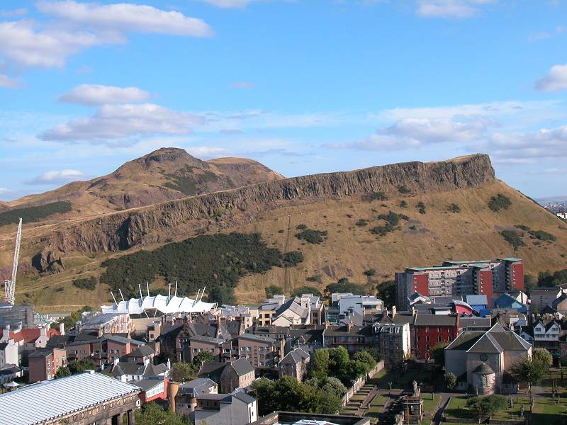
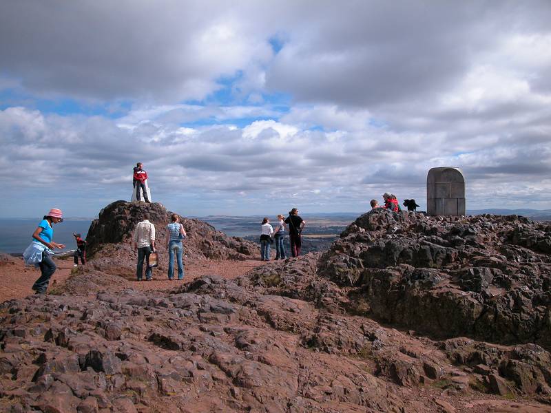
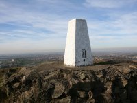
Arthur's Seat
Location: Edinburgh
Grid Ref: NT
275729
Height: 822 ft (251 m)
Status: Marilyn
Notes: There are
very few
capital cities in the world that can boast extinct volcanoes barely a
mile
from their centres. Edinburgh has two. The greater of these is Arthur's
Seat and is part of Holyrood Park, the outer grounds of the royal
palace.
Arthur's Seat is ringed on the city side by Salisbury Crags, a sill of
volcanic rock. A road goes right around the hill and the summit is most
easily ascended from the road's highest point on the east side, from
where
a broad grassy rake goes most of the way to the top. The views are
glorious,
ecompassing the city, the Firth of Forth, the Pentlands, Fife and the
Ochils,
as well as Ben Lomond and other mountains on the edge of the Highlands.
|
|

|
Atkinson Pike
Location: Lake
District,
Northern Fells
Grid Ref: NY
324282
Height: 2772 ft (845
m)
Status: Nuttall
Notes: The north
top of Blencathra,
in the north of the Lake District. If you recognise Blencathra by its
popular
but incorrect name of Saddleback, then Atkinson Pike is the rear end of
the saddle. It's a fearsome looking pyramid when seen from the outliers
of Bannerdale Crags or Bowscale Fell, buttresed to the left by Sharp
Edge
and to the right by Foule Crag. Wainwright does not refer to the summit
by name. Most approaches will be from Blencathra itself, from which
it's
but a ten minute stroll across the grassy col. There are two cairns, of
which the northern one appears to be a shade higher. The best views are
those of Skiddaw and across the vale of Eden to the east.
|
|

|
Auchnafree Hill
Location: Scottish
Highlands, Perthshire
Grid Ref: NN
808308
Height: 2589 ft (789
m)
Status: Corbett,
Marilyn
Notes: Auchnafree
Hill stands on the opposite side of Glen Turrett from Ben Chonzie,
about 7 miles northwest of Crieff. The most straightforward access is
from the Loch Turrett dam, where either of two tracks will get you to
NN808300, from where a path (sketchy in parts) rises to the summit
cairn. There's also a track up the north side of the hill, from
Larichfraskhan in Glen Almond. Don't attempt to cross the summit
plateau from Choinneachain Hill; the path shown on the 1:25000 map
doesn't exist and the col is rent with peat hags that make progress
extremely tedious. The view is not disimilar to that of neigyhbouring
Ben Chonzie; the highlight is undoubtedly the view of the Ben Lawers
group to the northwest.
|
|
|
Aughertree Fell (Green How)
Location: Lake
District,
Northern Fells
Grid Ref: NY
258374
Height: 1053 ft (321
m)
Status: Wainwright
Outlying Fell, Clement
Notes: This fell is s
small area of unimproved moorland situated imediately to the east of
the village of Uldale, nestling in the northwestern foothills of the
Lake District. It's an undistinguished hill and is easily reached from
the Uldale moor road by a couple of rough vehicle tracks. The view
features the "Back o'Skiddaw" fells, Binsey and Skiddaw itself, and the
Cumbrian coastal plain.
|
|
|
Bache
Hill
Location: New
Radnor Forest, Powys
Grid Ref: SO
213636
Height: 2001 ft (610
m)
Status: Hewitt,
Nuttall
Notes: Bache Hill is
a lonely swelling of moorland in the New Radnor Forest. A track uo from
New Radnor village rises over the southern slopes of the hill; walk
past it to the east to gain the east ridge path up to the trig point.
It is, in truth, an unlovely place and is a summit for list tickers and
trig pillar collectors only. The view encompasses plenty of rolling
hill country around the southern arc, and across the border into rural
Herefordshire.
|
|
|
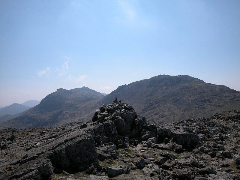
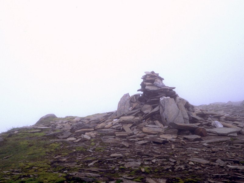
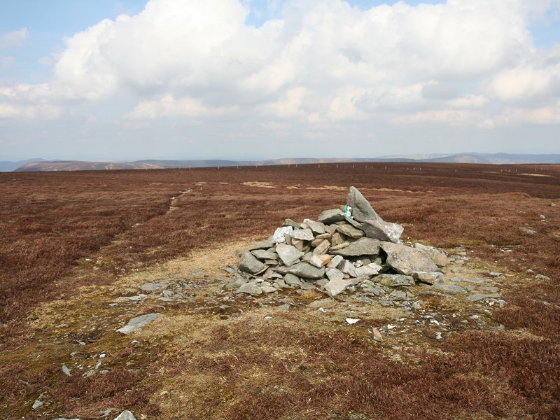
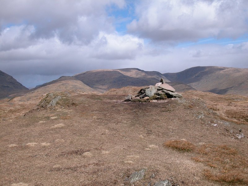
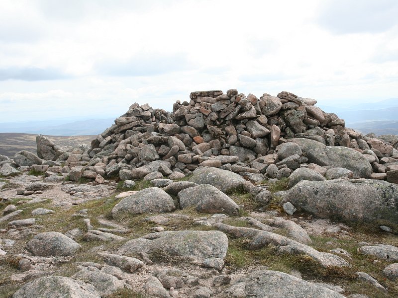
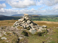
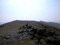
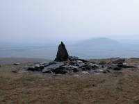
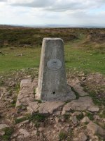
Bannerdale
Crags
Location: Lake
District,
Northern Fells
Grid Ref: NY
335290
Height: 2241 ft (683
m)
Status: Wainwright,
Hewitt,
Nuttall
Notes: Part of the
Blencathra
massif in the northern part of the Lake District, Bannerdale Crags is a
grassy top that falls away to the northeast in an impressive series of
cliffs. These are only seen from the eastern approach, from
Mungrisedale
village via Bannerdale (which is probably the easiest approach). On the
other side the fell slopes down to the infant Glenderamackin river,
across
which Blencathra itself looks daunting. The cairn (pictured) is not
actually
at the highest point, which is some 100 metres to the west and is
unmarked.
The moors to the rear of Skiddaw are well seen, though the bulk of
Blencathra
shuts out the view of most of the main Lakeland fells.
|
|
|
Bardon
Hill
Location: Charnwood
Forest,
Leicestershire
Grid Ref: SK
459131
Height: 912 ft (278
m)
Status: Marilyn,
County Top (Leicestershire)
Notes: Bardon Hill is
the highest point of Charnwood Forest, a hilly area in northwest
Leicestershire composed of ancient volcanic outcrops. The wooded top
lays within the boundaries of Bardon Hill Quarry and the whole eastern
side of the hill has been quarried away. Access is easy, via a series
of footpaths leading up from the Fying Horse roundabout on the A50,
just a mile away. Views are extensive and include Leicester, Coalville,
Castle Donnington, and Cannock Chase out to the west.
|
|
|
Base Brown
Location: Lake
District,
Western Fells
Grid Ref: NY
225114
Height: 2119 ft (646
m)
Status: Wainwright,
Nuttall,
Hewitt
Notes: Base Brown
is an outlier
of Great Gable and is often overlooked, sitting by itself out on a limb
from the main Gable - Brandreth ridge. It overlooks Seathwaite and
Stockley
Bridge and can be climbed from the former by way of Gillercombe. For
those
already up on the ridges it's a short and easy stroll from Green Gable.
With high fells closing in the view in most directions the best
panorama
is to the north and northeast over Borrowdale.
|
|
|
Baystones (Wansfell)
Location: Lake
District, Far Eastern Fells
Grid Ref: NY
403051
Height: 1597 ft (487
m)
Status: Wainwright,
Clement, sub-Marilyn
Notes: Many walkers
climb Wansfell Pike, a kilometre to the southeast, but relatively few
walk along the ridge to Baystones (which, confusingly, Wainwright names
as Wansfell). Baystones is the true summit of Wansfell and is a little
higher. It's unfortunate that its situation is inferior to that of its
smaller brother, either as a viewpoint or as a place to be. It is
almost always climbed from Ambleside by way of Wansfell Pike and there
are no paths to or from the summit in any other direction. In only one
respect does Baystones score over Wansfell Pike and that's the view
northwards towards Kirkstone Pass, with Red Screes and Stony Cove Pike
crowding in from either side.
|
|
|
Beacon Batch
Location: The Mendips, Somerset
Grid Ref: ST
484572
Height: 1066 ft (325
m)
Status: Marilyn,
Clement
Notes:Beacon Batch is
the highest point of the Mendips. A shallow heathland dome, it is
easily ascended from either the Chew valley to the north or Cheddar to
the south. The fairly flat nature of the summit area provides no
foreground interest but the far panorama is intesresting and extensive,
and ranges around the Somerset Levels and across the Bristol channel to
south Wales. The Brecon Beacons would be visible on the clearest days.
The town of Weston Super Mare is very prominent to the north west.
|
|

|
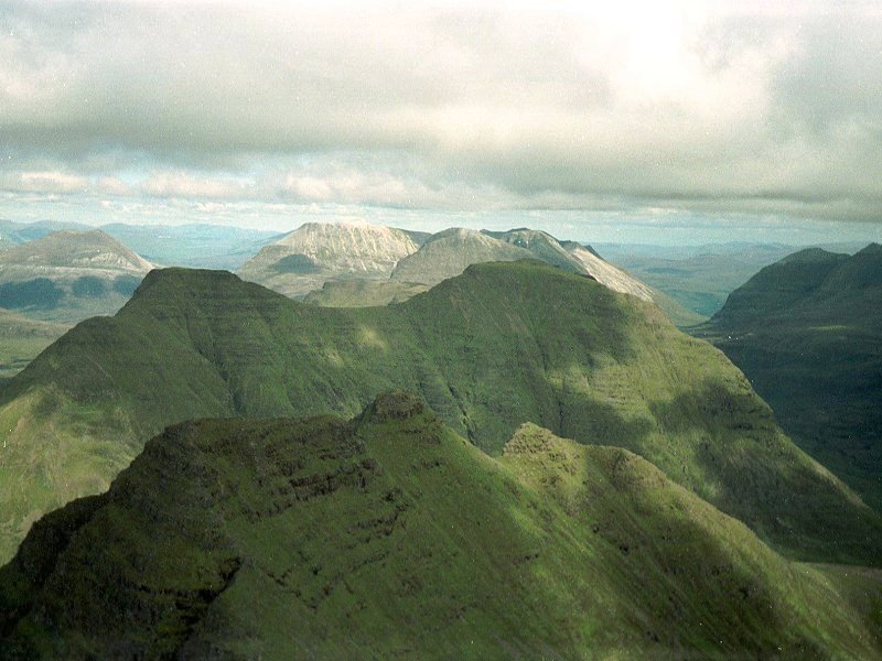
Beinn
Alligin (Sgurr Mhor)
Location: Scottish
Highlands,
Torridon
Grid Ref: NG
865612
Height: 3235 ft (986
m)
Status: Munro,
Murdo,
Marilyn
Notes: Beinn Alligin,
the Jewel Mountain, is one of the three superb mountains that stand to
the north of Loch Torridon in Wester Ross. Of the three, Alligin is the
easiest to climb, there being a decent path from the Coire Mhic Nobuill
car park (although it's unpleasanly steep in parts). Sgurr Mhor is the
principal summit of the mountain, a shapely peak rent by the great
vertical gash known as the Eag Dubh (Black Notch). The ridge of the
mountain is quite spectacular, and features the famous Horns of Alligin
to the northeast of the main peak. The ridge between Sgurr Mhor and the
southern top of Tom na Gruagaich is airy but has no difficulties save
one awkward rockstep that can be bypassed. The Horns require some
scrambling but do not have to be climbed if you don't like the look of
them. Views from the top are awesome, taking in the other Torridon hill
such as Liathach, Beinn Eighe, Baosbheinn and Beinn Dearg, as well as
the vast sweep of Wester Ross and the west coast with Skye beyond. The
summit picture shows the view to the east; the Horns in front, Beinn
Dearg beyond, and Beinn Eighe behind Dearg.
Photo by Graham Jackson.
|
|
|
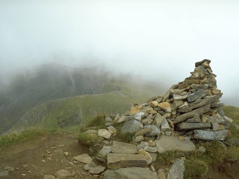
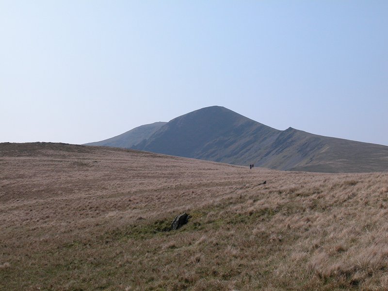
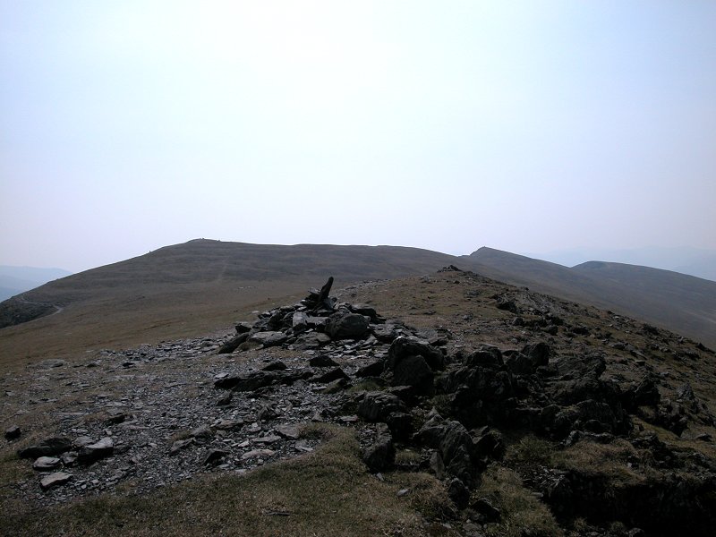
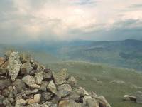
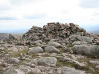
Beinn Dearg
Location: Scottish
Highlands, Perthshire
Grid Ref: NN
852777
Height: 3307 ft (1008
m)
Status: Munro,
Murdo,
Marilyn
Notes: Pertshire's
Beinn Dearg is a somewhat shy Munro, laying deep
within the wild country eastwards of Drumochter. The best access is
from Blair Atholl, from where it's a ten mile walk to the top with
tracks and paths all the way. The actual ascent path is one of the most
benign and easily graded in the district. The massive, stony summit
carries a wind shelter (pictured). No roads, towns or villages can be
seen from the top, just a magnificent 360-degree panorama of mountains
in which the Cairngorms, the Mounth, the Glen Tilt hills, the
Drumochter hills and the Ben Lawers group are all prominent.
|
|