 |
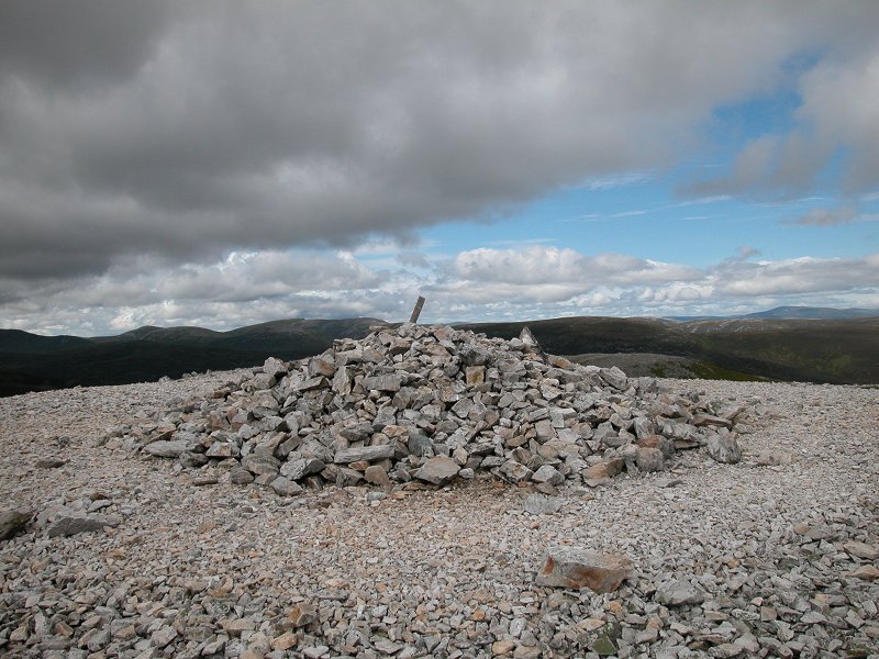
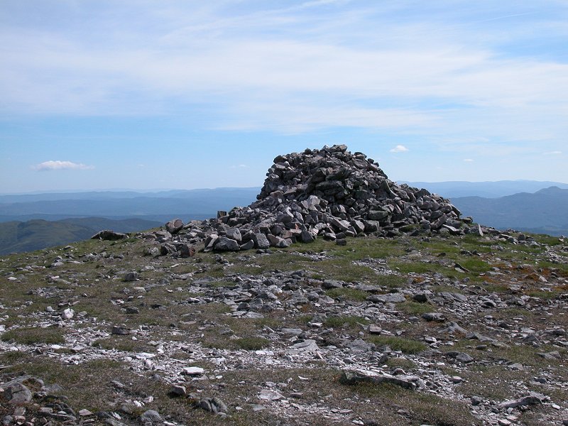
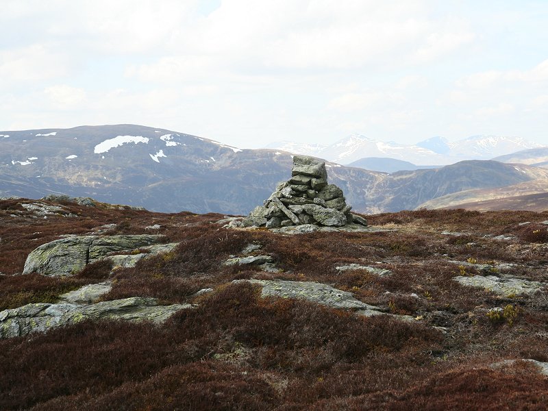
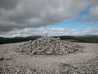
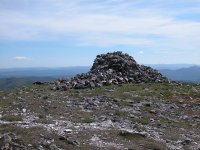
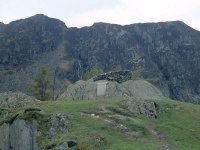
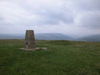
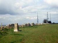
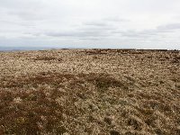
Carn
Aosda
Location: Scottish
Highlands,
Mounth
Grid Ref: NO
134791
Height: 3002 ft (917
m)
Status: Munro, Murdo
Notes: Arguably the
easiest and most accessible Munro of all, Carn Aosda lays at the heart
of the Glenshee ski centre and can be climbed in a mere 40 minutes from
the car park. It only just qualifies as a Munro - various sources give
its height as between 2997ft and 3009ft. The ascent, by way of rough
vehicle tracks from Glenshee ski centre, is completely straightforward
though a little steep. The summit is only just clear of the intrusions
of ski fences and towbar supports; the view to the south is rather
spoiled by these developments and even more so by the clutter of radio
masts atop the neighbouring Cairnwell, but in other directions the
hills of the Mounth and the Cairngorms offer an exciting prospect. |
|

|
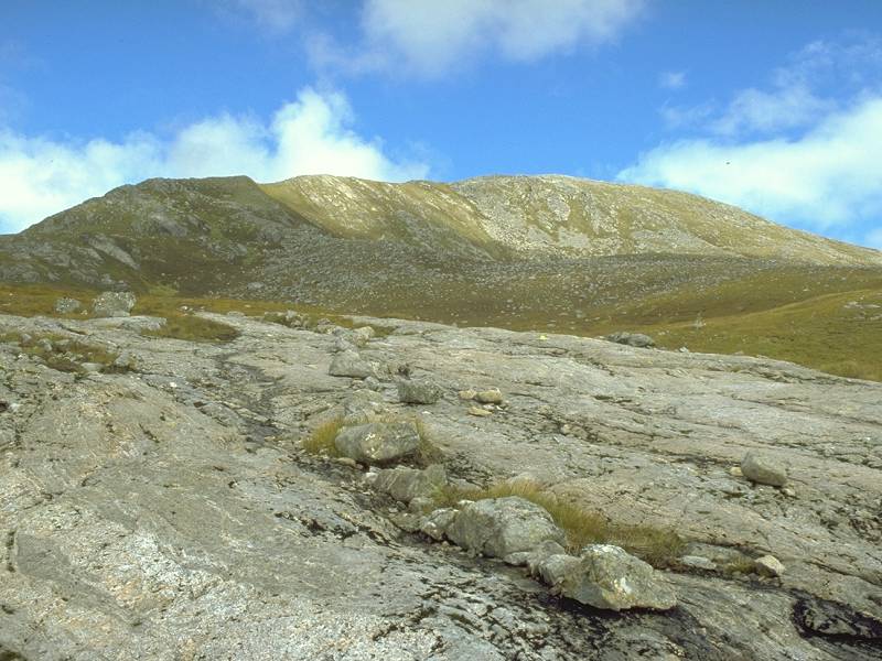
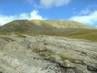
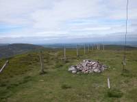
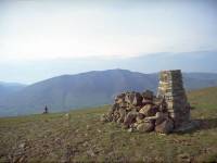
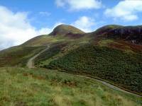
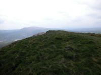
Carn
Ghluasaid
Location: Scottish
Highlands,
Kintail
Grid Ref: NH
145125
Height: 3140 ft (957
m)
Status: Munro, Murdo
Notes: The
easternmost Munro
of those overlooking Loch Cluanie and Glenshiel from the north, Carn
Ghluasaid
commands a superb view to the east, down Glen Morriston towards the
Great
Glen. Ghluasaid is one of the easier Munros to ascend, thanks to an
excellent
stalker's path to the top from the locality of Lundie down in the glen.
The summit is a broad stony plateau, with two summit cairns (some 100
metres
apart) towards the northern edge. In the summit picture we're looking
northwest
to Sgurr nan Conbhairean, of which Ghluasaid is technically an
outlier.
|
|
|
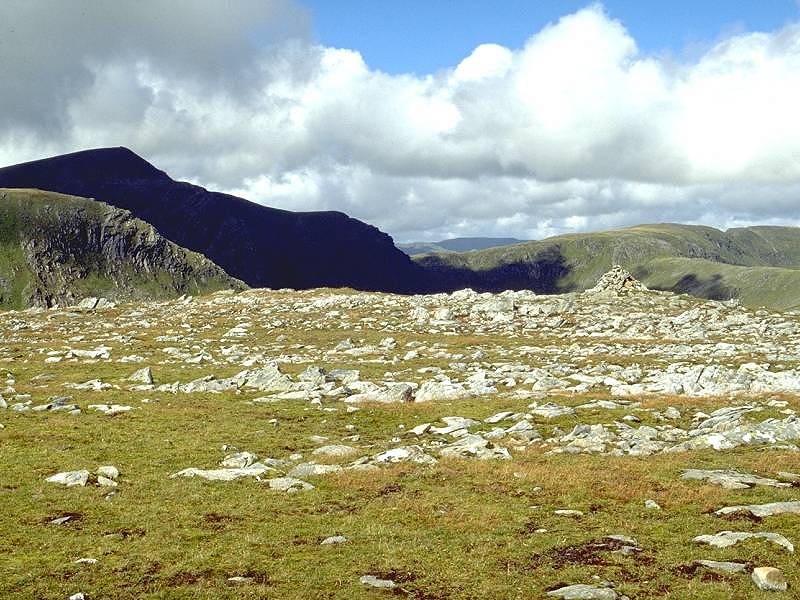
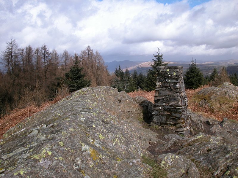
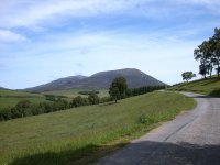
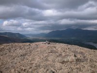
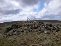
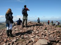
Carn
Liath
Location: Scottish
Highlands, Mounth
Grid Ref: NN
936698
Height: 3199 ft (975
m)
Status: Munro, Murdo,
Marylin
Notes: The
westernmost summit of the Beinn a' Ghlo massif, Carn
Liath is a straightforward expedition from Blair Atholl. There is a
public road as far as the picturesque Loch Moraig, from where an estate
track and then a path lead directly (if somewhat steeply) to the
summit. Allow three hours for the climb from Blair Atholl, or two hours
from the car park. The rest of the Beinn a' Ghlo massif dominates the
view to the east, Ben Vrackie stands directly to the south and the Glen
Tilt hills and the Cairngorms fill the skyline to the north. The most
intriguing view is to the west, where to the right of Ben Lawers and
Schiehallion, the Glencoe and Mamore summits form a clearly visible
cluster some fifty miles away. |
|
 |
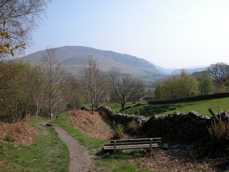
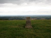
Castle
Crag
Location: Lake
District, North Western Fells
Grid Ref: NY
249159
Height: 978ft (298 m)
Status: Wainwright
Notes: Sandwiched
between the loftier hills of Grange Fell and High Spy, Castle Crag is
the hill that forms the "Jaws of Borrowdale", forcing the Derwent
through a narrow channel and effectively dividing Borrowdale into two
halves. It's the only fell less than 1000 ft high to figure in
Wainwright's guides. Although of very modest height is is surprisingly
steep and requires real effort to climb. It rewards those who reach the
summit with excellent views of Derwentwater to the north. |
|
|
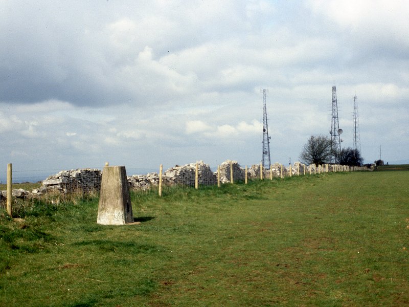
Castlelaw
Hill
Location: Pentland
Hills
Grid Ref: NT
225648
Height: 1601ft (488 m)
Status: none
Notes: A dark,
heathery dome
at the eastern end of the Pentlands, situated about a mile south of
Allermuir
Hill. A vehicle tracks reaches the summit from the north, ensuring an
easy
ascent, but Castlelaw Hill lays within the boundaries of an army firing
range so it should not be approached when the red flags are flying. The
summit features an observation point and a flagpost. The central
Pentlands
are seen to advantage from here. Should anyone ever compile a list of
Marylin
tops, Castlelaw Hill would be a typical example.
|
|

|
Catbells
Location: Lake
District, North Western Fells
Grid Ref: NY
244199
Height: 1480 ft (451m)
Status: Wainwright
Notes: The striking
profile of Catbells and its position on the western side of
Derwentwater ensures that it is one of the Lake District's most popular
climbs. However, it is not a climb to be taken lightly. All ascents are
unpleasantly steep and the fell's topknott is craggy enough that the
summit is impossible to attain without some undignified and awkward
clambering. The view is glorious, taking in Derwentwater to the east,
the Newlands valley to the west, the Skiddaw massif to the west and a
host of Lakeland summits to the south. |
|
|
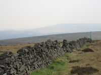
Cats Tor
Location: Peak District
Grid Ref: SJ
994759
Height: 1713 ft (522
m)
Status: Dewey
Notes: Cats Tor is
effectively the north top of Shining Tor, not far north of the Buxton -
Macclesfield road on the western fringes of the Peak District. It
stands on the Derbyshire - Staffordshire border. Its ascent is best
undertaken as an addition to that of Shining Tor. The surroundings are
of bleak and open moorland, with hills of various sizes in the middle
distance; the plateau of Kinder Scout is obvious to the northeast.
|
|
|
Cefn
Eglwysilan
Location: Taff Vale
Grid Ref: ST
097925
Height: 1253 ft (382
m)
Status: Marylin,
Clement
Notes: A lonely
summit of rough pasture standing above Pontypridd to the east. The trig
point is exactly an hour's walk from Pontypridd railway station, with a
road most of the way; some walkers will find parts of it rather steep.
Motorists can make their task far easier by parking at the road bend
just below the summit dome. The whole summit pasture is open access
land and carries more paths than the map shows. There's not much of a
view from the top but the Brecon
Beacons should be seen to the north on clearer days.
|
|
|
Chanctonbury Ring
Location: South
Downs, Sussex
Grid Ref: TQ
135120
Height: 781 ft (238 m)
Status: Marylin
Notes: Chanctonbury
Ring is one of many tops of the South Downs in West Sussex, and stands
out from the pack only because of its relative height. It is a few
miles north of Worthing and overlooks the village of Washington, from
where it is most easily ascended. The photo shows the trig pillar to
the west of the Ring, which is an ancient
hill fort crowned by a thicket of trees. The Ring is marginally higher
than the trig point. Worthing can just be
glimpsed to the south, while northwards there is a view across the
Sussex countryside towards Billingshurst and Horsham.
|
|

|
Cheriton Hill
Location: North
Downs, Kent
Grid Ref: TR
196396
Height: 617 ft (188 m)
Status: Marylin
Notes: Cheriton
Hill is the
easternmost Marylin in Britain and is the highest elevation of the
Dover
and Folkestone downs, though the actual highest point - seen here -
lays
way back from the lip of the downs in standard farming country.
There's
no feeling of being at the top of anything and in that respect Cheriton
Hill is among the most boring of Britain's high points. The 1:50000 map
shows the highest point as a trig pillar adjacent to a reservoir, but
the
1:25000 map has a spot height on a road a couple of hundred metres to
the
west (as depicted). In truth the exact location doesn't really matter
because
the surrounding terrain is virtually flat. The upside of a visit to
Cheriton
Hill is that it introduces you to the possibilities of the North Downs
proper. France can be seen from the top of the scarp, three quarters of
a mile to the south. Cheriton Hill can be walked from Folkestone
railway
station in about 75 minutes.
|
|
|
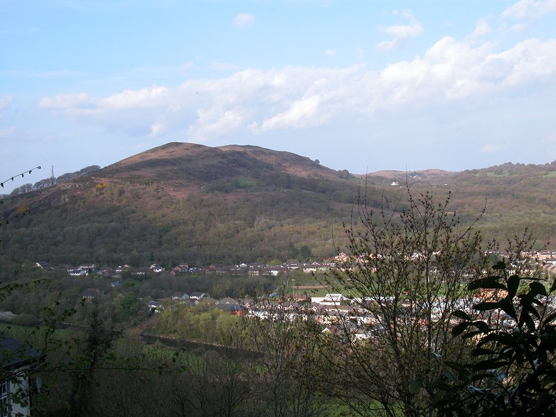
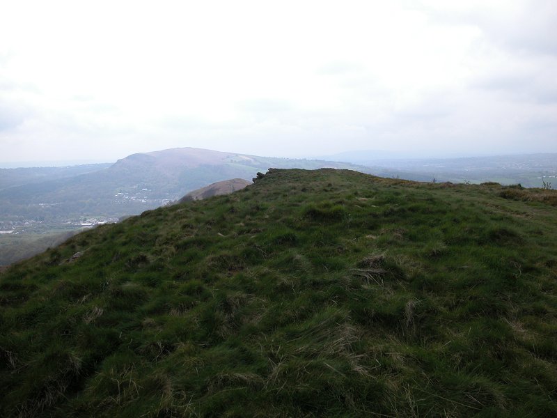
Choinneachain
Hill
Location: Scottish
Highlands, Perthshire
Grid Ref: NN
818289
Height: 2582 ft (787
m)
Status: Corbett Top
Notes: Just a few
metres lower than its parent, Auchnafree Hill, this top is most easily
reached along the track up from the Loch Turrett dam. A sketchy path
leads north from King Kenneth's Cairn, from which you venture off left
to reach the summit. Ben Chonzie and Auchnafree Hill shut in the view
somewhat, but the Ben Lawers range is prominent to the northwest and
there is a suggestion of a huge plateau to the northeast that might be
the Cairngorms.
|
|
 |
Claife
Heights
Location: Lake
District, South Eastern Fells
Grid Ref: SD
382973
Height: 886 ft (270
m)
Status: Marylin
Notes: Claife
Heights is one of the lesser Lakeland fells that failed to make it into
Wainwright's seven volume guide but instead got a mention in his later
"outlying fells" book. A Marylin, it rises on the west side of
Windermere a few of miles north of Beatrix Potter's stamping ground of
Near and Far Sawrey. The craggy limestone top is half hidden in forest
and is defended by a series of paths that are ill defined and which
flounder around desperately in bogs. There's not much of a view from
the actual summit but nearby locations have glimpses of Windermere,
with Windermere town and Bowness directly opposite, with the Fairfield
and Kentmere ridges ranged to the north and northeast. |
|
 |
Cleeve
Hill
Location: The
Cotswolds, Cheltenham
Grid Ref: SO
996246
Height: 1083 ft (330
m)
Status: Marylin
Notes: It's
such a crying shame that this, the highest point of southern England's
most charming range of hills, should be such a cheerless and mundane
place. The Cotswolds are formed from a limestone escarpment and the
scarp slopes are full of interest, yet the highest point lays on the
edge of a flat pasture adjacent to a car park, a golf course and a
cluster of radio masts. It's fortunate that the immediate environs of
Cleeve Hill make up for the disappointment of its summit, being fine
walking country and commanding a view over Cheltenham and the Severn
vale. You can drive to the top but any self respecting walker will at
least stroll up from the town. |
|

|
The Cloud
Location: Staffordshire / Cheshire borders
Grid Ref: SJ
904636
Height: 1125 ft (343
m)
Status: Marilyn,
Clement
Notes:The Cloud is a
delightful heathland summit laying a handful of miles west of
Congleton, Cheshire, more or less on the Cheshire / Staffordshire
border. It is easily ascended from the village of Timbersbrook. An
excellent viewpoint, it looks across the Cheshire plain to the
northwest and extends to the cities of Manchester and Liverpool. The
Jodrell Bank radio telescope is also prominent. The western reaches of
the Peak District form the skyline to the east. On the clearest of days
the view would include Winter Hill to the north and The Wrekin to the
south west.
|
|
|
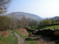
Clough
Head
Location: Lake
District,
Eastern Fells
Grid Ref: NY
333225
Height: 2382 ft (726
m)
Status: Wainwright,
Hewitt,
Nuttall
Notes: The
northernmost fell
of the Helvellyn massif, Clough Head enjoys a superb view along the
Keswick
- Penrith gap and across the Glenderamackin valley to Blencathra, whose
five southern ridges are displayed to full advantage (see photo, left).
Clough Head is rarely climbed on its own, but more usually ascended as
part of a ridgewalk including the Dodds.
|
|
 |
Codale
Head
Location: Lake
District, Central Fells
Grid Ref: NY
288090
Height: 2395 ft (730
m)
Status: Nuttall
Notes: A minor top
of High Raise laying just a few hundred metres northeast of Sergeant
Man. Despite being the geographical head of Codale it does not actually
overlook it, being some way back from the lip of the steeper gorund.
Easedale is partly in view. Apart from Sergeant Man the felltop most
prominent in the panorama is High Raise itself, half a mile to the
northwest. |
|
 |
Coety
Mountain
Location: Lwyd Vale
Grid Ref: SO
231079
Height: 1896 ft (578
m)
Status: Marylin, Dewey
Notes: Coety Mountain
is the highest point of the moorland ridge seperating Abertillery (in
the Afon Vale) from Blaenavon (in the Lwyd Vale). It is most easily
climbed from the latter but the terrain is very confusing and the paths
on the hill's lower slopes are very difficult to trace. You need to
head for the col carrying the power lines and then walk north. The
ridge path peters out some 400 metres from Coity's highest point, which
is unmarked and unmemorable. The highlight of the panorama is the view
of the Brecon Beacons to the northwest; the Bristol Channel and
Somerset can be seen to the south. |
|

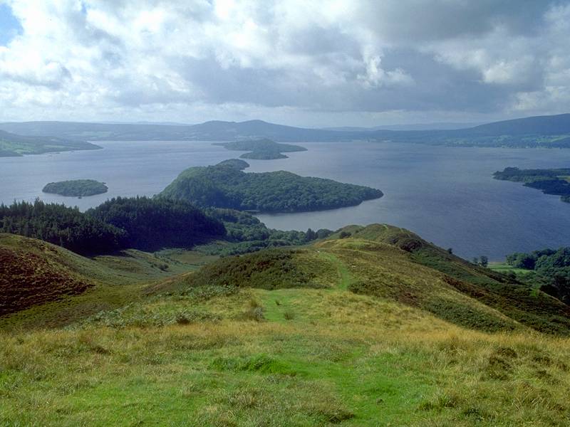
|
Conic Hill
Location: Scottish
Highlands,
Loch Lomond
Grid Ref: NS
432923
Height: 1185 ft
(361m)
Status: Marylin
Notes: Conic Hill
is a complex
little hill with three obvious summits, each of them heather-clad domes
with steep flanks. The summits lay immediately adjacent to the West
Highland
Way and the ascent is one of the walk's early highlights. The hill lays
on the eastern shore of Loch Lomond near Balmaha, from where it can
easily
be climbed in about 75 minutes. The views are glorious and include Loch
Lomond and its islands to the west, the Lanarkshire plains to the south
and Ben Lomond to the north. Conic Hill is more or less on the Highland
Boundary Fault.
|
|
|
Corn Du
Location: Brecon
Beacons
Grid Ref: SO
007213
Height: 2864 ft (873
m)
Status: Nuttall
Notes: Corn Du is the
second "Brecon Beacon", the slightly lower neighbour of Pen y Fan. It
shares its big brother's flat-topped profile. If you ascend the Beacons
by the normal route from Storey Arms then Corn Du will be the first top
you reach, the precursor to Pen y Fan itself. Views are glorious; the
plateau of the Beacons sweeps away to the south, the hills of mid-Wales
appear to the north, and there are distant views of Snowdonia, the
Shropshire Hills, the southern Pennines and Exmoor on clear days.
|
|
|
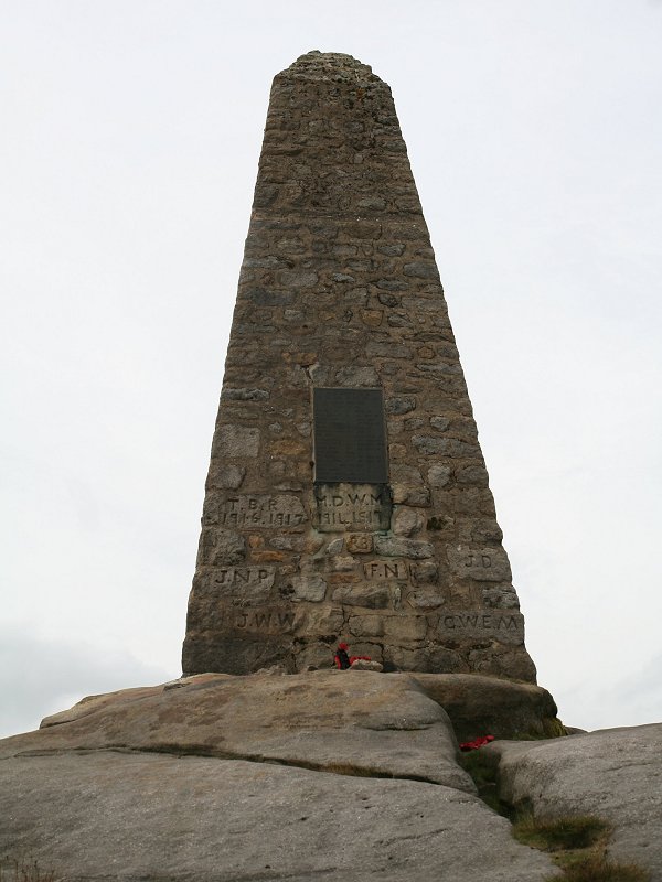
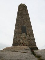
Cracoe
Fell
Location: Yorkshire
Dales,
Wharfedale
Grid Ref: SD
993588
Height: 1660 ft (506
m)
Status: Marilyn, Dewey
Notes: Cracoe Fel is
the highest point of an area of moorland laying between Skipton,
Grassington and Bolton Abbey overlooking mid-Wharfedale. It is crowned
by an enormous memorial commemorating the war dead pf the parishes of
Cracoe and Rylestone, and is easily ascended from the latter; take the
track from SD971582 up to the ridge and then turn left, following the
eastern side of the ridge wall until you are opposite the memorial. The
hills of the southern Dales are well presented in the view.
|
|

|
Craig yr Allt
Location: Taff Vale
Grid Ref: ST
133850
Height: 896 ft (273
m)
Status: Marilyn
Notes: A splendid
little hill standing two miles northeast of Taffs Well, and just under
an hour's walk from the village's railway station. The Rhymney Valley
Walk runs along the ridge. The highest point is unmarked but is
nevertheless unmistakable, and lays a few paces east of a little rock
outcrop. Apart from Taffs Well itself the view encompasses Treforest
and Pontypridd to the northwest and Caerphilly to the northeast, as
well as the surrounding
countryside of hills
and woods.
|