|
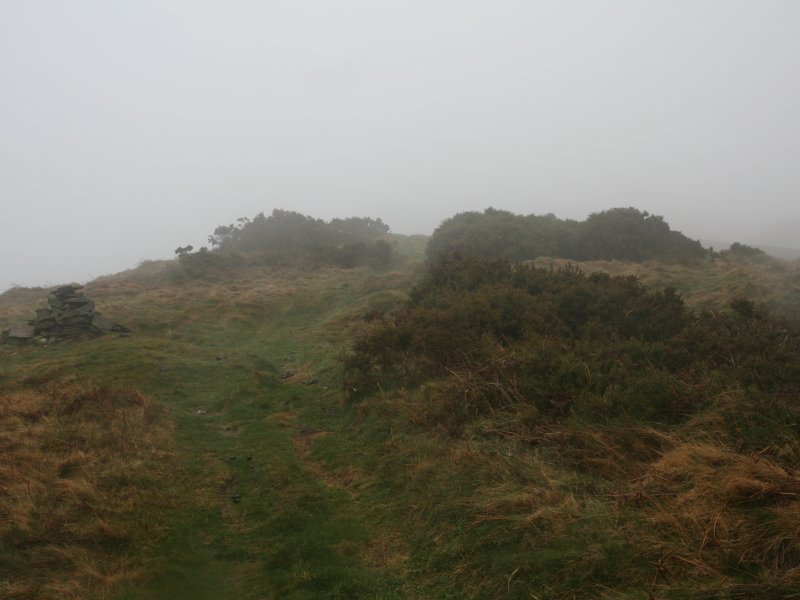
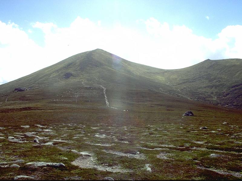
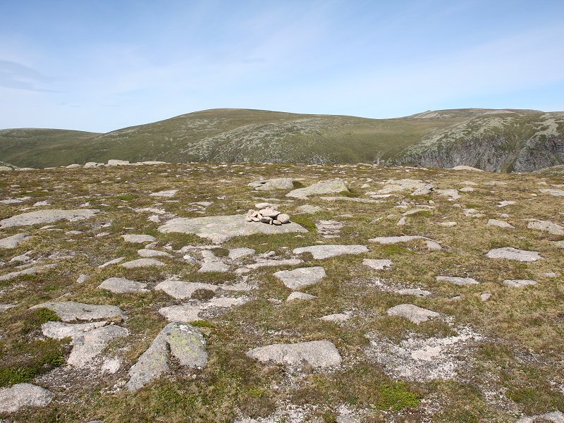
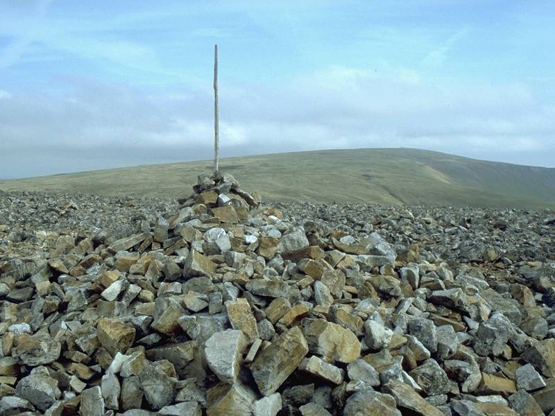
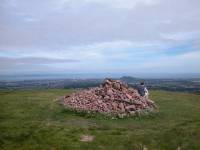
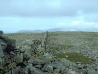
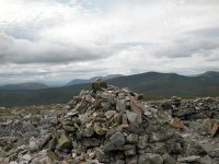
Bryn Arw
Location: Black
Mountains
Grid Ref: SO
301206
Height: 1260 ft (384
m)
Status: Marilyn,
Clement
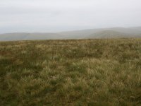
Notes: Bryn Arw is a
little heathland summit some four miles north of Abergavenny, just to
the south of the Black Mountains proper. The summit is unmarked and
slightly ambiguous, but it lays somewhere in among the gorse-covered
hillocks seen in the photo, left. The Sugar Loaf, two miles to the
southwest, dominates the view while the sprawls of Black Mountain and
Waun Fach form the skyline to the north. The hill is surrounded by
minor country lanes and footpaths, giving easy access from most
directions.
|
|
|
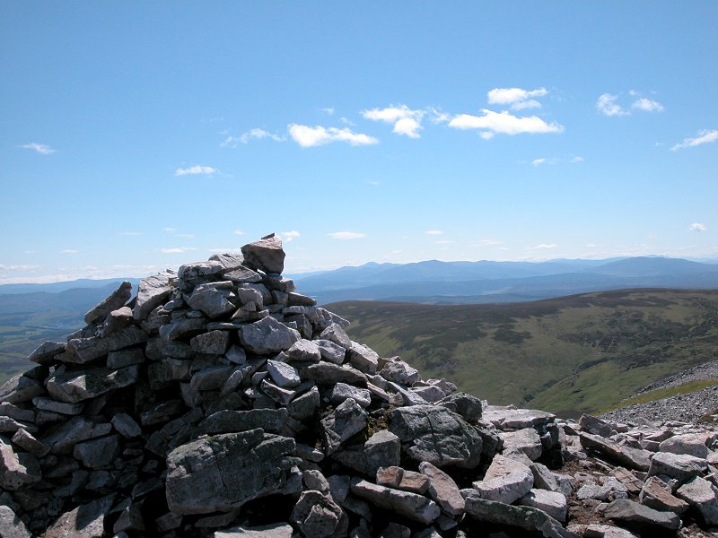
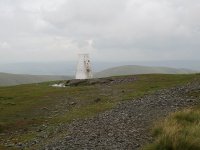
Buckden Pike
Location: Yorkshire
Dales,
Wharfedale
Grid Ref: SD
960787
Height: 2303 ft (702
m)
Status: Hewitt,
Nuttall, Marilyn
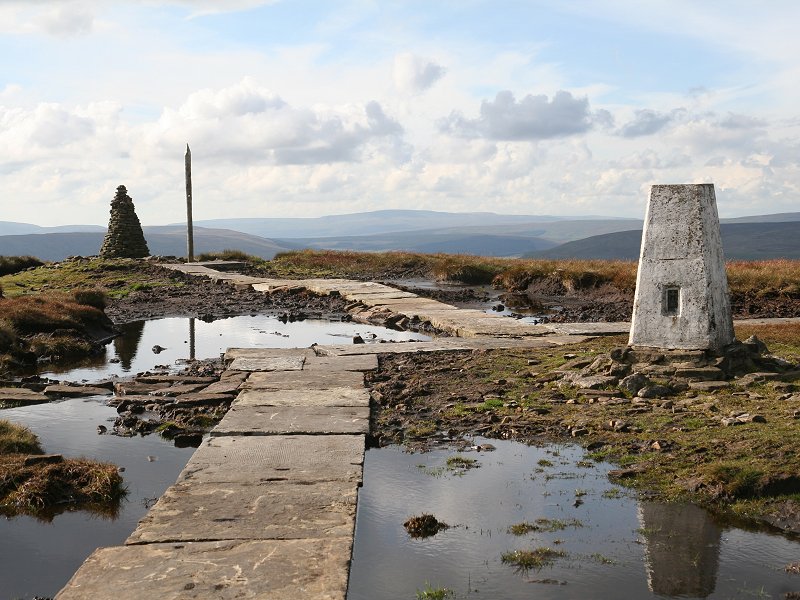
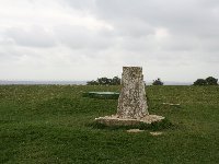
Notes:Buckden Pike
stands above and to the east of the village of Buckden in upper
Wharfedale, and can be climbed from Buckden's car park in a little over
an hour. The summit area is a sea of mud and flagstones have recently
been laid to aid walkers to reach the cairn and the trig point; critics
will seem them as an eyesore. The wild country around Coverdale is seen
to the east, and the marginally less wild environs of Wensleydale are
in view to the north, but most interest lies to the west where
Ingleborough, Pen-y-Ghent and Whernside overtop nearby Birks Fell.
|
|
 |
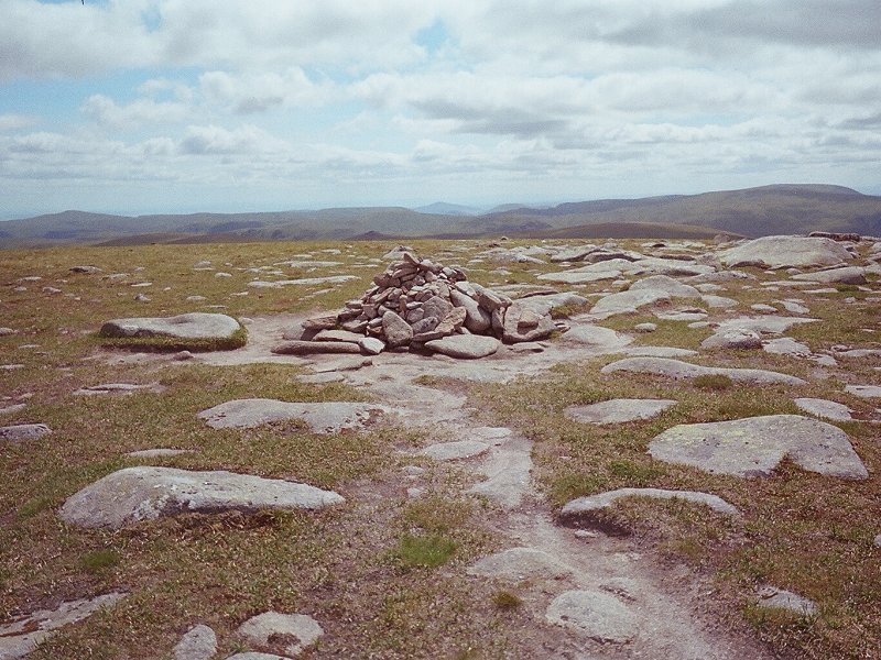
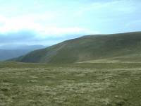
Bush
Howe
Location: Howgill
Fells
Grid Ref: SD
659980
Height: 2044 ft (623
m)
Status: Nuttall
Notes: A minor top of
the Howgills about fifteen minutes' walk northwest of the Calf. The
summit is a grassy dome almost devoid of features. The view is similar
to that of the Calf to the south except that it looks directly down
Chapel Beck to the southwest, to where the M6 motorway and the West
Coast main line squeeze between the hills. |
|
 |
Butser Hill
Location: South
Downs, Hampshire
Grid Ref: SU
716203
Height: 886 ft (270 m)
Status: Marilyn
Notes: A prominent
top on the South Downs, Butser Hill lays a handful of miles southwest
of Petersfield. Although the north slopes contain most of the hill's
interesting features there is no legitimate approach on this side;
access has to be from the south. A road leads almost to the summit from
the south side and the South Downs Way passes within a few hundred
metres. The summit features a trig pillar and a small village of radio
huts as well as a prominent microwave tower. The view is fairly
extensive and includes the Portsmouth / Southampton conurbation to the
south along with the Isle of Wight. |
|

|
Bynack
More
Location: Scottish
Highlands,
Cairngorms
Grid Ref: NJ
042063
Height: 3576 ft (1090
m)
Status: Munro,
Murdo,
Marilyn
Notes: Bynack More
(or Ben
Bynack, or Beinn Beithneag, or Caiplich) lays in the north west of the
Ben Macdui massif of the central Cairngorms, the highest range of
mountains
in Britain. It's the highest point of a vaguely wedge-shaped piece of
land
lying between Strath Nethy and the Lairg an Laiogh. Like most of the
Cairngorms
it's a vast, gently-rolling upthrust of pink granite carpeted by mosses
and short, wiry grasses. It's superb, easy walking terrain although
quite
remote. The easiest ascent is from Loch Morlich via the Ryvoan pass and
the Lairg an Laiogh, a distance of 8½ miles involving 2600 ft of
ascent. Views of the central and eastern Cairngorms, some of the
grandest
scenery in Britain, are superb.
|
|
 |
Caer
Caradoc
Location: Shropshire Hills
Grid Ref: SO
477953
Height: 1506 ft (459
m)
Status: Marilyn
Notes: A dramatic
and craggy little hill standing a couple of miles northeast of Church
Stretton in Shropshire. The normal route of approach is by a path
rising up the eastern flanks from the south - avoid the direct route
from Church Stretton as the lane adjacent to New House Farm is
atrocious, but instead take the farm track and bridleway east of
Helmeth Hill. The summit is unmarked and any one of half a dozen craggy
outcrops could be the highest point. The earthworks on the summit are
the remains of an iron age hill fort, claimed to be the last stand of
Caractacus in his battles against the Roman invaders (though that
battle probably took place elsewhere). The expedition from the town
takes just 65 minutes and the reward is a glorious view that takes in
the Long Mynd to the west, Wenlock Edge to the east and the Wrekin to
the northeast. |
|
|
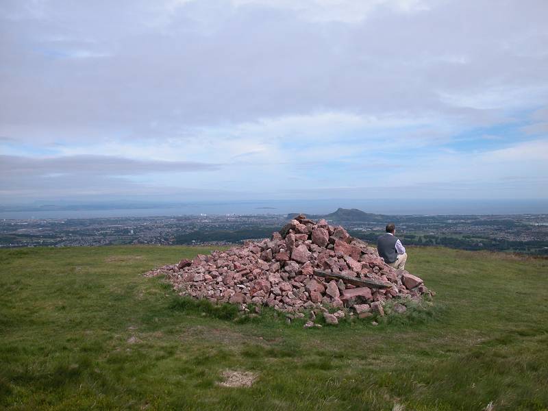
Caerketton
Hill
Location: Pentland
Hills
Grid Ref: NT
242662
Height: 1483 ft (452
m)
Status: none
Notes: Caerketton
Hill stands
at the northeastern tip of the Pentlands and provides a superb view
over
the city of Edinburgh. It is an outlier of Allermuir Hill, not quite a
mile to the west. Standing directly above the Hillend dry ski slope, it
can be ascended from Hillend's car park in about 45 minutes.
|
|
 |
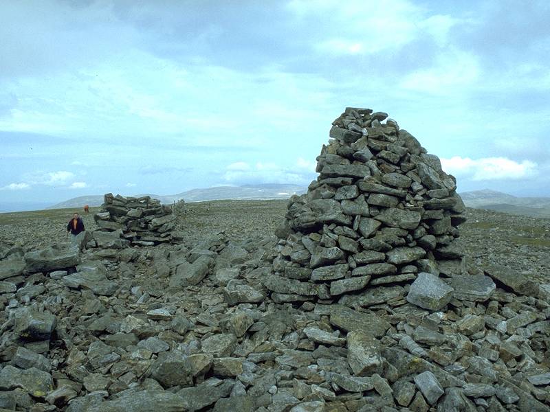
Cairn
Bannoch
Location: Scottish
Highlands, Mounth
Grid Ref: NO
222825
Height: 3320 ft (1012
m)
Status: Munro, Murdo
Notes: One of the
more remote summits of the Lochnagar massif, Cairn Bannoch lays some
10km from the nearest road access at Spittal of Glenmuick. Access is
via a track along the south side of Glen Muick that rises to the paleau
just short of neighbouring Broad Cairn, after which a
reasonablyprominent path leads the rest of the way. The summit is only
120 ft above the previous col and can easily be mistaken for a minor
top. The view is excellent, taking in just about all of the Mounth and
Cairngorm massifs. |
|

|
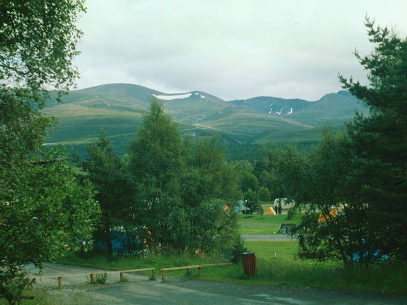
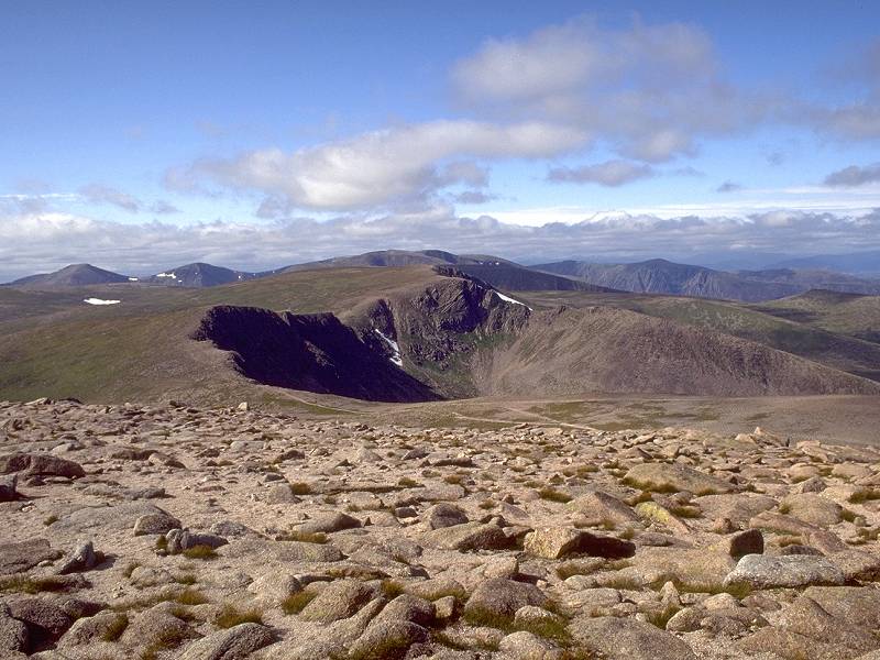
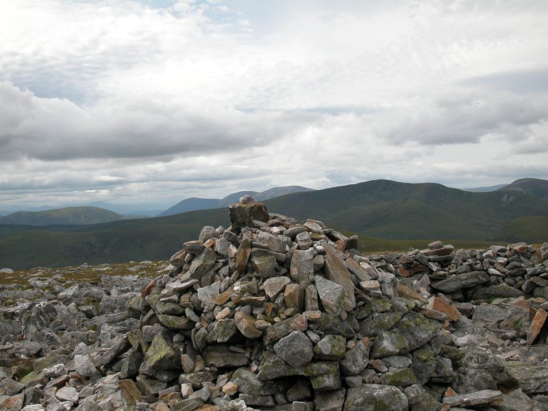
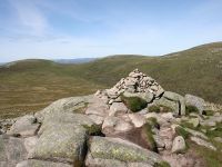
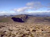
Cairn Gorm
Location: Scottish
Highlands,
Cairngorms
Grid Ref: NJ
005040
Height: 4085 ft (1245
m)
Status: Munro, Murdo,
HuMP
Notes: Cairn Gorm
is the sixth
highest mountain in Britain. Seen prominently from Aviemore and the
Spey
valley, it has given its name to the massif as a whole (though properly
the Cairngorms are Am Monadh Ruadh, the Red Hills). Cairn Gorm is a
gentle
dome of a mountain, easily climbed from the base station of the summit
railway by an ascent of some 2100 ft. It was formely possible to take
the
chairlift to the Ptarmigan cafe at 3700 ft and walk the final kilometre
to the summit, but since the chairlift was replaced by the railway
visitors
are no longer allowed access to the summit from the top station. The
summit
is home to an automatic weather station run by Heriot-Watt University
in
Edinburgh. Views from the summit are awesome, particularly along the
line
of the northern corries (as depicted).
|
|
|
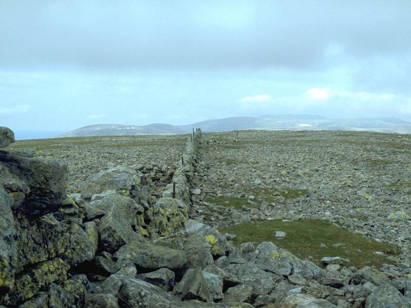
Cairn of
Claise
Location: Scottish
Highlands,
Mounth
Grid Ref: NO
185788
Height: 3491 ft (1064
m)
Status: Munro, Murdo
Notes: An outlier
of Glas
Maol, Carn of Claise is situated northeast of its parent mountain and
stands
on the boundary between Aberdeenshire and Angus. A rise in the general
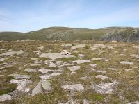
level of the plateau rather than a "proper" mountain, Carn of Claise
offers
no views as such, just a general vista of a stone-littered grassy void.
A stone wall leads away from the summit to the north but peters out. An
old track known as the Monega Pass runs past Carn of Claise a hundred
metres
to the east, and offers a very easy route from Glas Maol to those who
wish
to visit this summit.
|
|
 |
Cairn
of Gowal
Location: Scottish
Highlands, Mounth
Grid Ref: NO
226820
Height: 3251 ft (991
m)
Status: Munro top
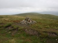
Notes: A top of Cairn
Bannoch (see above), Cairn of Gowal is not much over sixty feet short
of its parent and is crossed on the ridgewalk between Cairn Bannoch and
Broad Cairn. It is marked by the tiniest of cairns and can easily be
missed. |
|
|
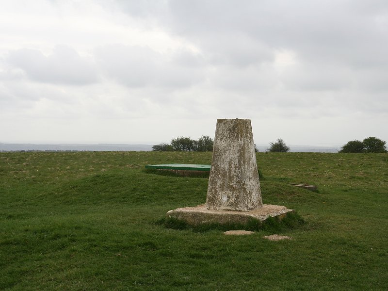
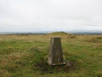
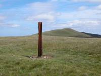
Cairnpapple Hill
Location: West
Lothian
Grid Ref: NS
987711
Height: 1024 ft (312
m)
Status: Marilyn,
Yeaman
Notes: Not the most
interesting of hills, cairnpapple Hill stands a couple of miles
northeast of Bathgate in West Lothian. The trig point is not far from a
road; the access point is a gate somewhere around NS990712. Shin over
the gate and walk up a track towards the summit. The view isn't
terribly rewarding but includes the pentlands, Arthur's Seat and the
Forth Bridges. There is a rather better viewpoint just across the road
at NS990711, complete with a topograph.
|
|
 |
Calders
(a.k.a. Brant Fell)
Location: Howgill
Fells
Grid Ref: SD
670960
Height: 2211 ft (674
m)
Status: Hewitt,
Nuttall
Notes: A fell in the
Howgills, roughly 3 miles northeast of Sedbergh, from which it can be
climbed in about 90 minutes via Arant Haw. It's a lonely place,
overlooking grassy fell ridges and empty valleys. The Calf dominates
the view to the north, and Arant Haw ditto to the south. Some of the
Lakeland fells are seen to the northwest and Pennine tops such as Great
Knoutberry Hill and Whernside appear to the east and southeast. |
|
 |
Calf,
The
Location: Howgill
Fells
Grid Ref: SD
667970
Height: 2218 ft (676
m)
Status: Marilyn,
Hewitt,
Nuttall
Notes: The Calf is
the highest summit of the Howgills, a relatively unfrequented group of
hills situated between the Lake District and the Yorkshire Dales. This
hill and its neighbours loom above the M6 motorway and the West Coast
main line as they squeeze together on their way north from Kendal to
Penrith. The hill therefore overlooks the motorway and railway, beyond
which are the far eastern groups of the Lakeland fells. Yet more lonely
hills feature in just about every other direction. The best base for
the Howgills is the town of Sedbergh that lies immediately to the
south, from which the Calf can be climbed in around two hours via Arant
Haw and Calders. The highest point lays a little way east of the trig
pillar. |
|
|
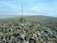
Capelaw
Hill
Location: Pentland
Hills
Grid Ref: NT
215660
Height: 1490ft (454 m)
Status: none
Notes: A grassy
dome in the
northern Pentlands, immediately west of Allermuir Hill, from which
there
is a path all the way. The top is marked by a wooden post. The ridge to
the east looks higher, but this proves to be an optical illusion. A
pleasant
enough place to be, with a splendid view of the city of Edinburgh, but
worth climbing only as part of the Pentlands ridgewalk.
|
|
 |
Carn
a' Chlamain
Location: Scottish
Highlands,
Mounth
Grid Ref: NN
915758
Height: 3159 ft (963
m)
Status: Munro, Murdo,
Marilyn
Notes: A landrover
track from Glen Tilt virtually all the way up to the summit makes this
hill one of the easiest Munros to ascend, although what the hill lacks
in difficulty it makes up for in distance, being a good ten miles from
Blair Atholl. This does make it quite a stretch for those without
transport, and a bike ride up the glen to Clachghlas cottage will save
a lot of time and effort. The conical top stands well back from the
south east ridge along which the ascent track rises and is not seen
from the glen itself. A glorious view is dominated by the various
summits of the Beinn a'Ghlo massif across the glen, but perhaps most
interest lays to the north where the high tops of the Cairngorms are
spread out. Five hours on foot from Blair Atholl, three and a half
hours back. |
|
 |
Carn a' Choire Bhoidheach (a.k.a. the White Mounth)
Location: Scottish
Highlands,
Mounth
Grid Ref: NO
226845
Height: 3642 ft (1110
m)
Status: Munro, Murdo
Notes: The White
Mounth is part of the Lochnagar plateau and its summit cairn lays
roughly 2km southwest of Lochnagar itself. It's not so much a mountain
but more of a gentle swelling in the general level of the plateau, a
broad, rounded top whose gradients are almost imperceptible. There is a
path from Lochnagar, though you could more or less choose your own line
across the short, wiry turf. The walk between the two hills takes
roughly 45 minutes; there's not much difference in the far panorama and
rather less foreground interest but you will probably be rewarded
instead with solitude. The Anglicised name presumably refers to the
vast snowfields that lie here in winter. |
|
 |
Carn
a'
Gheoidh
Location: Scottish
Highlands,
Mounth
Grid Ref: NO
107767
Height: 3199 ft (975
m)
Status: Munro, Murdo,
Marylin
Notes: The parent
hill of Carn Aosda and the Cairnwell, which together form the Glenshee
ski centre, Carn a' Gheoidh lays a couple of miles to the west of its
offspring and is far more secluded and pleasant. The intervening
terrain is a joy to walk - for the most part you can ignore the paths
and choose your own line over the short turf and gentle gradients.
Allow 65 minutes from Carn Aosda. The hill is excellently placed for
views into the western Mounth and isolated, remote hills such as Carn
am Righ and Beinn Iutharn Mhor seem very close. The Cairngorms and the
Beinn a' Ghlo massifs are the obvious highlights of the panorama, while
Ben Lawers and its neighbours appear way over to the west. Eastwards
lay Glas Maol and Lochnagar, while to the south the view extends as far
as the Fife hills (East and West Lomond). |
|
|
Carn an Tuirc
Location: Scottish
Highlands,
Mounth
Grid Ref: NO
174804
Height: 3343 ft (1019
m)
Status: Munro, Murdo
Notes:
A northern
outlier
of the Glas Maol massif east of the Glenshee ski grounds, Carn an Tuirc
is a stony ridge sitting atop grassy flanks. Though pathless it is very
easily ascended from the nearby Monega pass between Glen Callater and
Cairn
of Claise, there being barely two hundred feet of reascent from the
latter
Munro. Carn an Tuirc has a reasonably good view northwards, down the
glen
to Braemar with the high tops of the Cairngorms ranged around the
northwestern
arc, while the Lochnagar massif dominates to the east. |
|

|
Carn an t-Sagairt Mor
Location: Scottish
Highlands,
Mounth
Grid Ref: NO
208843
Height: 3435 ft (1047
m)
Status: Munro, Murdo
Notes: Carn Taggart
Mor, to give the Anglicised version of the name, is a fine hill laying
to the far west of the Lochnagar group. Although it coud be included in
a very long round of Loch Muick it is far more easily approached from
Glen Callater. A path from the disused Loch Callater Lodge runs up the
flanls of the hill northeast of the loch and ultimately rounds our hill
to the south; it's a simple matter to leave the path to the left and
climb the summit dome to the top. The extensive views take in the
Cairngorms and Mounth massifs.
|