
| Lizard to Coverack | Back to South Cornwall Coast Path index | Helford Passage to Falmouth |

| Lizard to Coverack | Back to South Cornwall Coast Path index | Helford Passage to Falmouth |
|
|
|
| Length: | 11.15 miles / 17.8 km |
| Total ascent: | 2200 ft / 671 m |
| Total descent: | 2250 ft / 688 m |
| Estimated time: | 4 hrs 19 mins |
Click
on
any thumbnail image in this gallery to display the corresponding full
size
image. The images are access protected through a cgi script to prevent
hotlinking. If you encounter problems while trying to view the full
size
images, please read the access advice
page.
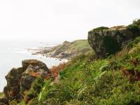
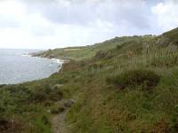

Retrospective views along the coast path north of Coverack
The Coast path leaves Coverack by the short stretch of road at the north end of the bay, immediately beyond the bus halt. The road passes a number of large, secluded houses, every one born of an estate agent's fantasy and surrounded by dense vegetation. The road becomes a driveway, then a path, and eventually you come out into the open.
![]() Truronian
services T2
and T3
from Helston to Coverack
Truronian
services T2
and T3
from Helston to Coverack
![]() First
Western National service 2, Penzance
- Porthleven - Helston - Falmouth (for connections to Helston)
First
Western National service 2, Penzance
- Porthleven - Helston - Falmouth (for connections to Helston)
![]() First
Western National service X7, Penzance
- Marazion - Helston - Falmouth - Truro - St Austell
First
Western National service X7, Penzance
- Marazion - Helston - Falmouth - Truro - St Austell
The coast path north of Coverack; Coverack from the foreshore; the rocky "beach"
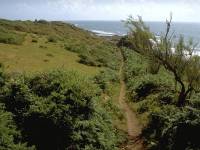
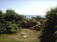
The coast path near Trevasloe
For most of the first mile and a half out of Coverack the coast path traverses a curious feature, an area of virtually flat heathland partially cloaked in scrub, and with a steep slope a couple of hundred meters inland. The geologists tell us that this area, which lies coastwards of the tiny locality of Trevasloe, is a raised beach; the slope to the left is what used to be the cliff face. It certainly makes for delightful walking, along lush, level ground that reminds you somewhat of Predannack Downs back beyond Lizard Point. Fans of wild campsites will no doubt give this area careful consideration. The present beach is just a rocky foreshore but it does allow a rather nice retrospective view of Coverack.
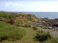
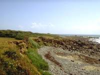
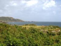
Coast path and terrain at Lowland Point
Things change at Lowland Point, a mile and a half out of Coverack; the path reaches the northeastern limit of Coverack Bay and turns left, perhaps giving you a view of Pendennis Head just east of Falmouth. The terrain is a little confused just here, a jumble of turf and gorse and brambles. As you round the head and enter the stretch marked as Polcries on the map, the industrial scar of Dean Quarry comes into view (I've deliberately not shown it in the images above). You can't avoid it, however for the coast path runs right through the middle of the works. Follow the signs, don't deviate from the path, keep out of the way of moving vehicles and operating machinery and follow any instructions you are given. The quarry is not a pretty sight but it is perversely fascinating to see the workings of the mineral extraction industry so close at hand.
Eventually, you pass the store heaps of graded chippings and finings at the northeast end of the quarry and leave its grounds to round Dean Point.
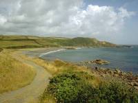
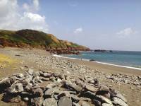
A rough track from Dean Point leads to the meagre beach fronting Godvrey Cove; more of a bay than a cove, really. The dark headland of Manacle Point rises on the other side of the bay.
Because of quarrying operations on the other side of Manacle Point no right of way exists around the headland at present. The coast path has to make a short diversion inland Watch for the direction sign at the apex of the widest part of the beach and follow the track into the rough pasture beyond.
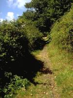
At the rear of the brief interlude of rough pasture a footpath heads smartly uphill between hedgerows to disgorge the walker into the tiny but impossibly charming village of Rosenithon, about seven hundred meters inland.
![]() Nearest bus
service
runs to St
Keverne, 10 mins walk inland
Nearest bus
service
runs to St
Keverne, 10 mins walk inland
Scenes in Rosenithon
Turn right ono the lane, which takes you the brief half mile back to the coast. The lane bends sharply left then right and a cross-field path cuts the first corner off - however, the diversion is so brief it's barely worth following. A brief but steep downhill stretch delivers you into the compact little haven of activity that is Porthoustock.
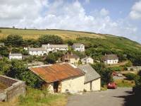
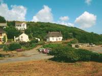
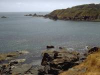
Porthoustock and Manacle Point
Porthoustock is grouped around a tiny, squareish inlet. I have to be honest here - it's probably one of the least attractive villages on the Cornish coast. The large concrete blockhouse beside the beach probably has much to do with this. There is a seasonal cafe here but you might consider holding off for half an hour for similar facilities in the far nicer surroundings of Porthallow.
![]() Nearest bus
service
runs to St
Keverne, 15 mins walk inland
Nearest bus
service
runs to St
Keverne, 15 mins walk inland
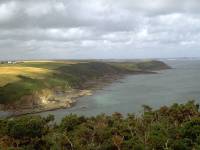
North of Porthoustock the coast loops around the headlands of Pencra Head and Porthkerris Point, which feature an abandoned quarry and a naval observation post. There is at present no right of way along the coast between Porthoustock and Porthallow, a mile and a quarter further on, so the coast path is once again routed inland. Most of the official route lies along back lanes but eagle-eyed map readers will spot an alternative. Leave Porthoustock by the road to the northwest and pass through the tiny village of Trenance at the top of the slope, but immediately afterwards turn left at the crossroads for a lane that loops round a naval radar station before heading towards Porthkerris, just short of the coast. The lane bends beck to the right. Two hundred meters further on, just before the lip of the steep slope down to Porthkerris, there is a short driveway to the left that leads into a field; once into this field turn left again and walk along the edge of the pasture, veering gradually away from the hedge. There will probably be a faint path. Two hundred meters further on you hit a public footpath which, according to the map, runs up from Porthallow along the cliff edge and then stops dead in the middle of this field.
The path certainly exists from here on and very quickly reaches a picturesque cliff edge. Porthallow is only five hundred meters ahead and the path is a much more satisfying route into the village than the roadway. Why the right of way should stop dead in the middle of the pasture is a mystery, but the route I have just described is perfectly viable even if it is a technical trespass for some 200 meters.
There is a further alternative out of Porthoustock for those who don't mind bending the rules a little further; northwards out of the village is a vehicle track that hugs the coast and runs beside the disused St Keverne quarry immediately inland. Some 500 meters north of Porthoustock you should spot a rough flight of steps climbing the bank to your left; these rise a dozen feet or so to a level area of gravely spoil overlooking the old quarry. You should be right next to the old vehicle access track heading out of the quarry grounds to the west and, if you follow this, it will lead out into the Trenance - Porthkerris lane near to the MOD radar station described above. You will pass a notice pointing the other way saying "no unauthorized vehicles" or something similar - fortunately it doesn't specifically ban pedestrians but you should be aware that this is technically a trespass - so if you feel like following it don't tell anybody I gave you the idea, OK?
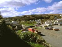
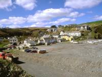
Porthallow and the beach
Porthallow is almost a twin of Porthoustock, a mile and a quarter behind (by whichever route you chose), being once again a compact little group of cottages huddled round a square inlet. But there are significant differences. Porthallow's "beach" might act as the car park but is rather finer and sandier than that at Porthoustock. Two steep, wooded valleys converge and disgorge into the sea here. There is a cafe and a pub and a shop by the beach, and a gorgeous little garden coffee shop a couple of hundred yards inland along the lane to the southwest. There are no concrete blockhouses or corrugated iron shed roofs to disfigure the charm of the place. Finally, Porthallow is on a bus route out of Helston.
![]() Truronian
service
T3
(the Lizard Rambler) to and from Porthallow
Truronian
service
T3
(the Lizard Rambler) to and from Porthallow
Scenes in Porthallow
From Porthallow onwards things become more straightforward again, at least for a while. The coast path leaves the village to the northwest, hugging the edge of the steep slope behind a wooden fence and then a thick wall of vegetation. The retrospective views of Porthallow are glorious.
Coast path NW of Porthallow; Looking back
Retrospective views of Porthallow
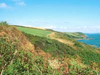
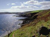
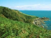
As you round the minor headland northwest of Porthallow you get a good view of Falmouth, now five miles away across the mouth of the Helford river. This part of the coast is known as Snail's Creep, for no known reason. It's a mile and a half of fairly standard coast scenery, with the path keeping to the lip of a scrubby slope with a rocky foreshore at the bottom.
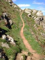
As you approach Nare Head the path rises briefly over a rockstep. On the far side the path descends fairly rapidly to Nare Point.
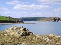
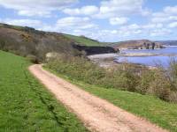
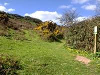
Follow the path across a greensward, cutting off the corner of Nare Point (it really isn't worth visiting) to come alongside Parbean Cove - just like Godvrey Cove a few miles back it's actually a bay rather than a cove. The path is initially a good vehicle track. It dips downwards a little at the far end of the little bay to run below the scrubby Lestowder Cliff, and then through a lovely area of lush pasture called Menaever.
The path now develops into a vehicle track once more and approaches Gillan Creek.
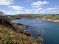
Gillan is lovely. A scattered community of dream houses stands immediately south of this beautiful stretch of water, a favoured sailing centre. It's a complex little place and there is far more of it than would appear possible on the map.
Scenes at Gillan
Gillan turns out to be a complex of several tiny harbours, each one separated by a winding pathway that bores through a lush screen of vegetation and bypasses a house picked out in blue paintwork. Blue seems to be a theme in Gillan.
A Gillan portfolio
Pleasure boats at Gillan
The map tells you that the journey through Gillan is no longer than four hundred meters. Your perception, as you wander along another footpath past another house with blue paintwork and come out onto another tiny beach with another cluster of sailing dinghies moored just offshore, is that it goes on forever.
![]() Truronian
service
T3
(the Lizard Rambler) to and from Gillan Garage
Truronian
service
T3
(the Lizard Rambler) to and from Gillan Garage
More scenes of Gillan
Gillan's west harbour
As you wander through Gillan's byways, wondering what kind of lucky bastard gets to live in this place and where the nearest estate agent is situated, you will come across an important path junction. It's going to be necessary to cross Gillan Creek, and that can only be done a couple of hours either side of low tide. Time your arrival at Gillan badly and you're looking at an inland detour by road via Manaccan. A sign at the path junction directs you to go one of two ways depending on the state of the tide.
Assuming you've timed your walk correctly and the tide is out, your next objective is the locality of St Anthony-in-Meneage, seen directly across the creek four hundred meters to the north. Take the coast path past a final cottage picked out in blue. The path runs out to a set of concrete steps down to the sandy flats. In theory you are supposed to use the stepping stones across the narrowest part of the creek - I've considered them three times and backed off, for they are damn slippery. It's easy enough just to wade across the shallows a couple of hundred yards to the east - when the tide is out the maximum depth of the creek across this sandy bed is less than three inches, so assuming you're wearing proper walking boots you won't even get your feet wet.
One of Gillan's blue-detailed houses; the stepping stones; the shallows
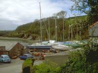
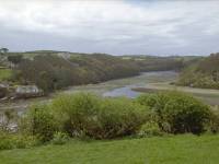
There's very little at St Anthony-in-Meneage; a church, a couple of cottages, some boats. The coast path nips smartly up the hill behind the church alongside a real rarity in these parts - a cropped field.
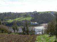
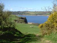
Just up the hill from St Anthony you find yourself atop the narrow ridge of land sandwiched between Gillan Creek and the Helford River proper, and giving excellent views of each. Falmouth is also well seen, now little over three miles away as the crow flies. The route of the coast path requires an excursion out to Dennis Head, the easternmost point of this neck of land about 600 meters away. My advice is not to bother. The head is a rough, scrubby place with nowhere to sit, and the view is far less extensive than that which you're already enjoying. If you do walk out to the head then it makes little difference which way you go - the out and back paths are but yards from each other. Once you find yourself at the neck of the ridge above St Anthony again, head a short distance northwest and pick up the main coast path along the southern bank of the Helford river.
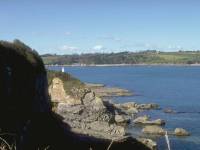
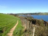
Helford River, south side
There's a pleasant two-mile stretch from here to Helford, where you can either call it a day or catch the ferry across to Helford Passage and continue to Falmouth. Initially the path runs through a couple of lush pastures on the lip of the slope high above the river, but it then dives through a gate in the hedge to the right and descends into the Boshahan woods.
Boshahan Woods; Ponsence Cove
The route through the woods is easy and pleasant, enlivened by some steep little rises and falls and the descent into two coves. The first, Ponsence Cove, is sandy; the second, Boshahan Cove, is rockier. The National Trust village of Durgan is almost directly opposite, about 800 meters away.
Boshahan Woods; Boshahan Cove
Helford River from Boshahan Cove; Rockpools; Coast path to Treath
From Boshahan Cove there's another 800 meters or so of woodland path to Treath.
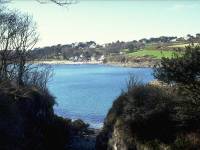
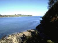
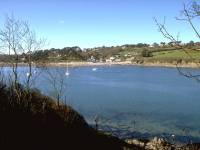
Helford River from the path near Treath
Treath is little more than a locality; the path becomes a vehicle track serving a couple of cottages, but you're out of the Boshahan estate now and Helford Passage can be seen on the opposite bank not far to the west.
Scenes near Treath
Treath is a lovely area; the vistas of woodland, sea and sky are a perfect blend, especially if you get here in the late afternoon with the sun more or less end-on to the river.
Coast path and river scenes on the approach to Helford
There's a brief view of part of Helford itself before the coast path avoids a private riverside driveway by running up through the woods to your left.
Arrival at Helford
Helford is a tiny village tucked away in a tidal inlet off the south side of the river. It's a place of chocolate box prettiness and it attracts the discerning visitor; National Trust owned, it's preserved in a pristine state. The road into the village is an adventure; steep, narrow and sharply curved, it is closed to non-residents. Visitors have to use the car park outside the village, which is also where the Lizard Rambler bus service makes its occasional calls.
![]() Truronian
service
T3
(the Lizard Rambler) to and from Helford
Truronian
service
T3
(the Lizard Rambler) to and from Helford
![]() Connections from
Helston to Penzance / Falmouth, Mon-Sat and Suns
/ bank holidays
Connections from
Helston to Penzance / Falmouth, Mon-Sat and Suns
/ bank holidays
The coast path into Helford
Helford village
Helford
Walk down into the tiny village, swing right over the river bridge and right again to pass the post office and garden cafeteria. A cottage here, named Loloma, was once a holiday rent where I stayed with three friends for a week in the spring of 1977 - it was an idyllic place but it was a pity we couldn't say the same for the weather that year.
Helston village; the path out to the ferry
Walk on past the pub (The Shipwright's Arms if I remember correctly). Shortly afterwards the road gives out and the coast path follows a simple footpath alongside a pasture towards a spit of land from where the passenger ferry leaves for Helford Passage.
The ferry landing and the Helford River
Details of the ferry crossing from Helford to Helford Passage are given at the start of the walk 7 page, but first some essential information: the ferry cannot run for two hours either side of low tide. In other words, during exactly the same window that it's possible to cross Gillan Creek, it's not possible to cross Helford River. This is why you need to time this section of the walk most carefully.
Helford Passage and the Helford River from Helford
| Lizard to Coverack | Back to South Cornwall Coast Path index | Helford Passage to Falmouth |
This page last updated 16th April 2005
![]()