|
|
||
| Kinbrace to Forsinard | Back to North of Scotland Way index |
|
|
|
||
| Kinbrace to Forsinard | Back to North of Scotland Way index |
|
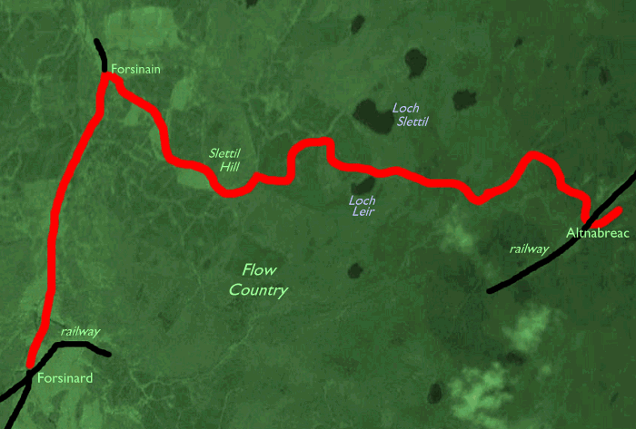
From Forsinard there is another three miles of road walk, north along the A897 Strath Halladale road, to reach Forsinain. Here you turn right onto an estate track and right again onto a dirt road that heads up into a dark mass of conifers. The next twelve miles consist of a march along that same dirt road, with never-ending views of heather moorland, conifer plantations and the occasional glint of lochans. Recreational fishing is just about the only pursuit here and you may encounter the odd estate car or landrover. Though you are crossing the Flow Country ridge the only real relief is the little hill of Slettil, whose shoulder you cross. The railway line is in view through much of the walk, as are the Ben Griams and the Knockfin Heights; more bizarre, isolated little mountains come into view to the south and south east, among them the striking cone of Morven. On a clear day the fascinating hills of west Sutherland can be seen; Ben Loyal, Ben Hope, Ben Stack, Arkle and Foinaven among them. Perhaps the most telling moment of the walk is reached when you cross the old county boundary from Sutherland into Caithness; marked boldly enough on the map, it adheres to no feature whatsoever on the ground as you are confronted with an unbroken sea of featureless heather. There is literally nothing to see.
The track eventually kinks to the southeast and you will catch glimpses of the Lochdhu "Hotel", actually a former hunting lodge and now a private residence, miles away through the forest. Eventually the track leads you across the railway line and to a junction in a hollow; take the left turn, bypassing a quarry. and you will find yourself at Altnabreac station. The cottage on the platform is a private house - do not disturb the residents. Altnabreac is a rarely used request stop and drivers tend to rattle through at 60mph or more - make sure the driver sees you in good time even if it means gesticulating wildly and jumping up and down on the platform as he gets within the last quarter of a mile. Although this is a long walk you need to time it between trains and it will effectively be a long half day - either from 7am to 2pm, or from lunchtime to 8.30 or thereabouts. If the evening train gets canceled - rare but not unknown - then you're stuck, so I would advise taking plenty of extra food and warm clothing, even a sleeping bag if you have the room, just in case.
Maps: 1:25000 OS Explorer 449 (Strath Halladale), 450 (Wick & the Flow Country)
Click
on
any thumbnail image in this gallery to display the corresponding full
size
image. The images are access protected through a cgi script to prevent
hotlinking. If you encounter problems while trying to view the full
size
images, please read the access advice
page.
Leaving Forsinard
![]() Scotrail
(North Scotland Line) timetable(.pdf document)
Scotrail
(North Scotland Line) timetable(.pdf document)
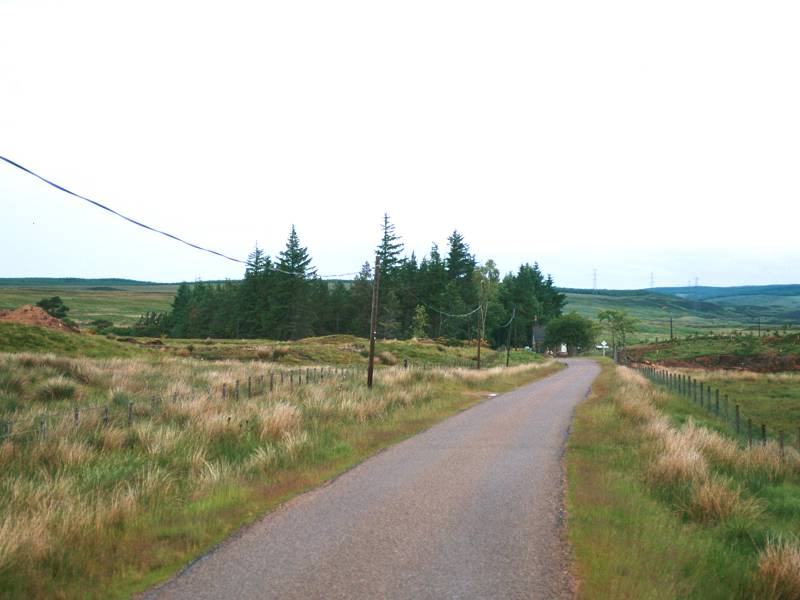
It's not really necessary to give directions away from Forsinard - just walk north along the A897 in the direction of Melvich. It's narrow, single tracked road and despite its A-classification traffic on it is virtually nonexistent. Forsinard falls away very quickly.
Scenes along Strath Halladale
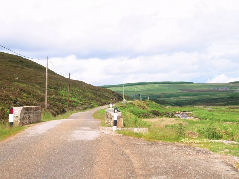
It's a three mile walk from Forsinard to Forsinain, and there's basically nothing in between. Most roads like this in Caithness and northeast Sutherland at least have the odd cottage every half mile or so, but this particular stretch of Strath Halladale is empty. There's a fairly considerable slope hugging the road to the west, so there's not even much of a view. A forested slope to the west, across which a line of pylons is marching; a ribbon of poorly maintained tarmac stretching ahead of you; a stream down to your right.
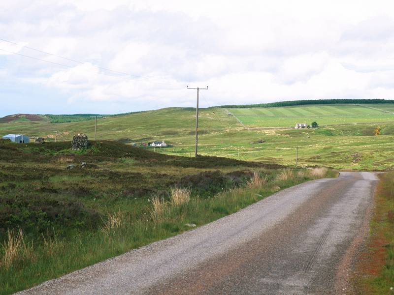
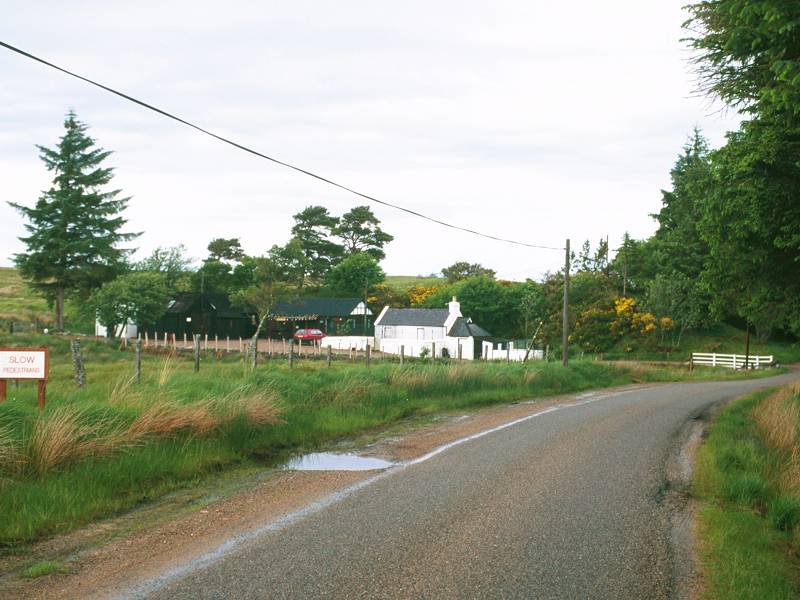
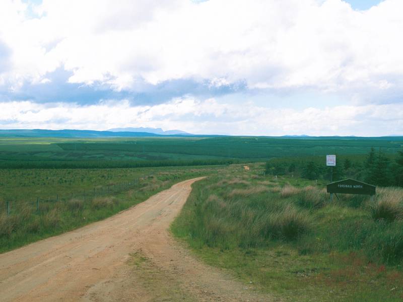
Approaching Forsinain
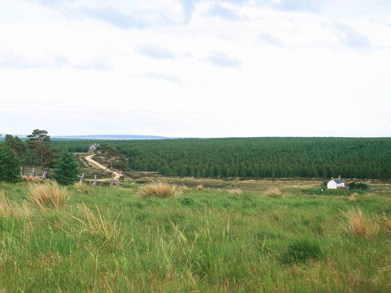
You can see Forsinain farm from a fair way out, mainly by virtue of a rectangle of enclosed and tended land some way up a hillside to the northeast. It looks more than a little incongruous out here in the middle of nowhere, and you develop a distinct feeling that it might vanish if you blink. As you get closer and round the last bend, you see a small cluster of cottages around and below the enclosure.
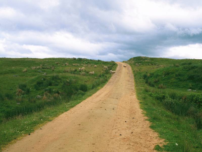
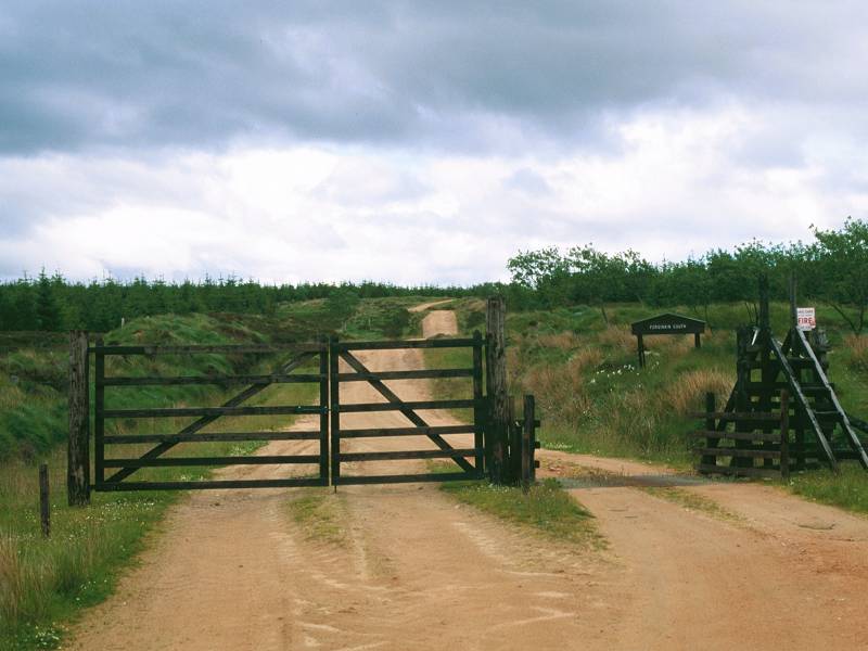
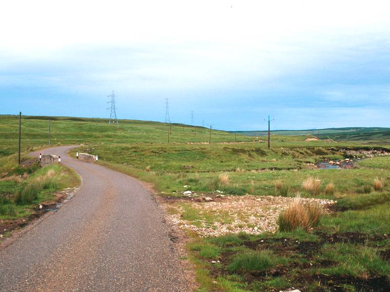
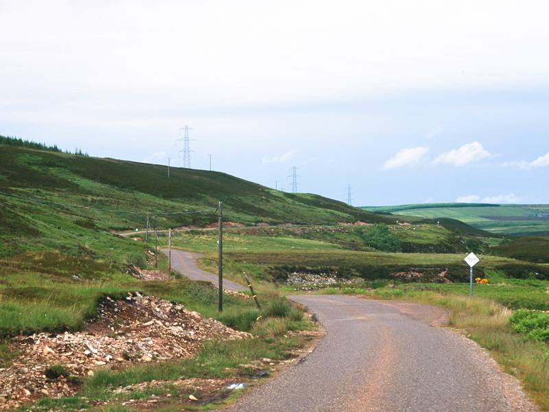
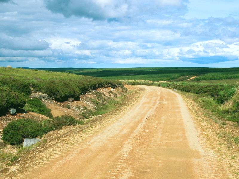
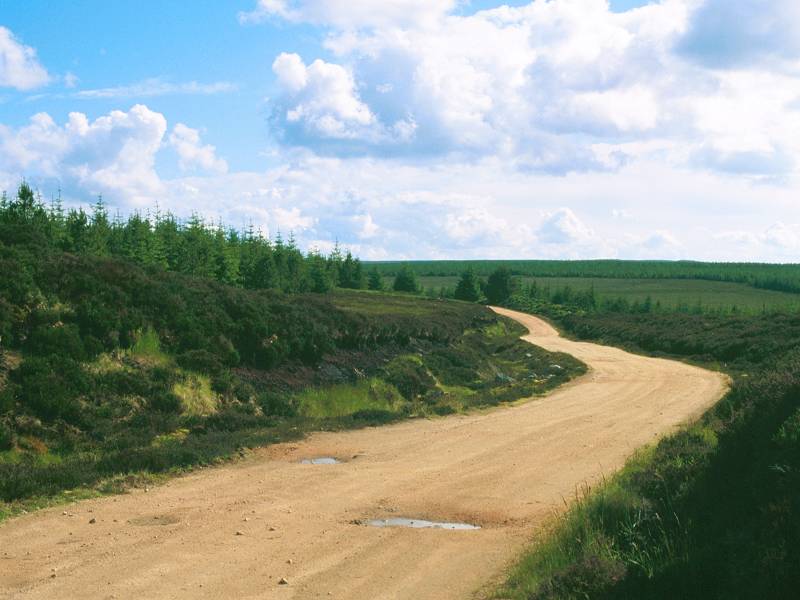
Turn right over the bridge; the forest track to Altnabreac; first of many gates
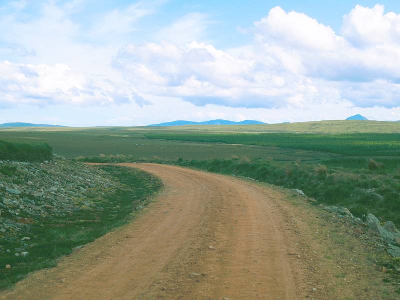
What looks on the map like the simple, direct approach to the forest track from the road is not actually viable thanks to the lack of a bridge. The actual way onto this track is a little complicated. Walk on until you're almost opposite the main buildings of Forsinain; there's a bridge across the Halladale river at this point. Turn immediately right again onto a driveway heading southeast and hugging the riverbank. After 200 meters the main drive swings away to the left to pass a couple of houses before going on towards the farm building by the enclosure up the hill; we take a lesser track heading straight on, across the side stream of Forsinain Burn.
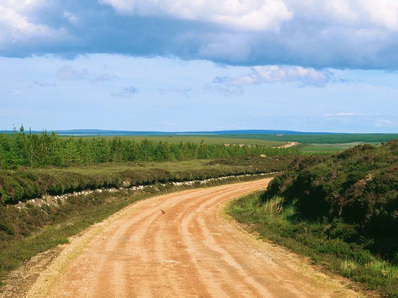
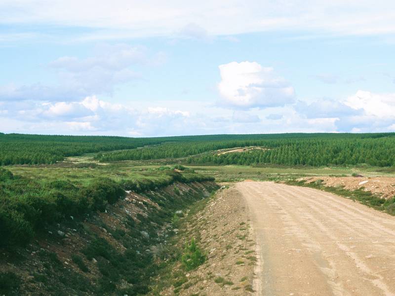
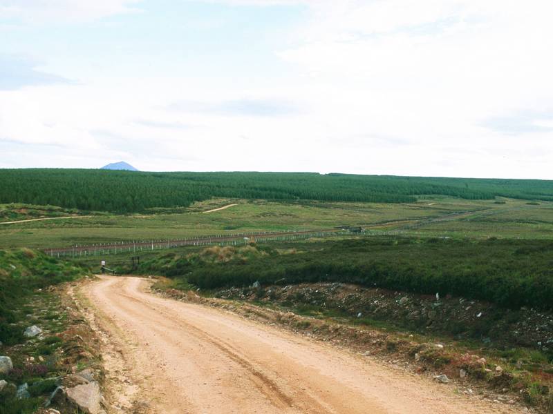
This track is of compacted red sand and is typical of forestry roads; it heads smartly uphill to the southeast towards a screen of conifers. Five minutes later Strath Halladale is lost to sight. All around is a sea of moorland and conifer plantations. There's just the red dirt track and this is your guide for the next twelve miles, all the way to Altnabreac. The track is gated here and there; it's up to you whether you use the gates themselves or the high stiles adjacent.
The track meanders quite a bit, but tends generally southeast at first, then more easterly as it approaches the elliptical lump of Slettil Hill (elevation 280 meters). There's a trig pillar on the summit and Slettil Hill might well be a Marylin (hill with relative height exceeding 500ft), but only dedicated hill-baggers will wish to visit the top and there is no track, just cloying heather.
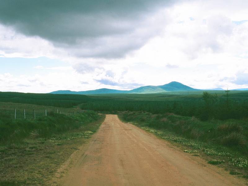
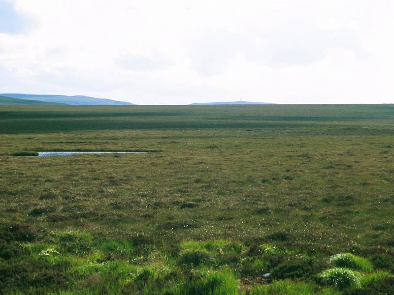
The Ben Griams; Slettil Hill; the Flow Country
Ben Griams; Morven and the hills beyond the Thurso river; virgin moorland
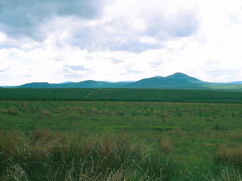
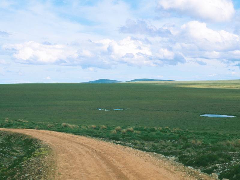
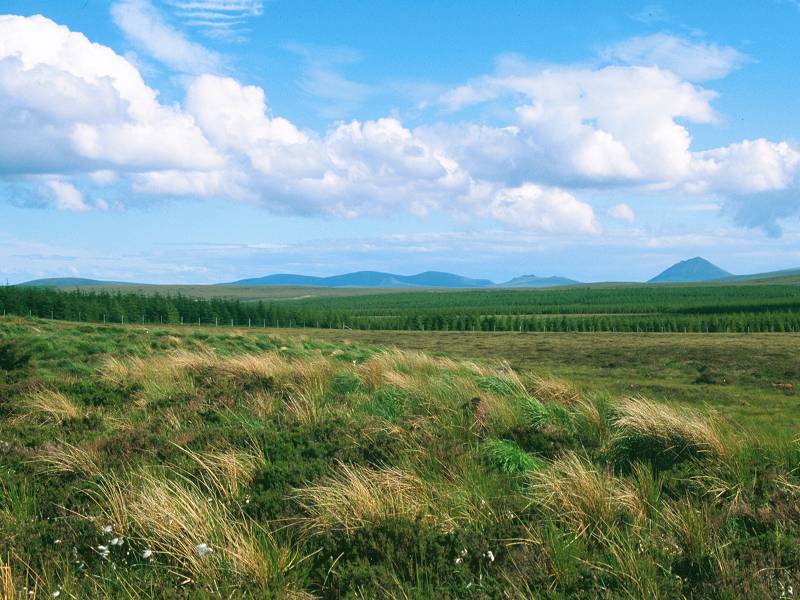
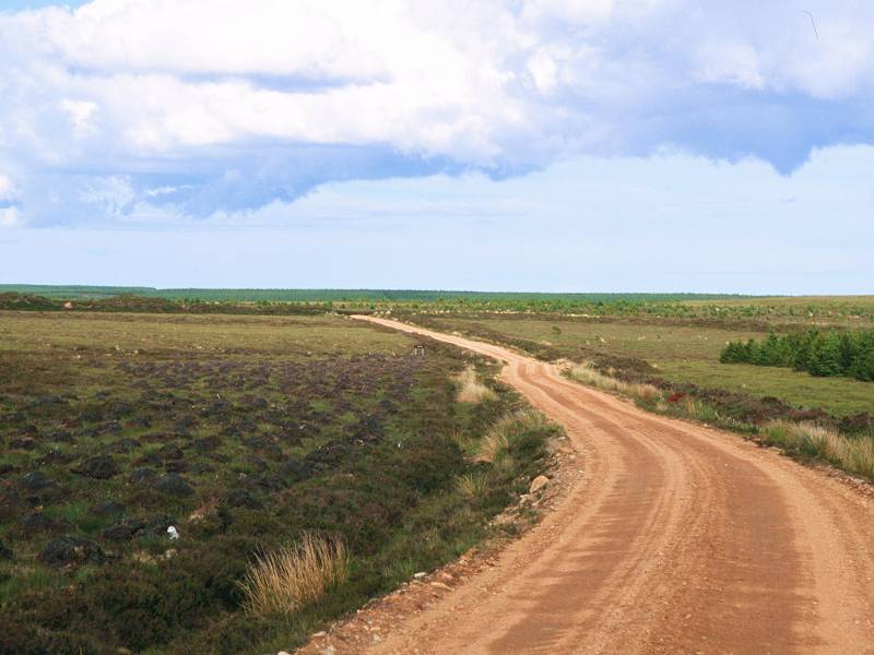
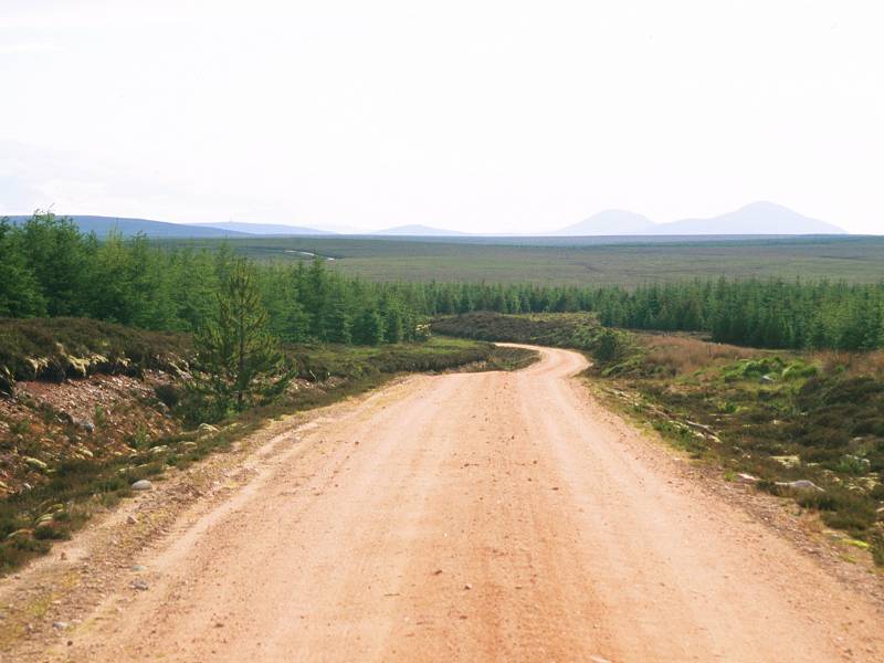
The track approaches Slettil Hill, having weaved its way between patches of conifers. Views are opening up, but they are views of nothing very much - this is, after all, the Flow Country and is the world's largest area of blanket moorland. Dartmoor, Rannoch Moor, Stainmore Common in the Pennines, the Border Forest, all are mere blobs on the map compared to the Flow Country. We're crossing its wildest part and this track is the only way to go. You will immediately recognize Ben Griam Beag of course, with Ben Griam Mor beyond it to the south. The view due west, past the shoulder of Ben Griam Beag, is more arresting - isolated, serrated lumps of hills, untold miles away, rising starkly from the vast seas of moorland that comprise this empty country. You're looking at hills such as Ben Loyal, Ben Hope, Ben Stack, Arkle and Foinaven. (The latter two mountains both had racehorses named after them that went on to win the Grand National. The sequence ended with Arkle; don't look for Red Rum on the map.)
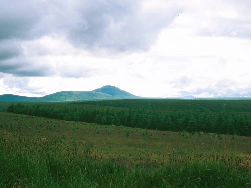
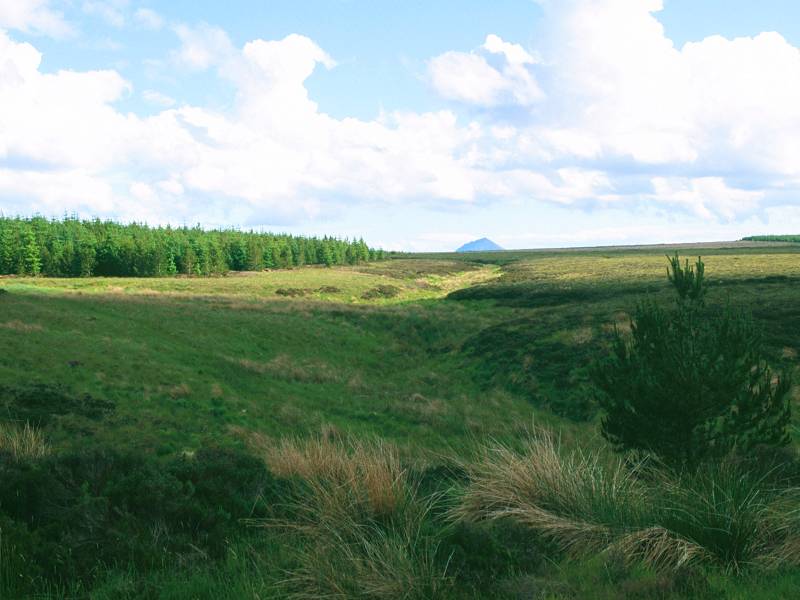
Once the track hits the shoulder of Slettil Hill it loops around it to the south. Across the moor you will see Meall a Bhealaich again, with its radio mast; below it you should be able to make out the line of the railway fairly easily. The ridge of the Knockfin Heights is pretty much end-on to Slettil Hill but, as you make your way around its base, a new vista of hills begins to appear far to the southeast. The most obvious of these is the cone of Morven, elevation 705 meters and the highest mountain east of the Kildonan - Halladale trough. Its companions include Scaraben and Maiden Pap, with lesser hills running along the far side of the Thurso river. We'll come closest to these around lunchtime tomorrow.
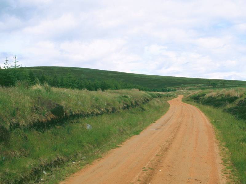
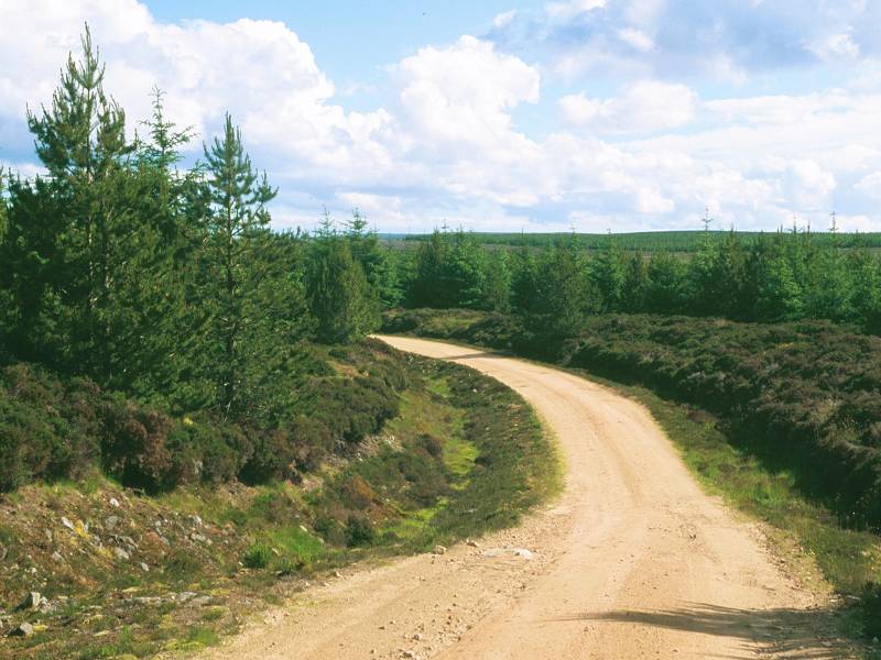
The track through Slettil forest
Beyond Slettil hill the track continues generally eastwards,
ploughing
through the same vistas of heather moorland and conifer plantation.
Forestry
commission signboards here and there indicate that somebody has
bothered
to give names to each patch of forest, though the map just plasters the
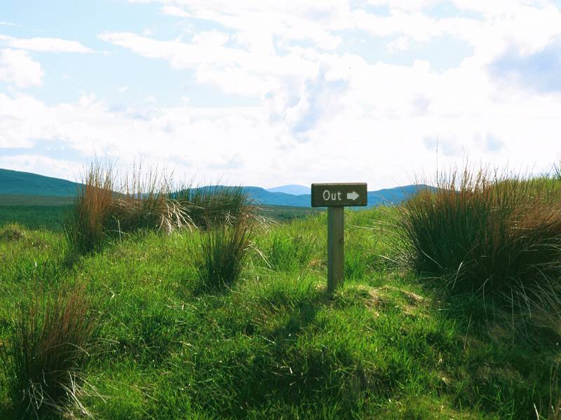
legend "Slettil forest" over everything hereabouts. Other signs
indicate
access to various fishing lochs hereabouts; every one of these side
tracks
is a dead end and, more than once, you will come across a simple wooden
signboard pointing back to Forsinain bearing a single, terse message:
"out".
Probably a good thing; if you're on a fishing holiday and get misted
out,
you could easily find yourself heading for Altnabreac instead of
Forsinain
and having to head all the way back. The track does, ultimately, head
out
to Strathmore Lodge where it joins the public road network just short
of
Westerdale; it's the route we'll be following tomorrow.
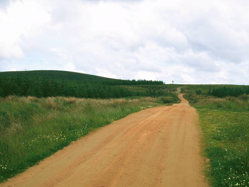
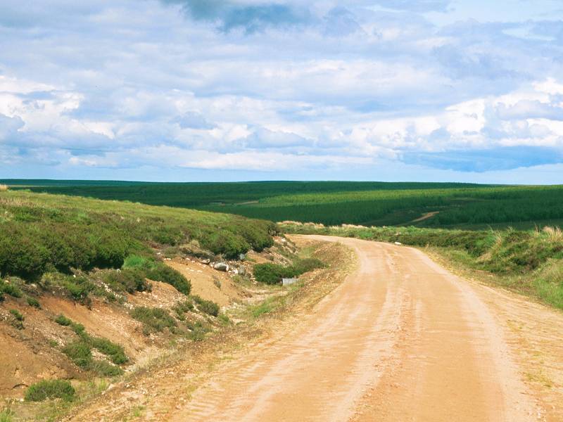
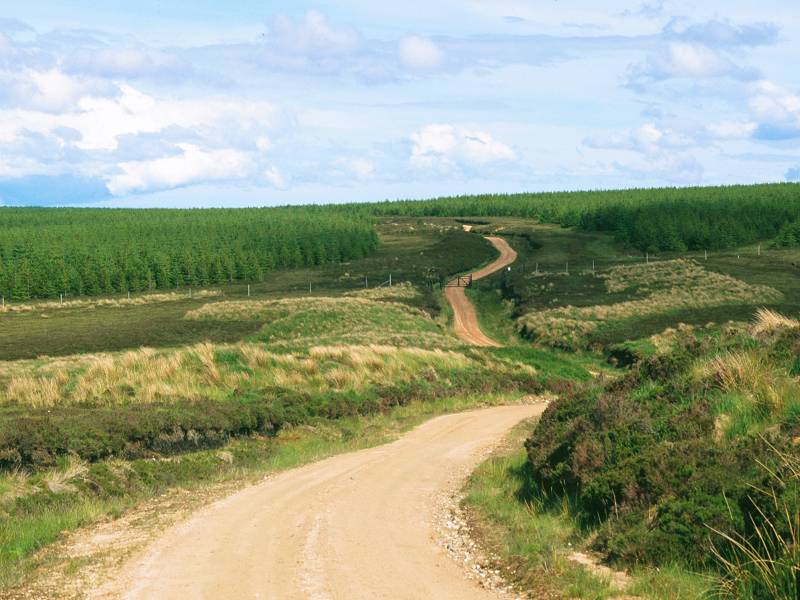
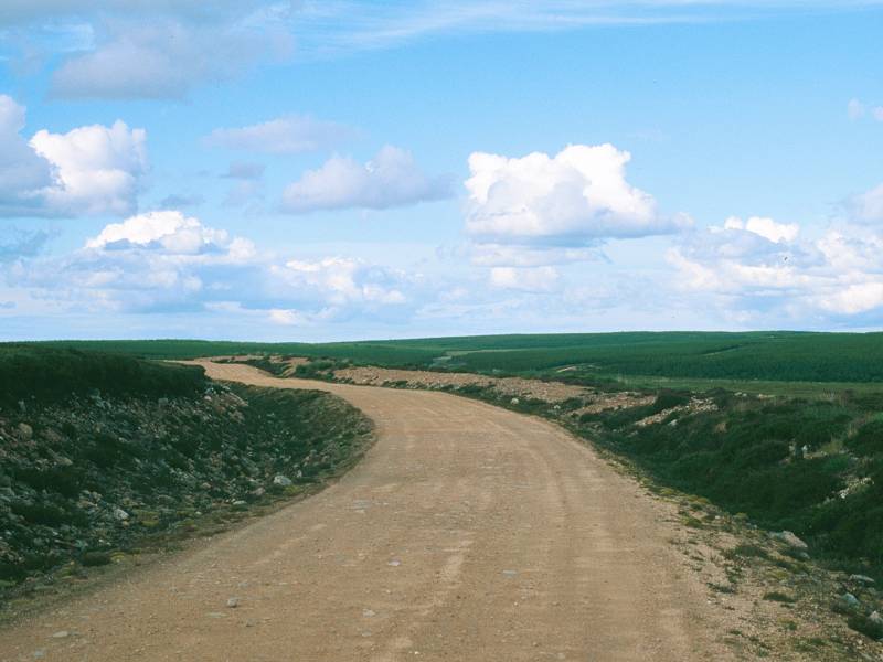
The track ploughs ever onwards, and begins to meander somewhat; within the forest, more or less by a feature named Lon a Bhard on the map, it curves leftwards and heads northeastwards to a confluence of streams and forest tracks. Side tracks head off to Loch Slettil and Loch Talaheel. The main track curves right, then right again, heading briefly southwest, before bending left to emerge from Slettil forest just by Loch Leir.
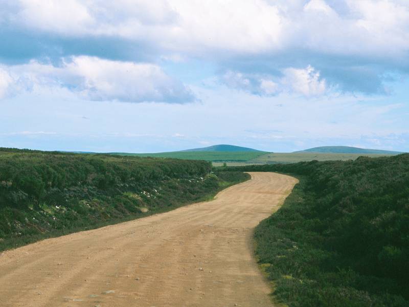
Emerging from Slettil forest; Loch Leir
Loch Leir is a lovely spot, and is pretty much a perfect place for a refreshment break. Half a mile beyond the loch is the almost imperceptible summit of Cnoc a Gharbh-Bhadain; you're at the top of the Flow Country ridge here and you're crossing the old county boundary between Sutherland and Caithness. The boundary is crossed about 200m short of a forest enclosure; turn to look towards the radio mast on Meall a Bhealaich; you're looking directly along the boundary, with Sutherland to your right and Caithness to your left. There is nothing to mark the boundary on the ground, not even the odd fence post.

Reaching the county boundary; The Sutherland / Caithness boundary
First steps in Caithness
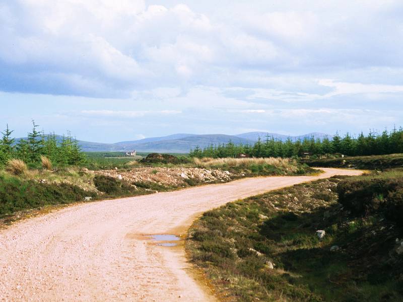
Caithness looks no different to Sutherland, at least out here. You follow the same track, through the same forest plantations, across the same empty moorland. At least this area has managed to acquire a name; Cnoc Maol, pretty much translating as "bald hillock". There's a more open view to the southeast along here, you should be able to see Morven and its companions quite easily and you may also be rewarded by a first view of the former Lochdhu Hotel - originally a hunting lodge and now a private residence - about a mile beyond Altnabreac station. We'll be passing it tomorrow.
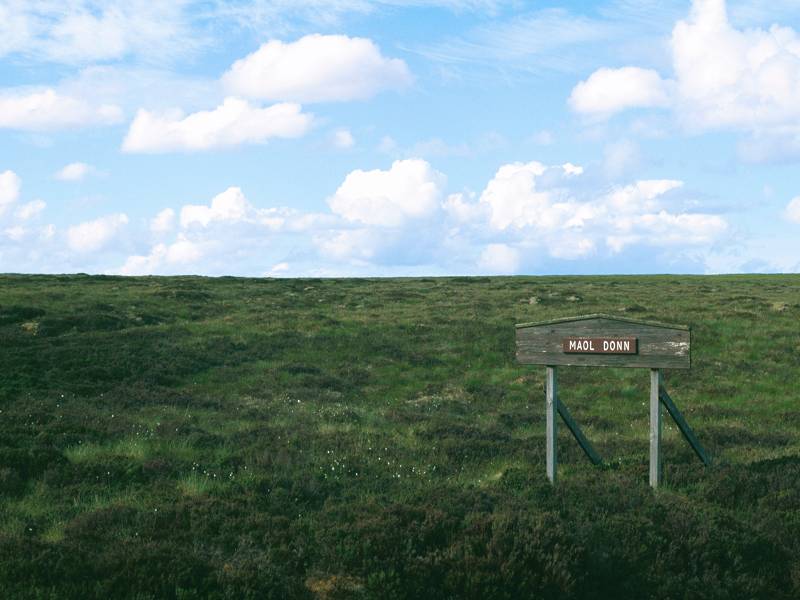

Cnoc Maol
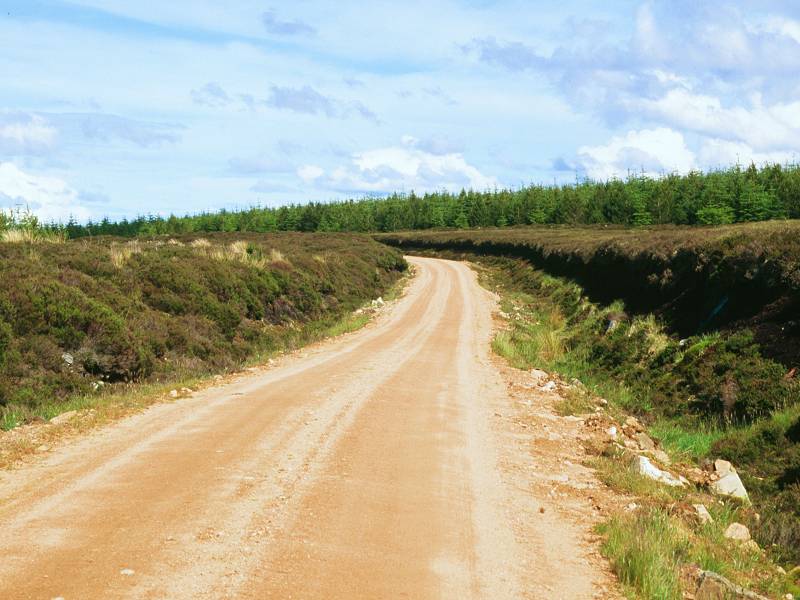
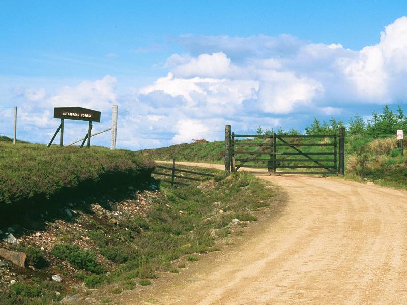
The track rises and falls here and there, crossing the odd tiny burn. The map is littered with streamlets and lochans; it's difficult to trace any of the streams because all they seem to do is wind between lochans and and peter out in the moor. But they do actually gather themselves together and become feeders of Sleach water; it's one of the main tributaries of the Thurso river and we'll meet it a couple of times tomorrow. Sleach Water itself is first crossed on the eastern side of Cnoc Maol, from where the track heads northeast again. As you enter yet another forest plantation - signed, Altnabreac Forest, you will note with some glee - there is about 2½ miles left to walk.
The track reaches Altnabreac forest

Altnabreac forest
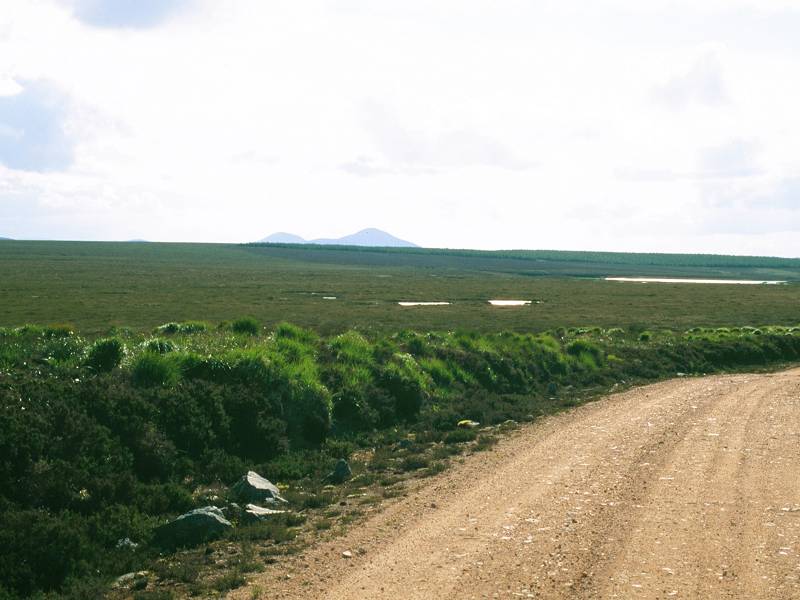
Once the track reaches the Altnabreac plantation it rises slightly, climbing the unimaginatively-named Station Hill. More side tracks, leading to yet more obscure fishing lochs, lead off to the left. The track is still heading northeast but, quite suddenly, it enters a long curve to the right. More, equally empty moorland and lochan country is revealed to the east and northeast but you might spot the hills north of Scotscalder; they sprout radio masts and are pretty much the first outpost of civilization in Caithness (the "lowlands beyond the highlands"). Lochdhu lodge should reappear, pretty much ahead of you and looking tantalizingly close. Altnabreac itself is hidden in the shallow valley of Sleach water.
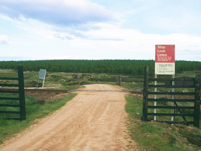
Arriving at the rail crossing just west of Altnabreac
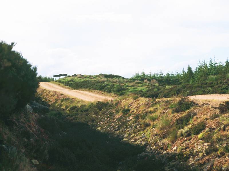
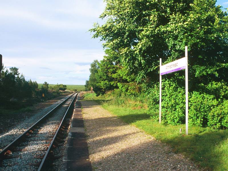
It's a little over a mile of forest track from the big curve to the right on Station Hill until you spot the tiny cluster of buildings that comprise Altnabreac, a little way to your left. The track crosses the railway line on the level; there are a forest of safety notices advising you to look out for trains, of which there are as many as six per day.
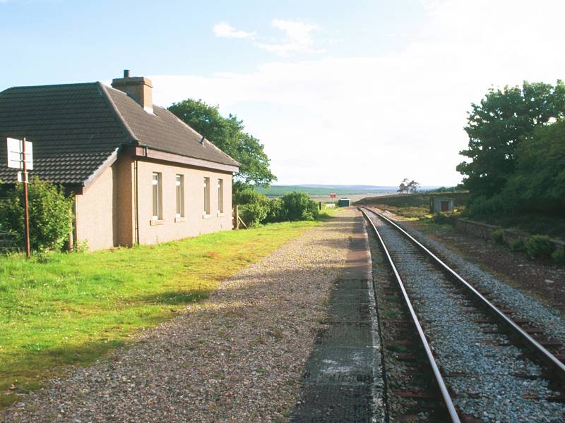
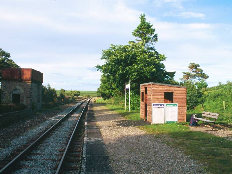
Arrival at Altnabreac; The station and cottage (looking west); the platform and shelter (looking east)
Altnabreac is charming. You reach it by following the track into a hollow just south of the railway line and then turning left onto another track that rises past what appears to be an old quarry. There's a wooden hut here that appears to be something to do with the water supply. Just at the top of the rise you reach the western end of the platform; it's necessary to cross an overgrown siding but I think it's safe enough to ignore the dire warnings about trespassing on the track.
Altnabreac consists of four cottages, two of which appear to be uninhabited and used merely as barns. One of the two inhabited cottages lies adjacent to the platform; if this ever was the station building it certainly isn't now, so don't seek access. The other inhabited cottage, about a hundred yards away, is a former school (closed since 1986).
Late evening at Altnabreac
So this is the end of the day's journey. There is nowhere to stay, or to camp, and the reason we've come here is to get the train out to wherever you're based (most likely Thurso). It's inevitable that, while you wait for the train, your mind will exercise itself with the puzzle of Altnabreac station's very existence. What's it doing here, fifteen miles from the nearest village, twelve miles from the nearest road? In a country full of rail enthusiasts who document the precise history of each and every line and locomotive, nobody seems to have written a history of the Inverness - Thurso - Wick line. The only book in print about the Highland lines mentions Altnabreac just once, in the context of a minor accident. Scotrail never replied to my inquiries, and a question to a usenet group was met by the single reply that it serves the scattered communities hereabouts. This seems a little unlikely given that there are plenty of less scattered communities near the line that have no such facility, and indeed the former stations at Halkirk and Watten, both substantial villages of several hundred inhabitants, have long since closed.
My initial theory was that it was a concession to the landowner (presumably Lord Thurso) to allow him and his guests access to the Lochdu Hotel, but I have since learned that the lodge was built in 1895, 21 years after the station. An old water tower still stands here, suggesting that this was a refill station in the days of steam engines. The rail service did bring children to and from the school, but this closed in 1986. Since first constructing this page I have learned that the area was being considered as a depository for nuclear waste some years ago, but this plan was abandoned after being exposed by a national newspaper. The station can be used but rarely now; it serves only a hadful of inhabited dwellings and is probably visited only by the odd hiker or cyclist. Yet the station boasts a newly constructed shelter and a public phone, along with the useful information that the nearest taxi is available from Halkirk, erroneously quoted as being five miles away.
Train drivers will not expect to stop here and the last few hundred yards of approach is blind - make yourself as visible as possible by signaling as obviously as you can while the train is still a quarter of a mile or so out - and again when the train emerges your side of the curve. The best place to stand for this is at the very western end of the platform.
![]() Scotrail
(North Scotland Line) timetable(.pdf document)
Scotrail
(North Scotland Line) timetable(.pdf document)
|
|
||
| Kinbrace to Forsinard | Back to North of Scotland Way index |
|
This page last updated 27th February 2005
![]()