
| Penzance to Porthleven | Back to South Cornwall Coast Path index | Lizard to Coverack |
| Penzance to Porthleven | Back to South Cornwall Coast Path index | Lizard to Coverack |
Helston is the most obvious base from which to tackle this walk, though long journeys in from Truro, Falmouth or Penzance are viable as long as you check the bus connections. It can also be done, of course, from Porthleven, Lizard or Mullion.
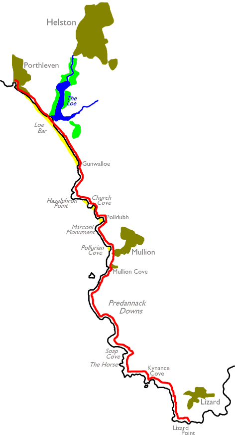
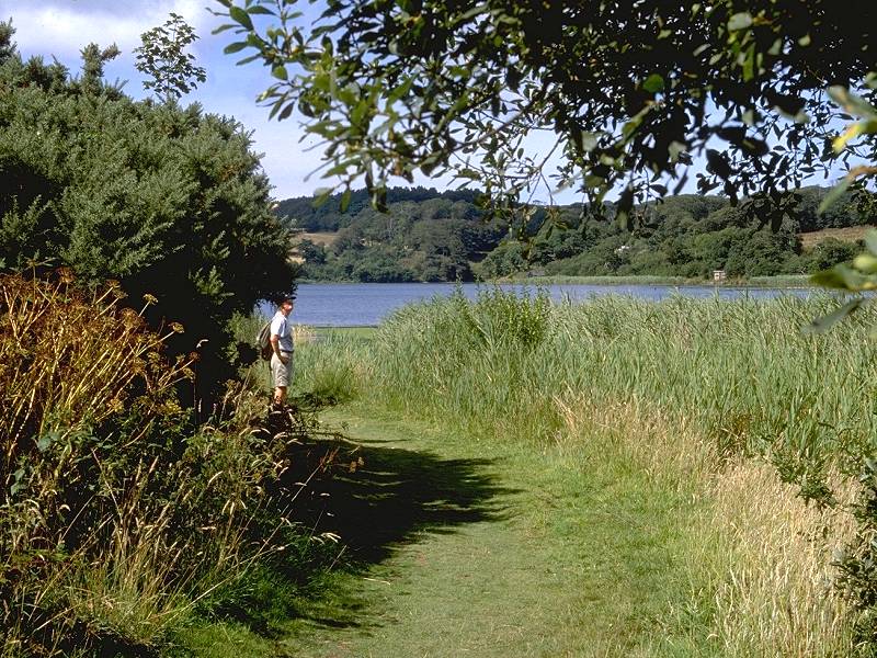
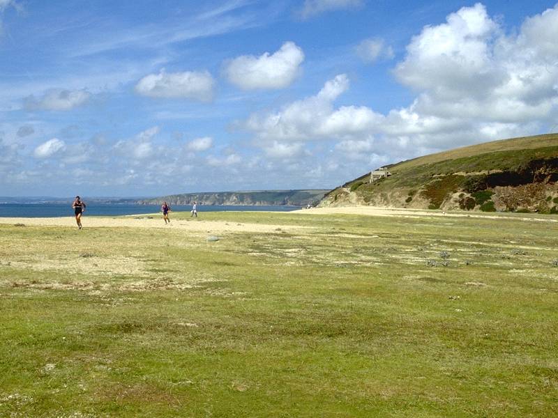
The walk splits naturally into a handful of subsections. A surprisingly drab first two miles out of Porthleven leads to the sandspit of Loe Bar, which gives rather heavy going. Loe Pool, which lies behind the sandspit, was once a tidal estuary and the town of Helston, at its head, was a port several hundred years ago. A curious feature of Loe Pool, now a freshwater lake, is that it has no apparent outlet to the sea. A long, scrubby clifftop walk leads from Loe Bar to Gunwalloe, though a beach-level walk is a rewarding alternative if the tide is out.
Beyond Gunwalloe is a "bitty" section, with high and sometimes dramatic clifftop walks such as that at Hazelphron, interspersed with popular sandy beaches such as Church Cove, Polldubh and Polurrion. This section ends at the delightful stone harbour of Mullion Cove.
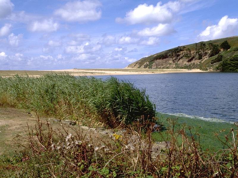
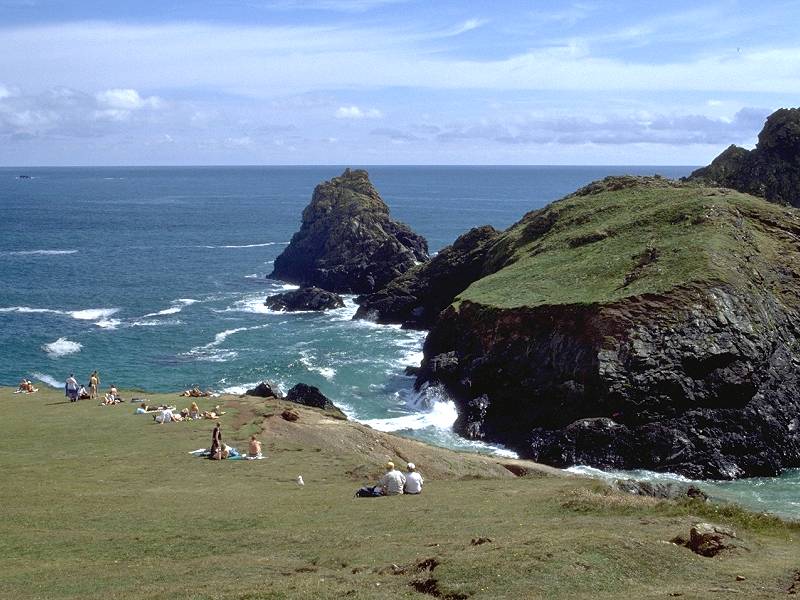
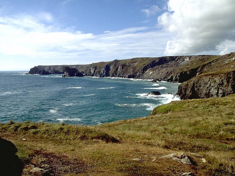
Beyond Mullion the nature of the walk changes completely. Seven miles of unbroken heath lay before you. The level swathe of Predannack Downs gives superb walking and the miles seem to melt away - there will be nothing like this again until you reach Dartmoor. A couple of dramatic coves indent Predannack Downs. Soap Cove, unnamed on the maps, is a geologists' paradise containing a wild multiplicity of rock types. Two miles further on is Kynance - arguably the most famous beauty spot on the Cornish coast, and possessed of rock scenery that rivals that of the Atlantic coast back at Land's End. The dramatic clifftop scenery continues as far as the Lizard, the most southerly point of Britain and the end of the day's walk. As you relax with a cream tea at Britain's Most Southerly Tea Shop you might reflect, wryly, that you are further away from John O'Groats than you were when you started out this morning.
|
|
|
| Length: | 13.54 miles / 21.7 km |
| Total ascent: | 2806 ft / 855 m |
| Total descent: | 2734 ft / 833 m |
| Estimated time: | 5 hrs 21 mins |
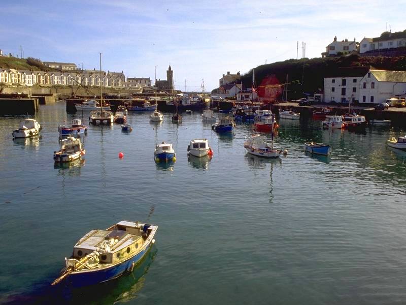
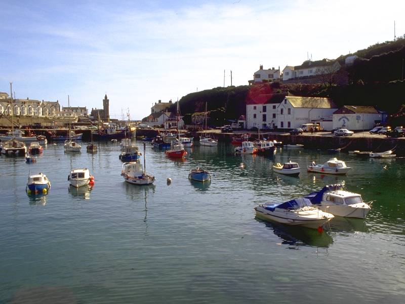
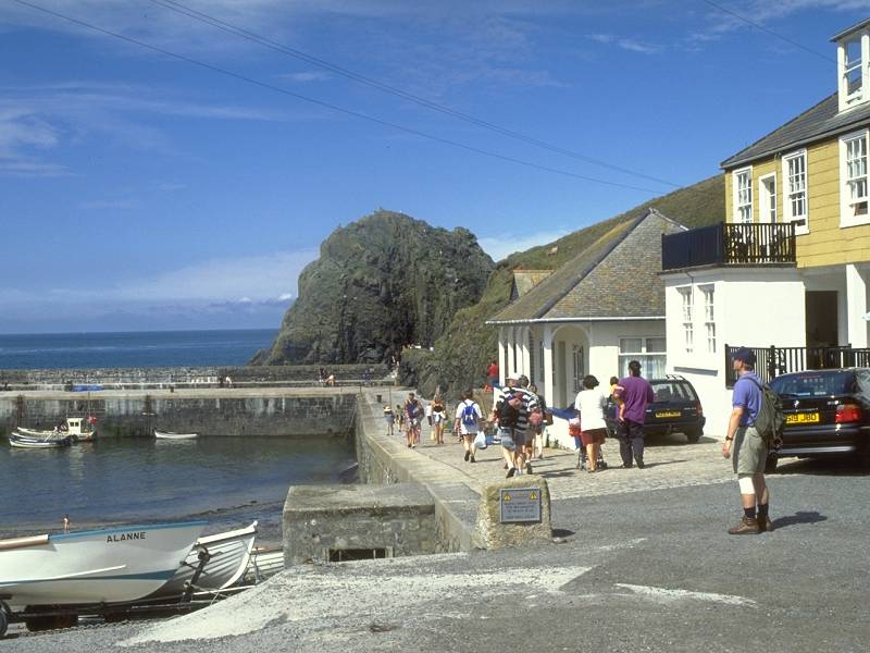
Porthleven harbour
![]() First
Western National service 2, Penzance
- Porthleven - Helston - Falmouth
First
Western National service 2, Penzance
- Porthleven - Helston - Falmouth
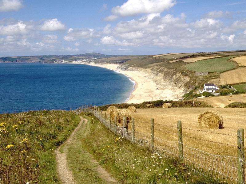
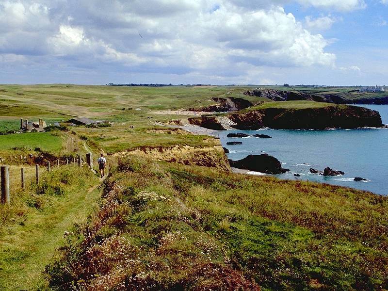
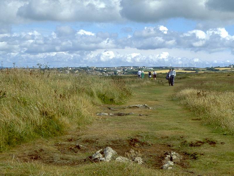
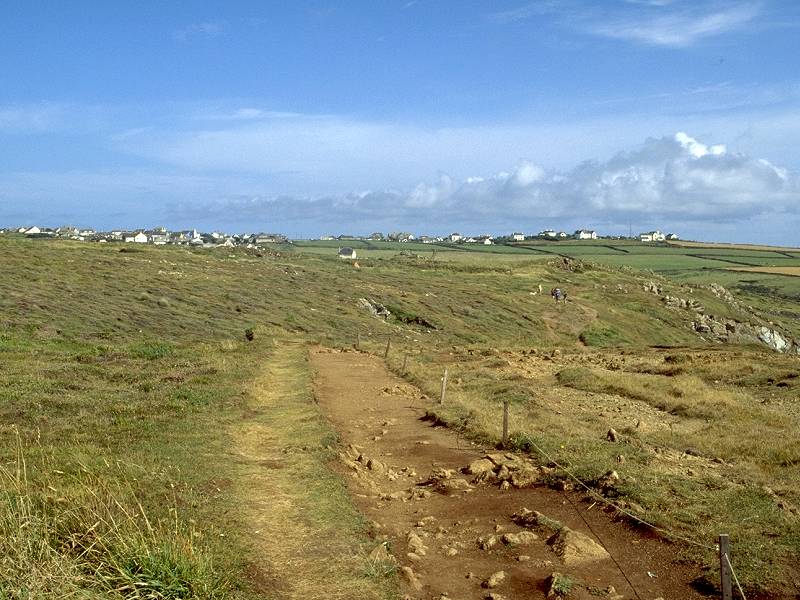
Walk 4 begins at the neat village square adjacent to Porthleven Harbour and proceeds along the lane to the harbour's eastern side, then turns left for the lane through the village's southeastern outskirts. Others will have their own opinions, but I'm inclined to say that the lane out of Porthleven is one of the Cornish Coast path's less aesthetically pleasing sections. The lane snakes through a hotchpotch of holiday flats and car stances. At its far end is a car park, from which the coast path mounts a scrub-covered slope running for about 800 yards towards Bar Lodge and the Penrose estate.
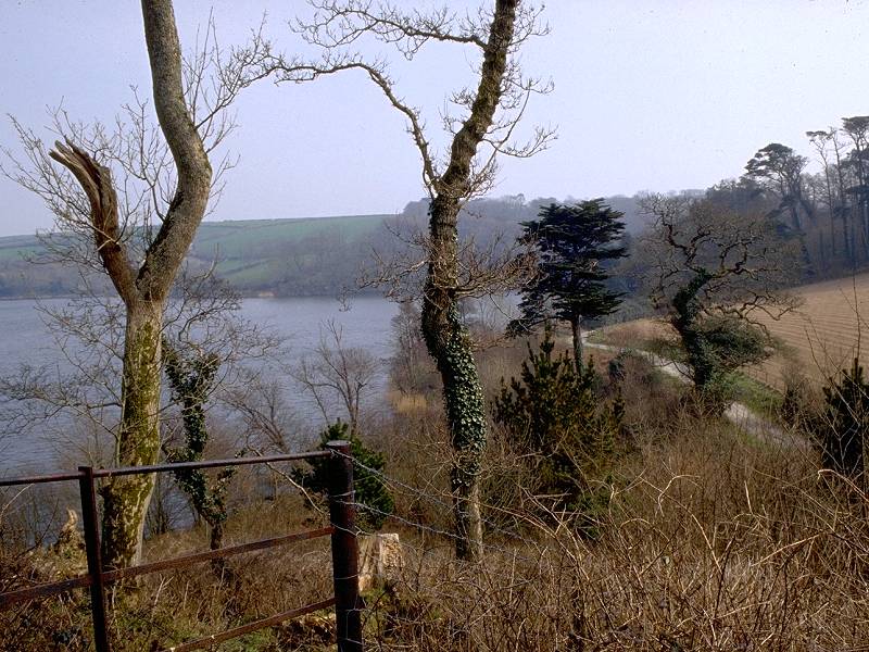

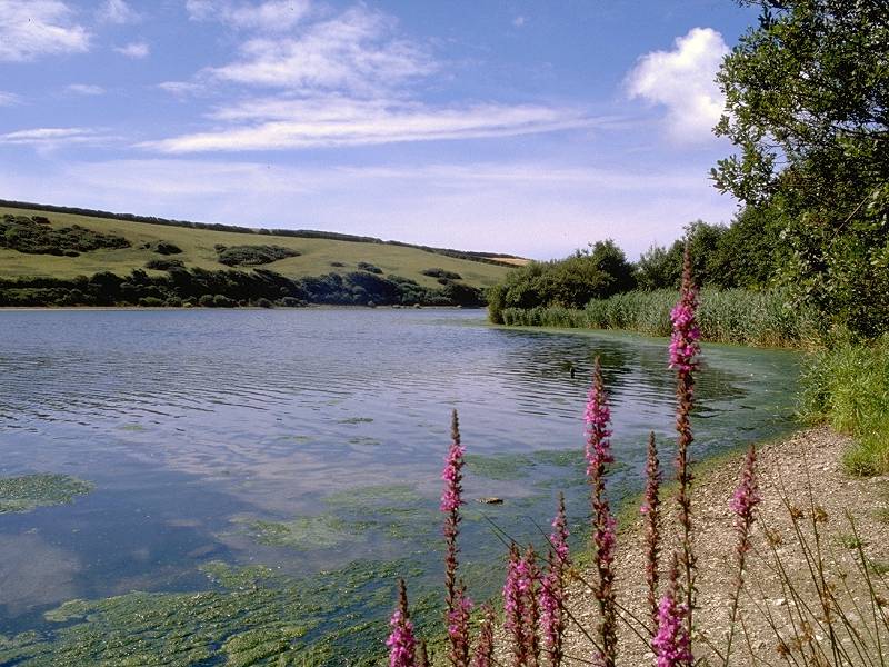
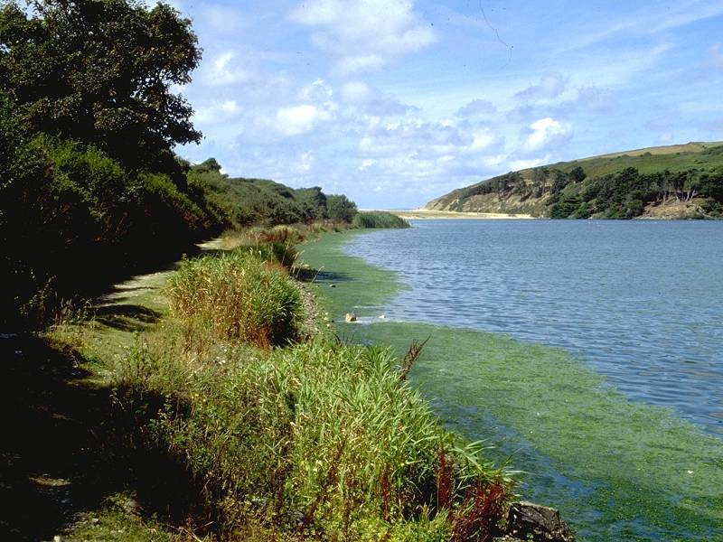
The north side of Loe Pool at Easter, 1996
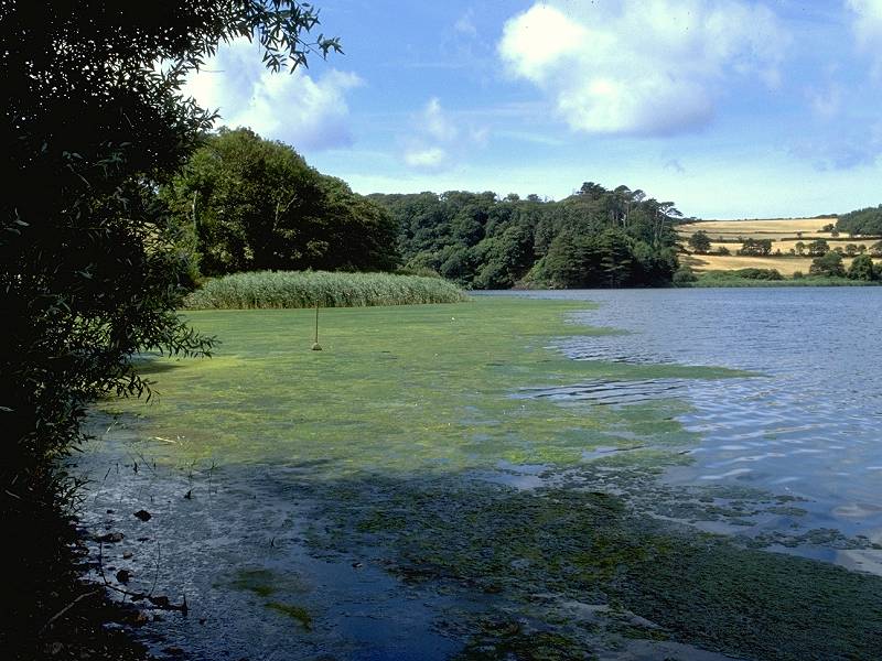
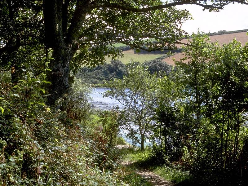
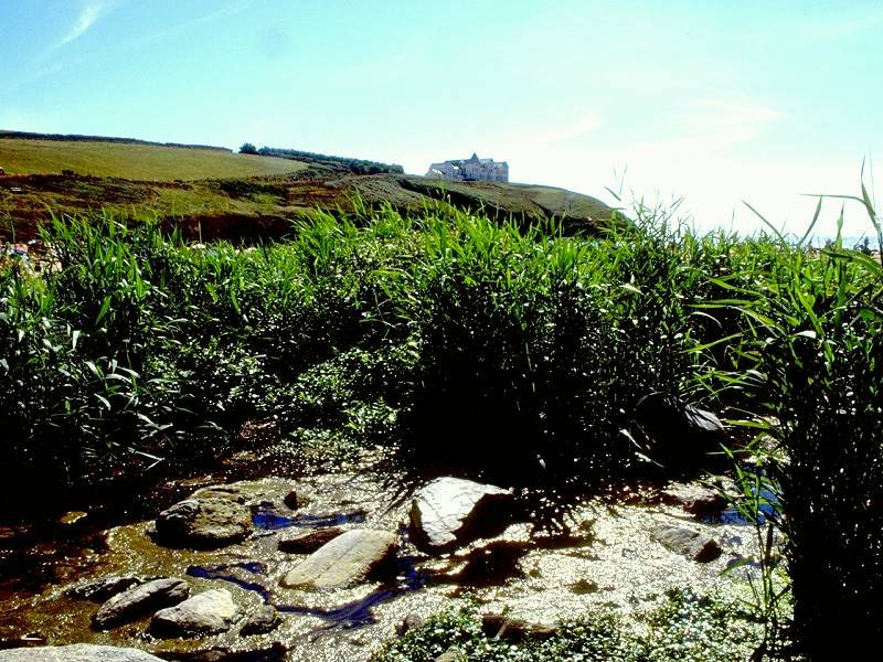
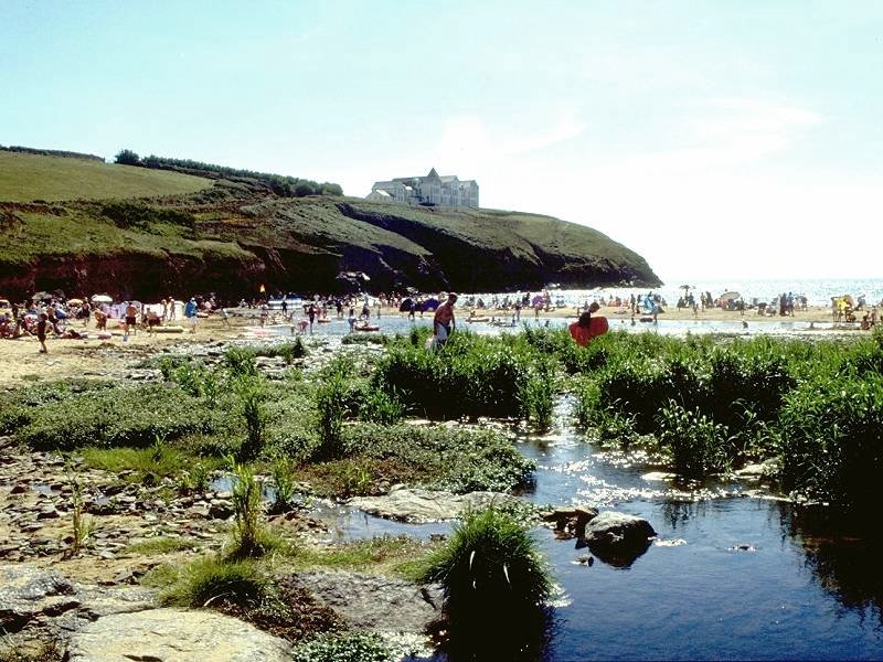
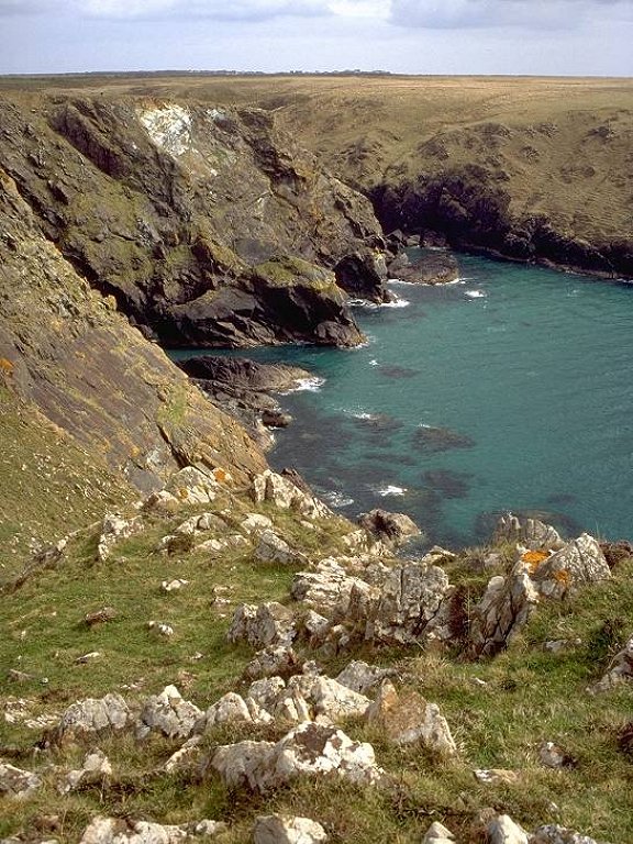
As explained above in the introduction, the next six hundred yards of the coastline is a sandspit - Loe Bar - which, around six or seven hundred years ago, closed off the mouth of the Loe estuary and left it as a freshwater lake. It's Cornwall's largest body of water. The Penrose estate maintains a permissive footpath right around the lake on both sides and it's a rewarding circular walk, either done as part of the coast path or as a separate expedition. The paths on the northeast and southwest sides converge at the boating lake in Helston park.
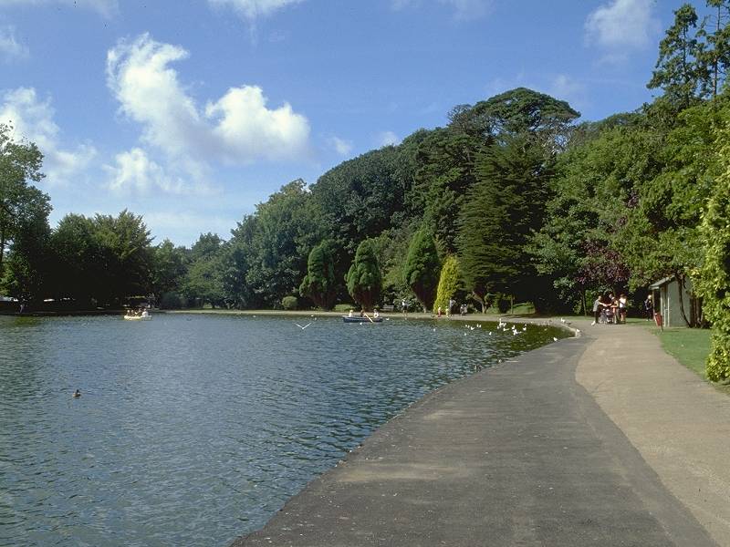
Helston Park; Penrose Valley; Loe Pool

A Loe Pool photo album
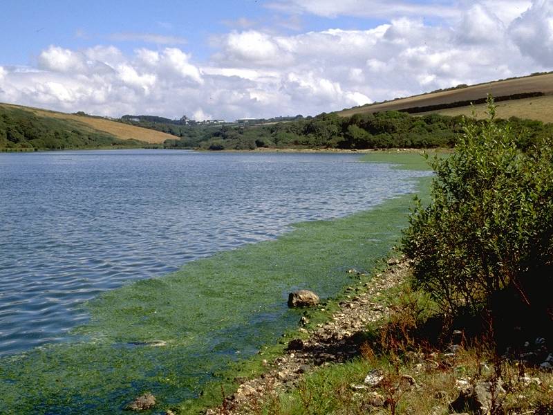
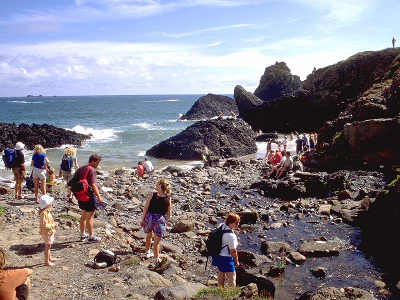
The sandspit of Loe Bar itself is a curious place. The seaward side has a very shallow slope, so that the tide comes in and out a fair distance. The landward side, which might have been expected to have supported extensive vegetation in its seven hundred year existence, is still very much a desert and only manages to support simple dune grasses (and then only on its fringes). Walking across the Bar is a chore; the wet sand left by a receeding tide probably gives the most cohesive footing.
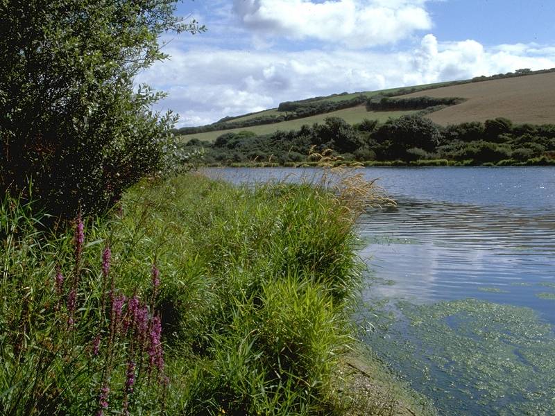
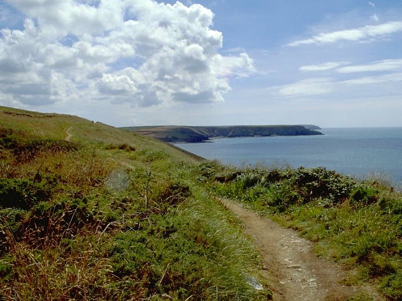
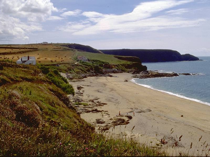
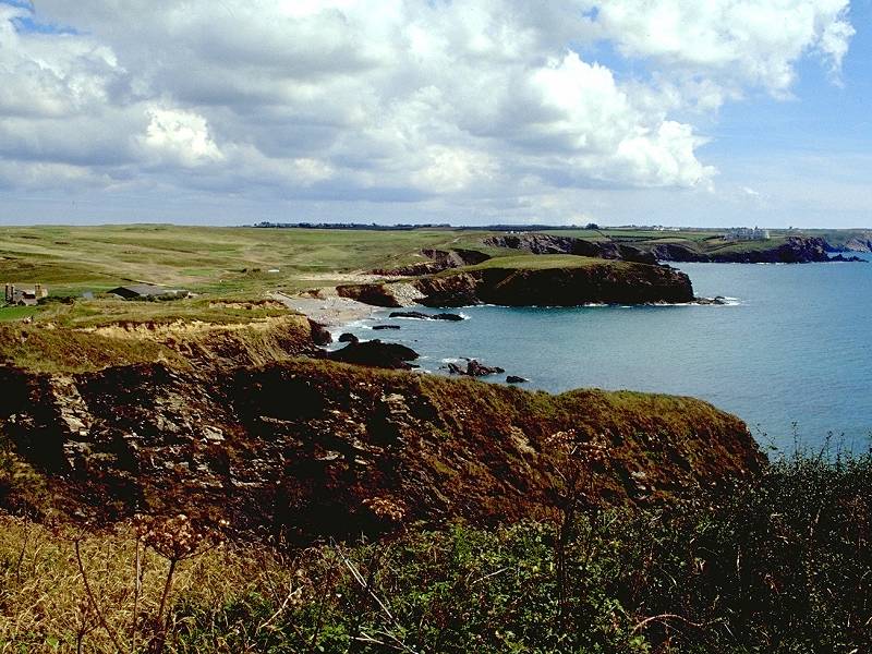
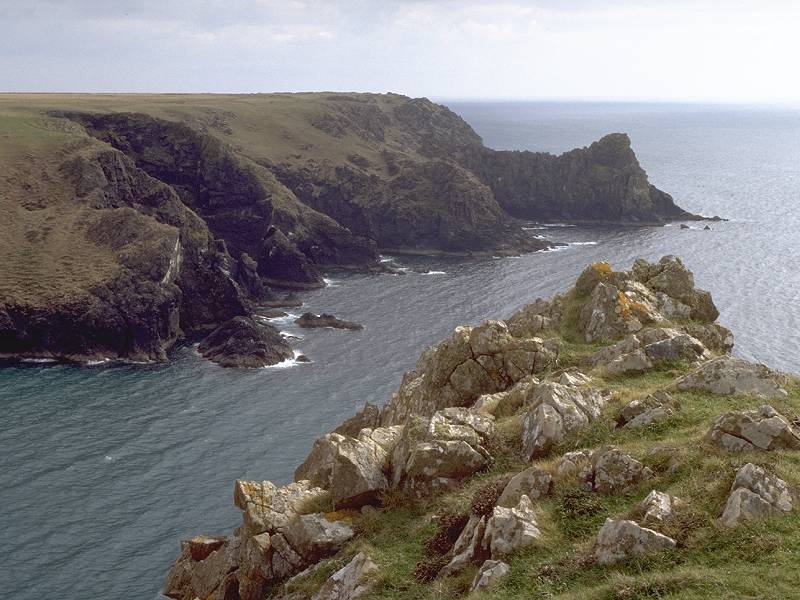
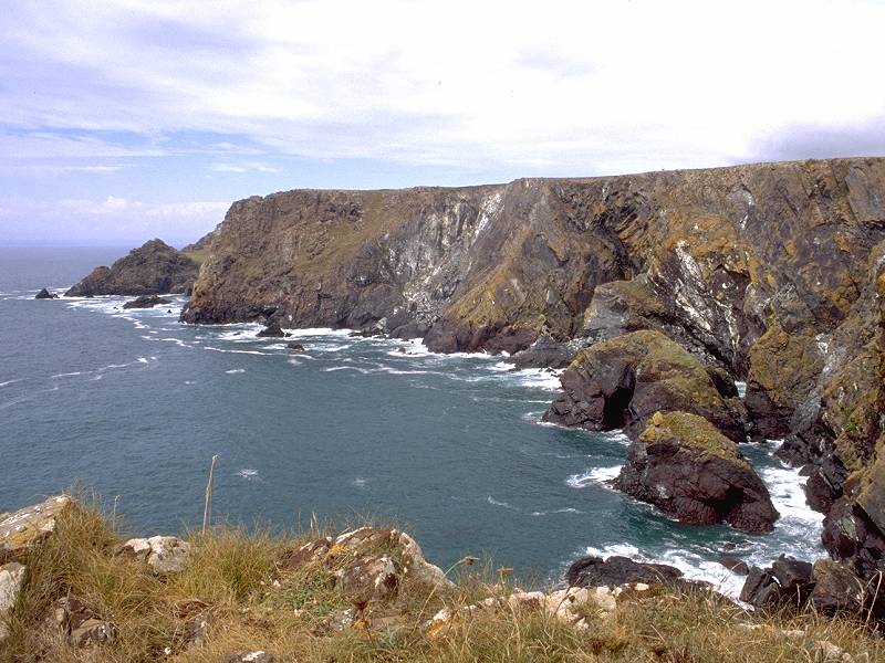
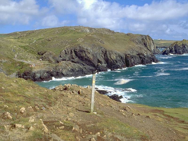
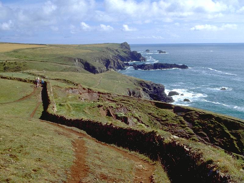
At the southeastern end of the Bar the coast path resumes along another scrubby clifftop, heading pretty much in a straight line for Gunwalloe Fishing Cove two kilometers away.
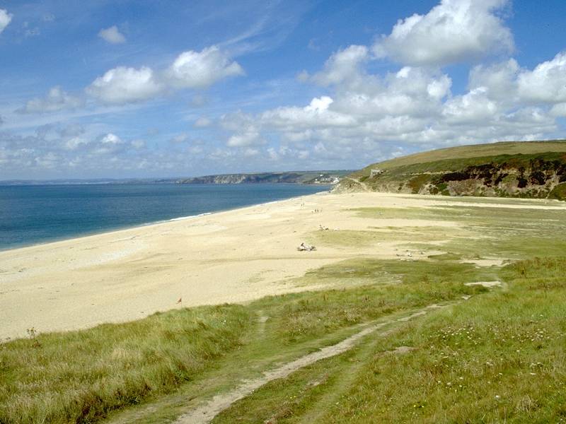
Two views of Loe Bar; The path to Gunwalloe Fishing Cove
The clifftop path to Gunwalloe Fishing Cove
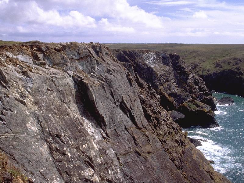
The clifftop path does at least give some variety of altitude, rising and falling several times and at one point giving a slightly strenuous clamber around a rock outcrop. As an alternative, a beach-level walk (only viable at low tide) is both less strenuous and less scenically rewarding. The rocks in the cliff are intriguing, however, containing bold sinewy veins that look very much like quartz (maybe a geologist will read this and tell me if I'm talking nonsense or not).
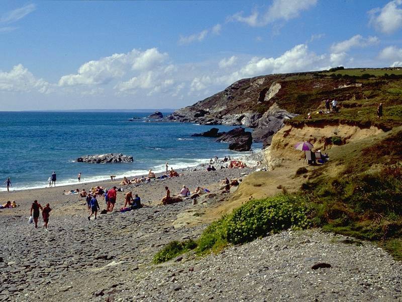
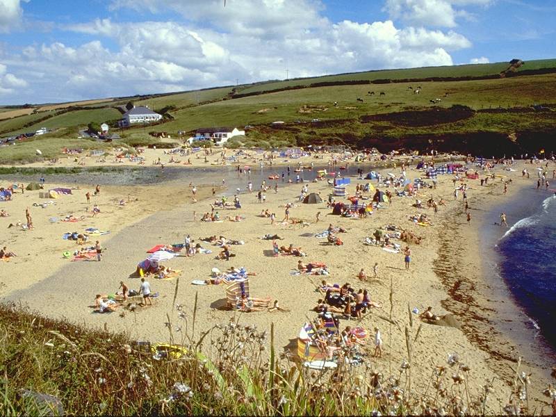
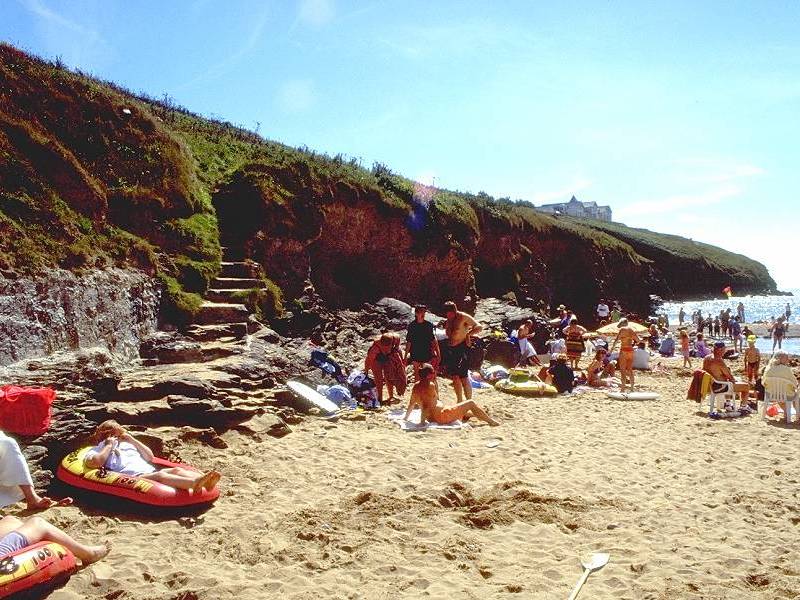
The beach - known locally as Gunwalloe Fishing Beach - comes to and end at a locality marked as Gunwalloe Fishing Cove on the map. Beyond this cove the coastline breaks up in a jumble of rocks and resumes its normal pattern of headlands and inlets.
Approaching Gunwalloe Cove; leaving Gunwalloe to the southeast
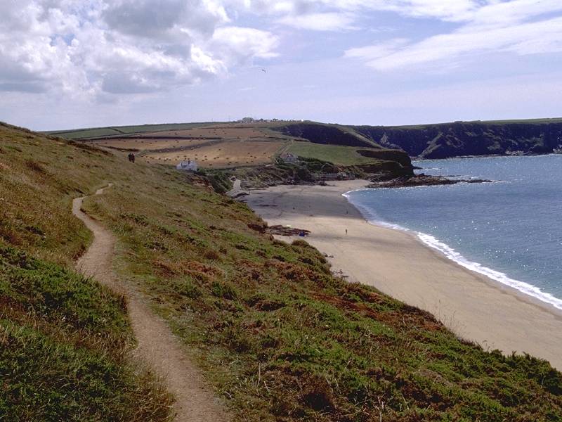
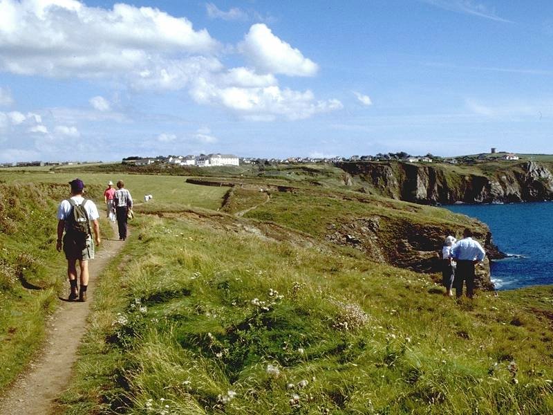
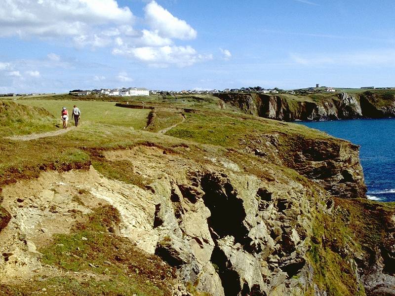
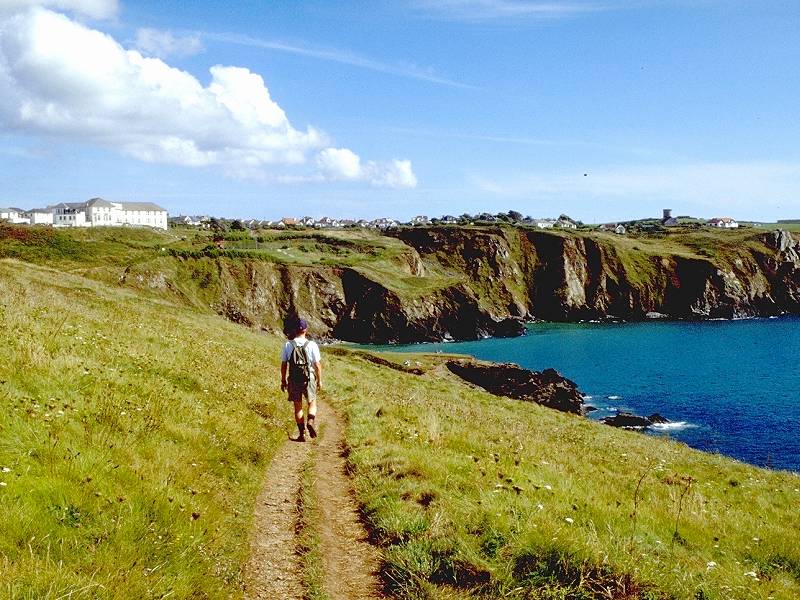
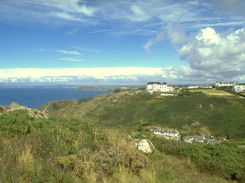
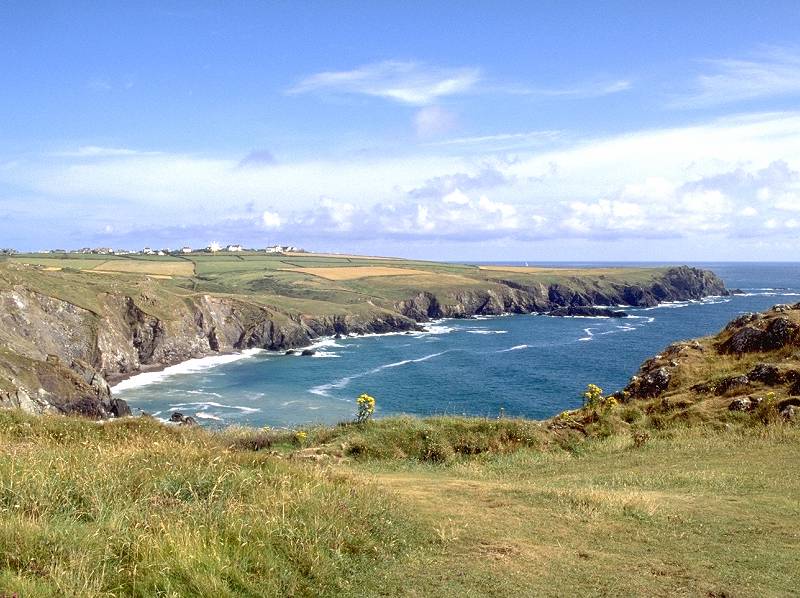
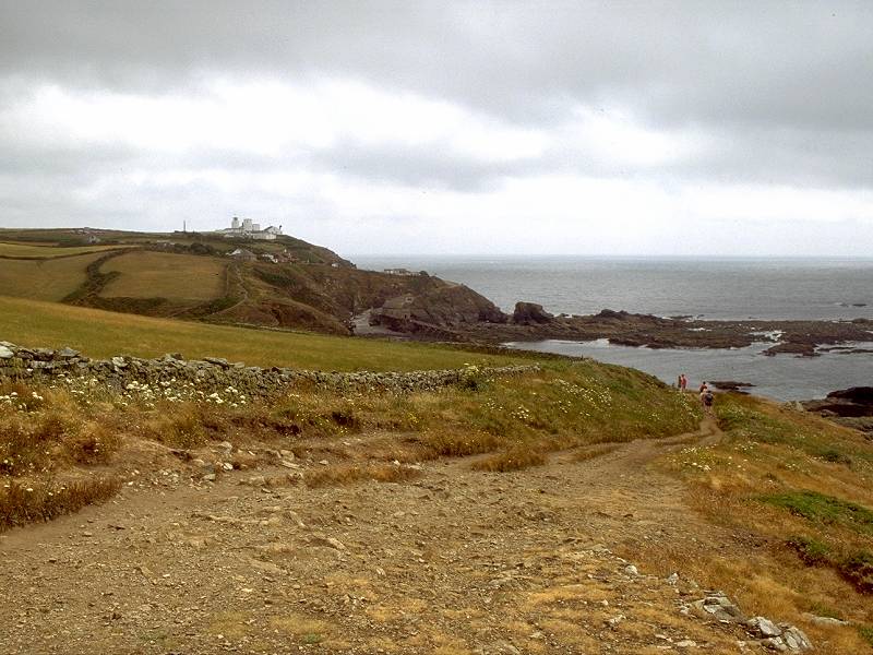
The headland lies four miles from Porthleven (and 33 miles from Land's End), and provides an excellent view of much of the rest of the day's walk. Winnianton Farm lies in the immediate vicinity, and beyond it are the twin beaches of Church Cove. The absurdly ostentatious Polldubh Hotel stands atop a cliff about two miles away, with Mullion village beyond it. You might also glimpse the Goonhilly communications satellite ground station and the neighbouring wind farm a few miles inland.
Winnianton Farm; Winnianton cliff; the coast path at Winnianton
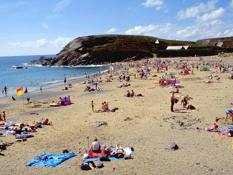
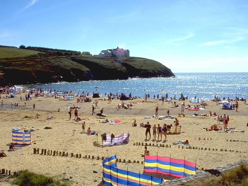
The maps and guide books give just one name - Church Cove - but there are in fact two coves here, each with a popular sandy beach. The rear corners of the two beaches almost touch but they are separated by a rocky little knoll, below which Gunwalloe Church shelters. In fact the larger and more southerly beach is Church Cove proper, and the more northerly, smaller and stonier beach is called Dollar Cove. (Thanks to James Tarling for local information).
Dollar cove; Hazelphron Point from Dollar

Chruch Cove from the headland; The view to Polldubh and Predannack Downs; Church Cove
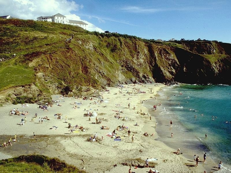
Church Cove is a substantial little beach of about 500 square yards in area. It is very popular, perhaps surprisingly given its remoteness from any main road. The motor road to this point is the same one that brushed the clifftop back at Hazelphron; it comes to an end here and has weaved a narrow, winding course from the main road at Culdrose, four miles away.
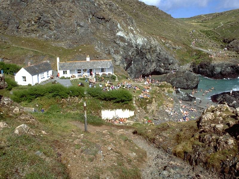
Polldubh Cove from the north side

Polldubh Cove and the old hotel
A Polldubh photo album
![]() Buses to and
from
Polldubh: Truronian
service T1
Buses to and
from
Polldubh: Truronian
service T1
You can either follow the road around Polldubh cove or walk across the beach (dodging its tiny river in the process) and take the steep, stepped path up to the hotel's access drive. A bypass footpath avoids the driveway though it has a substantial fall and rise and is almost a continuous series of flagged steps. Around the back of the hotel is the Marconi monument.
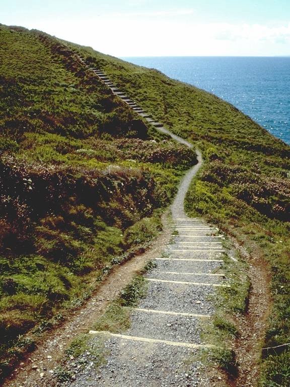
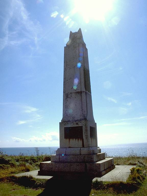
Steps in the coast path on the south side of Polldubh cove; the Marconi monument
It was from this spot that the Victorian engineer Guillermo Marconi sent the first transatlantic radio signal in 1901, an event that was recently marked by its centenary celebration. The signal from Marconi's spark-gap transmitter was received in Newfoundland, very roughly 3,000 miles away. A visitor centre was due to open in 2001.
![]() BBC
news report of Marconi centenary, 12 December 2001
BBC
news report of Marconi centenary, 12 December 2001
![]() "Marconi
Calling" online company archive
"Marconi
Calling" online company archive
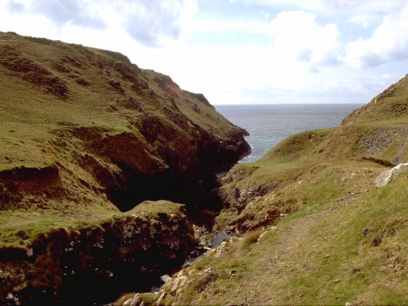
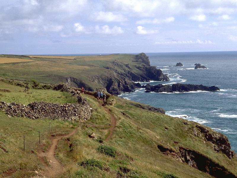
A pleasant clifftop path some 700 yards long leads southeast of Polldubh Point towards Polurrion Cove, with the village of Mullion adjacent.
The clifftop walk from Polldubh to Polurrian
![]() Bus times
to and from Mullion: Truronian
service T1
Bus times
to and from Mullion: Truronian
service T1
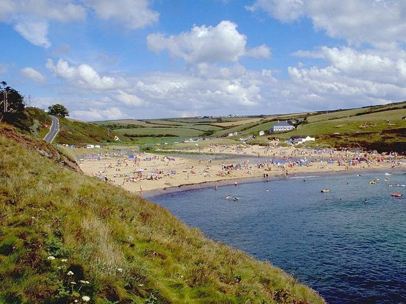
Mullion is a busy little village, and apparently one of the main centres of the Cornish holiday cottage industry. It was here that I was based in the summer of 1999 (when many of these pictures were taken) for the total eclipse of the sun, an event which unfortunately was denied us by the only cloudy day of an otherwise glorious week. Polurrian Cove, despite its close proximity to the village, is much less frequented than either Polldubh or Church Cove, perhaps because of the excessively steep path that is its only approach.
![]() Allen Nunneley's Mullion Cove
and
Mullion Village website
Allen Nunneley's Mullion Cove
and
Mullion Village website
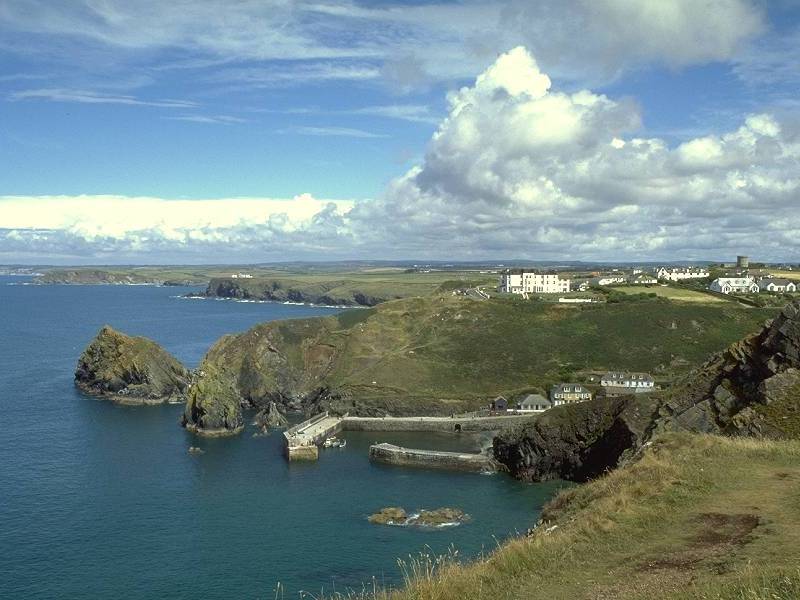
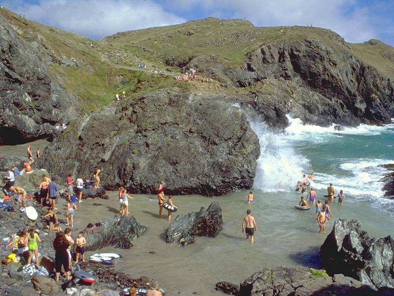
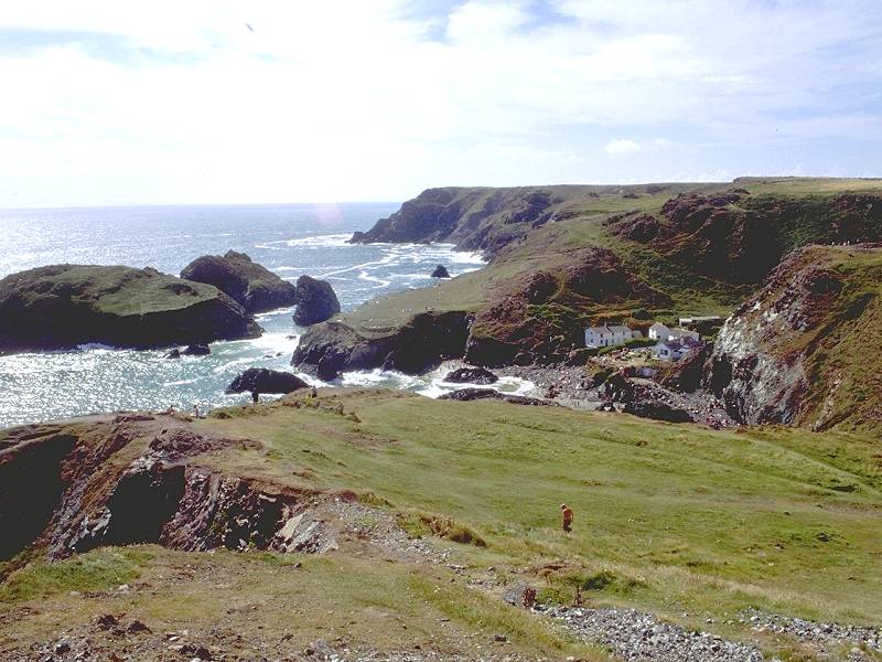
From Polurrian, the coast path squeezes between a cluster of houses and gardens and follows the short clifftop walk behind Trennance Farm to Mullion Cove. A National Trust-owned beauty spot, its stone harbour and surrounding cliff scenery attract visitors from far afield.
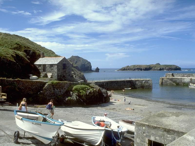

Three shots of Mullion Cove
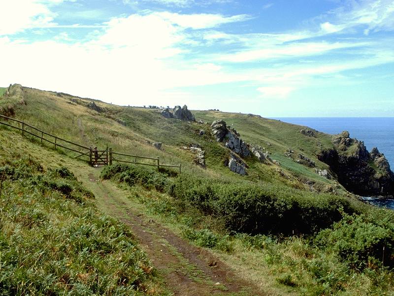
As Mullion Cove is owned by the NT, it is bereft of facilities such as beach shops or refreshments, and the car park is kept well out of sight some four or five hundred yards back up the approach road. A steep little path behind a couple of stone cottages takes the coastal path up onto Mullion Cliff and the first stretch of the delightful heathland of Predannack Downs.
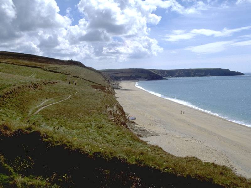
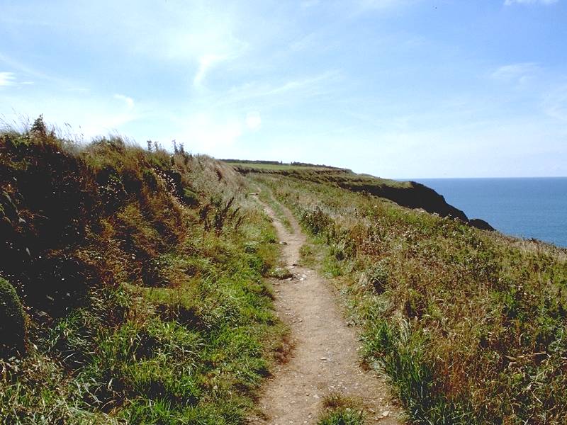
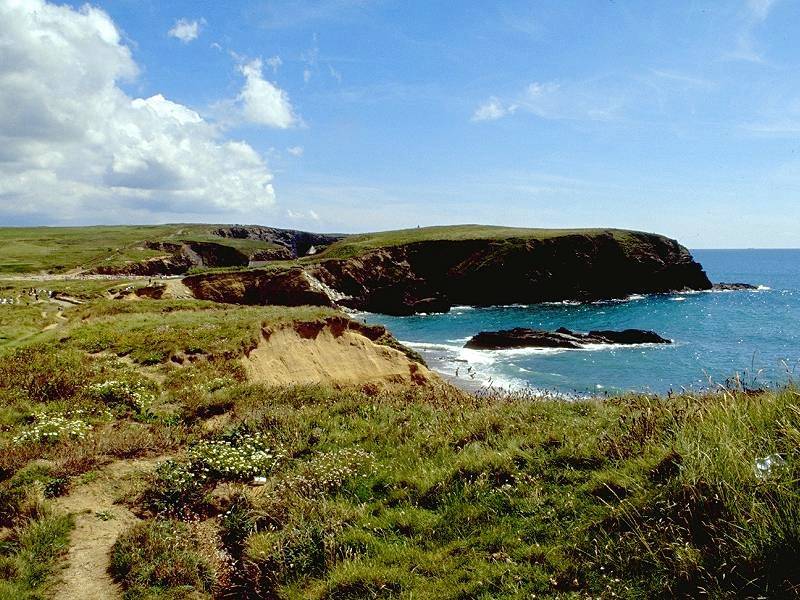
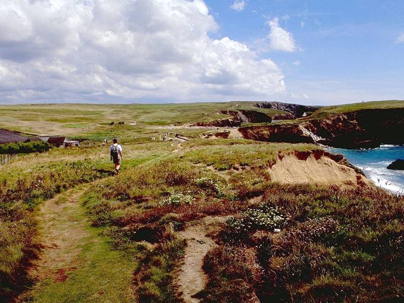
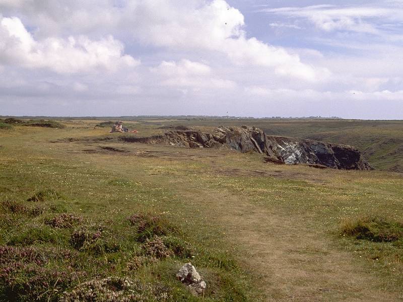
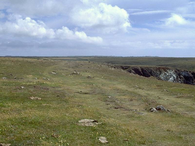
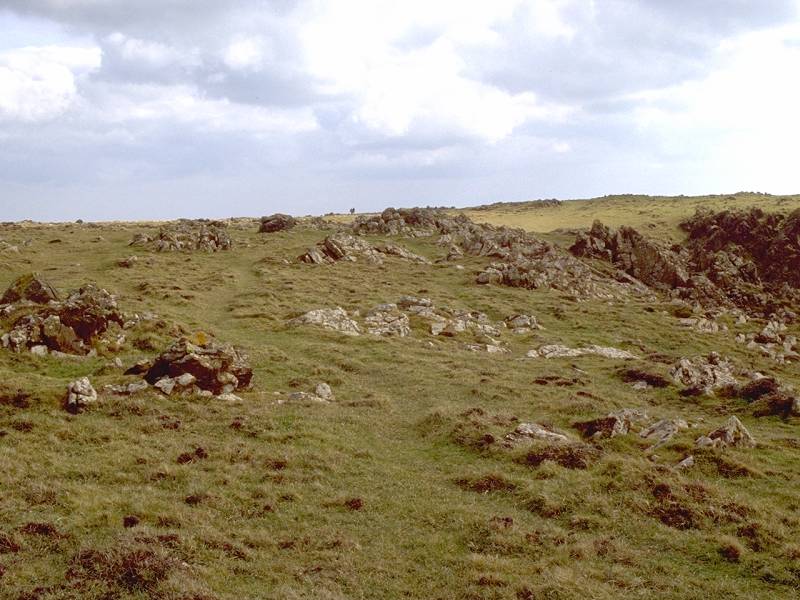
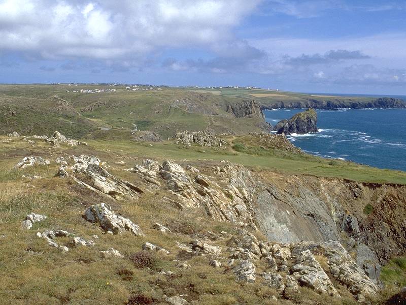
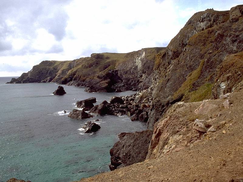
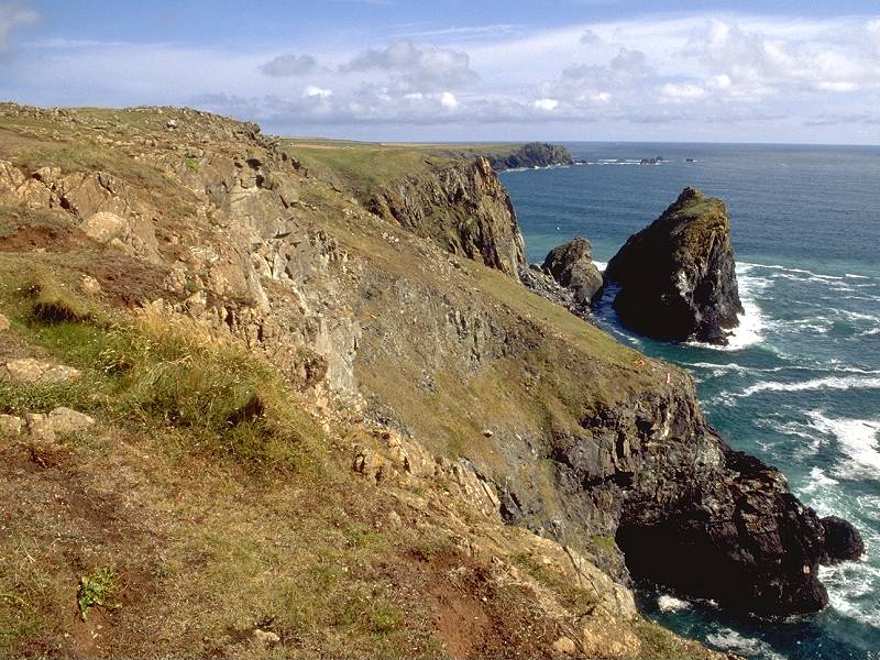
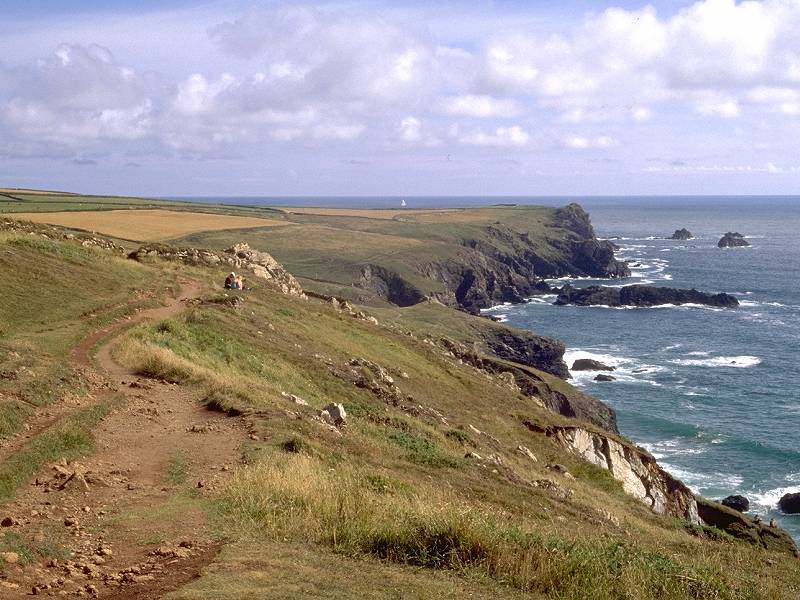
Beyond Mullion lies Predannack Downs. The Downs are quite unlike the rest of the coast path in these parts, in that they are a fairly level plateau of grassy heath. The terrain is pretty much like that back at Land's End but here there are no coves and inlets for the path to drop into and climb out of again. The walking is effortless and the miles melt away under your boots.
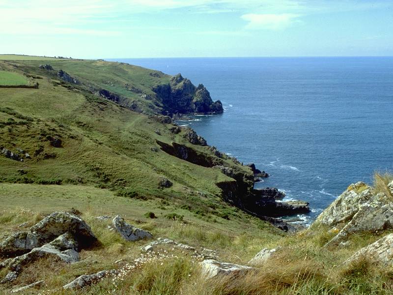
That's not to say that there is no cliff or rock scenery - far from it. Granite slopes, rich in detail, fall to the sea some 200ft below. There is an initial swathe of heath immediately beyond Mullion and then enclosures appear inland and the path stays to seaward of the stone walls of the around Predannack Head.
You pass the grounds of Predannack manor Farm, Higher Predannack, Windyridge Farm and Wollas Farm, to reach Lower Predannack Cliff at the head of the bay formed by Parc Bean Cove.
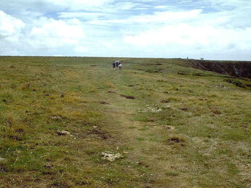
The enclosures fall away now and you have a mile of smooth, level grassland ahead of you all the way to Soap Cove.
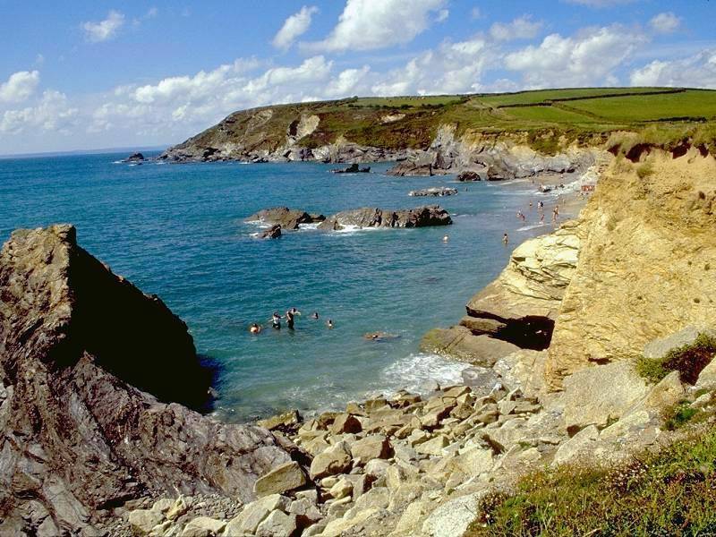
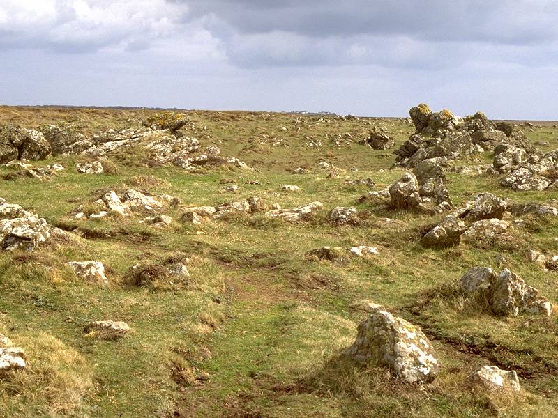
As the unseen Soap Cove is approached the terrain starts to become bouldery, a foretaste of what is to come over the next two miles.
It's not actually named on the map. The only name given is "Gew Graze" which, since it's in blue type, presumably refers to a water feature such as an arch or cave. The guidebooks, however, refer variously to "Soap Rock", "Soapy Cove" or "Soap Cove".
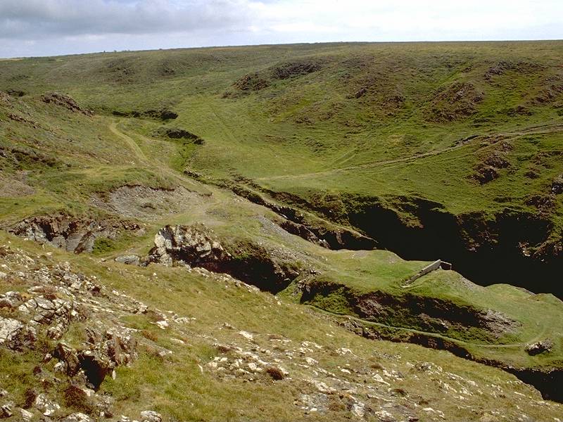
It's certainly a very dramatic feature. After several miles of the flat tableland of Predannack Downs a dip appears in the terrain ahead, revealing itself suddenly to be a deep and jagged tear in the coastline. Its features include terraces, down which side paths run precariously; a narrow sub-inlet within the main cove; and, above all, a remarkable multiplicity of rock types that reduces geologists to gibbering wrecks. I don't have the relevant text to hand but I remember that there are igneous rocks here (mostly granite) and metamorphics (including serpentine, which has a dark purply colour and polishes very smooth) and inclusions of soft, lightly-coloured soapstone.
Two views of Soap Cove from the northern side
Soap Cove also includes a ruin, situated quite deep within the chasm; whether this was a cottage or simply a barn or animal enclosure is not known. The south side of the main cove is dominated by a shapely rock formation known as the Horse.
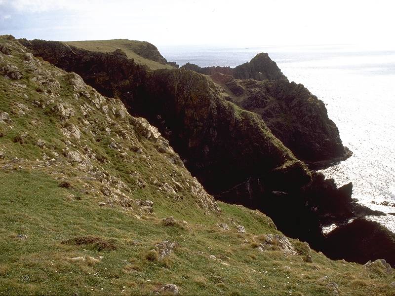
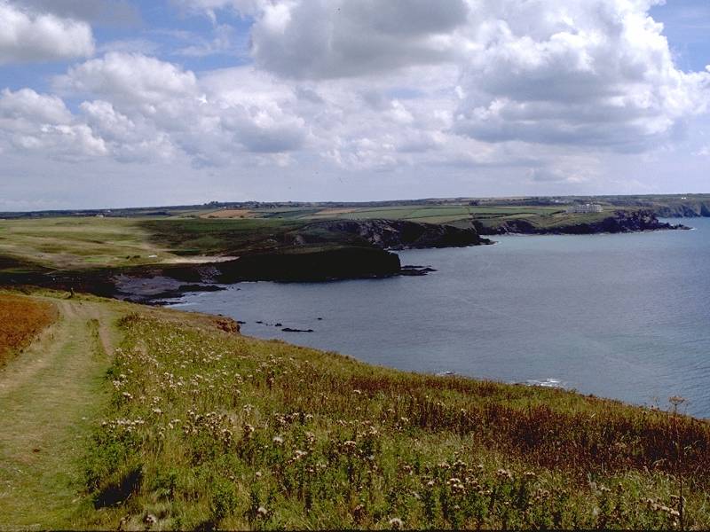
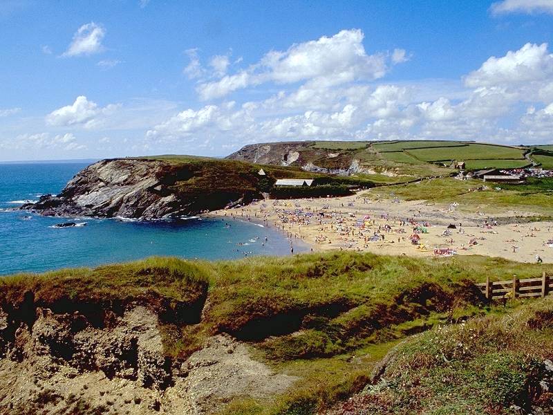
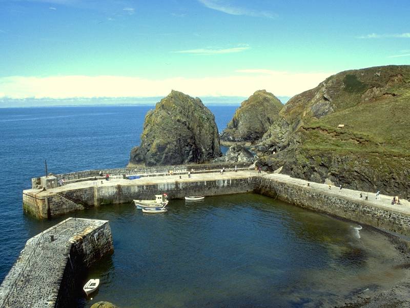
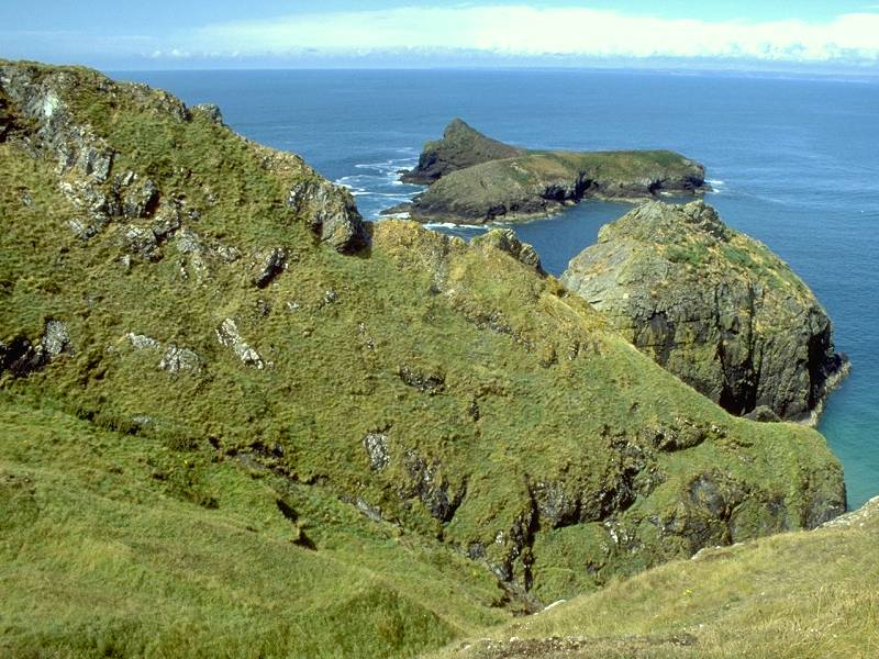
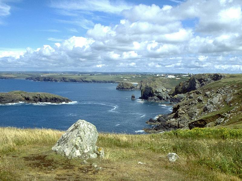
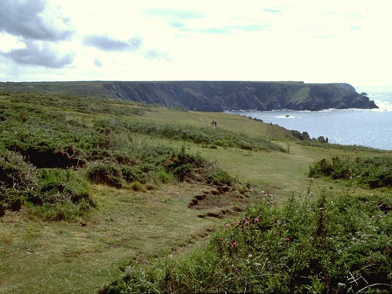
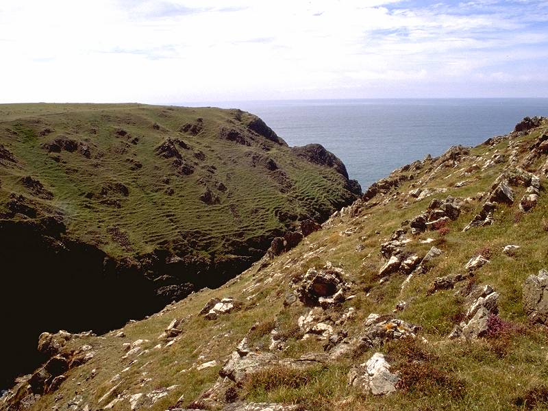
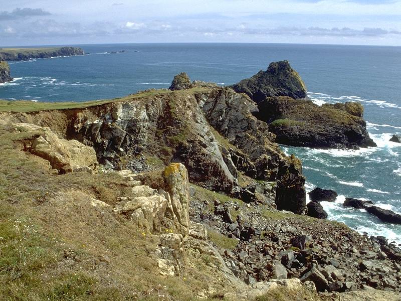
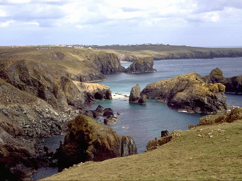
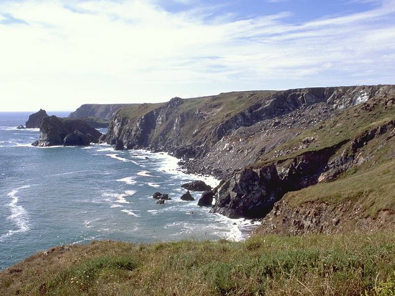
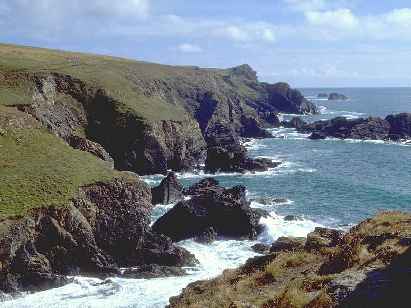
On the south side of the cove the coast path hugs the clifftop and passes the Horse, and the level heathland of Predannack Downs resumes. At Rill Point, however, nearly a kilometre south of Soap Cove, the coastline and coast path turn left (east) to begin the sweep around Kynance to Lizard Point.

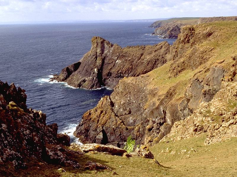
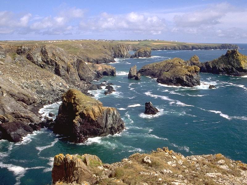
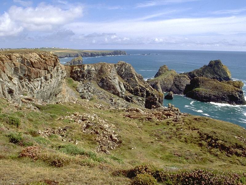
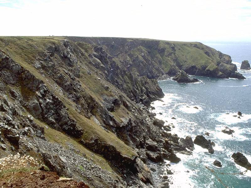
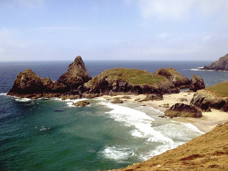
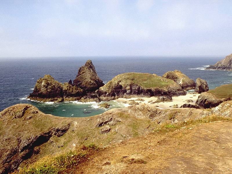
The Horse from Rill Point; Kynance cliffs and islands; Kynance Cliffs
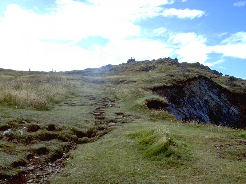
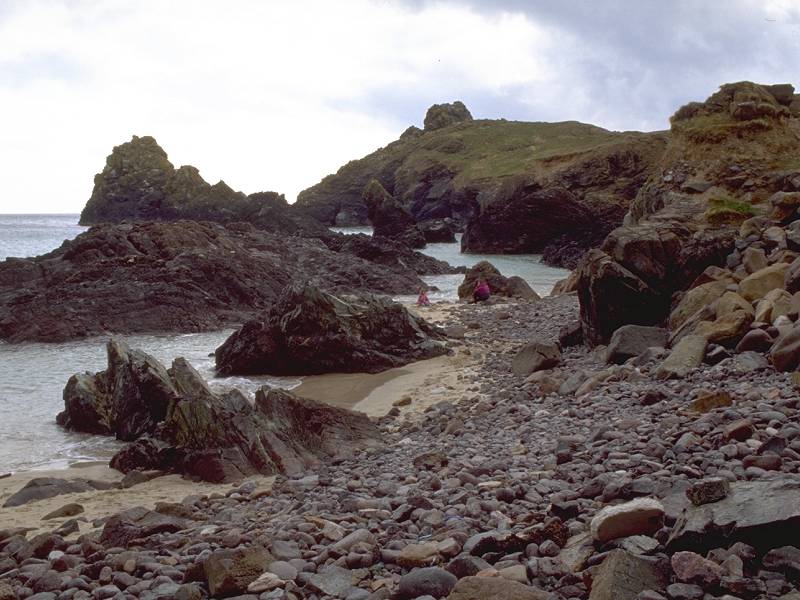
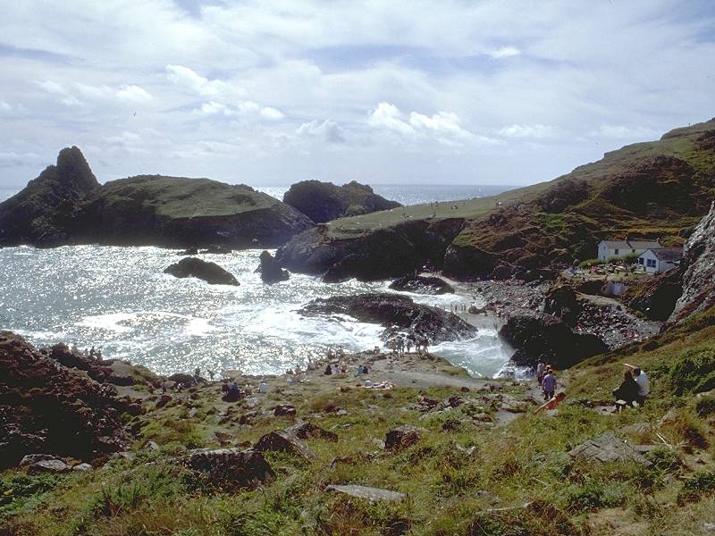
And so we come to one of Cornwall's most celebrated beauty spots, the chaotic jumble of cliffs, stacks, arches and offshore islands that is Kynance Cove. Over the next mile the path takes an airy meander above the rocky fantasy world to the right as it wends its way among the rocks and boulders that litter the grassy clifftop. This is a place to linger, and to watch the forces of nature at work.
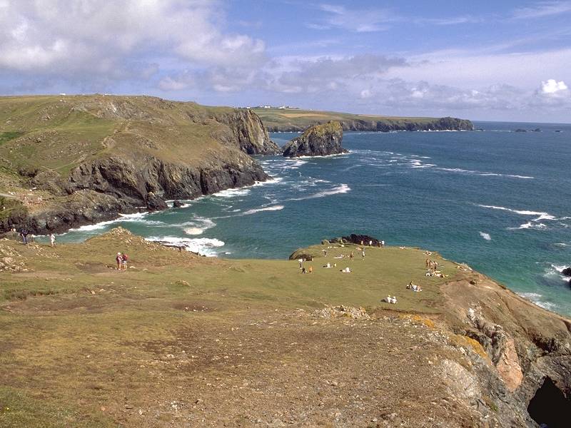
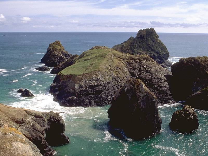
Kynance Cliffs and Asparagus Island; Kynance Cliffs; Kynance Cove
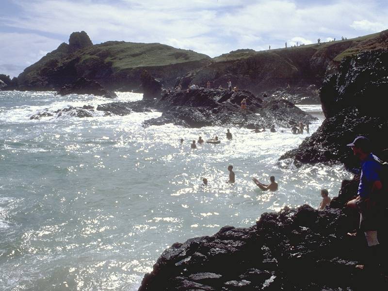
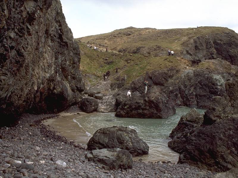
The most prominent offshore lump is named Asparagus Island. Between the islands and the mainland is a narrow channel, the Bellows, which is uncovered at low tide and which gives access to a couple of caves from the cove proper. If you explore these caves from the cove take care not to linger. The tide rises quickly and could leave you stranded.
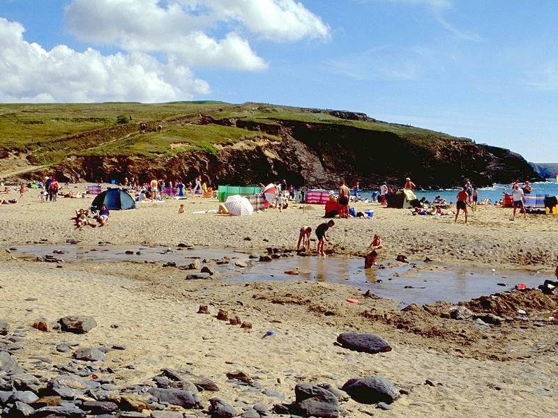
The path keeps close to the edge of the land, falling to an oval-shaped swathe of grass that I call the Table, though the map gives it no name and the guidebooks are equally reticent. The Table is a favoured picnic spot. The coast path swings north, or inland, from the Table - an unexpected feature in this most unusual of coves. The path ahead of you falls suddenly, to reveal Kynance Cove itself just below you with its little cluster of cottages and its rockpools and beachlets.
Coast path; Kynance Cliffs from the Table
Descending to Kynance Cove; Asparagus Island and the Bellows
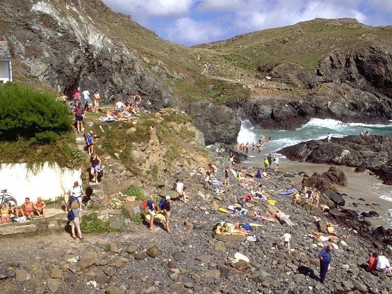
Holiday crowds at Kynance Cove

The beach at Kynance; Breaking waves
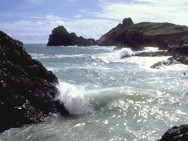
Incoming waves; Kynance Cove; The coast path exit from the cove
![]() Bus times to
Kynance
Cove - Truronian
service T3 (Lizard Rambler) (pdf document)
Bus times to
Kynance
Cove - Truronian
service T3 (Lizard Rambler) (pdf document)
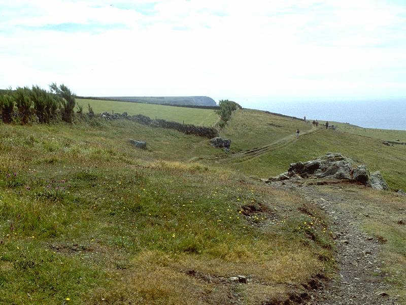
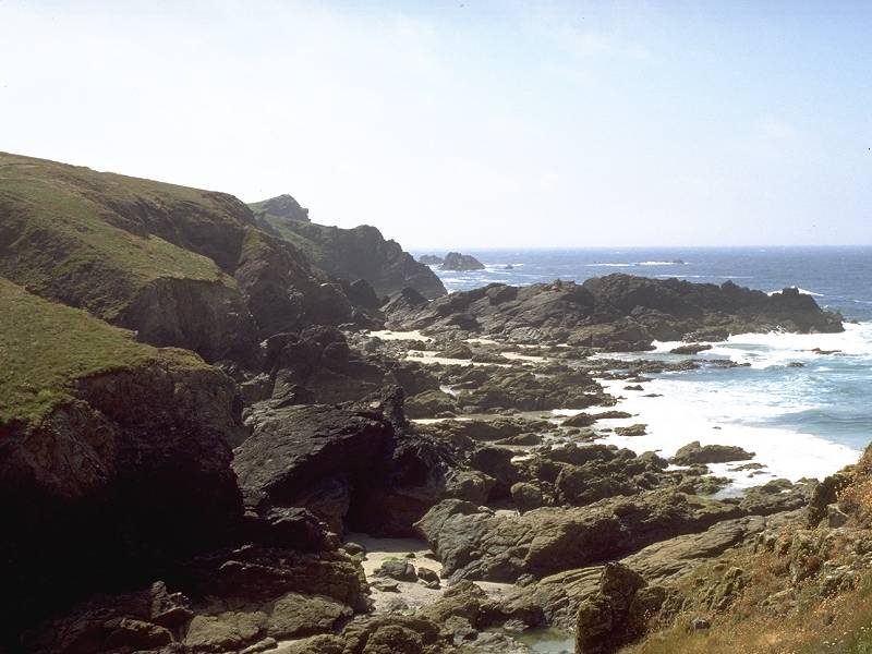
Kynance is delightful at any time but is perhaps best seen on a rising tide on a breezy day, when the sands are half covered and the wave action is vigorous. One of the cottages is a cafe and shop, and does brisk business. The coast path exits from the cove at its northeastern corner, beside a slightly undercut cliff face - if the tide is advancing you may have to time it carefully and take a run! A steep flight of stone steps takes the coast path up to the extensive car park above the cove. Leave the car park to your left and continue, past Kynance Cliff House, to the curve of Pentreath Cove. Lizard Point is the next major headland, a mile and a half away.
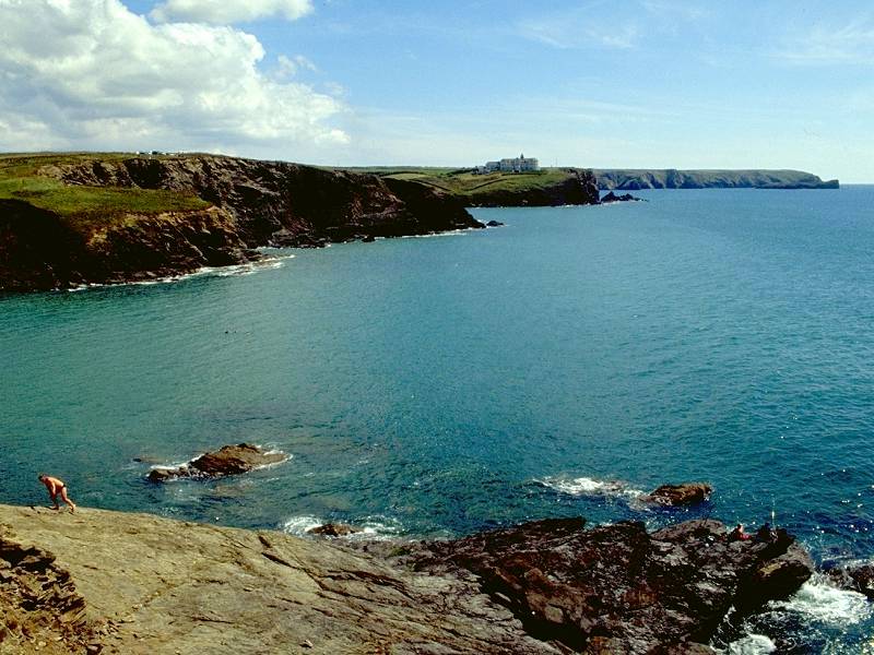
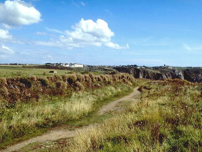
The remainder of the walk to Lizard is interesting, but it can't match the drama of Kynance and there may well be a tendency to press on to the end and get the walk over with. This would be a mistake, for the scenery is still of excellent quality. One odd point, and one which will become even more apparent tomorrow, is the continuing proximity of Lizard village. This small, yet widely scattered village, is now less than a mile away. It continues to be less than a mile away for the next four miles of coast path. This seemingly impossible illusion is actually explained by the shape of the coastline. The southern tip of Britain, Lizard Point, is a rectangular chunk of land measuring about a mile north-south by a mile and a half east-west. The village lies at the centre of this rectangle; the coast path goes right around three sides of it, meandering round a couple of deep indentations for good measure. Thus, for the rest of this afternoon, and for a good hour and a half tomorrow morning, you're always just fifteen minutes' walk from the green in the centre of Lizard village.
Holseer Cove; Pentreath Cliffs
The coast path curves gently around Pentreath, rather more a bay than a cove, and its stony little beach. Beyond a rocky shoreline feature known as Crane Ledges the path dips sharply to cross the head of Holseer Cove.
Six hundred yards beyond Holseer, Lizard Point (the southwest corner of the rectangle) is reached and the path turns sharp left. The path follows a couple of field boundaries and then hugs the edge of the slopes for some six hundred yards, coming finally to the Lizard itself, the most southerly tip of Britain.

You're a tad south of the 50th parallel here (in fact, you crossed it at Higher Predannack, about five and a half miles back). There isn't much here. There's a couple of cafes, a gift shop at which you can buy postcards and carved serpentine trinkets, and the Lizard lighthouse. All that remains now, once you've partaken of the traditional Cornish cream tea to round off the day, is to stroll the leisurely 1200 yards north to Lizard village from where the Truronian bus can whisk you back to your starting point.
![]() Truronian
service
T1
Lizard - Mullion - Helston-Truro
Truronian
service
T1
Lizard - Mullion - Helston-Truro
![]() Truronian
service
T3
(Lizard Rambler) Kynance-Lizard-Coverack-Helston-Truro (pdf
document)
Truronian
service
T3
(Lizard Rambler) Kynance-Lizard-Coverack-Helston-Truro (pdf
document)
![]() First
Western National service 2, Penzance
- Porthleven - Helston - Falmouth (for connections from
Helston)
First
Western National service 2, Penzance
- Porthleven - Helston - Falmouth (for connections from
Helston)
| Penzance to Porthleven | Back to South Cornwall Coast Path index | Lizard to Coverack |
This page last updated 18th March 2007
![]()