| Fowey to Polperro | Back to South Cornwall Coast Path index | Looe to Portwrinkle |
| Fowey to Polperro | Back to South Cornwall Coast Path index | Looe to Portwrinkle |
|
|
|
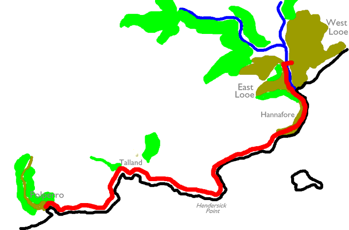
| Length: | 5.07 miles / 8.17 km |
| Total ascent: | 969 ft / 295 m |
| Total descent: | 943 ft / 288 m |
| Estimated time: | 1 hr 57 mins |
Map: OS 1:25000 Explorer 107 (St Austell & Liskeard)
Click
on
any thumbnail image in this gallery to display the corresponding full
size
image. The images are access protected through a cgi script to prevent
hotlinking. If you encounter problems while trying to view the full
size
images, please read the access advice
page.
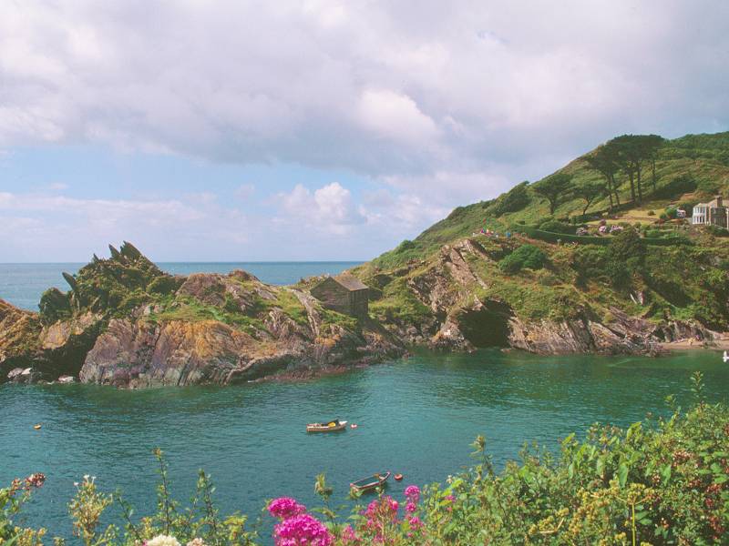
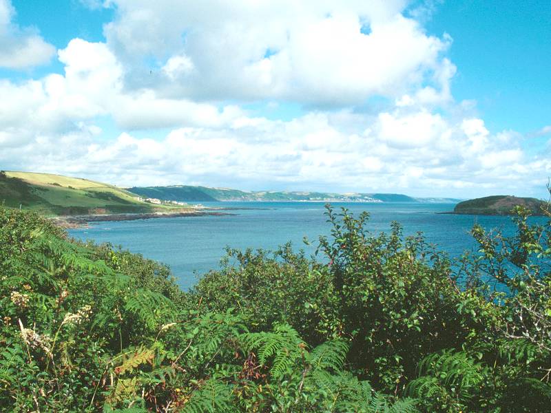
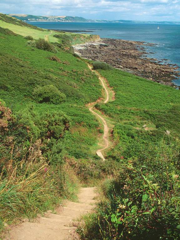
The coast path leaving Polperro Harbour to the east
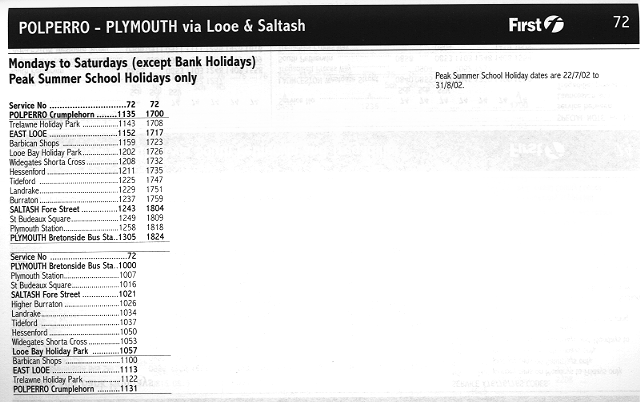
![]() Service
72, Plymouth - Looe - Polperro, Mon - Sat,
mid-July to late Aug (summer 2002 timetable)
Service
72, Plymouth - Looe - Polperro, Mon - Sat,
mid-July to late Aug (summer 2002 timetable)
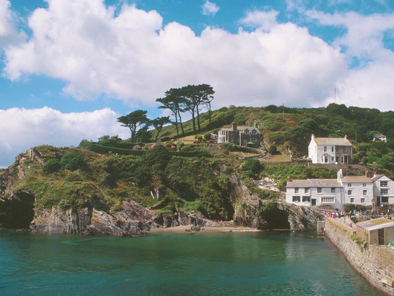
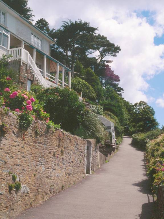
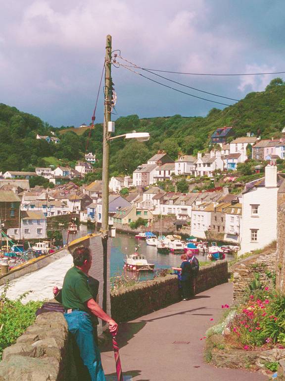
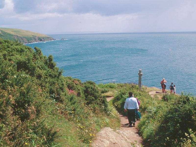
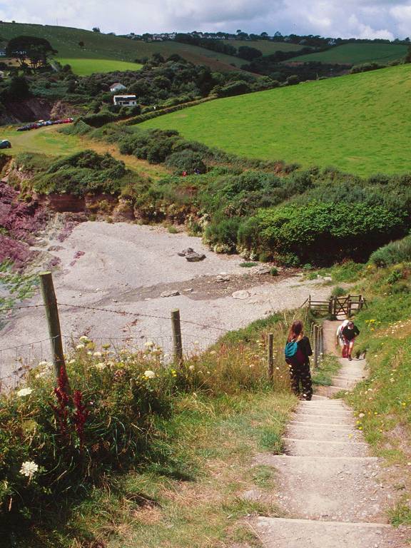
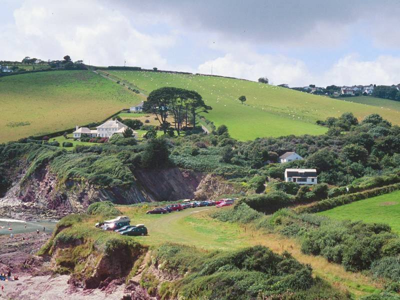
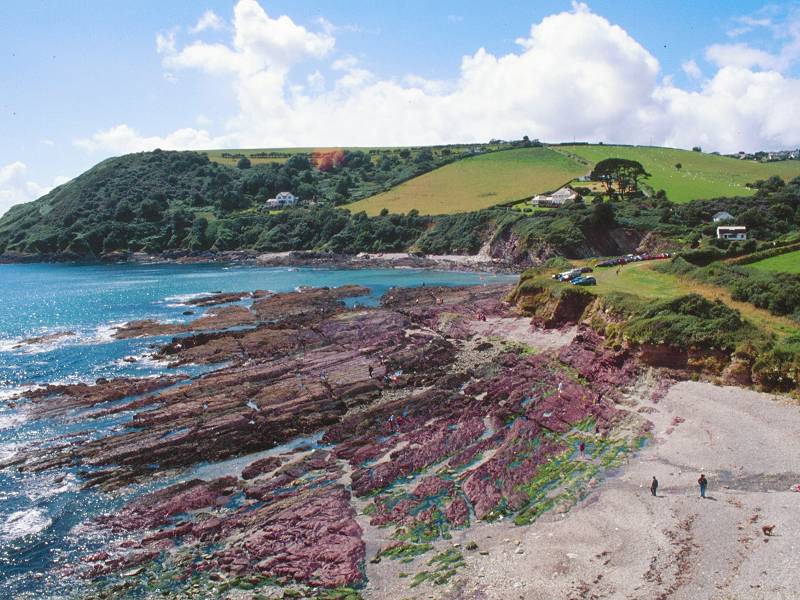
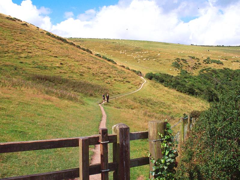
I've already described and portrayed Polperro and its impossible narrow streets and lanes on the previous page (Fowey to Polperro), so take a look there for a fuller description. The coast path to Looe heads directly away from the harbour to the east, initially along a narrow lane heading fairly smartly uphill. As the lane widens out and the cottages start to acquire gardens, you pass a small area on which bench seats have been laid out. A great place for admiring the view, but it's too early to think of taking a rest yet.
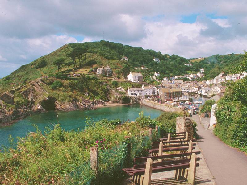
Bench seats from which to admire Polperro Harbour
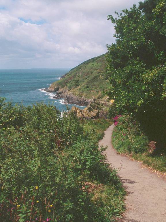
A retrospective view along the path to Downend Point
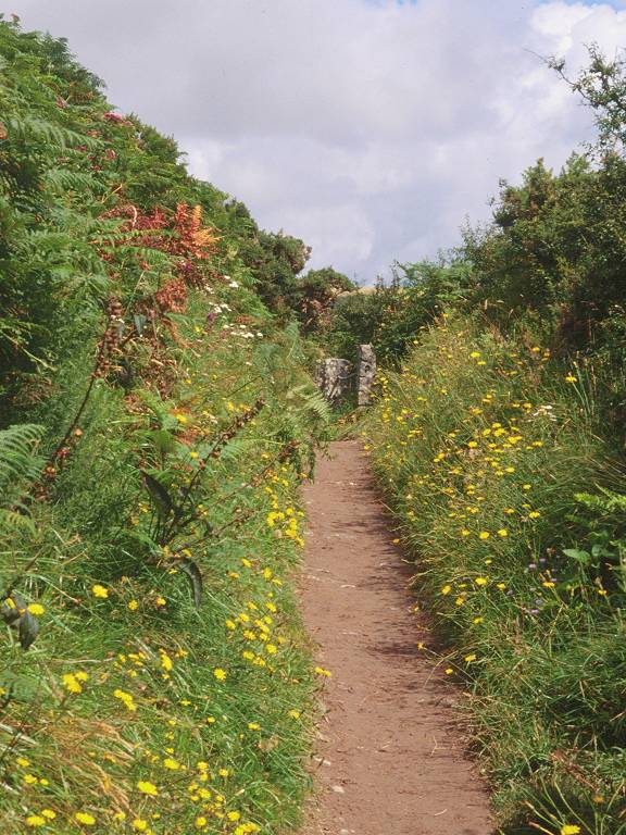
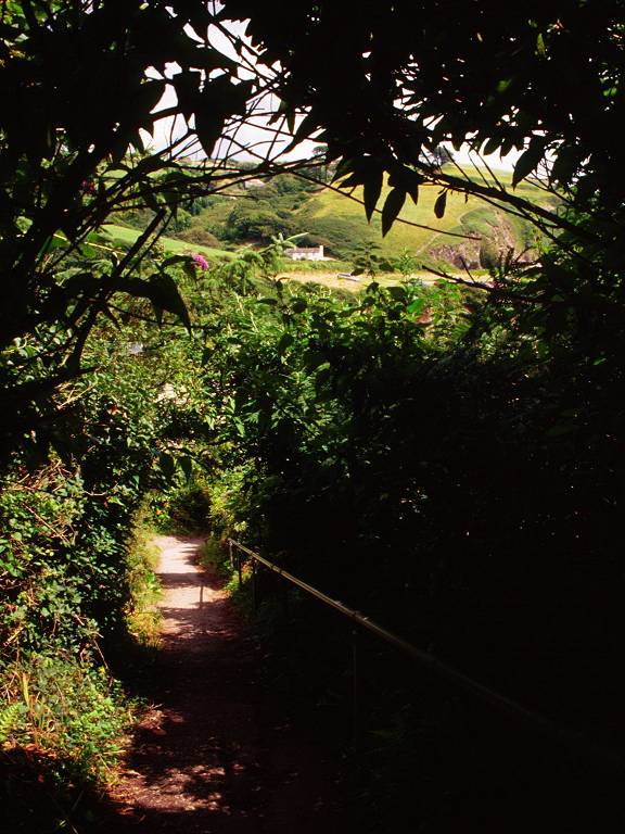
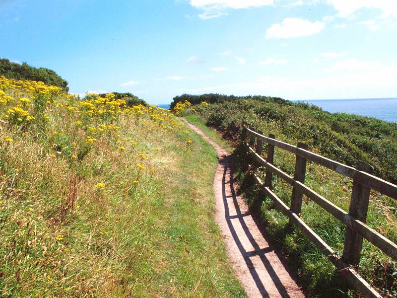
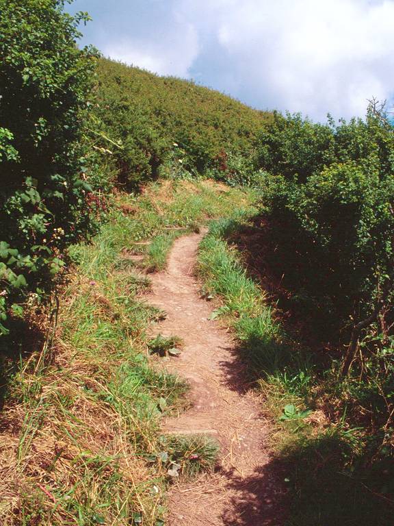
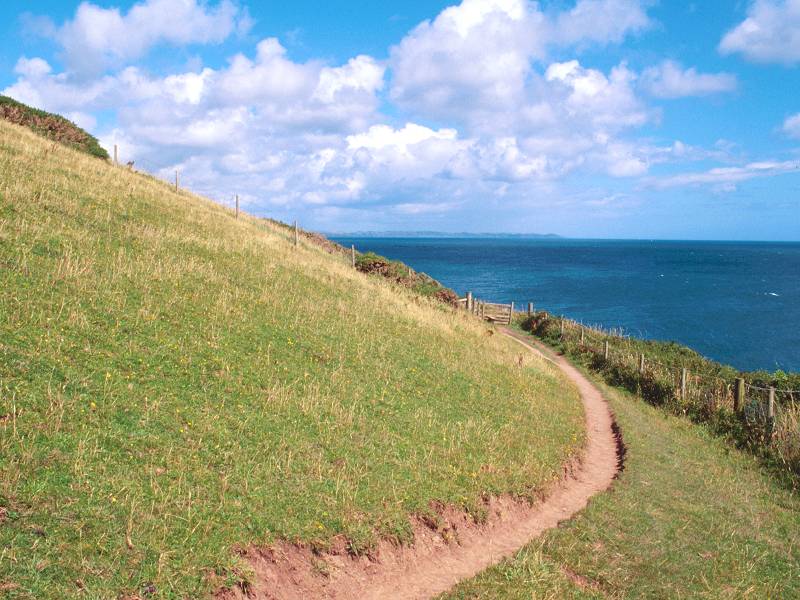
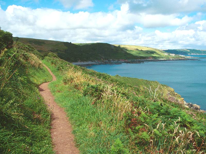
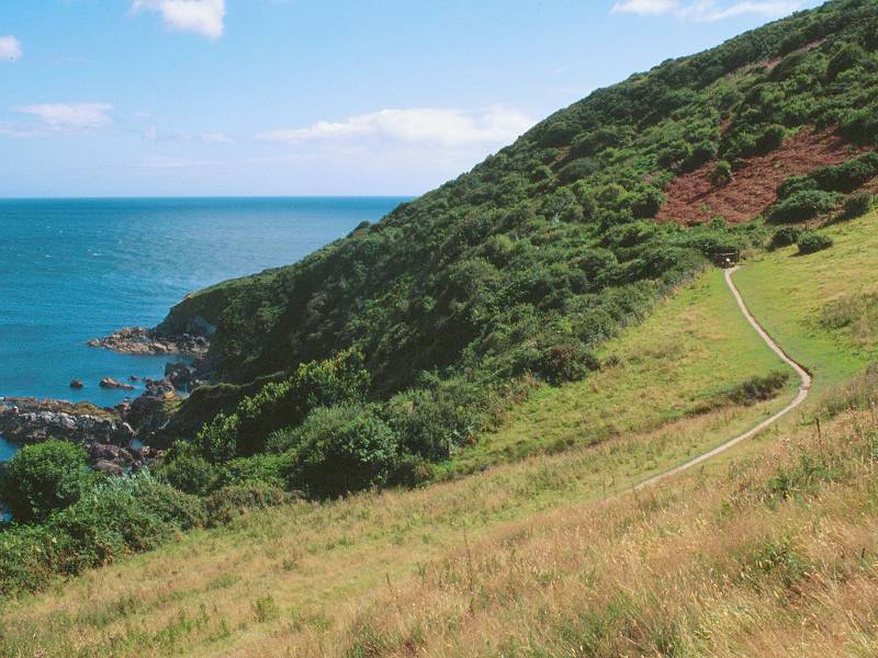
The excellent made path leading east out of Polperro is heading for Downend Point, the next headland along the coast and about half a mile away. The path is crowded in by vegetation. Downend Point itself is the site of a war memorial shared between Polperro and the neighbouring but much smaller community of Talland.
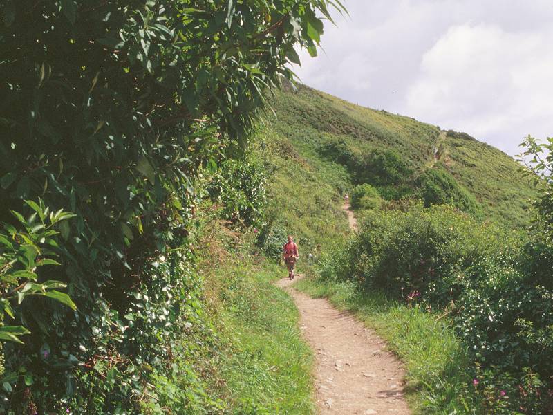
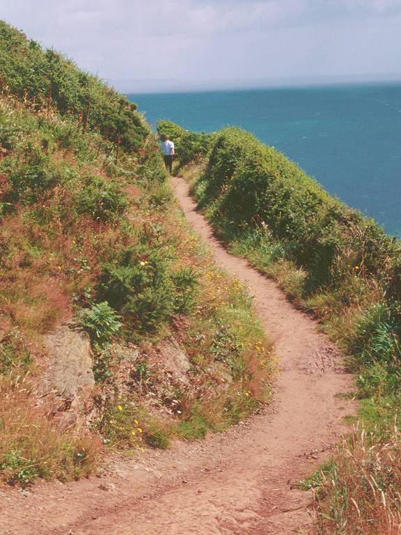
Coast path to Downend Point, and the war memorial
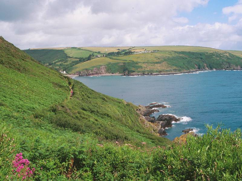
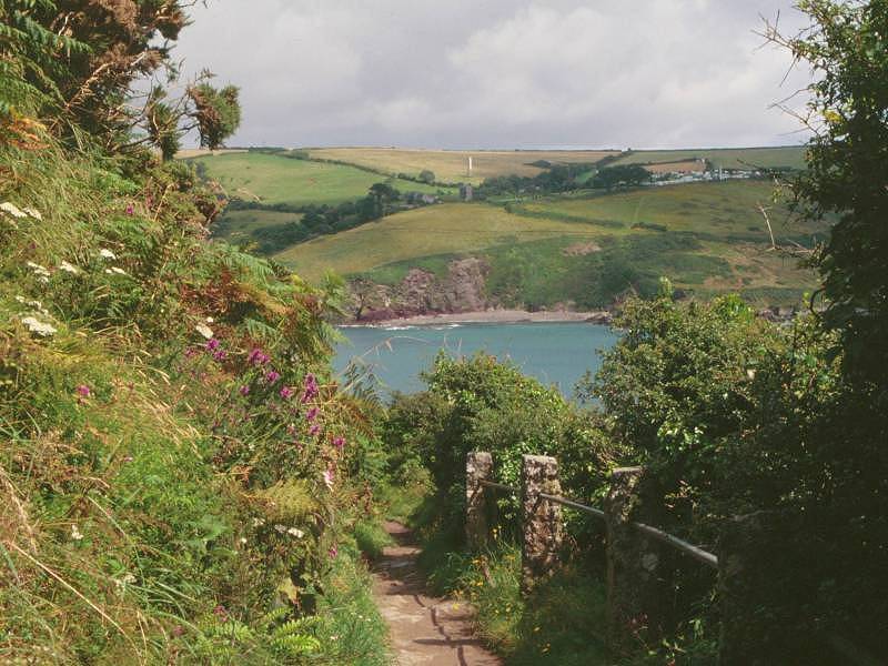
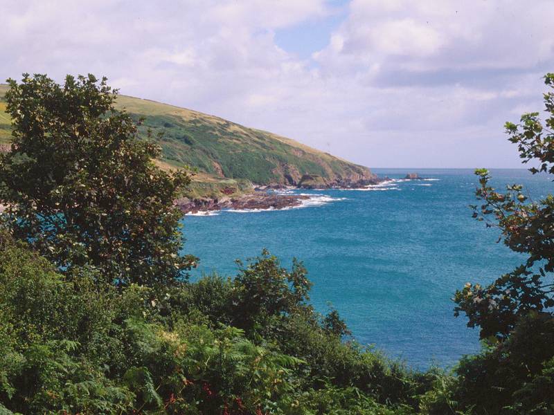
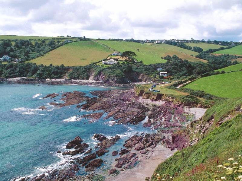
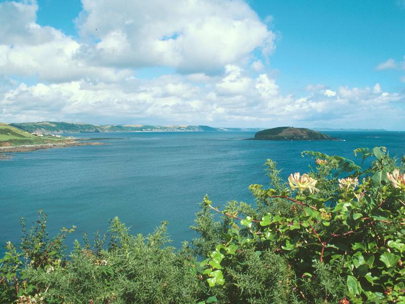
Talland Bay seen from Downend Point
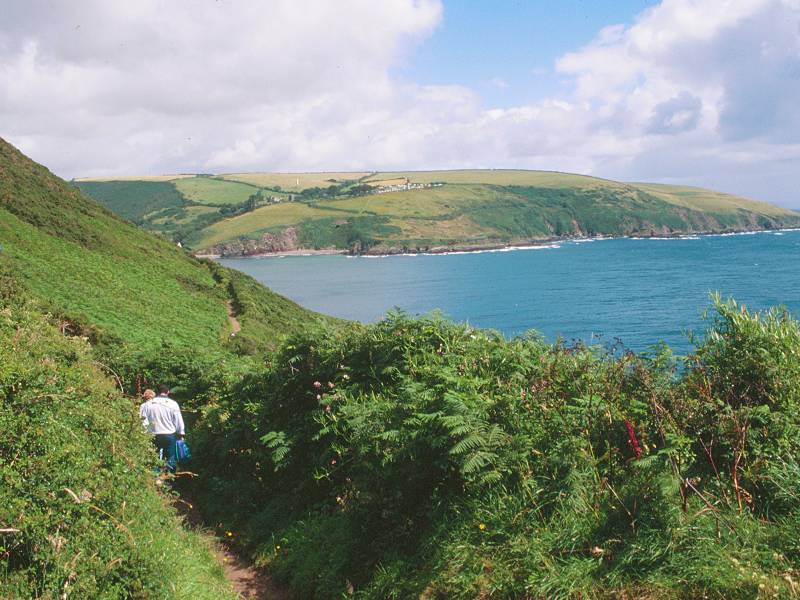
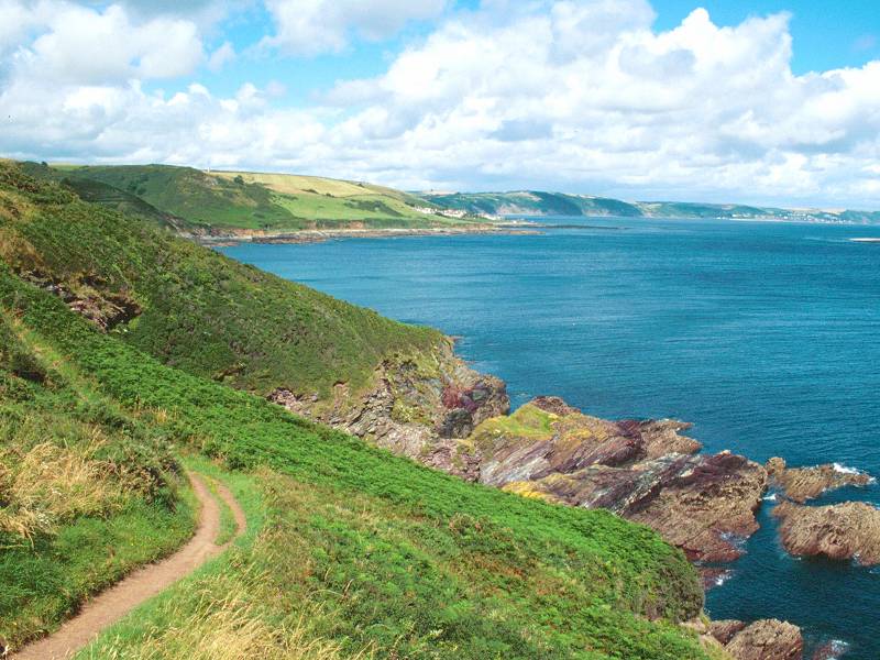
From Downend Point the path swings northeast as it begins to follow the curve of Talland Bay. The land here slopes gently to a rocky foreshore and the slope itself is cloaked in some pretty dense vegetation. The path almost forms a tunnel through the screen of trees and shrubs, and once you lose height on the approach to Talland itself the views of the bay are pretty well cut off.
The coast path approaching Talland
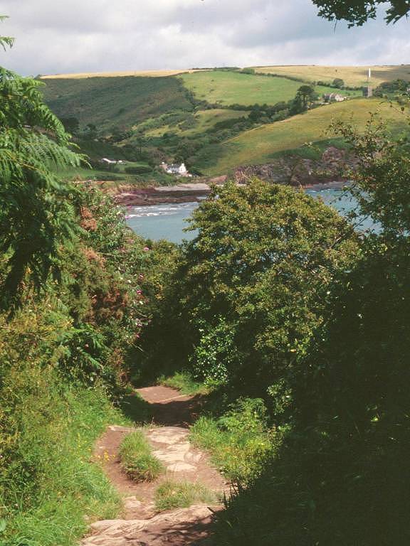
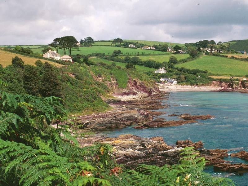
Talland Bay
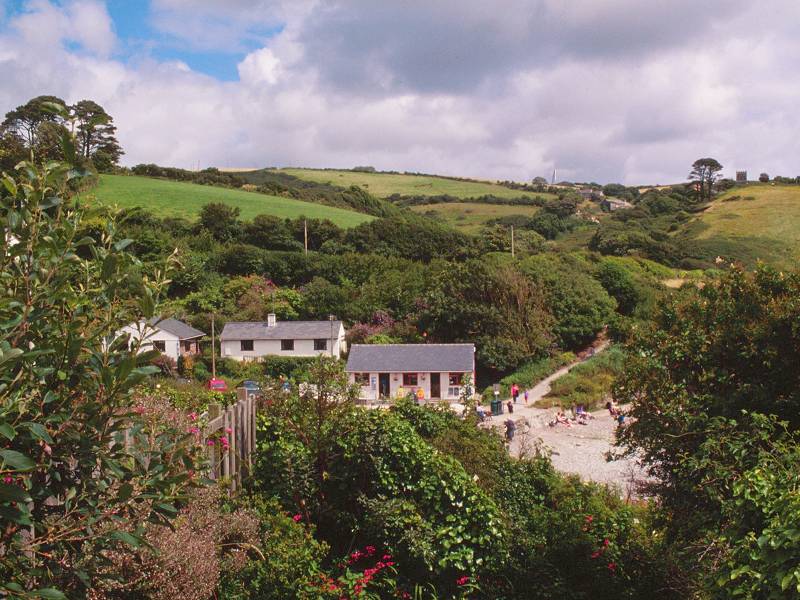
The walk down to Talland itself is quite lively. When the vegetation does relent and allow you a view. the immediate scene is one of a rocky foreshore backed by the cluster of cottages that is Talland, with the picturebook English country scene of irregular fields and hedgerows rising inland from the coast.
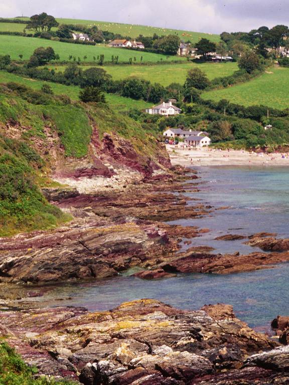
Coastal scenery, Talland
Talland and the bay
Coast path, Talland
As you approach the village the path merges with the access drive to a couple of the cottages on the southwest side of Talland, dream cottages all and no doubt with very hefty price tags. There's a short but steep descent to the small patch of heath behind the beach. There are a few more cottages clustered round this "green", one of which is an inn.
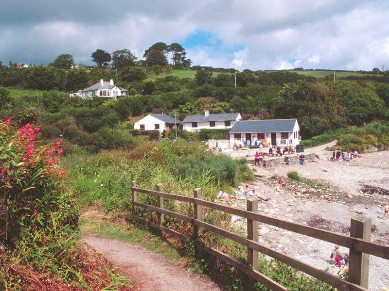
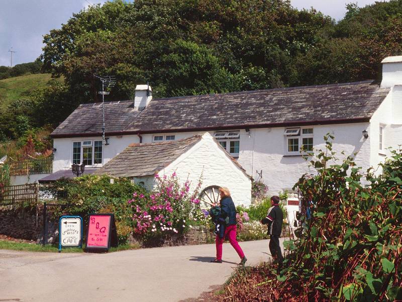
Photos of Talland
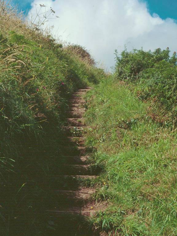
Walk onwards, to another patch of grass that doubles as the village car park. From here there's a fairly steep ascent out of the village and the path has been provided with steps. As the coast path heads out to Hendersick point the views back to Talland are excellent.
The coast path between Talland and Hendersick Point
Approaching Hendersick Point
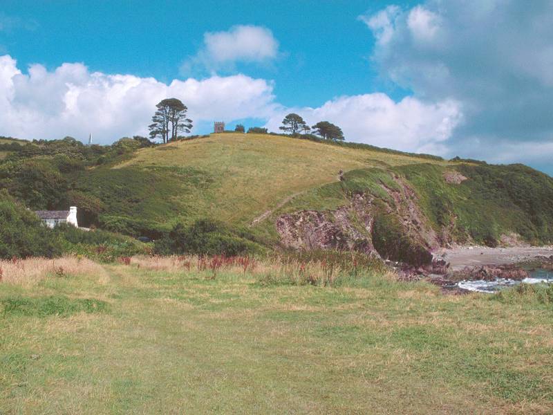
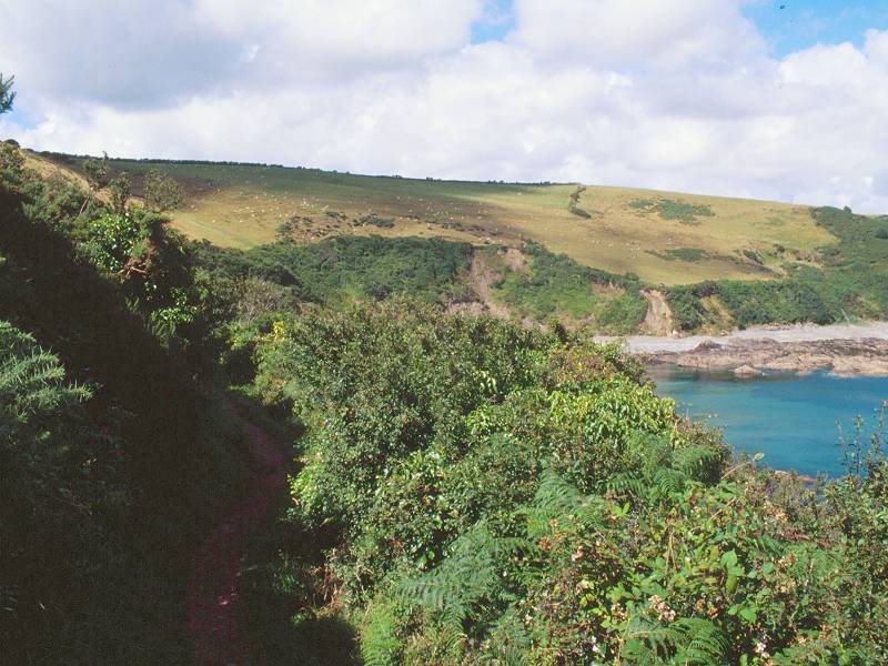
Beyond Talland the path follows a route above a meagre and rather rocky beach before settling once more into a world of scrubby, gorse-cloaked slopes. The map gives the succeeding headland no name, but the National Trust have named it "Hendersick" after the nearest farm, a little over half a mile inland.
Coastal scenery, Hendersick
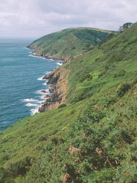
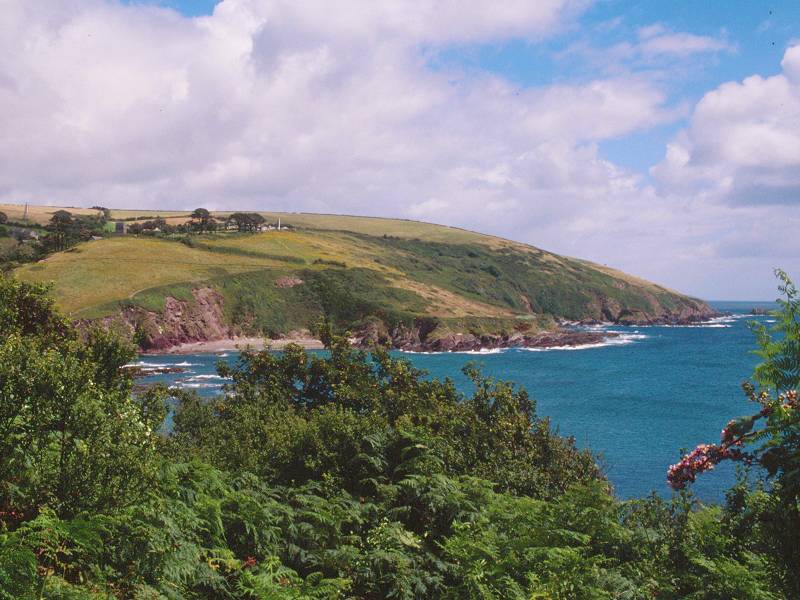
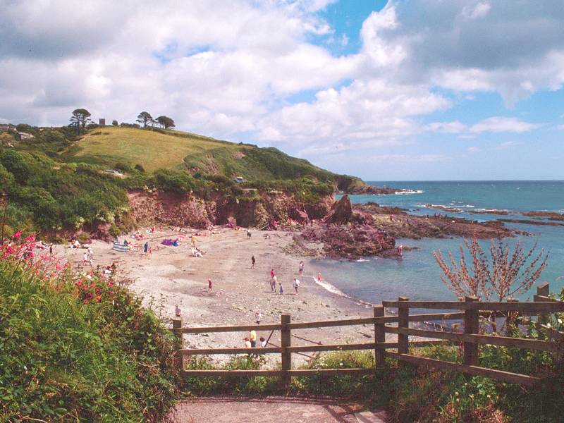
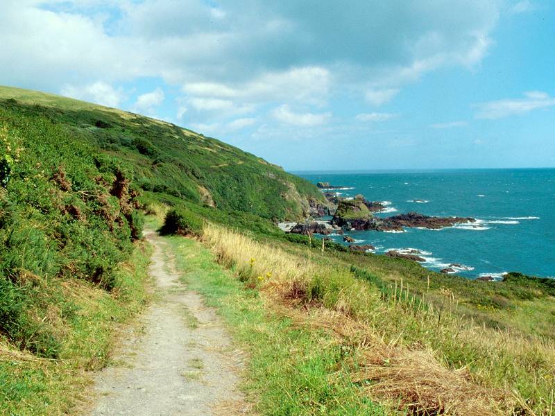
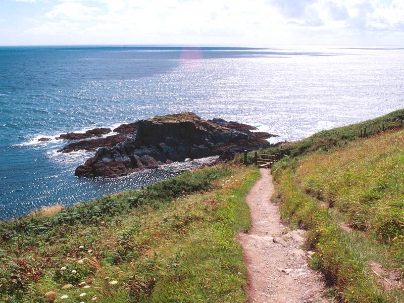
Hendersick point is quite complex, consisting of two or three minor headlands with little baylets between. The shoreline becomes unusually rocky and there are even one or two slabby islands just offshore. Hendersick point proper is unmistakable, with its jagged rocky outcrop just proud of the coast path. From here there's a good view across Portnalder Bay. Looe is close, but is tucked away within its harbour inlet and is not well seen.
Hendersick Point and views across Portnalder Bay
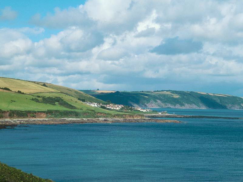
Portnalder Bay and the coast path
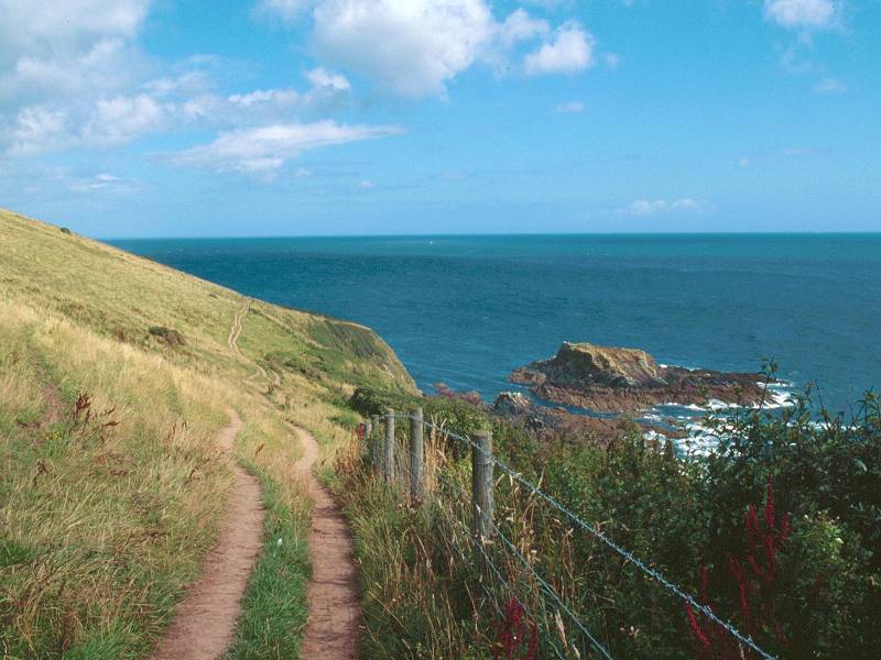
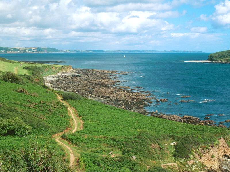
The first stretch of the coast path around Portnalder Bay pretty much mirrors that at Talland Bay, a couple of miles back. You're high up a slope, and the path is rising and falling and twisting among fairly dense vegetation. Portnalder Bay has another similarity to that of Talland, in that its foreshore is mainly of slabby rock. There are a couple of meagre beaches. However, there is no habitation within the bay - not even as much as a couple of cottages.
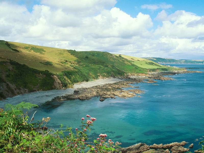
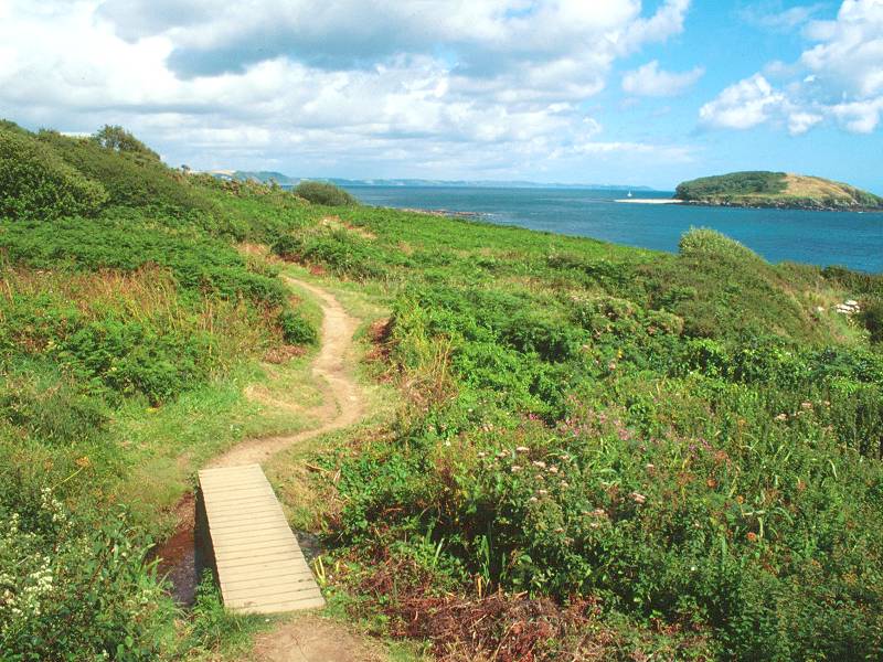
Portnalder Bay; Looe Island and Rame Head are in view
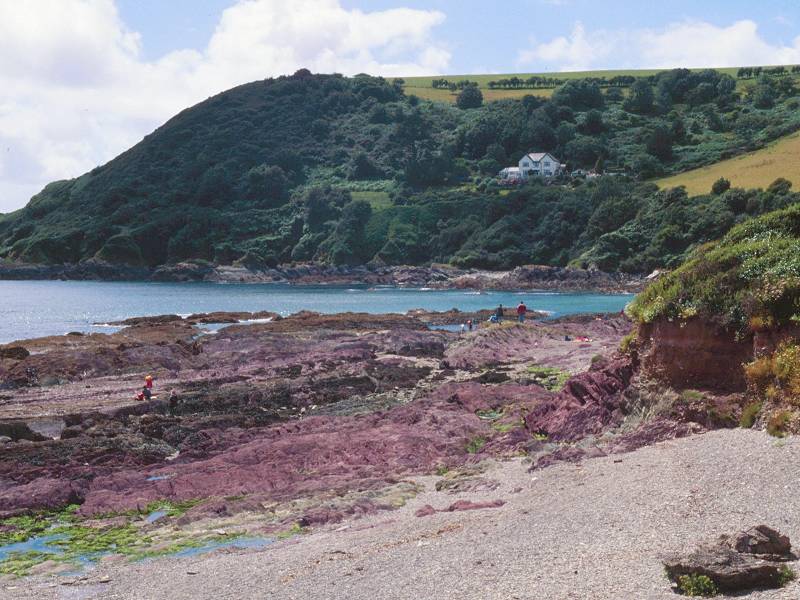
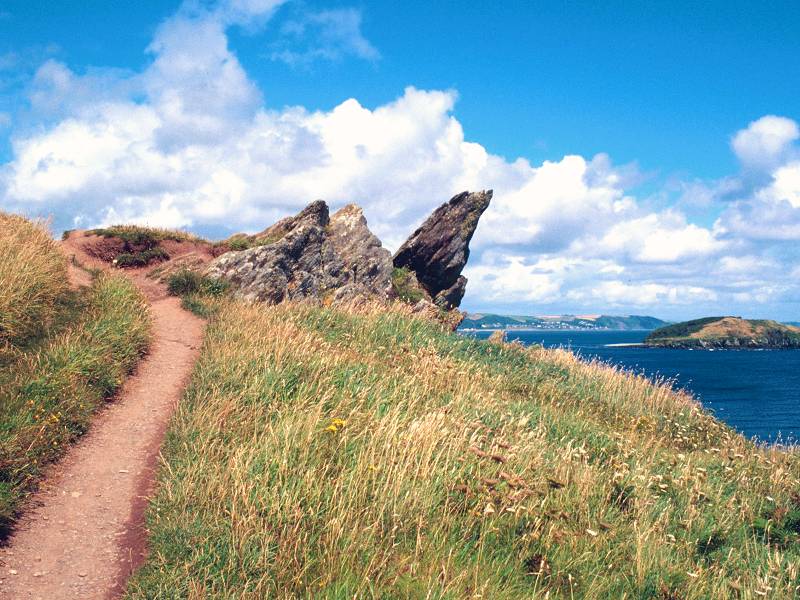
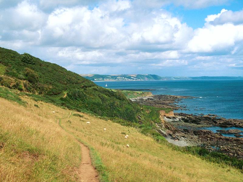
From the elbow of Portnalder Bay the coast sweeps right around to Rame Head, which should be well in view now beyond Looe Island (one of the few inhabited islands off the Cornish coast). If the day is clear you should be able to see the series of scattered communities along the coast; Downderry, Seaton, Portwrinkle and Whitesand Bay. There's two more days of walking in view.
Coast path at Portnalder Bay
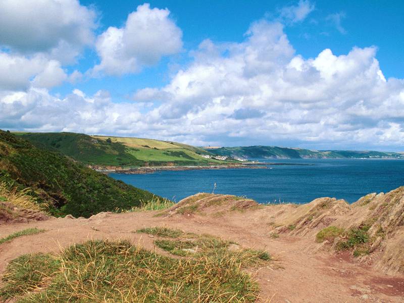
As the path reaches the elbow of the bay, just where you would expect to find a huddle of cottages, the path breaks out of the vegetation into open pastures. You round the baylet and cross an area of scrub, thereafter descending to a low "shelf" of land, possibly a raised beach, cloaked in scrubby heathland vegetation. Remember this scene; it's typical of the moors and hills that characterize much of the End-to-End walk. Dartmoor, Exmoor, the Quantocks, the Pennines, the Southern Uplands and the Highlands of Scotland, all consist of countless miles of moor and heath cloaked in this same brown mat of tussock grass, heather, bracken and gorse.
Heathland vegetation at Portnalder Bay
Coast path, Portnalder
There's comparatively little to see on this stretch apart from the curious slabby rock formations of the foreshore itself. After some little distance of heath, the path approaches a stile between two substantial brick-built pillars and thereafter crosses a single open pasture before reaching the first houses in Hannafore.


Entering Hannafore
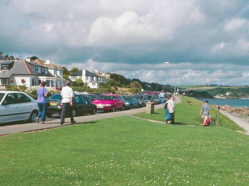
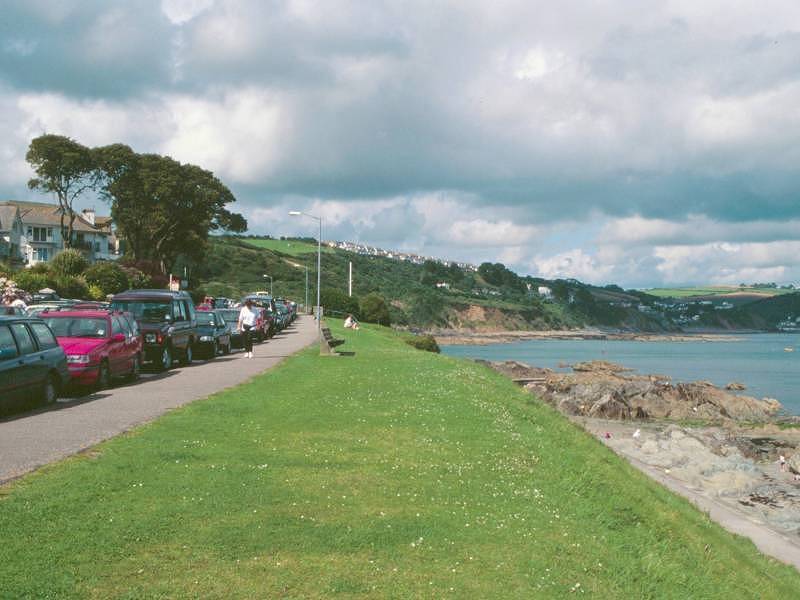
Hannafore is an outlier of Looe and consists of a long strip of residential development fronted by a green promenade and a meagre sandy beach. Parked cars mar the view but the houses are grand, neat and whitewashed and make a charming scene. As you approach Looe proper, hotels begin to appear. There's a toilet block if you're desperate. You might also wish to partake of a cool drink or an ice cream, though Looe itself is just around the corner.
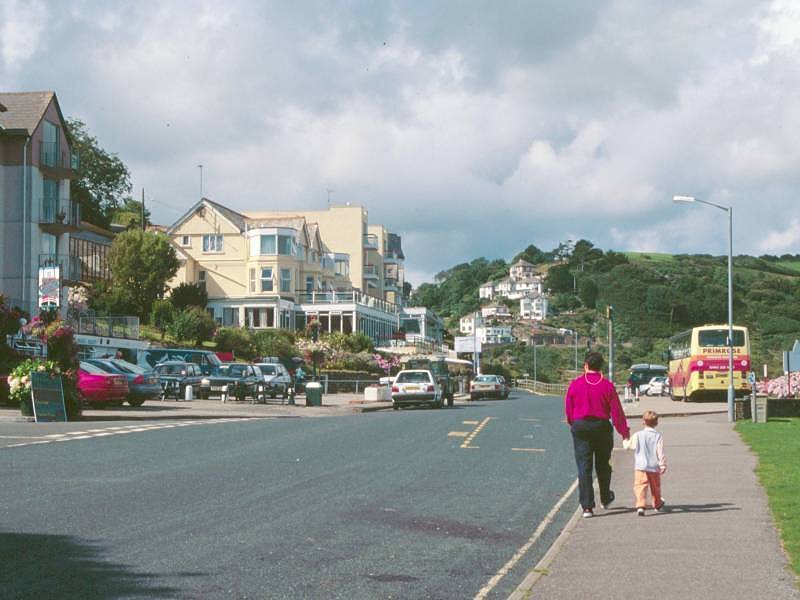
Hannafore
The road widens and curves leftwards, and suddenly Looe Harbour is revealed before you.
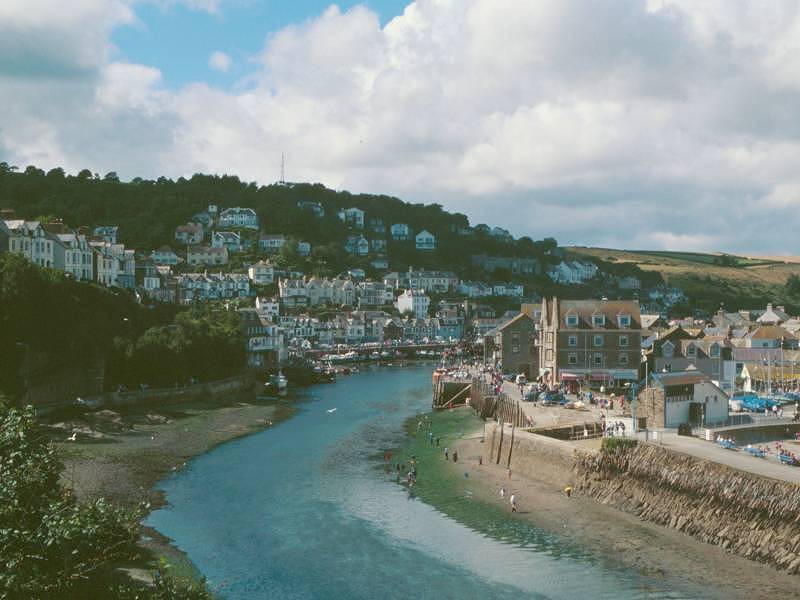
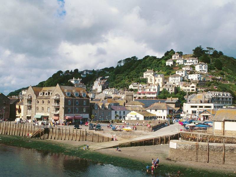
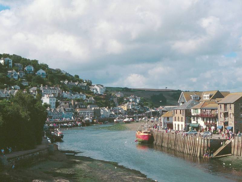
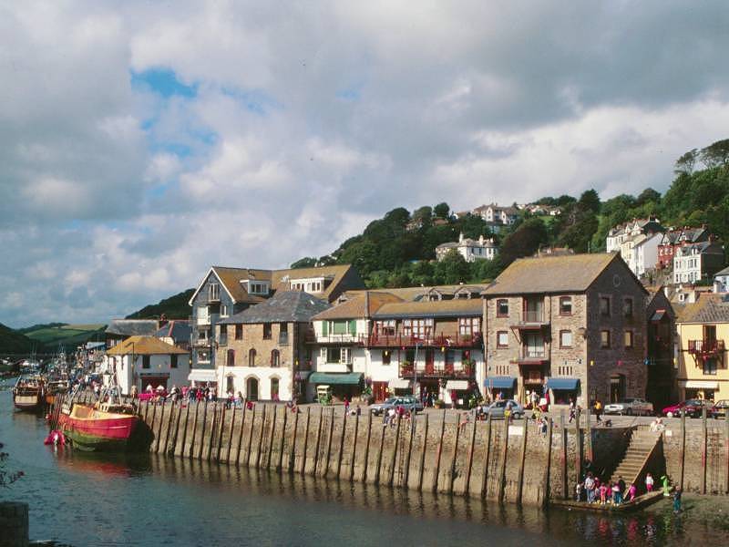
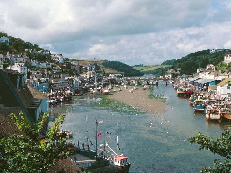
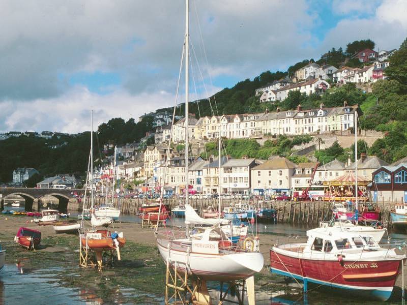

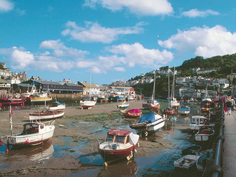
A Looe Harbour portfolio
Looe is built around its harbour and river estuary and is smartly divided by it into two halves, West Looe and East Looe. In terms of topography and layout Looe is, essentially, a rather larger version of Polperro. The division of the town, however, seems to be cultural as well as physical. West Looe is the upmarket, grander, genteel side of town with its big houses and Victorian hotels.
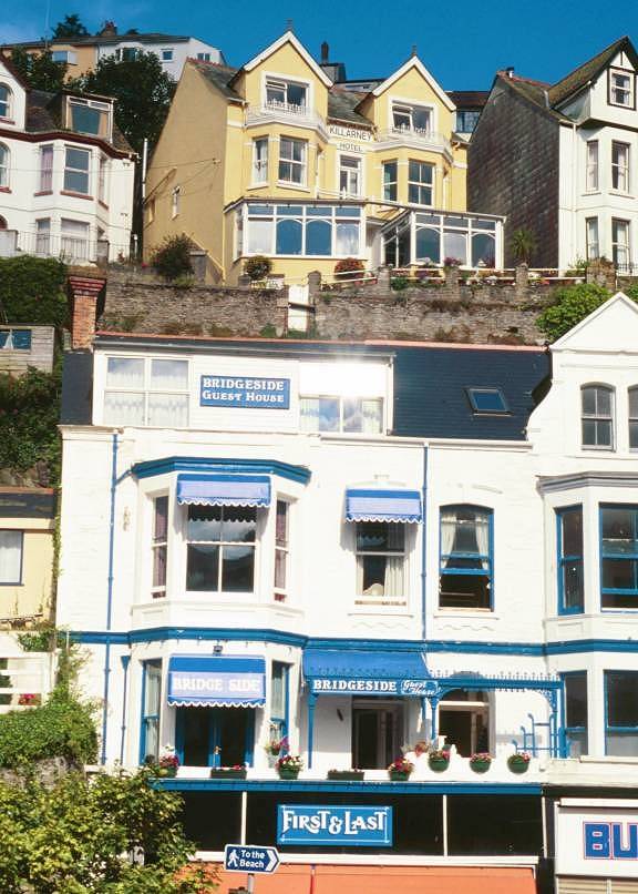
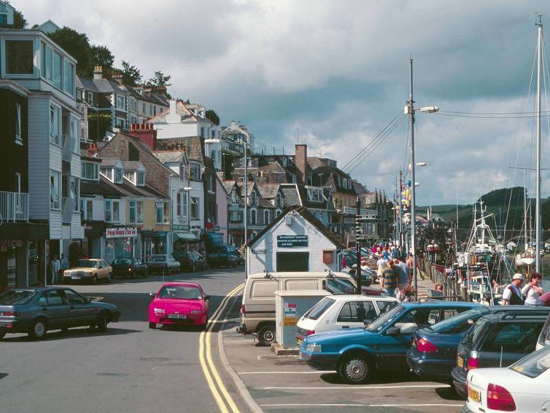
Once across the riverbridge into East Looe, you're in a different world; the higher terraces of smart houses look just the same but down here on the quayside you plunge into the town proper, a cluster of narrow lanes full of downmarket tourist outlets. There is charm here but you have to seek it out; there are some classy boutiques among the tat shops, there are a couple of agreeable patisseries and coffee shops among the gamut of fish and chip emporia. Looe hasn't gone as shamelessly or irrevocably downmarket as Newquay, on Cornwall's north coast, but it's heading that way - if you flinched at the seedier side of Mevagissey you will probably conclude that Looe is a lost cause. But I repeat - it does have its good points. You just have to look for them.
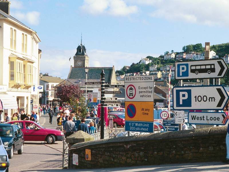
The bus stops and railway station are beside each other just north of the main bridge on the East Looe side.
![]() Service
72, Polperro - Looe - Saltash - Plymouth,
Mon
- Sat, mid-July to late Aug (summer 2002 timetable)
Service
72, Polperro - Looe - Saltash - Plymouth,
Mon
- Sat, mid-July to late Aug (summer 2002 timetable)
| Fowey to Polperro | Back to South Cornwall Coast Path index | Looe to Portwrinkle |
This page last updated 7th November 2005
![]()