| Exford to Porlock | Back to Devon Coast-to-Coast index | Minehead to Dunster |
| Exford to Porlock | Back to Devon Coast-to-Coast index | Minehead to Dunster |
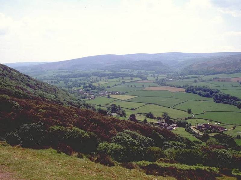
In this case, it must be admitted that the term "coast path" is something of a misnomer. It is certainly the nearest right of way to the coast, but it does wander up to a mile inland at a couple of points. The lack of coast and cliff scenery is, however, grandly compensated by the moorland environment. Today's route climbs and crosses Selworthy Beacon, a semidetached outlier of Exmoor and in my opinion its most scenic corner. The walking is easy, the views are wide, the air is clear. To the west, the North Devon coast path looks very inviting. To the south is Dunkery Beacon, and the latter half of yesterday's hike. To the east are the Quantocks and the coastal plains of the Bristol channel. And to the north, across the channel, is Wales.
The walk is logistically simple - there is a regular, though infrequent, bus service between Minehead and Porlock. Minehead itself is easily reached by bus from Taunton, which has fast rail connections to Plymouth, Exeter, Bristol and London. Get out there, and enjoy!
Map: 1:25000 OS Outdoor Leisure 9 (Exmoor)
Click
on
any thumbnail image in this gallery to display the corresponding full
size
image. The images are access protected through a cgi script to prevent
hotlinking. If you encounter problems while trying to view the full
size
images, please read the access advice
page.


![]() Service
38, Minehead - Porlock (Mon - Sat, Summer
2002
timetable)
Service
38, Minehead - Porlock (Mon - Sat, Summer
2002
timetable)
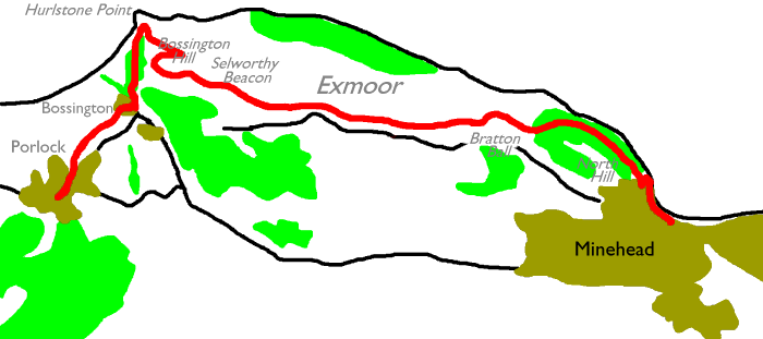
Porlock is a small, but charming, village characterized by haphazard architecture and a winding main street with impossibly narrow pavements. Our route does not actually go through the village centre. Assuming that you've taken a while out to explore the village, you should now return to the main road junction where you ended yesterday's walk. Go back along the main Minehead road for a short distance, where you will find a lane forking off to the left. Follow this road past the residential roads to the north of the village. It becomes a lane, which bifurcates just north of the last houses. Take the right turning, which almost immediately turns left again, running between and alongside hedgerows northeastwards to the tiny locality of Bossington.

Just as you enter Bossington you reach the coast path proper, at a "T" junction. Turn right onto the lane through the village. After about 200 meters turn left, then left again, to cross the bridge over a fast-flowing stream. This is the same river you crossed yesterday in Horner wood. It was called Horner Water at that point; the map is reticent about any other name closer to the coast despite it having been joined by another stream or two.

The base of Bossington Hill
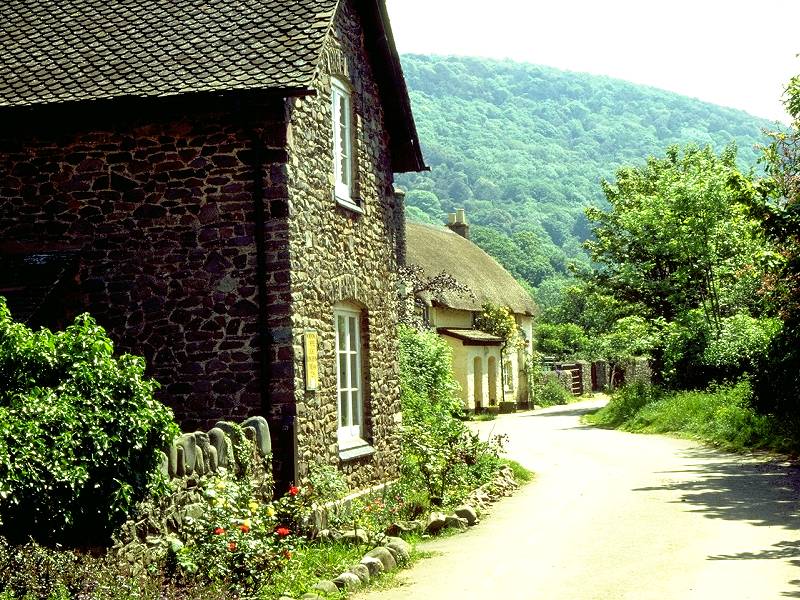
The path runs out northwards towards the coast now, rounding the base of Bossington Hill. At first it runs among and then beside a grove of tree cover, but after a few hundred meters it emerges into more open scenery.


The Somerset coast and Porlock Bay; Hurlstone Point; Hurlstone Combe
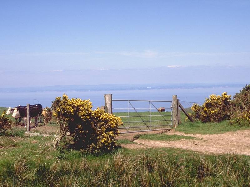
The path is running about 50 ft above sea level and from even this slight elevation there is a grand view of the Somerset coast across Porlock Bay. About a kilometre out of Bossington the path reaches the coast itself at last, by a ruined fortification overlooking the rocky headland of Hurlstone Point. Perversely, after tramping all the way across Devon and Somerset to reach the north coast, we immediately spurn it again and turn hard right for the path ascending through Hurlstone Combe to the high ground of Selworthy Beacon.

At the top of the combe you have a choice of routes. The direct coast path across Selworthy Beacon continues straight ahead ESE, but since today's walk is a short one you might like to take the side trail around the lip of Bossington Hill. This diversion is highly recommended as it encompasses splendid views across Porlock bay to the west, and across the bulk of Exmoor - including Dunkery Beacon and the ground covered yesterday - to the southwest and south. To the north you will be able to see clear across the Bristol Channel to Wales.


At the top of the combe, on about the 200-metre contour, turn hard right for the path around the top of the hill. Tending west at first, it curves around to the southwest and then the south. Excellent views open up across the bulk of Exmoor.
The path continues around the lip of the hill and curves round to the east to enter Church Combe. You can follow the path around and out of the combe, walking east past the top corner of a wood, to a wide dog-leg at South Combe back up to the plateau. Alternatively you can cut off a good kilometre of distance by climbing up the trackless grass in Church Combe direct - this is what I did and there are no difficulties. You very quickly find yourself on the 243m moorland summit of Bossington Hill.
Selworthy Beacon lies ahead, slightly south of east. There is actually no discernible drop in height, and a gentle upward trek lies ahead. Keep towards the highest ground, and in a very short distance your line will merge with that of a vehicle track About 800 meters east of Bossington Hill this track merges with the route of the Coast path, one kilometre short of Selworthy Beacon itself.


Retrospective view of Bossington Hill; route onwards to Selworthy Beacon
Selworthy Beacon is not a dramatic summit, but rather the highest point of a sprawl of moorland detached from the rest of Exmoor by the Porlock-Minehead gap. Although it is not physically joined to the bulk of Exmoor it is geographically part of it, and is in my opinion the most scenic section of the Park. It certainly gives the easiest and most straightforward walking.


Porlock Bay; path crossing south of Minehead Bluff; the Bristol Channel and Wales
Follow the broad ridge as far as a "scissors" crossing half a kilometre short of Selworthy beacon itself. The path junction lies almost exactly a mile south of Minehead Bluff, the northernmost point of coast hereabouts. Although the coast itself is not visible, the views northwards across the Bristol Channel to Wales are extensive. At the crossing the Coast path proper turns half left, bypassing the summit of Selworthy to the north. The other branch of the path, leading straight on, heads to the summit. You can choose either route - I recommend a visit to the summit.


Selworthy Beacon has an elevation of 308 meters, just a tad short of a thousand feet above sea level. The End-to-End will not achieve a similar elevation again before the Pennines are reached, except for the Quantock Hills - two days' walk to the east and visible from here as a dark mass of skyline in that direction.
The ridge path onwards from Selworthy Beacon tends slightly south of east and soon runs very close to a motor road. The traffic on this moorland road is light and not too distracting, though you could find the car park an unwelcome visual intrusion. Just past the car park a side trail heading off to the left get you back to the coast path, which is followed ever eastwards.


The coast path north of Bratton Ball
Bratton Ball is the name of the moorland summit a mile and a half east of Selworthy Beacon. If you stay on the ridge path from Selworthy you cross this 280-metre summit having walked a mile parallel and close to the road. The coast path proper, however, avoids it and traverses the quieter northern slopes.


The coast path from Bratton Ball to North Hill
The path hits a dogleg at the top of Burgundy Chapel Combe and, for the first time, tends close to the actual coast at last. The map marks a rough, steep and sketchy path down the combe which provides an alternative route, though I would recommend staying on the approved coast path as the following woodland section is so good.


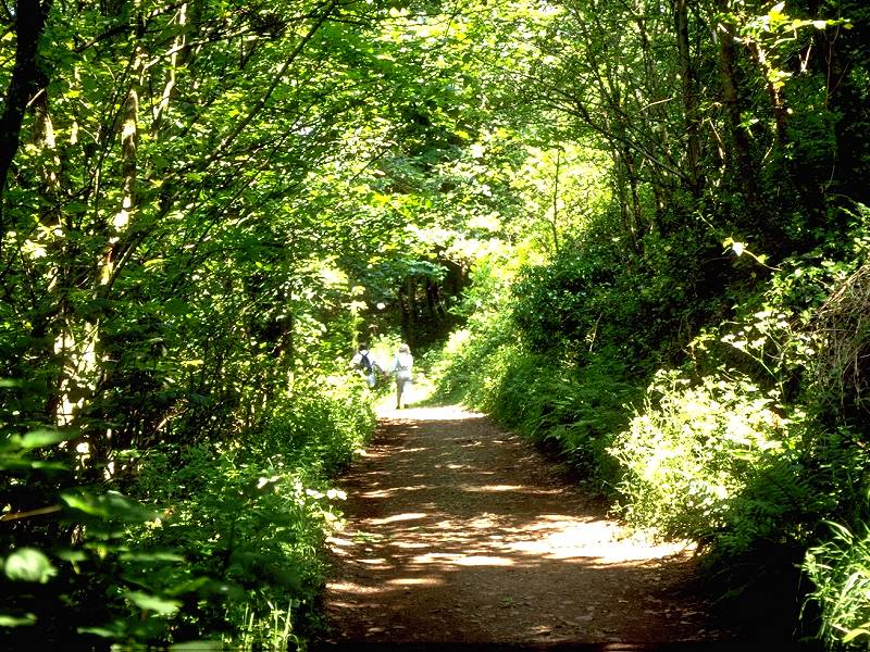
Views of Minehead (east, including Dunster, and south) from North Hill
Minehead has a bit of a national reputation as a typically downmarket seaside resort but that reputation is undeserved. It is a lively and fairly handsome little town, largely Victorian, that just happens to have a coastline as a bonus. The former Butlins holiday camp, one of a chain that brought seaside holidays to the masses in the post-war years, is nowadays known as Somerset World and is detached from the town proper to the east. Here, on the western side of town, the residential streets sprawl up the slopes of North Hill to form an exotic and wealthy mini-district of large villas hidden within riots of vegetation. One of the most prominent of these villas is the Beaconwood Hotel, where I've stayed on both of my visits to the town.


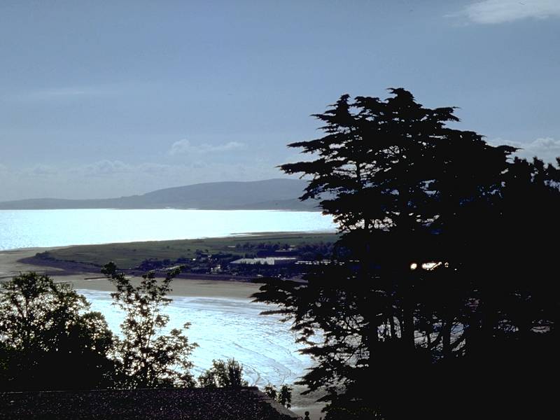
Dunster and Minehead Bay from North Hill
A feature of the Beaconwood is the first-floor balconies that give amazing views across Minehead towards Dunster, and out to the Bristol Channel. From North Hill, Minehead looks quite exotic and its sheltered position on the west coast allows some Mediterranean plants such as palm trees to flourish here.


Minehead from North Hill; The end of the Coast Path; descent to the seafront
The coast path emerges at the end of a surfaced residential road high on North Hill, and from here the official route descends down a zigzag path through a stand of trees to reach the beach just west of the town centre. A road sign here tells you that Poole, the other end of the South West Way, is 500 miles distant; the official figure given in the guidebooks is 594 miles and is rather more plausible.


You've arrived, then, at Minehead - end of the South West Way (aka the South West peninsula Coastal Path) and also the terminus of the Devon Coast-to-Coast. Walk eastwards along the short coastal strip to the head of the main street, about 300 meters to the east. The terminus of Britain's longest stretch of preserved steam railway is adjacent, and beyond it is Somerset World and a local coast path to Dunster. Minehead's major claim to fame is that it is the birthplace of the celebrated science fiction writer Arthur C Clarke.


The West Somerset Railway
The trains don't go anywhere really useful; the line runs three-quarters of the way to Taunton but the line only really comes into its own as a transport link on summer Sundays and bank holidays, when the rail services are more frequent and more conveniently timed than the buses. The bus terminus lays at the other end of the main street, the picking-up point for the Taunton run being in a side-street to the left.
![]() Service
28, Minehead - Dunster - Bicknoller -
Taunton
(Mon-Sat) (Summer 2002 timetable)
Service
28, Minehead - Dunster - Bicknoller -
Taunton
(Mon-Sat) (Summer 2002 timetable)
| Exford to Porlock | Back to Devon Coast-to-Coast index | Minehead to Dunster |
This page last updated 11th September 2004
![]()