A sketchmap will appear here shortly
| Melrose to Galashiels | Back to South of Scotland Way index | Innerleithen to Peebles |
| Melrose to Galashiels | Back to South of Scotland Way index | Innerleithen to Peebles |
It's a long, lonely descent from Minchmoor to the road at Traquair, three miles further on. Here we leave the Southern Upland Way to resume Hamish Brown's route, which takes us into Innerleithen (and subsequently to Peebles, West Linton and across the Pentlands to West Lothian). I've taken a diversion here through the grounds of Traquair House, a minor stately home open to the public. After a sixteen mile walk you'll probably not have the time or energy for a decent look at the house and grounds, but they might make a useful diversion for the following morning.
Galashiels is pretty much the public transport hub of the Borders
region,
with regular services to Melrose, Edinburgh, Jedburgh, Kelso, Peebles
and
Selkirk as well as long distance coach links to Carlisle, Berwick on
Tweed
and Newcastle. If you're not actually staying at Galashiels to tackle
this
walk then either Melrose, Peebles or Edinburgh would make an excellent
base. If you wish to break the journey into two shorter halves then be
aware that the Tweed crossing at Yair Bridge carries no public
transport
and it's a nasty experience walking along a main road with no footway.
Three Brethren Cairn would be a much better choice, as a track south of
this summit reaches Selkirk, via Corby Linn, in just three miles.
|
|
|
| Length: | 14.9 miles / 24 km |
| Total ascent: | 2725 ft / 831 m |
| Total descent: | 2659 ft / 810 m |
| Estimated time: | 5 hrs 42 mins |
Maps: OS 1:25000 Explorers 337 (Peebles & Innerleithen) and 338 (Galashiels, Selkirk & Melrose)
Click
on
any thumbnail image in this gallery to display the corresponding full
size
image. The images are access protected through a cgi script to prevent
hotlinking. If you encounter problems while trying to view the full
size
images, please read the access advice
page.
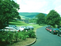
Gala Park
As you discovered yesterday, the Southern Uplands Way plays a curious cat-and-mouse game in the vicinity of Galashiels, approaching the town twice - first from the east, then from the south - without actually getting there. It's nearest approach is from the south where it descends towards the town centre through at network of suburban roads before diving off to the west through Gala Park, and that's where we ended yesterday's section. Walk back up from the town centre, therefore, to the same spot and turn right into the park.
The Southern Uplands Way in Gala Park
Gala Park is extensive and appears to encompass the grounds of two (or possibly three) schools along with an area of open woodland attached to Gala House. The route of the SUW is reasonably well waymarked but is very complex, so keep your eyes open for waymarks (there's always one missing at critical points where one can go astray, I find), and refer to the map often. The general route runs initially northwestwards keeping close to the edge of the park, then turns left (southwest) just short of one of the schools to run through a mixture of parkland and woodland. Watch out for a confusing corner near a small pond.
Woodlands adjacent to Gala House
It appears that when I did this walk in the summer of 1999 there was a temporary diversion in place that further complicated the line of the route. The above advice is repeated - watch the waymarks. The route appears to change direction several times within the woodland area. The following section, where it comes out onto the edge of open country, is equally confusing and seems to make use of paths and tracks which the map doesn't show. You should be walking generally southwards now, approaching the edge of Gala Hill on a tangent, and shortly after crossing Stannis Burn your route turns half right and runs southwest up a spur of open pasture with the aforementioned Stannis Burn a couple of hundred meters to your right.
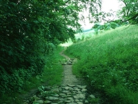
Edge of woods on Gala Hill
The SUW now traverses a large area of hill country, lying southwest of Galashiels within a meander of the Tweed and the northern loops of Gala Water and Caddon Water. Curiously this lump of hill country is nameless, though it does rise to the two distinct summits of Meigle Hill (alt 423 metres and bristling with communications masts) and a nameless top of 301 metres. The meagre watercourse of Stannis Burn descends the trough between these two heights and the SUW accompanies it some 200-300 metres to its left..
The Southern Upland Way adjacent to Stannis Burn
The route traverses a landscape of open pastures, copses of trees and stone walls to a col at about 280m a mile and a half out of Galashiels, pretty much in a straight line.
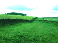
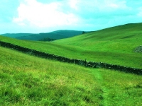
Southern Upland Way on Hog Hill
The landscape of pastures and walls continues on the far side of the col, as the SUW descends across a slope named on the map as Hog Hill.
The Southern Uplands
The scenery hereabouts is lonely and will call to mind the landscapes of the Pennines and the Cheviots once more, though the Southern Uplands are a good deal more extensive than either. There's probably thirty miles of hill country in any given direction in a vast arc from the south round to the east, and only in the direction we've come from - plus of course the narrowing ribbon of the Tweed valley to the west - is there a predominance of pastoral country. The SUW continues along a southwest trend between two large copses of trees, then approaches another ribbon of woodland where it kinks half left to drop to Farnilee farm and the Tweed.
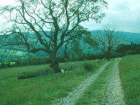
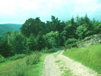
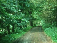
Passing through woodland at Farnilee
Once out of the woodland described above, the path heads just west of south, and smartly downhill to enter an area of woodland. The path turns half right and emerges from the side of the wood some 250m further on, just above the farm itself. It's a simple matter of following the path down to the B7060 road on the north bank of the Tweed.
Southern Upland Way at Farnilee
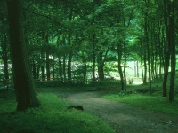
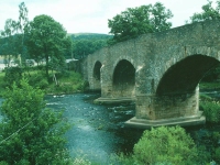
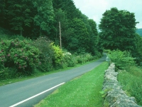
Go very slightly along the road to the left, then turn right to cross the Tweed via Yair Bridge, a handsome stone structure about which I can find no historical details. Turn right again and walk along the tarmac road for about 550 metres. Just before you reach Yair House (which is strictly private), you should spot a SUW marker pointing into the forest plantation to your left. Dive into the trees and start climbing.
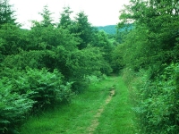
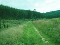
The Southern Uplands Way in Howlands Plantation
The forest plantation you've now entered is pretty extensive but this part of it is named as Howlands Plantation on the map. This section has certain similarities to the ascent out of Galashiels three miles back; you're climbing a valley to the southwest once more, that of Shorthope Burn on this occasion. The burn is to your left and little of it is likely to be seen. Pretty soon after leaving the Yair road you reach the northwestern edge of the plantation and have an open area to your right. After a further 600 meters the path swings half left and dives back into the forest, still generally following the line of Shorthope Burn.
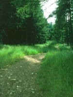
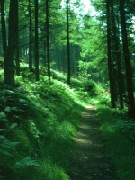
The forest path at Red Score Nick
Five hundred meters further on the path doglegs left, then right, traversing a narrower and steeper path through the forest and then crossing a ride on the diagonal. You're now following a feature named on the map as Red Score Nick, a col between the hilltops of Three Brethren and Peat Law. The path now descends to the locality of Little Crib.
Little Crib; the Selkirk track
The path emerges from the edge of the forest at Little Crib and ahead of you is a sea of drab heather moorland. The track turns half right, then half right again, following the edge of the trees and climbing once moor. You are converging with a track coming up from the valley of Corby Linn behind you; this track will get you to the nearby town of Selkirk in little over an hour and is the best bet for dividing this walk into two short sections should you wish to do so.
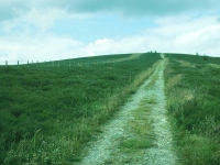
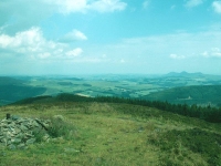
The track ascends resolutely in a north-northwesterly direction, making a beeline for the approaching trio of "stone men" (tall cairns) at the 464-metre summit of Three Brethren. The trees fall away to the right and you are now crossing open moorland. The cairns are reached without undue effort and you can now declare a lunch stop. Several forest tracks popular with both hikers and cyclists converge at this spot, so you are unlikely to be alone. The three cairns are thought to signify the mutual boundaries of three parishes.
The adjacent trees shut in the view to the north, but in most other directions it's pretty extensive. Selkirk is well in view, and following the line of the Ettrick and Tweed valleys along to the left you will not fail to spot the distinctive shape of the Eildons once more. A little more daunting is the view to the west, and the line of the Minchmoor ridge along which the Southern Upland Way disappears into the far distance.
Once you've had your lunch, taken your photos and swapped gossip and anecdotes with your fellow Three Brethrenites, it's time to move on. Shoulder your pack once more and take the path to the west, heading initially for a minor top about 900 meters away and then for the next summit, that of Broomy Law.
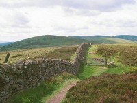
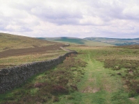
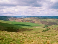
Broomy Law; Southern Uplands Way at Broomy Law; northwest view
You will probably feel daunted by the long, switchback path ahead, which may well bring back memories of those tiring up-and-down sections of the Cheviots, the Pennines, or even the Cotswolds or the Cornish coast path. Fear not, it looks worse than it is. From Three Brethren the trees accompany you to your right as you drop to a col then ascend to the minor summit already mentioned above, then you drop to another col beyond and the trees give out, leaving you on an open moorland ridgetop. This isn't a place to be in rough weather but on a fine, settled day it's heaven and the views are glorious. The SUW follows a stone wall and ascends from the col to cross the shoulder of the next top along the ridge, that of Broomy Law, but it doesn't actually visit the summit. The path then turns slightly right, to head more northwest than west, as it rounds the top of a shapely valley called Wolf Glen that falls to your right. You continue to follow the wall, which now crosses the southern shoulder of a nameless top of 452 metres and then descends to the locality of Four Lords Lands.
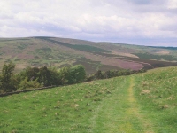
Approaching Four Lords Lands
Four Lords Lands is a pretty little place, a sheltered col graced by a stand of trees and an excellent refreshment stop if you didn't already partake of lunch back at Three Brethren. Nameless valleys fall to the left and right, the one to the left carrying a vehicle track down to Yarrowford. The name would suggest that this spot was once the meeting point of four estates.
From Four Lords Lands the SUW continues westwards once more, rising quite steeply from the col at first, to resume the ridge to the minor top of Lucken Head and then Brown Knowe.
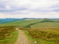
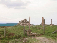
The 523-metre summit of Brown Knowe is the highest ground actually on the route of this section of the SUW (Minchnoor itself being off-route) and lies about 1km west of Four Lords Lands. There's a substantial cairn at the spot. The views in most directions are excellent, particularly to the east where the Eildons are unmistakable, though to the west the dark dome of Minchmoor and its carpet of forest plantations shuts out the distant panorama. Continue westwards towards Hare Law and the edge of the forest.
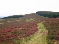
Meeting Minchmoor Road at the edge of the forest
As you climb to the top of Hare Law and approach the mouth of the wide forest ride ahead, a track converges from the left. This is Minchmoor Road, an ancient drove road, which the SUW now adopts for the next few miles. You enter the forest itself and trees now block out the view to the left and right, but initially the path runs through a wide gap in the trees; this gap gradually narrows. The path just misses the summit of Hare Law (510 metres), which lies within the trees to your right.
Rear view from Hare Law; initial forest section; Minchmoor Road
There now follows two kilometres of forest walking, during which time the wide ride narrows and pinches the track between dense stands of pines. This is rather a gloomy place. The path meanders somewhat (which does at least add some variety to the view) and falls to a shallow col before rising up the spur of land known as Little Minch Moor.
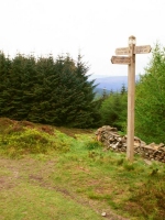
Minch Moor waymark
Two kilometres west of Hare Law you reach a point at which the trees clear to your left to reveal a dome of moorland rising to the south. The path is ascending its shoulder and, as you reach the highest point, you encounter a fingerpost. It tells you that Minchmoor lies five hundred meters to your left. It's off-route, but since there's nothing higher than this between here and John O'Groats and it will take you all of six minutes to reach it, you may as well make the effort. For list tickers, Minchmoor is a "Marylin" (hill with a relative height of 500ft or more), of which there are in excess of 1,500 in Britain.
The summit of Minch Moor; Minchmoor Road
The top of Minchmoor is a bleak, windswept place decorated by an Ordnance Survey trig pillar and a tall cairn or "stone man". Minchmoor is a broad top and there are no immediate views, just distant panoramas. The view between the southwest and west is particularly fine. You're looking towards the central massif of the Southern Uplands and there is just mile after mile after mile of the same scenery; broad sprawls of moorland summits just like the one you're on, sometimes carpeted with forest plantations, sometimes bare.
Return to the path junction and continue westwards. After a while you're back in the trees again and there's just over 1500m of forest walking to Dumbetha Knowe.
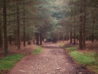
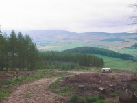
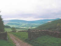
Forest path; track descending to Traquair
The line of the route westwards from Minchmoor is never in any doubt, but the detail of the terrain in these parts has an annoying habit of refusing to correspond with anything on the map. There shouldn't be an open area of moorland here - the map shows that it's forested. I can't make out that hill over there on the map. That stream should have been a mile back, where's this bend come from, and this steep descent down a spur of rough pasture beside a fence just doesn't figure at all. Where the hell am I?
We British walkers hold the cartographic skills of the Ordnance Survey and its staff in an almost religious regard - maps are generally so detailed and so perfect that, if any obvious difference between map and actual terrain should be encountered, there is a real tendency to believe that the terrain - and not the map - is at fault. The map is obviously out of date here but don't worry about it. You haven't got lost, you're on Minchmoor Road, you're heading for Traquair, and there will be another reprint of the map along in a few years.
Eventually, some 2km west of Minchmoor, you reach a locality shown as Dumbetha Knowe on the map. This is the nominal edge of the forest and the real end of the ridge; below you is the valley of the Quair Water, with the wider trench of the Tweed over to your right. Instead of moors and forests you see farms and pastures and villages ahead. The path descends along a series of rough vehicle tracks. It does seem to take rather longer than the maps suggests it should, but don't worry about knowing exactly where you are. You're going the right way, and if you're really fussed then a GPS receiver should be able to sort out the problem. Before long you're rewarded with a view of Innerleithen over to the right, with the shapely cone of Lee Pen rising behind it. That's tomorrow's first ascent.
The final mile into Traquair
The track settles down, heads pretty much due northwest, becomes a lane, and deposits you without fuss at the road junction and tiny village that comprises the locality of Traquair.
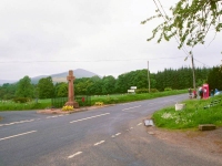
Traquair
There's little at Traquair itself. The B709 to the left heads for the valley of Yarrow Water and to the right it will take you to Innerleithen in two miles. We leave the route of the Southern Upland Way at this point; it follows the road to the southwest for a couple of miles before ascending into the hills once more. But not far ahead is Traquair House, and a slight diversion avoids some of the roadwalk into Innerleithen and takes us instead through the grounds.
The private road through the grounds of Traquair House
Traquair House is an interesting little pile. It has the status of a minor stately home - some would describe it as a castle - and is partly open to the public. It is large and rambling and gaunt and looks very old indeed - in fact it is reckoned to be the oldest continuously inhabited house in Scotland, possibly dating from as far back as 1100 with parts of the present building having been constructed in 1492. It's likely to be too late to look around the house or to explore any of the estate's other activities; do this instead on a "day off" or come back tomorrow morning and walk the Innerleithen-Peebles section in the afternoon.
![]() Traquair
House website
Traquair
House website
| Melrose to Galashiels | Back to South of Scotland Way index | Innerleithen to Peebles |
This page last updated 17th March 2006
![]()