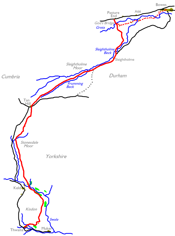
| Hawes to Thwaite | Back to Pennine Way index | Pasture End to Middleton-in-Teesdale |
|
|
|
| Length: | 13.1 miles / 21.1 km |
| Total ascent: | 1877 ft / 572 m |
| Total descent: | 1686 ft / 514 m |
| Estimated time: | 4 hrs 45 mins |
![]() Arriva
North East service 30: Keld - Thwaite - Reeth - Richmond
Arriva
North East service 30: Keld - Thwaite - Reeth - Richmond
![]() service
55
connections from Richmond to Northallerton railway
station
service
55
connections from Richmond to Northallerton railway
station
![]() service
X27,
connections from Richmond to Darlington railway station
service
X27,
connections from Richmond to Darlington railway station
![]() service
159,
connections from Richmond to Leyburn (for
Wensleydale
/ Hawes)
service
159,
connections from Richmond to Leyburn (for
Wensleydale
/ Hawes)
![]() service
79,
connections from Richmond to Barnard Castle (for
Teesdale)
service
79,
connections from Richmond to Barnard Castle (for
Teesdale)
| Hawes to Thwaite | Back to Pennine Way index | Pasture End to Middleton-in-Teesdale |
This page last updated 29th December 2004
![]()