
| Castleton to Edale | Back to Pennine Way index | Snake Pass to Longendale |
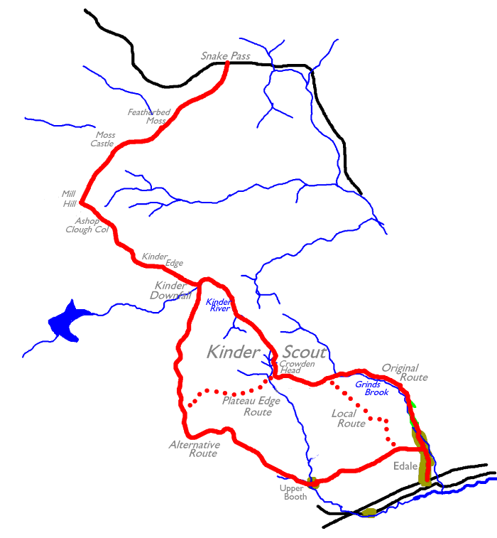
This first section, like the three that follow, takes you over some of the toughest terrain in Britain – peat moorland. Kinder Scout, the upland plateau crossed by this first section of the Pennine Way, is a large area of blanket bog. The plateau is virtually flat, which means that rainwater has nowhere to run; the soil, naked peat, soaks up this water like a giant sponge and retains it for weeks. Much of Kinder is permanently saturated. It’s quite usual for walkers on this plateau to find themselves sinking into black mud up to their knees, or even worse. There have been occasions on which unwary or inexperienced walkers have sunk up to their waists, or even their chests, and become trapped. Although nobody has actually drowned in this fashion it’s entirely possible to succumb to exposure as a consequence. Fatalites have occurred.
It’s easy, however, to paint too black a picture of Kinder Scout. Crossing it safely is simply a matter of common sense. If you’re used to the terrain you’ll know exactly what to expect. If you’ve never encountered peat moorland before, then avoid crossing it in bad weather. If you must attempt the crossing during or after rain, don’t go alone – or better still, stick to the “bad weather route” along the edge of the plateau. In fine, settled weather the moorland crossing is an enjoyable adventure.
The standard Pennine Way guidebooks would have you crossing both Kinder Scout and Bleaklow, the next moorland area to the north, on the same day. It’s up to you – if you need to get to Crowden youth hostel, if you’re an experienced and fit hiker, if you’re pushed for time and have to get the miles in, then by all means walk them both. This narrative assumes otherwise – that, for instance, you’ve spent half the morning just travelling to Edale, that you’ve spent the greater part of the year sitting at a desk or a bench or the wheel of a car and are not particularly fit, and that you’re not used to the rigours of moorland walking. In any of these circumstances it’s better to fix Snake Pass as the end of the day’s walk and Glossop as your eventual destination. Eight and a half miles is plenty on your first day.
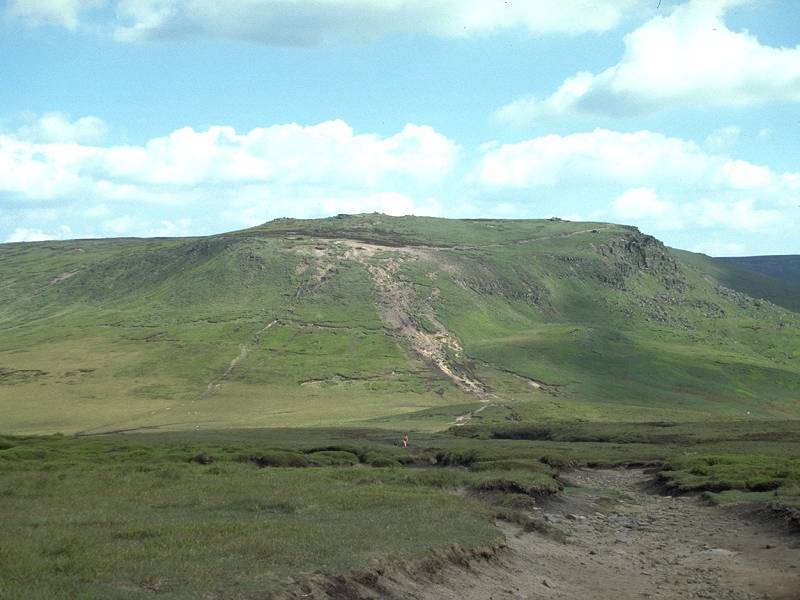
The walk from Edale to Snake Pass divides down more or less into three subsections, of which the crossing of Kinder is the central part. From the start at Edale you first have to ascend to the plateau. There were originally two routes; the “official” route by way of Grindsbrook Clough, and the “alternative” bad-weather route via Upper Booth. The latter alternative is now the “official” route, although purists will wish to stick to Grindsbrook. It’s the way I went and the way I’d recommend; Grindsbrook is fine ravine scenery. Eagle-eyed map readers will spot a third alternative, a local footpath ascending the spur of land between the two aforementioned valley routes. This path, up Grindslow Knoll, might well find favour if you wish to avoid the crowds or simply wish to be different.
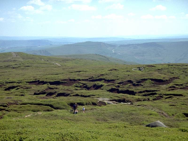
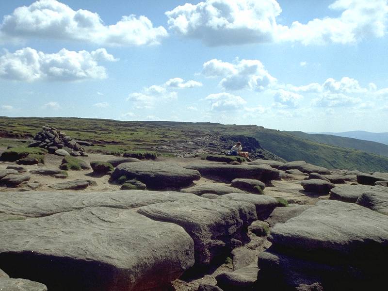
Having reached the plateau proper, you now have the choice of crossing it (if you ascended via Grindsbrook Clough or Grindslow Knoll), or taking the “bad weather” path around the edge (mandatory if you ascended via Upper Booth, optional otherwise). As I’ve already mentioned, Kinder is a great place to be on a fine, dry day. Many people expect moors to be featureless. Kinder is anything but. It’s a riot of vegetation, for one thing. There is mat grass and heather, ling, gorse, bilberry and a gamut of other wild shrubs, not to mention the host of alpines and bog flowers that thrive here. Topologically, too, it’s anything but dull. Although the plateau is flat overall, locally it’s a maze of knolls, hillocks, hummocks and sinewy watercourses known as peat groughs. These can be a real sod to cross – typically, a crossing involves a muddy descent of anything between six and twenty feet to reach the floor, followed by an even steeper, wetter and muddier climb out. Don’t expect to stay clean except under drought conditions. If crossing these things is difficult, walking along them can be a joy – the bigger and deeper ones tend to have cut right through the peat to reach firm, silty beds that make first class paths.
The direct and bad-weather routes converge at Kinder Downfall, four miles out of Edale. The path then follows the edge of the moor for another mile before descending steeply to the Ashop Clough col. From the col the path enters the third and final sub-stage of today’s walk, along the lonely and drab moraine ridge of Mill Hill and Featherbed Moss. There is little to be said about this two and a half mile stretch – it is featureless and it is sloppy. The main Snake Pass (A57) road is visible throughout. Once you reach the tarmac turn left and walk down to Glossop, 4½ miles to the west, or await the Glossop - Castleton bus (link to timetable below),
Glossop has rail connections for
Manchester
(travel time about 45 mins), and buses to New Mills (for rail
connections
to Sheffield and beyond).
|
|
|
| Length: | 8.25 miles / 13.3 km |
| Total ascent: | 1681 ft / 512 m |
| Total descent: | 828 ft / 252 m |
| Estimated time: | 4 hrs 10 mins |
Click on
any thumbnail image in this gallery to display the corresponding full
size
image. The images are access protected through a cgi script to prevent
hotlinking. If you encounter problems while trying to view the full
size
images, please read the access advice
page.
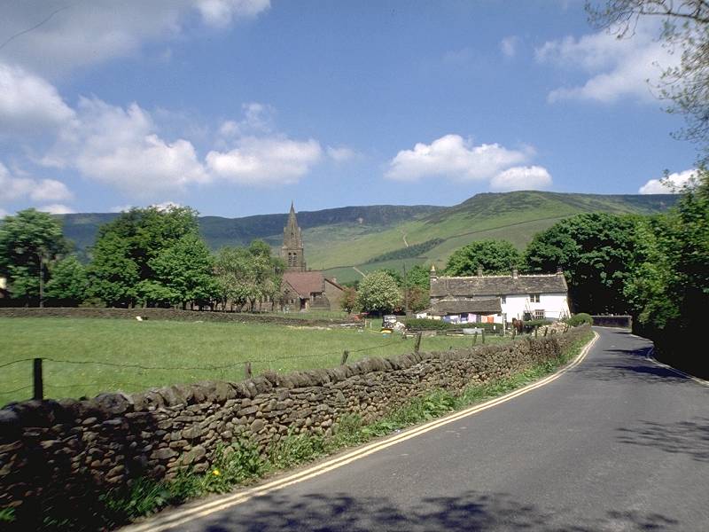
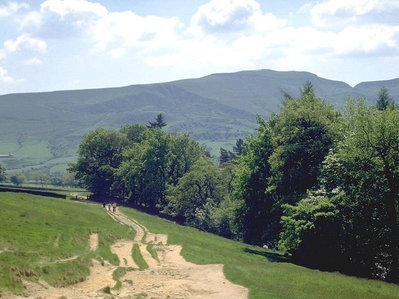
Edale, the village at the start of the Pennine Way, is not exactly out in the sticks; it's on the main railway line between Sheffield and Manchester and is about 45 minutes’ journey from each. InterCity connections bring it within a morning’s travel for the majority of Britain’s population.
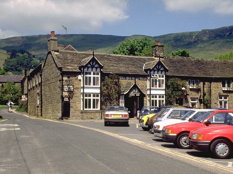
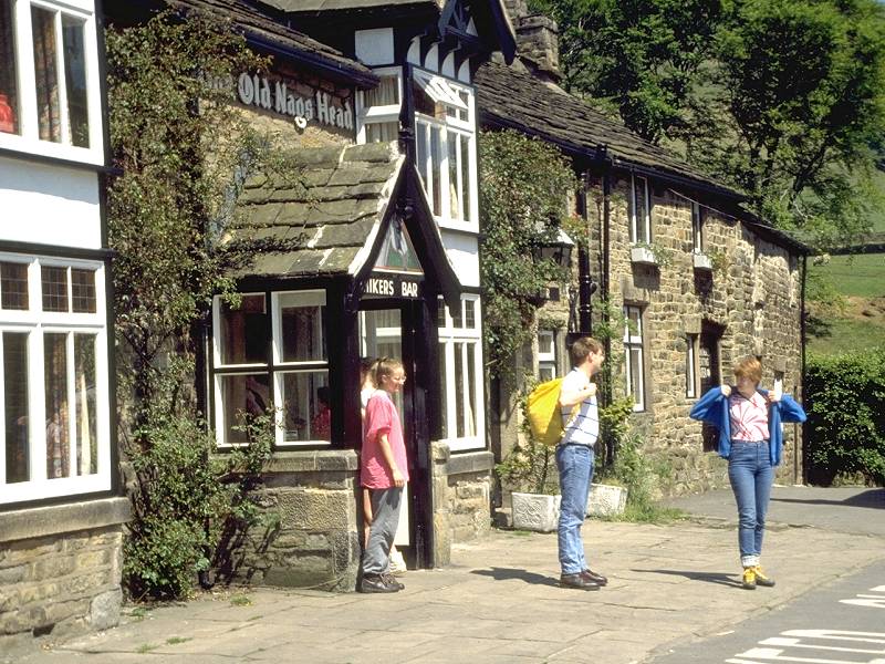
The official start of the Pennine Way is the Nag's Head Inn, shown above, in the centre of the village. Most hikers, however, will measure their progress from the railway station or from the youth hostel. Those walkers who have followed the White Peak Way and have walked in from Hollins Cross will emerge in Edale just opposite the church, about halfway between the station and the inn.
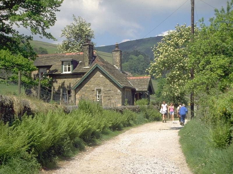
Edale is a charming and pleasant village but, despite its status as a jumping-off point for Britain's most celebrated outdoor challenge, it offers few facilities. When I first came here in 1975 every other house sold teas and refreshments from its lounge or front lawn. Nowdays there's only the inn and the post office. (A friend tells me that the food served at the Nag's Head is rather mediocre - anyone like to dispute, or confirm, this?)
The official Pennine Way route has been diverted away from the valley of Grinds Brook and now follows what used to be the "alternative" or "bad weather" route via Upper Booth and Kinder Low. The original route is still a right of way, however, and purists will want to use it in preference. It's the way I went in 1989 when these pictures were taken and hence the route this narrative will describe. If pushed, it's also the way I would recommend.
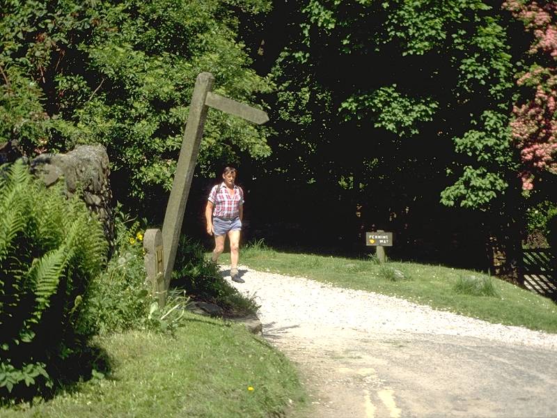
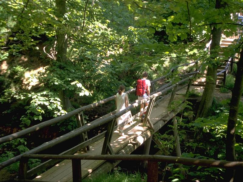
Walk northwards out of the village among pleasant cottages, with the stream splashing along to your right among trees. Just as the road appears to revert to a private driveway you'll spot a footpath sign pointing right. A short path runs between the driveway and the stream then descends to cross a smart wooden footbridge. Beyond this you're in open country.
The initial stretch; looking back at Edale and Mam Tor; the woodland section
the climb begins; Lower sections of the Grinds Brook ravine
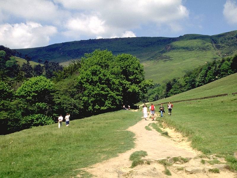
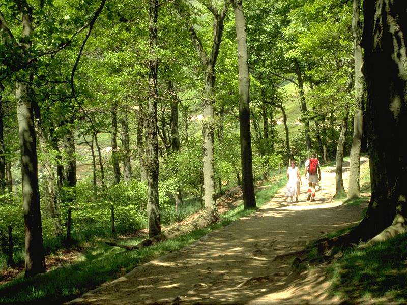
This is where the Pennine Way adventure begins, with the climb up to the Kinder plateau via the Grindsbrook ravine. The ascent ahead of you is one of the few on the Pennine Way that is actually taxing, and involves 1200ft of ascent over about two miles. The width of the path in the lower reaches of the ravine is an indication of the popularity of this route. Once you pass through a delightful patch of woodland the path narrows, begins to steepen, and veers round to the west as it disappears into the rocky fastnesses of the ravine.
Climbing into the Grindsbrook ravine
The path, which has started out on the east bank of the stream, crosses onto the west bank once the narrowest part of the ravine is reached. It gets steeper, and narrower. The scenery is wild and magnificent.
The upper ravine
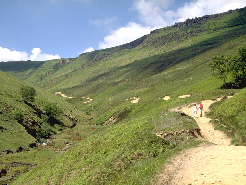
Eventually the path gives out altogether. You are left to clamber up a staircase of boulders, forming the bed of the stream in spate conditions. Normally the stream will not be a hazard; you will hear it, and perhaps glimpse it, flowing underneath the rocky staircase beneath your boots. Care needs to be taken here if the rock surface is wet. Make your way, slowly but surely, to the ravine head.
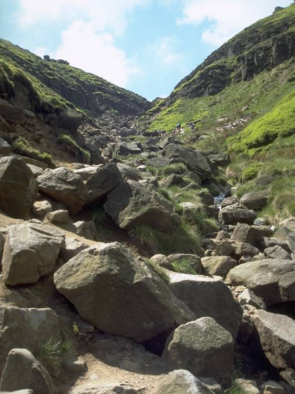
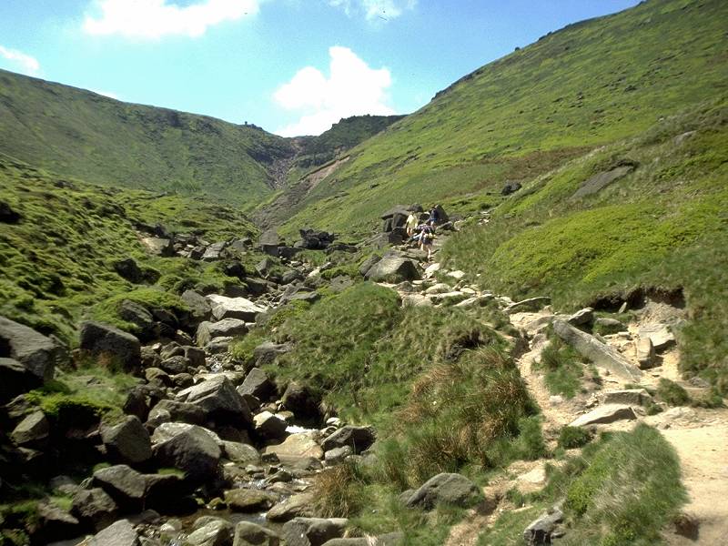
Scenes near the head of Grindsbrook
Grindsbrook Head
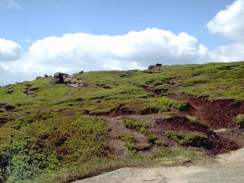
Beautiful, isn't it? The scene stretches for miles around you, a moorland plateau clad in heather and low-growing shrubs, a playground of hillocks and hummocks and dark, sinewy channels of peat. Beware. If you are unfamiliar with this terrain, proceed with great caution. Peat is waterlogged. It's the British equivalent of quicksand. Tread on the wrong bit and you're into black, gooey mire up to your knees, or worse. There's really only one way to learn which bits are safe to walk on and which bits must be avoided, and it's by experience. You soon learn to tell, mainly by the colour and nature of the vegetation or by the texture of the peat. Vomit-green vegetation should be avoided, and there's a particular shade of rich, velvety black peat that almost makes sucking noises as you approach. Remember, there's a 99% chance that you're going to get absolutely filthy crossing Kinder. There's also a 99.9% chance that you won't actually come to grief.
If you do get into trouble - which is extremely unlikely if you use common sense - the generally accepted form of escape is to lean forwards (shedding your pack if necessary) so as to use your knees and thighs as a lever. At the same time you spread your bodyweight over a greater area and so drastically cut down the chances of sinking in. Okay, so you'll be plastered in black goo, but at least you'll be free.
Anyway, you've chosen a day of fine, settled weather and clear views, and nothing like that is going to happen to you. Enjoy!
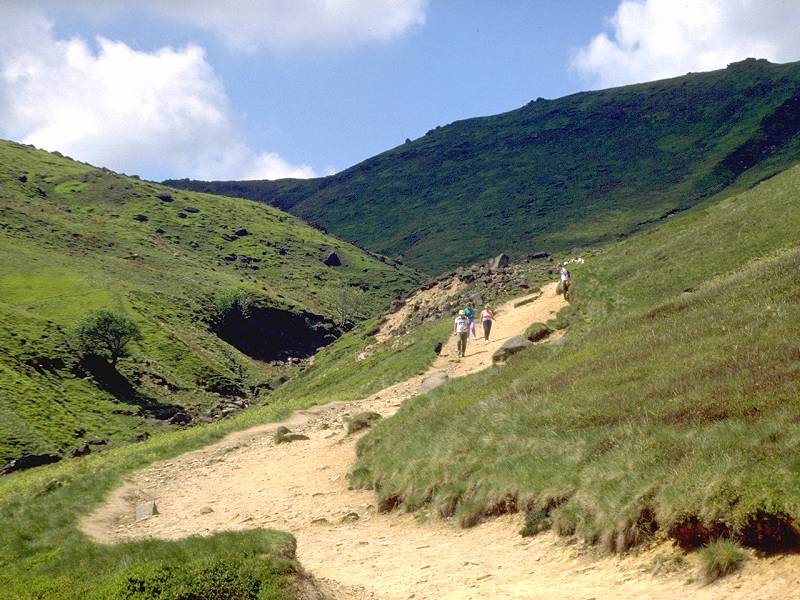
At the head of Grindsbrook several paths radiate away from you. The path heading sharp left is the local footpath coming up over Grindslow Knoll. The obvious, wide and solid paths heading left and right form the circular route around the edge of the moor. If the weather is bad, or if you don't fancy the direct moorland crossing, turn left (southwest) and take this path. The sketchier path heading west northwest, and climbing slightly, is the main path across the moor and the Pennine Way proper.
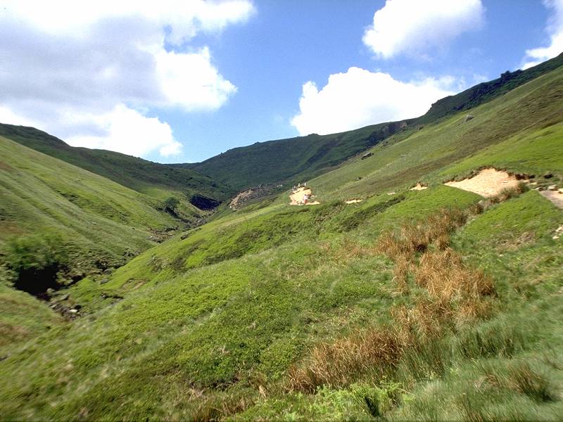
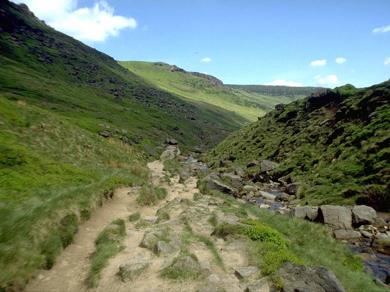
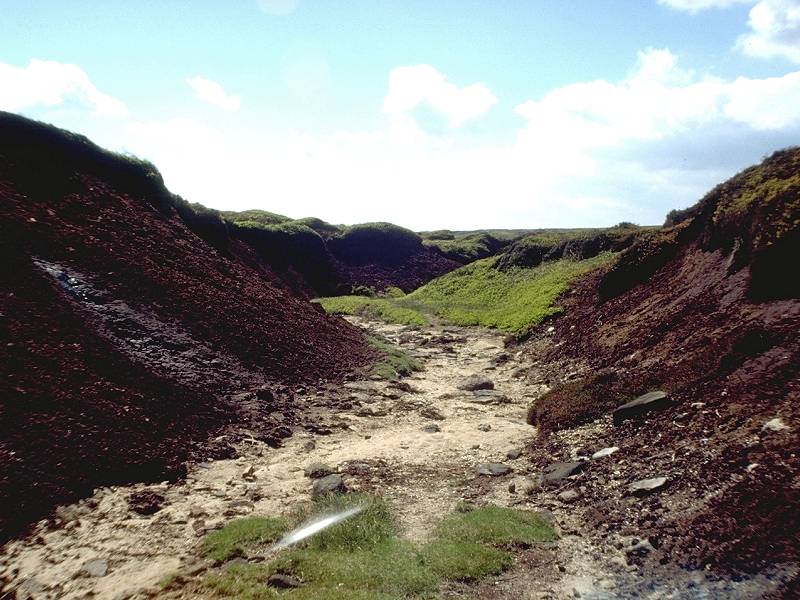
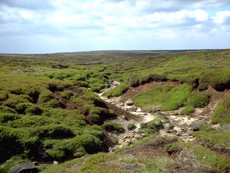
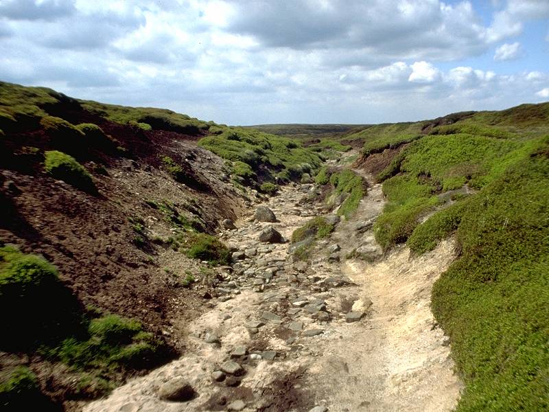
The path heads out across a playground of grassy and shrubby mounds, and the terrain is relatively firm. The route has a habit of breaking up into several parallel ribbons. It doesn't really matter which one you choose. You will, after about 600 yards, encounter the miniature ravine of Crowden Great Brook crossing diagonally ahead.
Follow it. It's heading just west of north. Initially it's about 6 to 8 feet deep but it gradually gets shallower and starts to break up into tributaries. You can choose to walk along its bed, which is firm and silty , or you can walk along its right (eastern) bank, which is preferable. You want to see where you're going, after all.
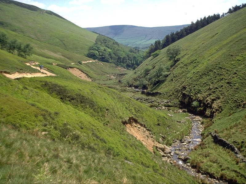
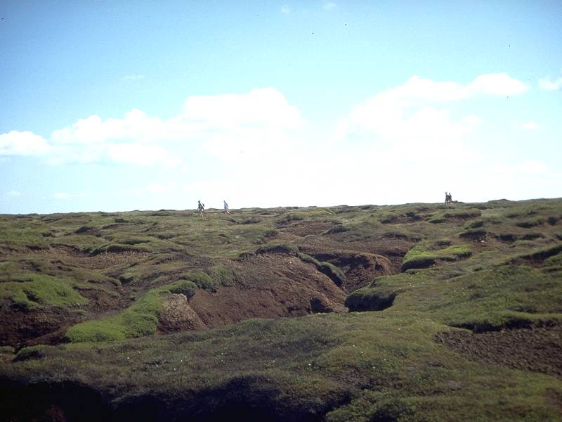
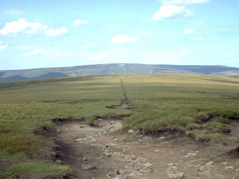
As Crowden Great Brook peters out you come at last to the central plateau. For some four hundred yards you're on wild, primeval, uncompromising moorland bog. This is the watershed between the drainage systems of the Trent (behind you) and the Mersey (ahead of you), and it appears to retain enough moisture to keep both rivers flowing in perpetuity. Look to the northwest and you should see, quite clearly, the line of rocks that is the plateau edge beyond Kinder downfall. Head for the eastern extremity of this feature. If the weather is anything other than foul you will almost certainly be following a ribbon of fellow hikers anyway, and probably passing those coming the other way. Stop and exchange a few pleasantries. Almost all the conversations out here consist of mud-splattered hikers telling each other that they must be mad to be doing this for fun.
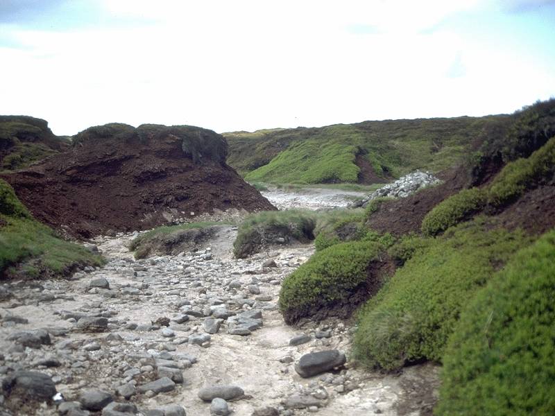
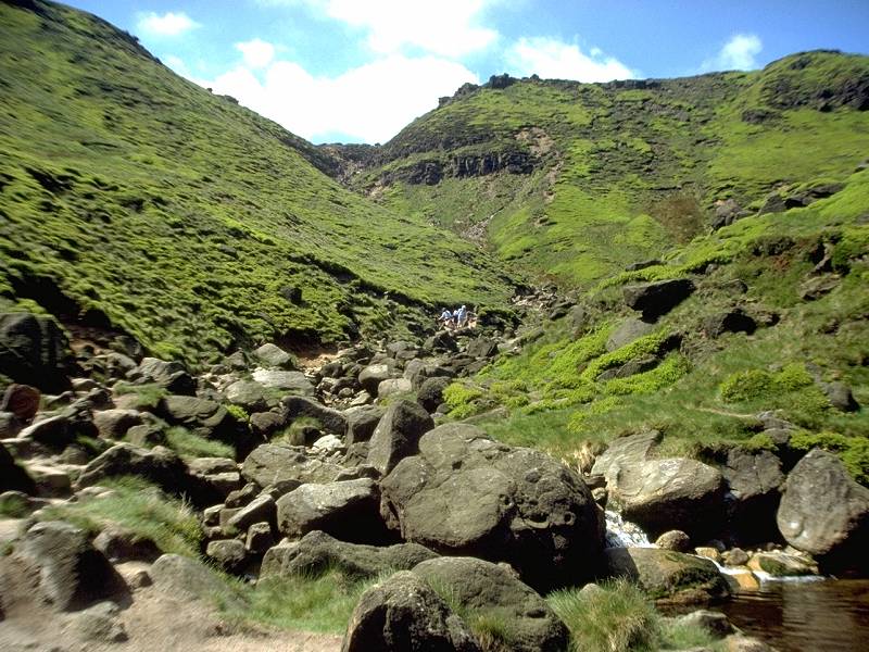
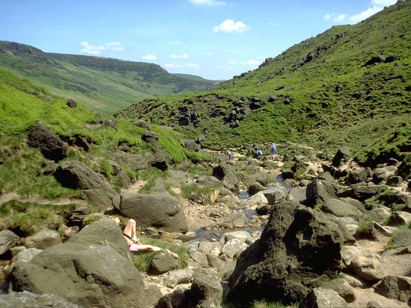
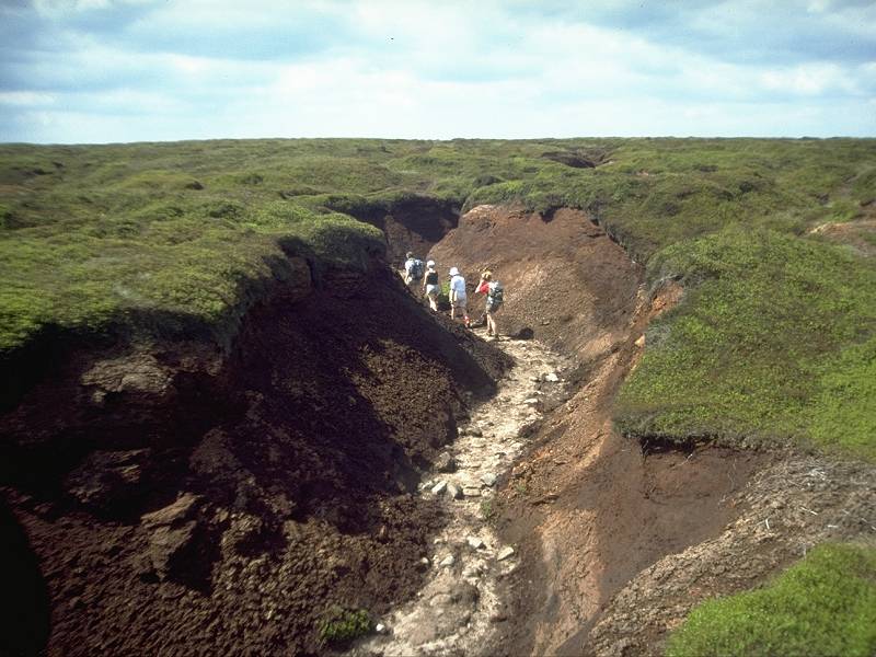
Walking along the silt bed of the River Kinder
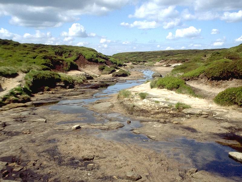
Just as you're starting to get a bit fed up with hopping across black, saturated channels of mud, a wider and deeper channel will appear at your feet. It will have a firm, sandy bed. You will jump down into it gratefully and follow it. It might be heading north, or it might be heading west. In either event you've found a feeder stream of the infant river Kinder.
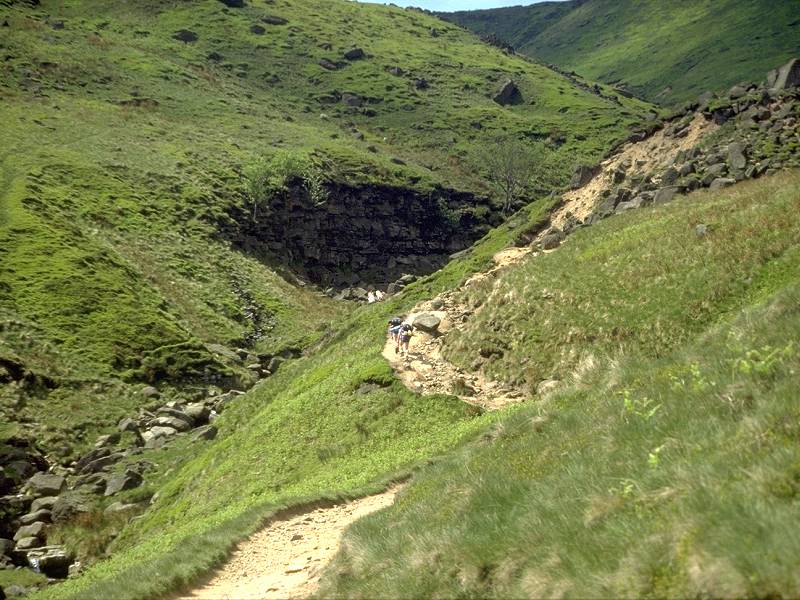
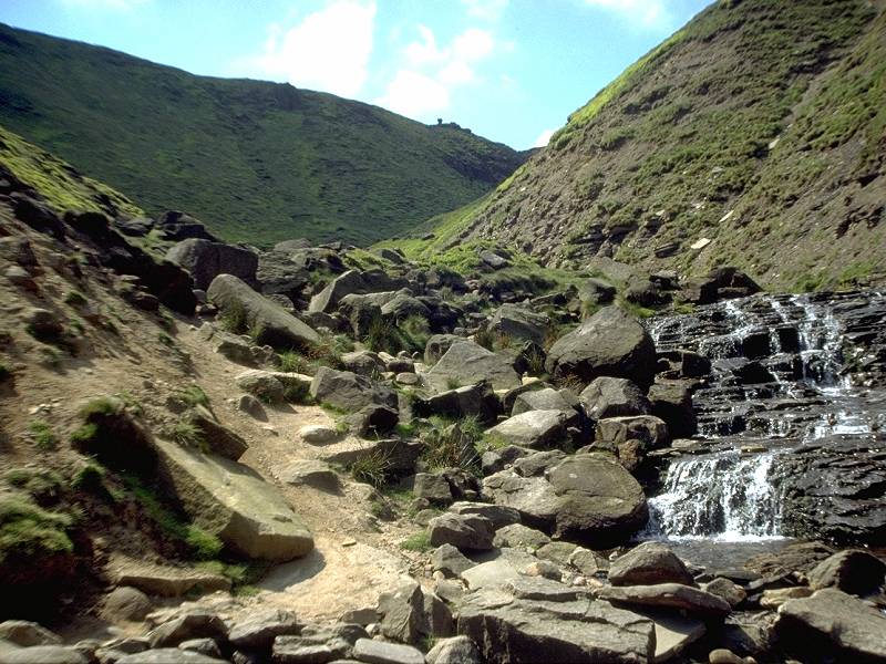
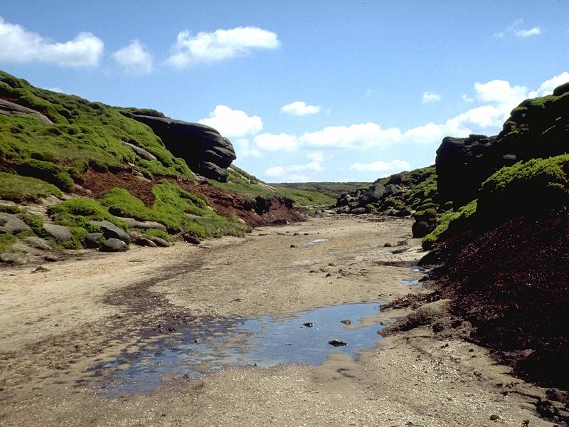
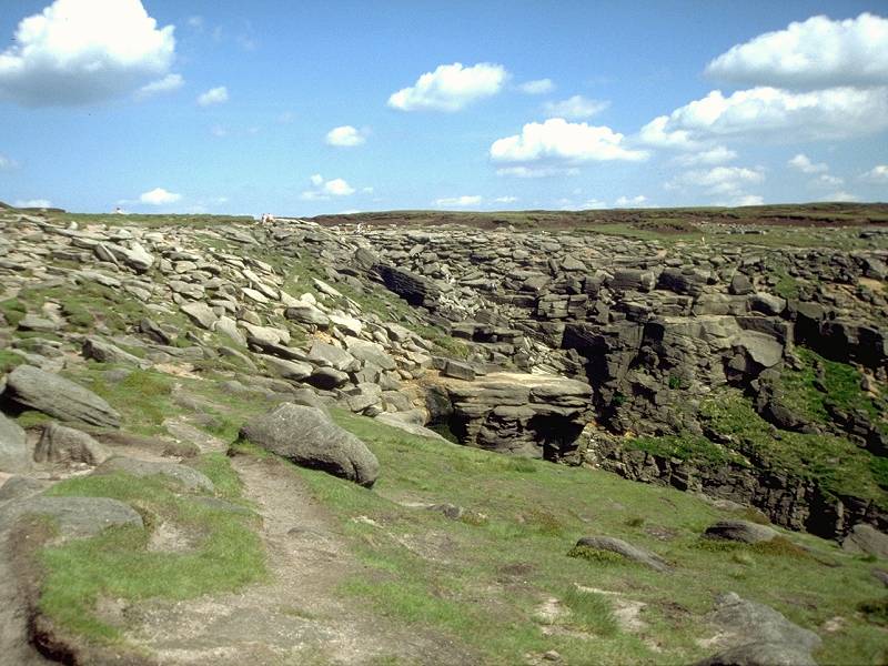
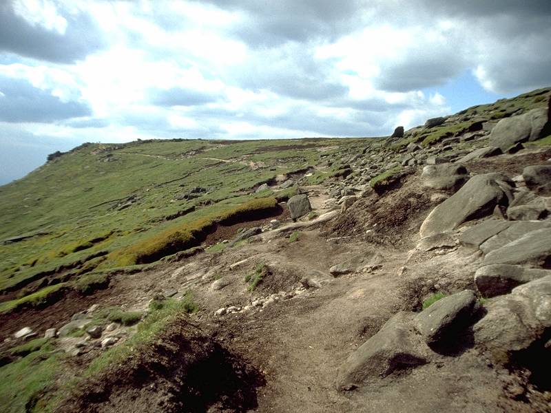
Walking along this maze of stream beds is an absolute delight. You can't get lost - the stream knows where it's going, and it's going towards Kinder downfall. You will hit several junctions, which may be enlivened by the emplacement of cairns (piles of stones), serving to remind you that you're going the right way. Eventually the walls of black peat give way to terraces of gritstone, glowing red-brown in the sun and wind-sculpted into fantastic shapes. You're at Kinder Gates. The streambed heads almost due west and shortly arrives at Kinder Downfall.
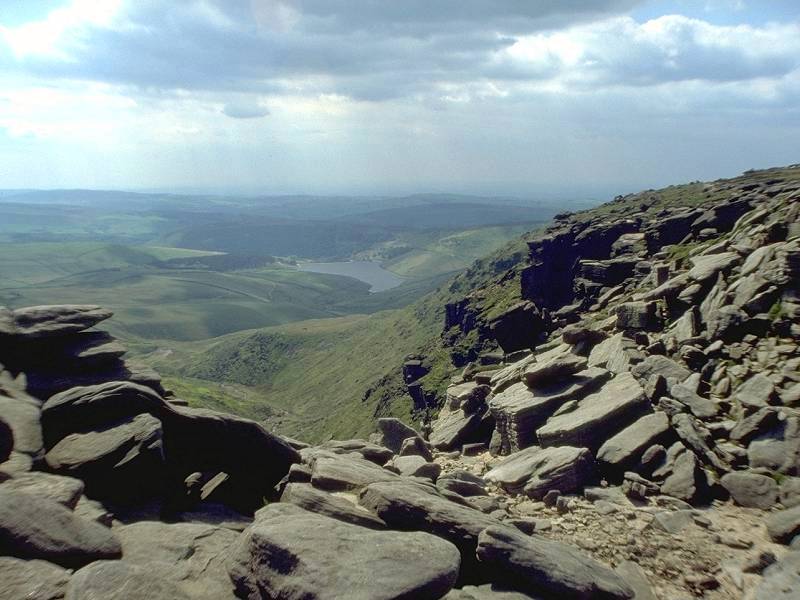
Kinder downfall; the plateau edge route converges; the downfall from the west
This is a rockstep over which the infant river Kinder tumbles on its way to the Mersey estuary at Liverpool. Under high winds – not an infrequent condition up here – the stream is whipped up into a spray that often ends up back on the plateau above. This place is very reluctant to let go of its water! The bad weather route reaches Kinder Downfall from the south.
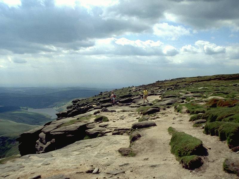
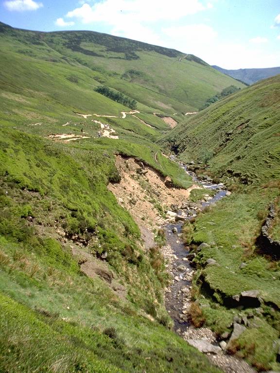
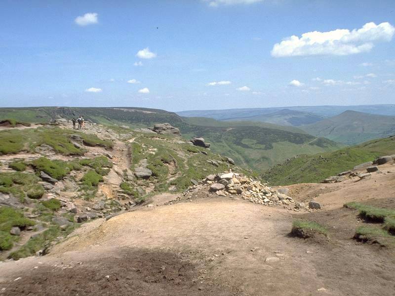
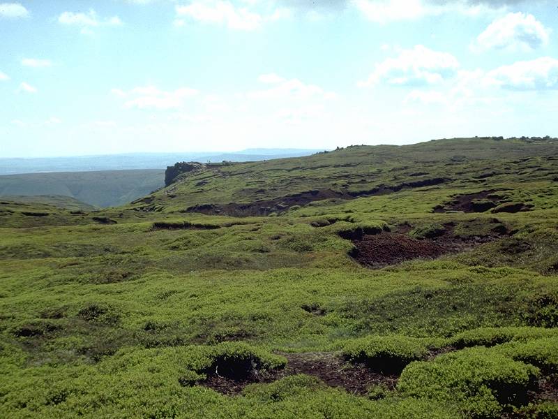
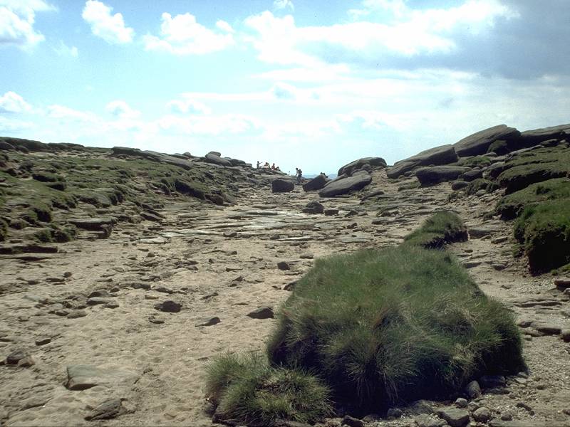
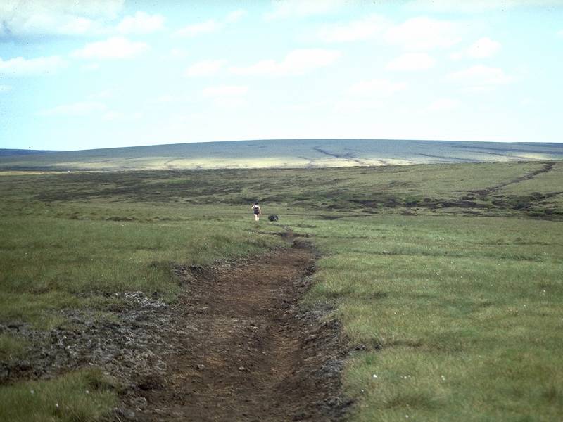
There's now a fair stretch of good, firm walking along the plateau edge towards the Ashop Clough col. Although the guidebooks insist that the gradient is level, your eyes and your feet both tell you that there is a perceptible ascent. The route overlooks the Kinder Reservoir a mile to the southwest. The path then heads out onto a little spur and drops abruptly and steeply off the plateau to reach the col above Ashop Clough.
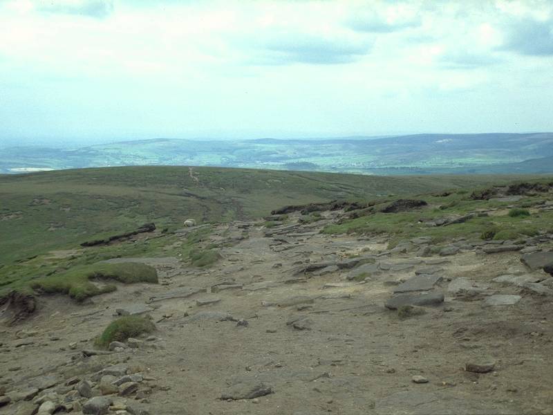
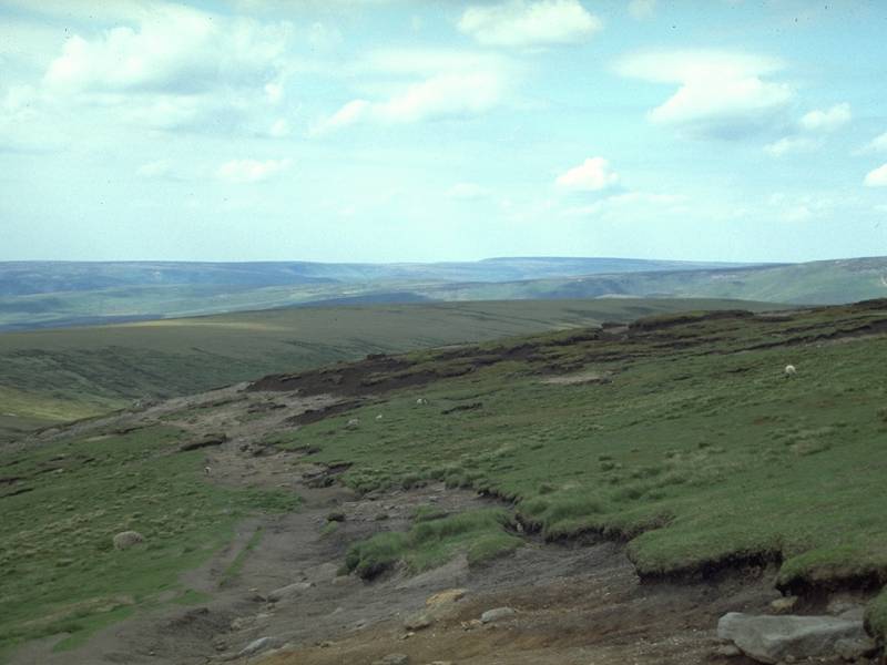
From the col you ascend to Mill Hill and turn right (northeast) to follow this drab, featureless and rather waterlogged ridge. This, unlike the gritstone plateau behind you, is composed of glacial moraine. "No mill," says Wainwright in his guidebook, "and not much hill". Mill Hill merges imperceptibly with Moss Castle ("much moss, no castle") and continues to Featherbed Moss.
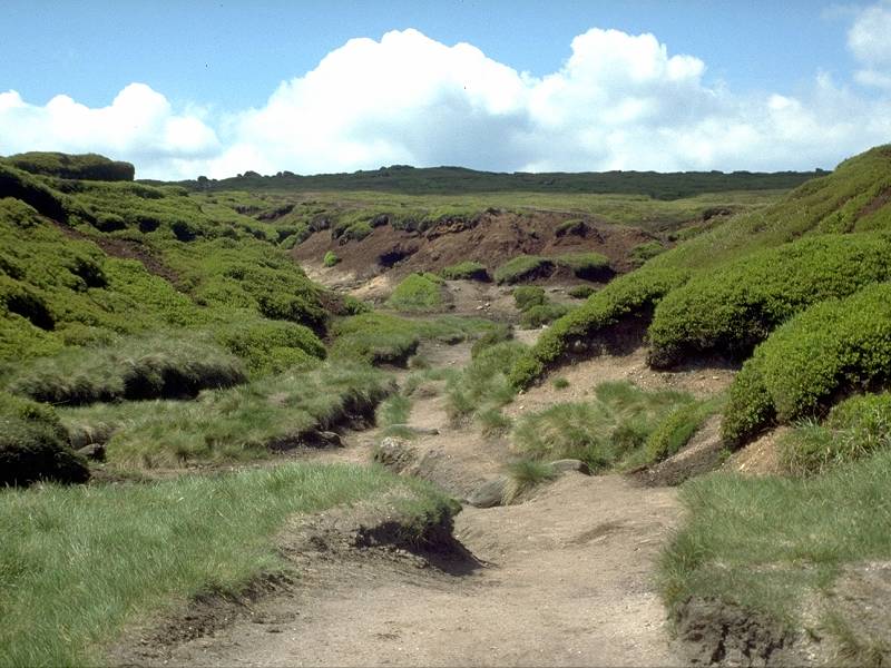
Featherbed Moss
The path over the Moss is sketchy. Keeping to the higher ground (to the right of the official line of the Way) avoids the wetter bits. The path is devoid of interest save for the approaching ribbon of tarmac that is Snake Pass, and the grey-blue dome of Bleaklow rising ahead.
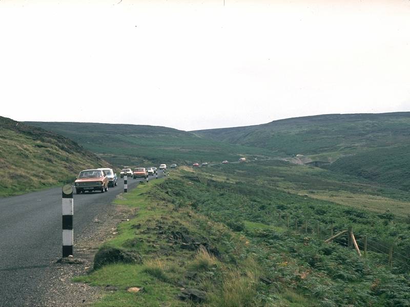
The Snake Pass is the name given to the A57 Sheffield to Glossop road. Its summit, the point at which you've just arrived, lies at an elevation of 512 metres (over 1650 ft). The road is frequently blocked by snow during winter.
The bus service over Snake Pass is
seasonal
and infrequent. Civilisation, in the form of the town of Glossop, lies
only four and a half miles to the west, however, and can be reached in
an hour and a half's walk (It's downhill all the way).
|
(refer to "Snake Inn" on timetable) |
![]() Derbyshire County
Council's Peak
District
website
Derbyshire County
Council's Peak
District
website
| Castleton to Edale | Back to Pennine Way index | Snake Pass to Longendale |
This page last updated 24th November 2004
