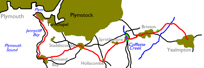
This first part of the Devon Coast to Coast walk was
originally a personal invention. It was designed to link the coast path
at
Plymouth with the start of the Two Moors Way at Ivybridge, making use
of the
footpath network. My first investigations proved that it was too much
for one
day and I broke it into two parts, divided at Yealmpton. Getting
to the start at
Turnchapel involved a bus ride from Plymouth as there was no ferry
crossing,
and the walk itself was beset by obstructions and routefinding problems.
Within the last couple of years, however, things have
changed for the better. Firstly, a new ferry service is in operation
between
the Barbican and Mountbatten Point, next to Turnchapel. Secondly, and
more
importantly, a new trail – the Earme-Plym Link – has been introduced to
link
Plymouth with Ivybridge. Remarkably it almost coincides with my
original route
as far as Yealmpton. It is well maintained and waymarked, and as a
result the
previous problems no longer exist.
The day’s walk, therefore, begins with a ferry crossing
from
Plymouth to Mountbatten Point. From there it follows the coast path for
two
miles to Bovisand Bay, at which point it turns inland to Staddiscombe.
For the
rest of the day it follows the Earme – Plym Link through a world of
villages,
fields, pastures and unfrequented back lanes, brushing the sea for the
final
time at the head of Cofflette Creek. If you’ve been following the coast
path up
to this point then inland walking can be a bit of a culture shock, and
the left
turn at Bovisand Bay is a significant psychological milestone. The walk
is
hillier than you might expect, and though the distance seems modest the
gradients and accumulated ascent make it enough for one day for most
walkers.
Yealmpton has an hourly bus service back to Plymouth.
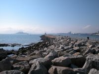
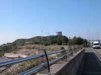
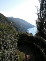
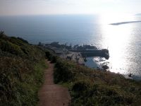
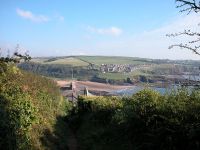
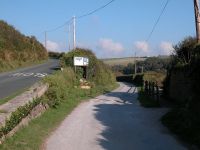
Turnchapel (Mountbatten Point)

View across the Plym and arrival at Mountbatten
We'll assume that you're starting off from Plymouth.
Get yourself to the Mayflower steps and then take the coast road south
for a couple of hundred metres to find the ramp heading down to the
ferry embarkation point. Look out for the orange boats of
Mountbatten Ferries,
who run a frequent passenger service. It's just a few hundred
metres across the mouth of the river Plym to Mountbatten Point, just
beside Turnchapel.

 The environs of Mountbatten Point

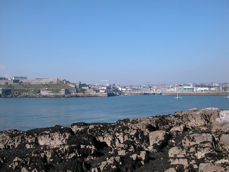
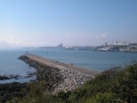
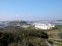
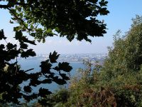
 Plymouth and the Mountbatten breakwater
The Mountbatten landing stage is brand new and cost
several hundred thousand pounds to build. In fact most of what you see
at Mountbatten is the result of a large scale and recent refurbishment.
Adjacent to the landing stage is a cluster of smart new buildings,
including a watersports centre. When I first came here in 1994 the
whole area was a building site, including the Mountbatten breakwater
itself. The only old building to be seen is the ancient gun tower up on
the ridge. You can walk out along the breakwater if you wish; it dates
from 1874 when it was constructed to protect the Plym estuary from
rough water, and was refurbished along with the rest of the area in the
1990s.


 The ridge behind Mountbatten point
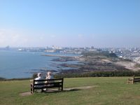
Climb the steps to the ridge behind the landing
stage. There's a little area of heath with a lookout and some seats,
and from here you get a good view across Jennycliff Bay to Rams Cliff,
as well as back across the Plym to Plymouth. Turnchapel itself lays
over to the east. There is a former RAF station here which was a base
for a flying boat squadron, and the guidebooks tell us that T E
Lawrence (a.k.a Lawrence of Arabia) was one of the airmen stationed
there during the 1930s. Nearer to us is another cluster of smart new
buuildings, including several residential blocks. The coast path makes
use of this new development and in fact no longer visits the original
Turnchapel. Go down the slope, stay coastwards of the car park
and walk along the short stretch of road (note the gleaming steel
railings) to the residential area beyond.

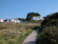
 The new part of Turnchapel
Go off to the right at the obvious coast path marker
just south of this new stretch of road. A path winds its way up the
slope through heathland scenery, passing close to a number of new
houses. Shortly afterwards it disgorges you out onto the vast sward of
grass that fronts Jennycliff Bay.


The route through the new part of Turnchapel,
approaching Jennycliff Bay
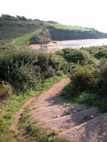
Jennycliff Bay
 Looking back; Jennycliff Bay
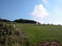
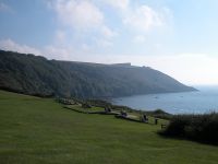
This is Jennycliff Field, a public open space. It is
extensive, it's dotted with clusters of shrubs and bench seats, and is
popular. In the midst of the field is a cafe, which I've
frequented more than once. Views across Plymouth Sound and back to
Plymouth are superb. The road is to your left, and ahead of you at the
top of the hill is yet another huge military fort, that of Staddon
Heights.
 Jennycliff Field
The clusters of vegetation serve to subdivide
Jennycliff Field into several small pastures. Make your way steadily
south, heading for the far southwest corner. The coast path followed
the road at one time but off-road provision has recently been made and
a new path winds along the slopes of Ramscliff, up ahead. At the apex
of the field find a path through a short run of heathland vegetation
leading to a smaller and rougher field beyond, and cross this in turn
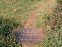
to a gate and stile at the far end. We've walked about a mile from
Turnchapel now and are just below Staddon Heights Farm up by the road
to our left. There's a coast path marker here telling you that it's 175
miles to the end of the south west coast path in Poole, Dorset.
Fortunately we turn off in just over half a mile. You will also find a
novely "welcome mat" here for walkers coming the other way, that
invites visitors to Plymouth to wipe their feet.

 South end of Jennycliff Bay, the coast path marker and the welcome
mat
South end of Jennycliff Bay, the coast path marker and the welcome
mat
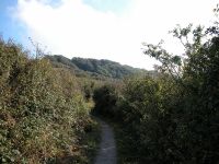
Here we leave the City of Plymouth and enter the
district of South Hams. Now the rollercoaster of the coast path begins
anew. This stretch is a little taxing in fact, and has quite a number
of steep rises and falls early on. After the biggest dip it enters
woodland and is carried up the last gradient by a series of steps.

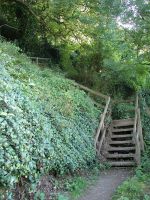
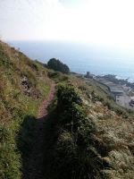
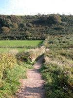
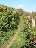
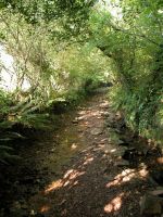
 The woodland path on the slopes of Rams Cliff
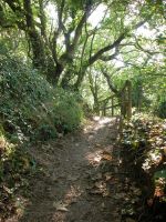
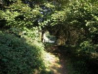
This seems like along half mile but it's a delightful
one. The path settles down to a more level course and threads its way
through the thick woodland around Ramscliff Point. Numerous clearings
allow superb views out across Plymouth sound and back to the city.
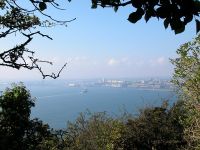
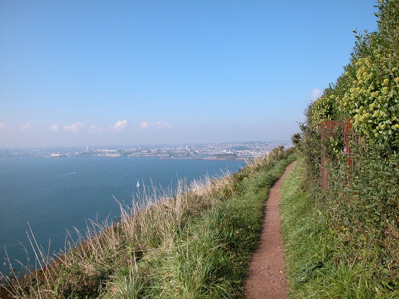
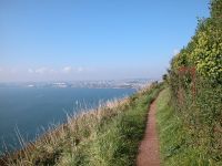
 The coast path at Rams Cliff and views out across Plymouth Sound
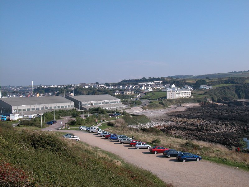
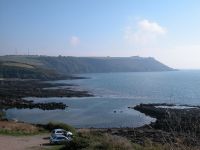
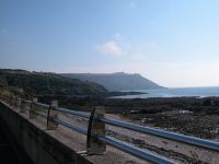
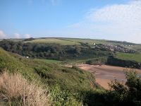
Bovisand
 The approach to Bovisand Point
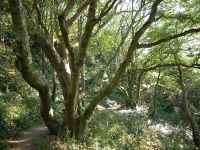
The coast path runs around Ramscliff Point, gradually
cutting off views of Plymouth. The woodland falls away and now you see
Staddon Point not far ahead, the site of Bovisand Fort. Just up the
slope to your left is an enclosed military communications site and up
on top of the cliff is Brownhill Battery. These are the last of the
many military sites and bases that surround Plymouth.
 Bovisand fort and bay
Bovisand Fort appears to be very much in use. The
coast path drops quite steeply to it and then turns sharply right,
doglegging around the perimiter and then crossing a steep sided coombe
by a smart new footbridge. Here you're outwith the environs of the base
and you follow a short stetch of path, still hemmed on by vegetation,
down to a road.
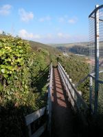
 The coast path approaches Bovisand Bay
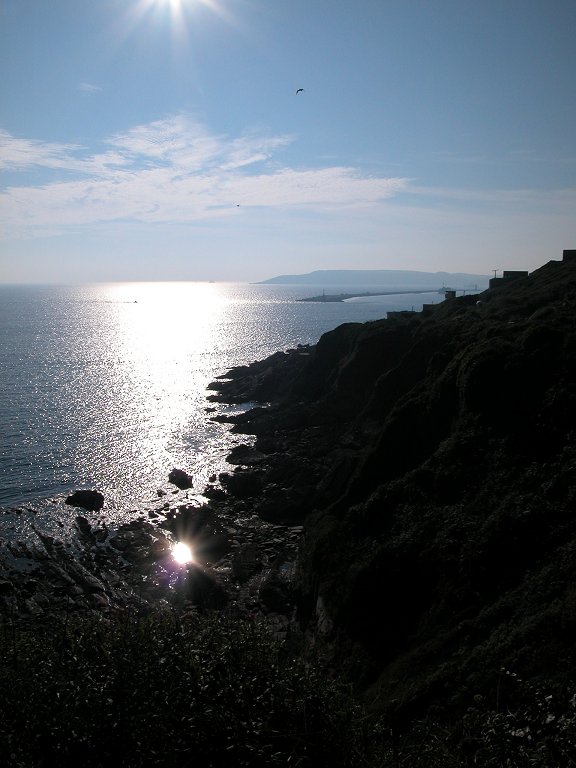
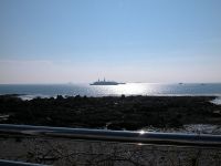
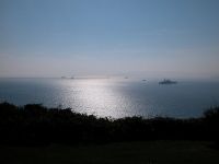
A look back across and beyond Bovisand Fort is
rewarding, for here we're almost end-on to Plymouth Bar at the edge of
Plymouth Sound. The sands of Bovisand Bay appear down to your right,
with the holiday village and the slopes leading up to Andurn Point
beyond.

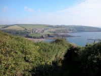
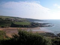 Bovisand Bay
The road swings uphill to Staddon Heights while a
lesser track gives access to the Bovisand Lodge caravan park. Take this
lesser track for a short distance then find a path to your right that
takes you down to Bovisand Bay just behind the beach.

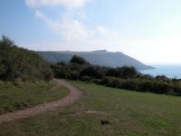
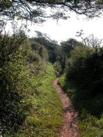
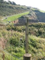 The final section of coast path
Just short of the footbridge across the stream
issuing into Bovisand Bay you'll find a fingerpost at a path junction.
This, a simple an unassuming place, represents a major psychological
turning point. Here, after roughly 155 miles of coast path, we turn
inland. Here we say goodbye to the familiar world of cliffs and coves,
the ever present vista of the sea to our right, and turn instead to a
diet of farm tracks and field paths and stretches of woodland and quiet
back lanes. And here we leave behind the certainties of the route (blue
bit to the right, green bit to the left) and from here on we have to
keep a close eye on the map and navigate by field boundaries.
Turn left, then, for the lane to Staddiscombe, and say goodbye to the
coast. We're setting out to cross Devon, and thence Somerset, to reach
the north coast of the southwest peninsula at Porlock. It's 109 miles
and nine days walk ahead. But let's think, immediately, of Staddiscombe.
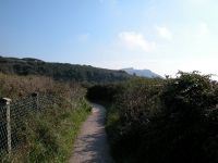
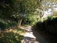
 Staddiscombe Lane by the lodge
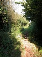
Bovisand Lane runs, pretty nearly dead straight,
through a ribbon of woodland accompanying the apparently nameless
stream that runs down into the bay. Initially it runs alongside the
caravan park at there is a moment of confusion as it converges with the
vehicle track that we left some ten minutes back. The lodge, a handsome
white building, stands to your right and there are a couple of cottages
nearby. Find the continuation of the footpath and follow it, into the
copse. Within a couple of minute all habitation has been left behind.
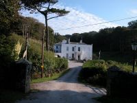
 Bovisand Lodge
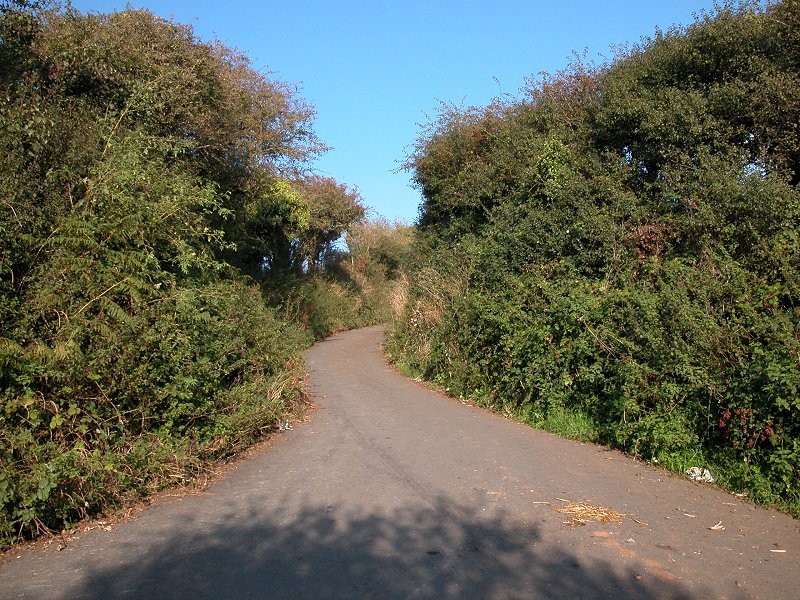
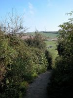
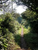
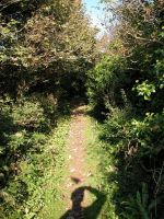
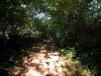
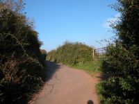
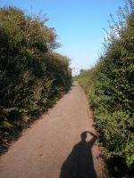
Now just follow the footpath through the wood. It
gets a bit rough, narrow and wet in places. Be prepared for mud,
stones, tree roots and running water. But it's a peaceful place,
a place to linger and look out for wildlife. It runs very gradually
uphill for about one kilometre before coming out onto a road.
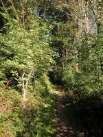

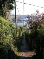
 Bovisand Lane
Staddiscombe

 Joining the road at the top of Bovisand Lane; looking back at
Plymouth Sound
Joining the road at the top of Bovisand Lane; looking back at
Plymouth Sound
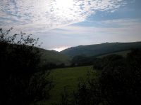
You've arrived at Little Lane, 306 ft above sea
level. The lane comes in from the Staddon Heights road over to your
left and here turns a sharp corner to head into Staddiscombe, straight
ahead. Another foorpath goes off to your right here, and offers the
only opportunity hereabouts for a sit-down break. Behind you a
surprisingly small wedge of sea can be seen at the foot of the valley.
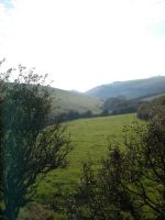 Looking back at Plymouth sound again
 The road to Staddiscombe
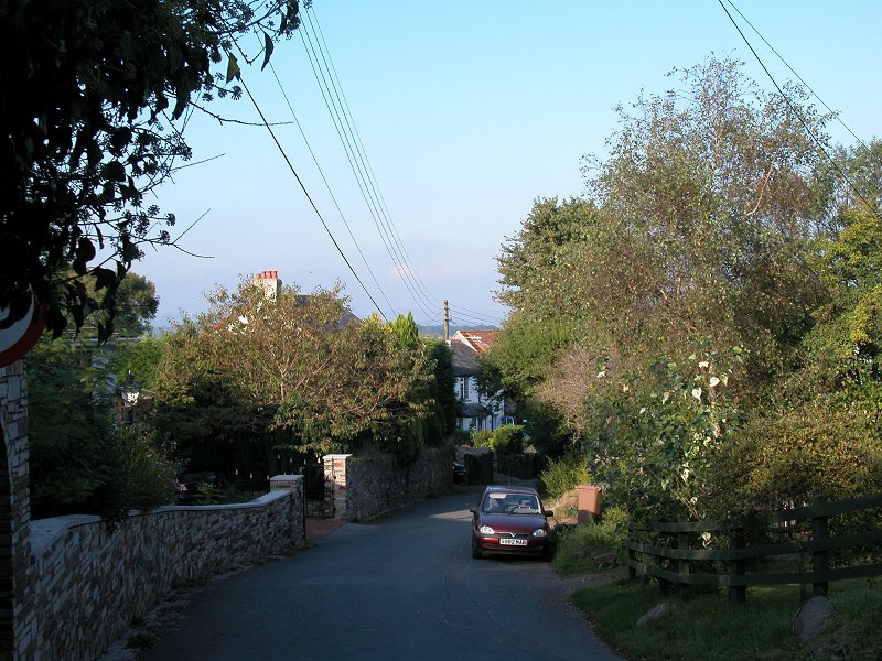
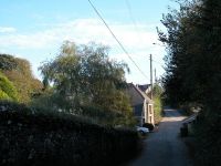
Now take the road straight ahead into Staddiscombe.
The lane is narrow and steep-sided, typical of Cornwall and southwest
Devon, but fortunately traffic is light and you reach the village in
just ten minutes. Staddiscombe is built around a square of roads and
onve you reach the first junction you could choose to go right- left or
left-right to reach the other corner; in my opinion you see the best of
the village by choosing the latter option. You've just crossed briefly
back into the City of Plymouth once again, and in fact a glance at the
map reveals Staddiscombe as an isolated pocket of tranquilty on the
edge of the sprawling housing estates of Plymstock, down to your left.
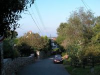
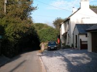
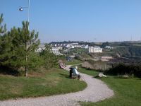
 Staddiscombe village
If you want to break the jorney here then simply walk
down into Plymstock by road or footpath and you'll soon find the bus
route. Otherwise, having wandered through the village to the far
crossroads, go back southwest for a few paces and then find the
footpath to Hollacombe off to your left. My photographic record ends
here for the present.
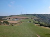
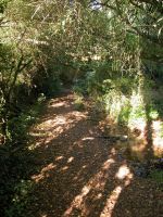
The footpath to Hollacombe initially follows a farm track, then a
fieldside path, and then crosses a corner of a cropped field. This is
where I first came to grief in my initial exploration in 1994 because
the cross-field path was not then viable. Hopefully, with the advent of
the Earme-Plym Trail, things have improved. Keep an eye on the map here
because the line of thin black dashes marking the line of the physical
path is at variance with the bold green dashes that mark the
theoretical right of way. The path reaches the far edge of the field by
a junction of field boundaries, and continues into the next enclusure
where it goes down into a dip and crosses a stream. Beyond the stream
continue in the same general direction across another field to reach a
second field corner. From here walk along the field edge, keeping the
boundary to your right, to reach the ridgeline of Hollacombe Hill. When
you reach the next field the path diverges from the field edge to cross
diagonally to the far corner, where you come to a road at the southern
edge of Hollacombe.
Hollacombe
Once you reach the road turn sharp left, back into
the village. Go half left again at the road junction and walk on for a
further 100 metres to find a footpath down into the wood to your right.
The path generally follows the line of a shallow dip as far as the
eastern edge of the wood, where you come out onto a grassy pasture.
This was another routefinding nightmare back in 1994 as the line of the
path was anything but obvious. It's now shown crossing a steam and
heading straight for the far northeastern corner of the pasture,
leaving a large barn to the right, but older maps will show the
footpath heading straight through this barn and then running about 100
metres south of a parallel farm track out to Spriddlestone. This is, in
a word, WRONG. The right of way now follows the sensible course, along
the farm track to the northeast alongside Knapps Wood. After about 800
metres you emerge at the tiny locality of Spriddlestone.
Spriddlestone
Blink and you'll miss it. I remember
Spriddlestone as a handful of cottages, mainly hidden behind tall,
dense hedges. You emerge at a T-junction. Go to your right, but in
about 100 metres look out for a footpath off to the left, accessed by a
little stone stairway half hidden in the hedge. A field edge path, a
cross-field path and a track brings you out onto the access road
to Tor Hill Farm, and just beyond the convergence you go round a
right-hand bend to reach the head of Cofflete Creek.
Cofflete Creek is a tributary of the Yealm river, which the coast path
crosses some three miles to the south via the passenger ferry at Newton
Ferrers. The head of the creek is an unlovely place, a confusion of
rough grasses and reeds that offers nowhere to park yourself for a
refreshment break. Follow the roadway around the head of the creek.
Having curved around almost to the south, this road now doubles back on
itself with a tight bend to the left, thence bending right again to
cross the route of an abandoned mineral railway to head towards Brixton.
This lane, like several in this area, is surfaced yet is so narrow that
one wonders what vehicles could possibly negotiate it; your average
family car would have no chance. After some 200 metres a footpath
appears, running parallel to the road on its southern side. Given that
the lane is virtually devoid of traffic and that the footpath is poor,
you might as well stay on the hard surface. It will get you to Brixton
with less hassle.
Brixton
At the junction with the driveway to Coflflette Farm our
lane turns left, running uphill to reach the main A379 road at Combe on
the western edge of Brixton. Turn right and walk along the roadside.
The Earme - Plym Link now goes out on a diversion to the north, turning
left along a back road for half a kilometre before coming back into
Brixton along a footpath, but to me this is a pointless excursion; you
are better off, in my opinion, walking directly along the road. Look
our for the point at which the road bends to the right, just before the
church; at this bend take the minor road straight ahead. This goes
across a junction into a residential road. At the far end of this road
head off across the pasture in the same general direction.
This was another profoundly confusing area back in 1994 and I'm hoping
that thngs have improved with the coming of the Earme-Plym Link. You
need to hit the eastern edge of the pasture about 100 metres south of a
copse of trees. Once into the next pasture go half left to pass the
southeast corner of this copse, and then go slightly further to the
left to head upilll.to the northeast corner of the enclosure, where you
come out to a junction of tracks. Go half right to take the track
leading east., which gets you to Scotch Fir Plantation. Go around the
northern edge of this wood as far as a hedge, beyond which you go half
left, across the pasture and over the shoulder of a slight rise. You're
heading for the northeast corner of Gorlofen Plantation. The path runs
alongside the northern edge of a limb of this wood before reaching the
main body of the trees and running through the middle. The map shows
the Earme-Plym link veering off onto a minor path going half left, and
subsequently reaching the road at Gorlofen; be sure to take this for
the track runs into a dead end further down.
Yealmpton
Turn right onto the road and head through the
scattered locality of Gorlofen to the east. You pass a road junction
and then start heading downhill. About 300 metres beyond the junction
you need to find and follow a footpath heading off to the right; it's
heading directly for Yealmpton, which you can see about half a mile
ahead, nestling within the shallow Yealm valley. It's a simple
cross-field path at first; head for the western edge of Cole Hill
Plantation then walk alongside it to the southwest corner. Your route
into Yealmpton is now pretty obvious, mostly by a short series of
field-edge paths. There's a dogleg right-and-left just short of Bowden
Farm which gets you onto a track that comes out into Yealmpton's
northernmost residential road. The official route of the Earme-Plym
Link now backtracks to the west for a couple of hundred metres but
there is a choice of routes and you may as well please yourself; the
objective is the crossroads in the centre of the village.
Here's where the day's walk ends. The building on the southest corner
of the crossroads was once a cafe that provided a welcoming end to the
day's walk; alas, it's now closed. Just to your right, on the south
side of the A379, is the bus stop; there's an hourly service back to
Plymouth.