| Thorpe to Hartington | Back to White Peak Way index | Millers Dale to Castleton |
| Thorpe to Hartington | Back to White Peak Way index | Millers Dale to Castleton |
|
|
|
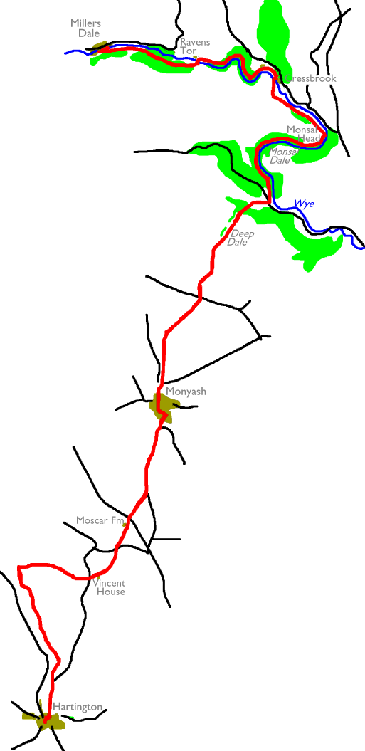
| Length: | 13.2 miles / 21.2 km |
| Total ascent: | 1747 ft / 532 m |
| Total descent: | 1850 ft / 564 m |
| Estimated time: | 4 hrs 41 mins |
Photographic
note: Owing to awkward bus times when I did this walk in 1990, it was
done
in the reverse direction (from Millers Dale southwards) and
unfortunately
my camera jammed in Deep Dale, less than half way through the walk. The
images are relatively poor anyway, owing to dull weather through much
of
the day. They will be replaced by a new set at a later date.
![]() Warringtons
service 441
Ashbourne - Thorpe - Ilam - Hartington
Warringtons
service 441
Ashbourne - Thorpe - Ilam - Hartington
![]() Bowers
service 442
Ashbourne - Thorpe - Hartington - Buxton
Bowers
service 442
Ashbourne - Thorpe - Hartington - Buxton
![]() Trent
"Trans-Peak" service - connections
from Buxton to Nottingham, Derby, Matlock, Bakewell, Stockport,
Manchester
Trent
"Trans-Peak" service - connections
from Buxton to Nottingham, Derby, Matlock, Bakewell, Stockport,
Manchester
![]() First
PMT service X18 - connections
from Buxton to Bakewell, Sheffield, Leek, Stoke on Trent
First
PMT service X18 - connections
from Buxton to Bakewell, Sheffield, Leek, Stoke on Trent
![]() Stagecoach
East Midland service 65
- connections from Buxton to Sheffield and Meadowhall
Stagecoach
East Midland service 65
- connections from Buxton to Sheffield and Meadowhall
![]() First
North Western train service Buxton
- New Mills - Stockport - Manchester - Preston - Blackpool
First
North Western train service Buxton
- New Mills - Stockport - Manchester - Preston - Blackpool
Take this path, which follows a rather more level route along the western shoulder of the ridge overlooking the upper reaches of Dovedale. You cross a number of walls before bending to the left by the tiny ravine of Madge Dale just above Bank Top farm. From here you head across an expanse of open pasture dotted with trees.
Follow the path northwards off the shoulder for a couple of hundred metres as far as a path crossing, at which you should turn right for a path heading eastwards to Vincent House farm.
You've reached the same road that you first took out of Hartington an hour or so back. Cross to Vincent House and find the path heading northeast up the shallow valley beyond. It's a little complicated at first. The path is shown to the south of the accompanying wall. At the col beyond the farm continue alongside the wall, which kinks slightly to the left and goes slightly downhill to yet another shallow valley. Continue alongside the wall straight ahead up to another spur, where you reach the road at Darley Farm.
Cross the old railway line and continue straight on, uphill once more to reach Moscar Farm. and continue past the farm to reach the main A515 road at a spot height of 371 metres (a little below 1200 ft). Go northwest along the road a few paces. On the other side of a wall to the right are two footpaths, one staying along the wall to the northeast, the other crossing the pasture on the diagonal. This is the one we want. It may not be obvious on the ground so keep your eye on the map and navigate by the pattern of walls, which are plentiful here. You should be able to spot the next stile every time. Having crossed five of them in a distance of only 500 metres you reach yet another lonely motor road. Turn left onto the road, which you follow for a mile northwards to the village of Monyash.
Walk northwards through the village to the north and go to the right at the road junction at the far end. Turn immediately left for a footpath heading uphill, almost due north. The path climbs steeply at first then the gradient lessens. You pass through successive pastures with a stone wall accompanying you to your right.
Follow the path, with a stone wall now to your left, for a further kilometre out to a lonely moorland road. Cross it and take the rough road straight ahead.
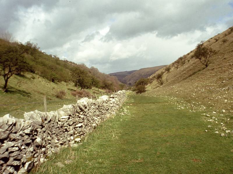

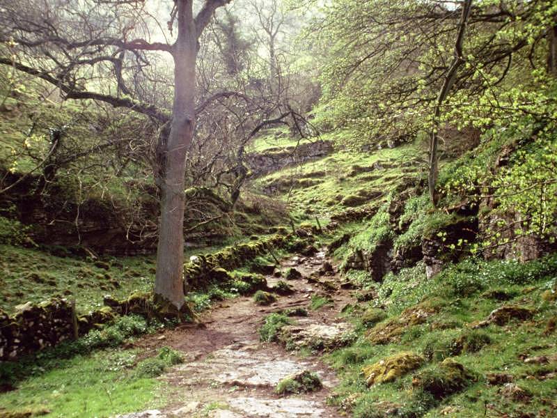
Scenes in Deep Dale
Deep Dale is a very pleasant limestone vale, featuring wooded slopes and an accompanying stone wall along most of its length. After two lazy meanders, first left then right, it keeps a fairly straight course to the north east.
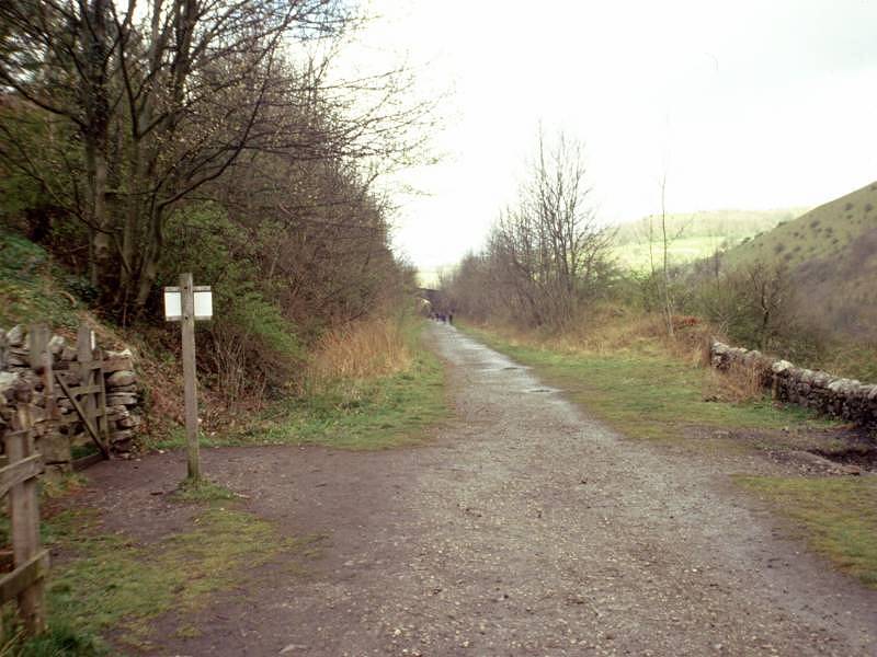
The dale runs for about a mile before running out into an area of wooded scrubland. The map here is a confusion of detail though the path should be obvious on the ground. It curves to the right through an area of limestone outcrops then swings left to run beside a wood out to the main A6 road.
Taddington Wood
You're at a major confluence of limestone valleys which forms the river Wye, running off to your right, but we now follow the path into Monsal Dale, straight ahead. The lower reaches of the dale are extensively wooded, the plantations going by the collective name of Taddington Wood. This is a popular recreational area and there are likely to be many walkers and cyclists about.


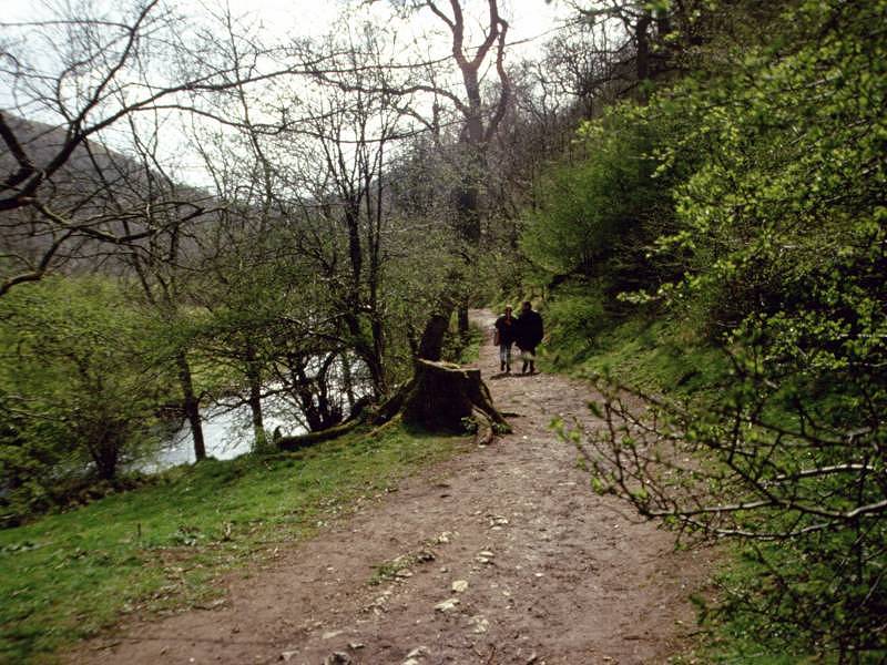
Scenes in Monsal Dale
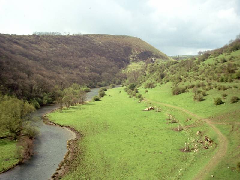
Monsal Dale is a splendid drop of scenery, a deep v-shaped valley with extensively wooded slopes and a stream at its foot. The dale sweeps gradually around to the right through a distance of about a mile.


Monsal Dale


The White Peak Way in Monsal Dale
Almost a mile into the dale, the scene changes as the valley floor widens out and the trees thin out to the left. There's a rather pretty weir here, behind which the river is wide and forms a pool.
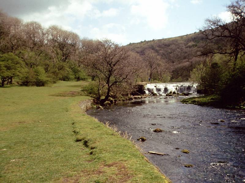

Monsal Dale by the weir
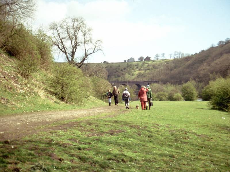
Walk along past the pool to approach the old railway viaduct at Monsal Head.

The viaduct, and a view back down the dale
The viaduct was one of the many engineering features of the second, and greater, railway line between Derby and Buxton. This was the line that ran through Matlock (still open), and Bakewell, five miles to the southeast from here. At Monsal Head the line emerged from tunnel to cross the dale and then run along its upper reaches. The dale itself swings hard to the left here to run northwest, and we've now joined a popular waymarked path, the Monsal Trail. You have two possible routes at this point: either ascend the bank to join the old railway line direct, or pass under the viaduct on the riverbank path, which turns left with the river and then climbs to the old trackbed further up.
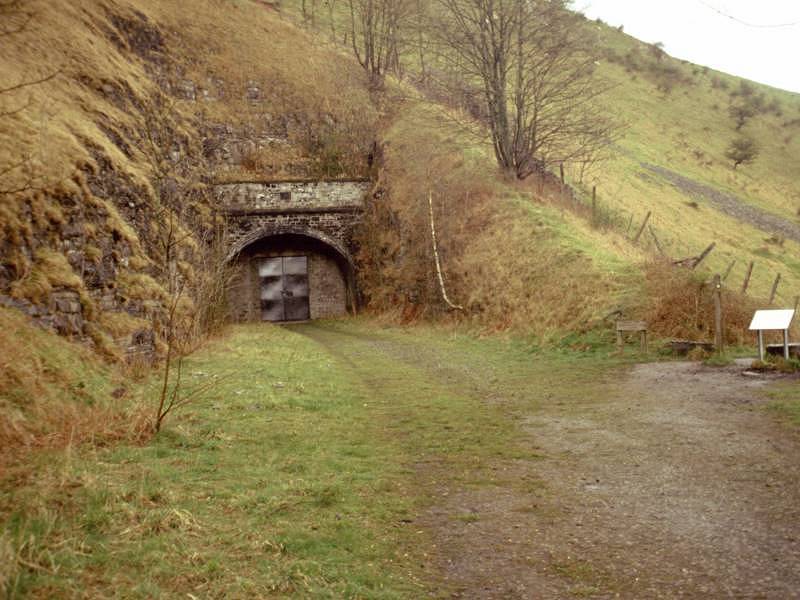
The old trackbed and the sealed tunnel
This part of Monsal Dale above Monsal Head is known as Upperdale, and our route here follows the Monsal Trail along the old railway line. It's a pleasant stretch, through partially wooded terrain with views down to the river to the right. Upperdale Farm is seen among the woods on the far bank. The old railway line continues for about a mile beyond Monsal Head, where it approaches a sealed tunnel portal. Our route now heads down to the left.

The path descending to Cressbrook
The path reaches the river at the locality of Cressbrook, which is crammed into the narrow valley on either side of the river. Here you cross the river by a footbridge. The river bends very sharply to the left here, and the path continues on the east bank.

The river above Cressbrook
The bend to the left runs through a good 130 degrees and you end up facing southwest. This is another grand bit of scenery, with steeply wooded banks climbing high above the river. Part way round the bend Cressbrook Dale diverges to the north and from here on the main valley is known as Millers Dale.


The riverbank path, Millers Dale
The bend above Cressbrook turns out to be just the first of three. The river now curves back, even more sharply, to the right and ends up facing north, but then immediately curves back to the left again, and once more you face southwest. These spectacular curves continue the theme of steep, wooded banks either side of the river. The path is excellent here and, though it is not classed as a bridleway, is quite good enough to cycle along.
After the third sharp bend there is a gentler curve to the right and the dale now settles down into a generally westward direction. Within a few hundred metres you come to Litton Mill.
Like Cressbrook, Litton Mill is a tiny hive of activity crammed into the narrow valley. Use the footbridge here to cross to the south side of the river. A little way above you the old railway emerges from the other end of the tunnel, which of course has cut out all the meanders and is only a kilometre long. Our route continues to follow the Monsal Trail as it leaves the river and climbs back up to the old railbed.


The old railway line in Millers Dale
The last mile of today's walk lays along the old trackbed, which manages to run a fairly straight course just to the south of the river. The slopes to either side become less severe. Tideswell Dale runs off to the north and somewhere around here you will need to switch back to the west sheet of the OS map. Half a mile further on you leave the Monsal Trail for a path off to the right, down to the river bank opposite Millers Dale village. Cross the bridge here to find a bus stop, almost opposite the church, from which you can get buses to Buxton, Sheffield or Chesterfield. Alternatively, Ravenstor youth hostel is about three quarters of a mile along the road to the right.
![]() Stagecoach
East Midland service 65, Sheffield
- Tideswell - Millers Dale - Buxton
Stagecoach
East Midland service 65, Sheffield
- Tideswell - Millers Dale - Buxton
![]() Stagecoach
East Midland service 66, Chesterfield
- Tideswell - Millers Dale - Buxton
Stagecoach
East Midland service 66, Chesterfield
- Tideswell - Millers Dale - Buxton
![]() Ravenstor
Youth Hostel
Ravenstor
Youth Hostel
![]() Derbyshire County
Council's Peak
District
website
Derbyshire County
Council's Peak
District
website
| Thorpe to Hartington | Back to White Peak Way index | Millers Dale to Castleton |
This page last updated 8th January 2005
![]()